
Beginner Off-Road Trails
Near Lockport, New York
Explore All Beginner Trails Near Lockport, New York
Beginner Off-Road Trails Near Lockport, New York
Discover the best beginner-friendly off-road trails near you. These easier, lower-rated trails are a great place to start — browse trail maps, check difficulty ratings, and find your next adventure.
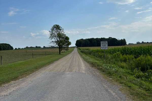
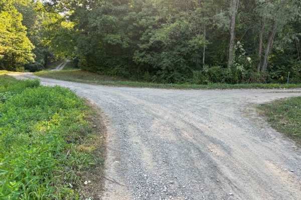
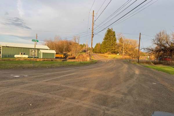
Van Valkenburg Road
This is a north/south road west of Perry Center. There are horse and cow farms at the north end. Scenic views of the low rolling hills can be found on either end on clear days. The road is a great addition to any route if you are coming from the west, heading to Letchworth State Park or other destin...
Learn more about Van Valkenburg Road
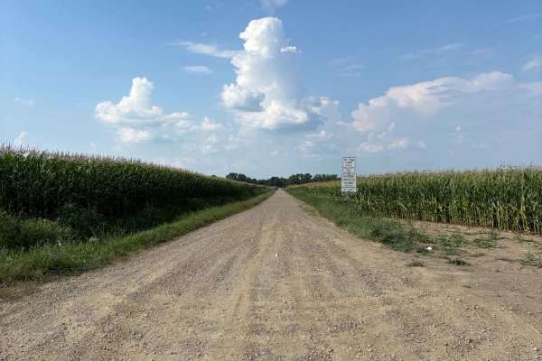
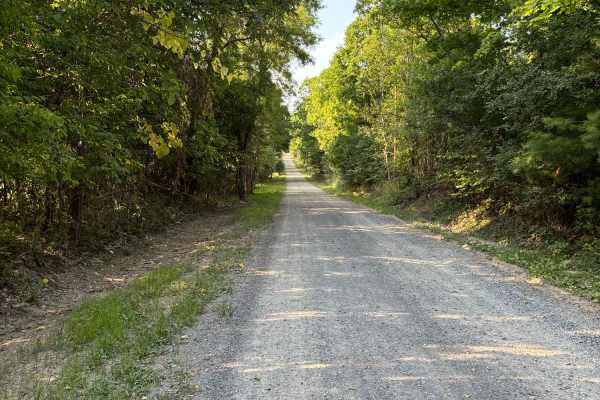
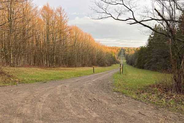
Brian Road
This scenic drive takes you through some open fields along the Wyoming/Livingston County line. The road passes through a small section of woods and a single-lane bridge. This road is a great road to add to a route of the area if traveling from the west to get to Letchworth State Park.
Learn more about Brian Road
Hysert Crossroad
A crossroad trail located in Grimsby, Ontario, sandwiched between Mud Street and Ridge Road, the trail consists of a thick clay-covered pathway littered with large ruts and mud. It can be very sticky and difficult to navigate in wet conditions as the main hazard of this trail is the large 5-foot dee...
Learn more about Hysert Crossroad
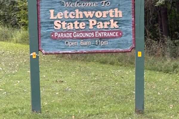
East Park Road
This road runs along the eastern edge of the gorge of Letchworth State Park. The road is closed during the winter months, but is open to the public during Spring, Summer, and Fall. The road is initially paved, but in rough shape, up to the parade grounds area. After that, it turns to dirt and offers...
Learn more about East Park Road
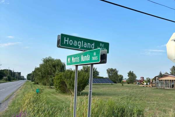
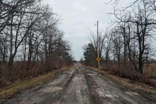
Hoagland Road
This road is minimally maintained and may be in rough shape at times. The road offers scenic views of the surrounding farm land. The road ends on the east end at an Amish farm. The road is a great addition to any route in the area, especially if you are traveling between Sonyea State Forest and Letc...
Learn more about Hoagland Road
River Road
This seasonal road runs through the eastern portion of Letchworth State Park. Letchworth State Park is a canyon with several waterfalls and attracts tourists from far and wide. This road is not one of the main roads and does not require payment to access. This road offers access to several hiking tr...
Learn more about River Road
Totsline Road
This seasonal road runs along the Genesee River, offering some great views of the river before it heads into the Letchworth Gorge. It is located near River Road and East Park Road. Near the east end of the road, a piped natural spring can be found pouring out of the side of the hill. At the west end...
Learn more about Totsline Road
Williams Road
On the western end, this seasonal road grants access to Letchworth State Park and River Road. Some interesting signs can be found along the road. The vegetation in some spots narrows the road and can make it difficult to see oncoming traffic. The eastern intersection of the road also grants parking ...
Learn more about Williams Road
Shaker Access Road East Extension
This seasonal road grants access to the eastern portion of the Sonyea State Forest. The road is not maintained during the winter months and is in rough shape during the summer and muddy in the spring. Sonyea State Forest offers camping by permit and access to hiking trails. During the spring, the DE...
Learn more about Shaker Access Road East Extension
Shaker Access Road
This seasonal road grants access to Sonyea State Forest. The road is not maintained during the winter months and is in rough shape during the summer and muddy in the spring. Sonyea State Forest offers camping by permit and access to hiking trails. During the Spring, the DEC does prescribed burns on ...
Learn more about Shaker Access Road
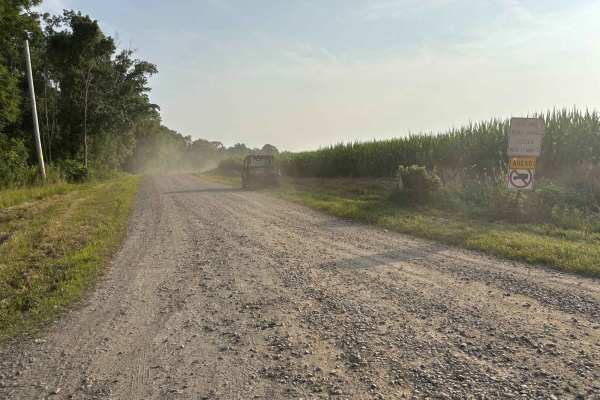
Wise Road
The east end of the road is open agricultural fields, allowing you to see quite a way. Traveling west, the road becomes more wooded and would be a great road to see the colors in fall and a nice shaded trip in the warmer months. The road is a continuous grade either uphill or downhill depending on y...
Learn more about Wise Road
Back Road to Rattlesnake
This state forest road intersects with Scoville Rd and takes you to a parking area and trail that leads to Rattlesnake Hill State Forest. The parking area is also a camping site that may require a permit if you wish to stay overnight. The state has put up a gate that blocks progress past the parking...
Learn more about Back Road to Rattlesnake
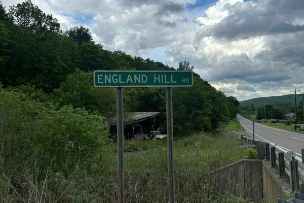
England Hill Road
The trail immediately climbs a steep rutted road that is rough; most low-clearance street vehicles will want to go slow to avoid damage. The road climbs quite a ways before leveling off. Several driveways might look like spur roads, but they are all private and most go to your right, so stay left. S...
Learn more about England Hill Road
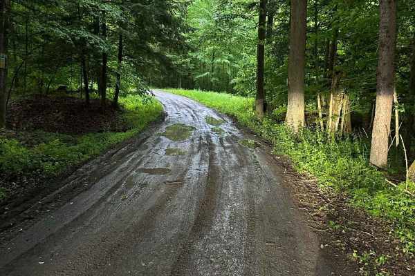
Scoville Road
This trail is a state forestry road that travels through Ossian State Forest. The road is rough, rutted, and muddy in some sections. There are no technical obstacles that would be a concern. It is mostly level and could be a challenge in wet or snowy conditions. There is a spur road, Back Road to Ra...
Learn more about Scoville Road
Coombs Road
This is a section of road that is not maintained during the winter months. The road is in good shape and climbs a hill for most of this section. At the top, the road levels off and offers a great view of the surroundings and nearby hills. This is a nice road to add to a route of the area.
Learn more about Coombs Road
Lander Road
This is a small seasonal highway located in southern Steuben County. It's a great place to get away from the world for a fraction of time. It can be moderately difficult in the winter due to snow accumulation. This trail is accessible from both ends and leads to many more seasonal highways for some ...
Learn more about Lander Road
Turnpike Forest Road
This road travels through Turnpike State Forest which offers access to 4,744 acres of state land. A large section of the road is gated during the winter. This road offers access to several campsites, hiking trails, and horseback riding trails. The road climbs to over 2200' and was recently cleared o...
Learn more about Turnpike Forest Road
Stewart Forest Road
This road branches off of Turnpike Forest Road, granting access to campsites and a horse trailer parking and mounting site. This area can also be used as a picnic area and has a ramp that makes mounting a horse simpler. There is access to several horseback trails and parking areas. The majority of t...
Learn more about Stewart Forest Road
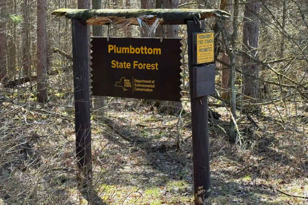
Plumbottom Reddy Forest Road
Plumbottom State Forest totals 1,666 acres. The main road is a fun, slow drive with scenic views. The road is rocky and has some ruts due to rain runoff. At the end, there is a turnaround with group parking/camping. Found a small lake with a few beaver lodges. The forest provides opportunities for o...
Learn more about Plumbottom Reddy Forest Road

Deloss Road
This forest road offers access to a campsite located in Turnpike State Forest. The road dead-ends at a turnaround area. The campsite can be used when exploring the 4,744 acres of State land. This road branches off of Turnpike Forest Road. There are two gates at the turnaround that lead to private pr...
Learn more about Deloss Road
Beginner ATV trails near Lockport, New York
Explore ATV-friendly trails near you. These trails are accessible for vehicles up to 50 inches wide, perfect for ATVs and smaller off-road machines.
Hysert Crossroad
A crossroad trail located in Grimsby, Ontario, sandwiched between Mud Street and Ridge Road, the trail consists of a thick clay-covered pathway littered with large ruts and mud. It can be very sticky and difficult to navigate in wet conditions as the main hazard of this trail is the large 5-foot dee...
Learn more about Hysert Crossroad
Lander Road
This is a small seasonal highway located in southern Steuben County. It's a great place to get away from the world for a fraction of time. It can be moderately difficult in the winter due to snow accumulation. This trail is accessible from both ends and leads to many more seasonal highways for some ...
Learn more about Lander Road
Beginner UTV/side-by-side trails near Lockport, New York
Find UTV and side-by-side trails near you. These trails accommodate vehicles up to 60 inches wide, ideal for UTVs, side-by-sides, and wider off-road rigs.
Hysert Crossroad
A crossroad trail located in Grimsby, Ontario, sandwiched between Mud Street and Ridge Road, the trail consists of a thick clay-covered pathway littered with large ruts and mud. It can be very sticky and difficult to navigate in wet conditions as the main hazard of this trail is the large 5-foot dee...
Learn more about Hysert Crossroad
Lander Road
This is a small seasonal highway located in southern Steuben County. It's a great place to get away from the world for a fraction of time. It can be moderately difficult in the winter due to snow accumulation. This trail is accessible from both ends and leads to many more seasonal highways for some ...
Learn more about Lander Road
The onX Offroad Difference
onX Offroad combines trail photos, descriptions, difficulty ratings, width restrictions, seasonality, and more in a user-friendly interface. Available on all devices, with offline access and full compatibility with CarPlay and Android Auto. Discover what you're missing today!
Open Trail Map