
Beginner Off-Road Trails
Near Hastings, Oklahoma
Explore All Beginner Trails Near Hastings, Oklahoma
Beginner Off-Road Trails Near Hastings, Oklahoma
Discover the best beginner-friendly off-road trails near you. These easier, lower-rated trails are a great place to start — browse trail maps, check difficulty ratings, and find your next adventure.
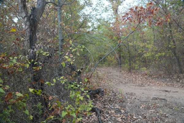
Green 58
This trail follows a forested dirt route and may be slightly overgrown in some areas.
Office hours are approximately 9:00 a.m. to 5:00 p.m. Thursday through Sunday, with later hours on Fridays to accommodate visitors arriving after work. If the office is closed, rides can be booked online to receiv...
Learn more about Green 58
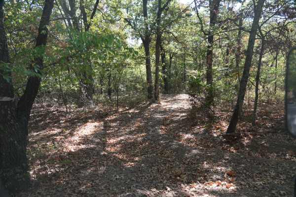
Green 20
This is a nice forested trail with tight trees and some overgrown areas. Shallow ruts may become muddy after rain or snow, but there are no major obstacles.
Office hours are approximately 9:00 a.m. to 5:00 p.m. Thursday through Sunday, with later hours on Fridays to accommodate visitors arriving af...
Learn more about Green 20
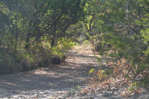
Green 53
This trail is mostly flat and wide open, with a mix of rock, gravel, and dirt.
Office hours are approximately 9:00 a.m. to 5:00 p.m. Thursday through Sunday, with later hours on Fridays to accommodate visitors arriving after work. If the office is closed, rides can be booked online to receive proof...
Learn more about Green 53
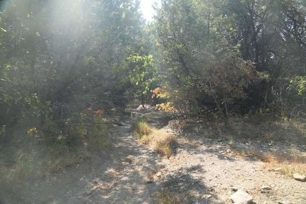
Green 52
This trail is mostly flat, with a mix of dirt and gravel.
Office hours are approximately 9:00 a.m. to 5:00 p.m. Thursday through Sunday, with later hours on Fridays to accommodate visitors arriving after work. If the office is closed, rides can be booked online to receive proof of purchase by email...
Learn more about Green 52
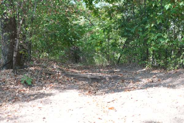
Green 54
This trail is mostly dirt and may be slightly overgrown in some areas.
Office hours are approximately 9:00 a.m. to 5:00 p.m. Thursday through Sunday, with later hours on Fridays to accommodate visitors arriving after work. If the office is closed, rides can be booked online to receive proof of purc...
Learn more about Green 54
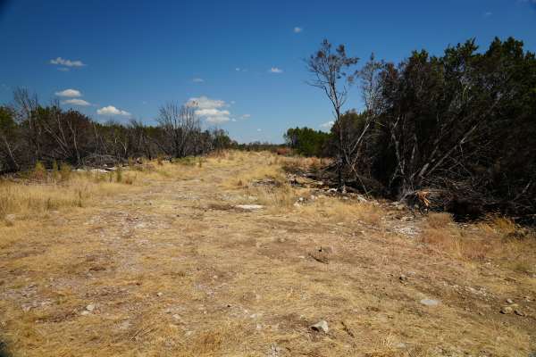
Green 22
This trail crosses rocky grassland with rolling hills and no notable obstacles.
Office hours are approximately 9:00 a.m. to 5:00 p.m. Thursday through Sunday, with later hours on Fridays to accommodate visitors arriving after work. If the office is closed, rides can be booked online to receive proo...
Learn more about Green 22
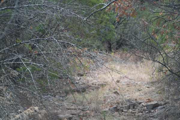
Green 61
This trail is overgrown and thick with brush, but has no notable obstacles.
Office hours are approximately 9:00 a.m. to 5:00 p.m. Thursday through Sunday, with later hours on Fridays to accommodate visitors arriving after work. If the office is closed, rides can be booked online to receive proof of...
Learn more about Green 61
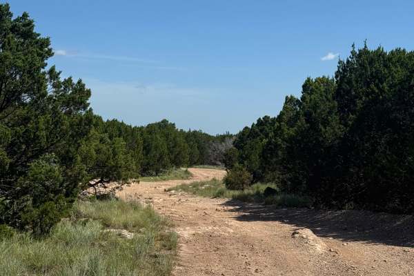
Crossover Road
This easy connector trail features areas of packed dirt, loose rocks, shallow ruts, and mild elevation changes. Lightly stepped sections add variety without making it technical. Occasional uneven surfaces and erosion add to the challenge. It's a great scenic link between main trails, offering a more...
Learn more about Crossover Road
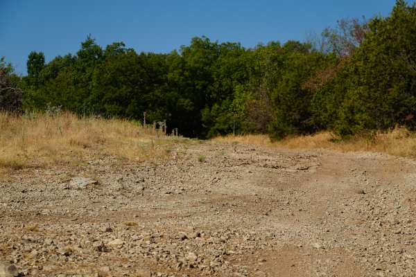
Green 15
This trail is mostly small, rocky terrain with a slight grade.
Office hours are approximately 9:00 a.m. to 5:00 p.m. Thursday through Sunday, with later hours on Fridays to accommodate visitors arriving after work. If the office is closed, rides can be booked online to receive proof of purchase by ...
Learn more about Green 15
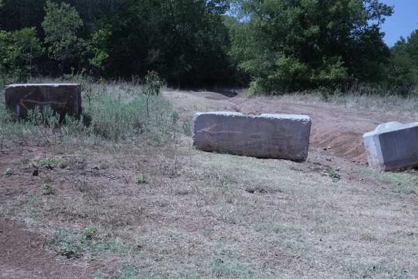
Green 5
This route serves as a bypass around the closed sections of Crossover Road. The terrain is mostly dirt and gravel.
Office hours are approximately 9:00 a.m. to 5:00 p.m. Thursday through Sunday, with later hours on Fridays to accommodate visitors arriving after work. If the office is closed, rides c...
Learn more about Green 5
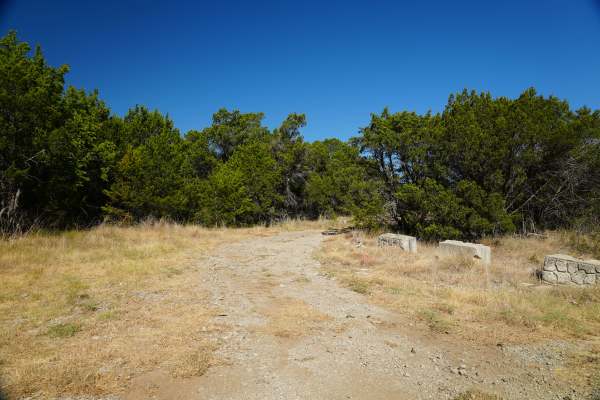
Green 14
This trail travels across mostly gravel and rocky terrain with gentle rolling hills throughout the route.
Office hours are approximately 9:00 a.m. to 5:00 p.m. Thursday through Sunday, with later hours on Fridays to accommodate visitors arriving after work. If the office is closed, rides can be boo...
Learn more about Green 14
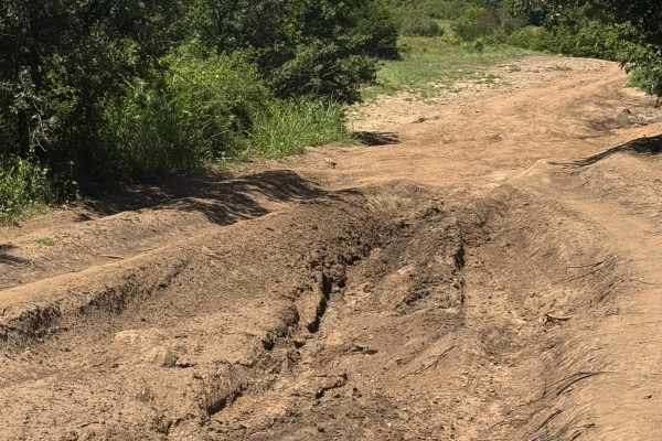
Main Road
This section of the Main Road presents more significant challenges with large ruts, pronounced washouts, and mud that can reduce traction. Shallow water crossings may occur depending on recent weather conditions. Drivers should be prepared to navigate uneven terrain, variable ground stability, and p...
Learn more about Main Road
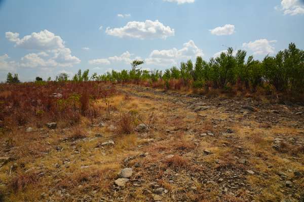
Green 63
This trail crosses mostly rolling, hilly terrain with rocky grassland.
Office hours are approximately 9:00 a.m. to 5:00 p.m. Thursday through Sunday, with later hours on Fridays to accommodate visitors arriving after work. If the office is closed, rides can be booked online to receive proof of purc...
Learn more about Green 63
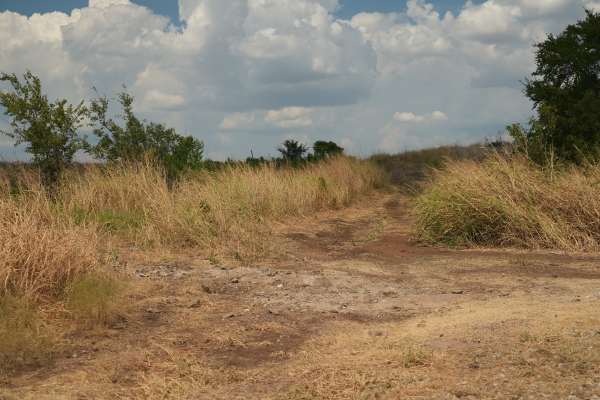
Green 62
This is a mostly rocky grassland trail, that has a deep mud hole, in wet season with a bypass.---------------Office hours are 9am - 5ish Thursday - Sunday except later on Friday knowing folks are leaving after work. If the office is closed, you can book your ride online to receive proof of purchase ...
Learn more about Green 62
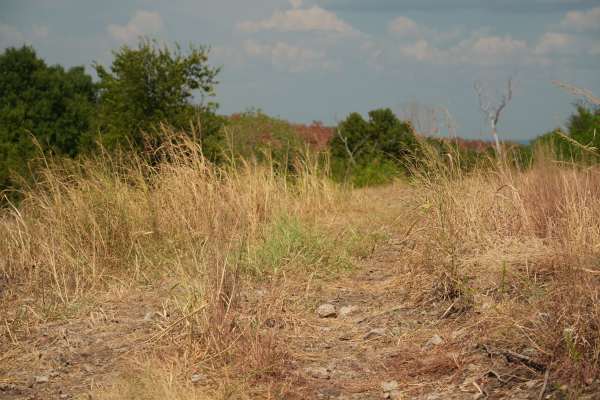
Green 64
This trail is mostly flat, with a mix of dirt and rocky terrain. The route provides plenty of room for vehicles of any size.
Office hours are approximately 9:00 a.m. to 5:00 p.m. Thursday through Sunday, with later hours on Fridays to accommodate visitors arriving after work. If the office is close...
Learn more about Green 64
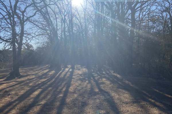
Sumac trail
Sumac Trail is a scenic, beginner-friendly off-road route within the Lake Murray State Park ATV Area, perfect for riders of all skill levels looking for a relaxed trip with beautiful shoreline views. Stretching approximately 1.9 miles, this dirt and sand trail is the main artery of the park's off-ro...
Learn more about Sumac trail
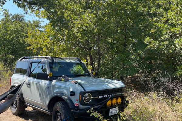
Miller Access Trail
This is a short scenic drive on gravel that takes you through the Lyndon B. Johnson National Grassland. There are some ponds in the area that can be accessed by using some offshoots. The trail can be accessed by 1655 County Road and Gossett-Foster Road. This is an easy road that can be completed wit...
Learn more about Miller Access Trail
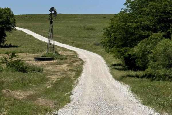
Mesa - 900
This is a well-maintained gravel road through the scenic LBJ Grasslands. There are no major obstacles or water crossings, but lots of campsites and photo ops. Find somewhere to pull off and have a picnic, or use one of the pavilions near the trailhead. This is the perfect trail for people looking fo...
Learn more about Mesa - 900
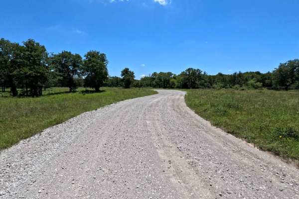
Gravel Pit - 904
This is an access point to the LBJ Grasslands system of trails. There is a lot of room to air down and secure gear just inside the gate if needed. Be aware of horseback riders coming in from the farms in the area, as these are mixed-use trails. You can expect two-way traffic on this road, so drive c...
Learn more about Gravel Pit - 904
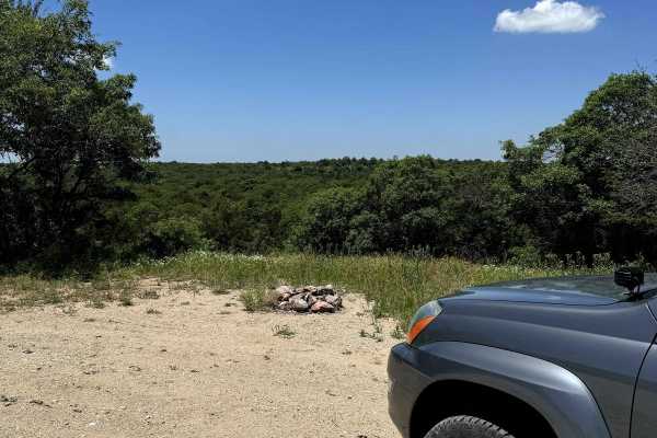
Scenic Overlook - 900H
This trail has a beautiful view with multiple campsites. It is a branch off the Mesa - 900 trail and connects back to it on both sides. The campsites have stone fire pits and the entire trail is surrounded by flowers overlooking a scenic view to the north. Be sure to check for campsite availability ...
Learn more about Scenic Overlook - 900H
Beginner ATV trails near Hastings, Oklahoma
Explore ATV-friendly trails near you. These trails are accessible for vehicles up to 50 inches wide, perfect for ATVs and smaller off-road machines.
Green 58
This trail follows a forested dirt route and may be slightly overgrown in some areas.
Office hours are approximately 9:00 a.m. to 5:00 p.m. Thursday through Sunday, with later hours on Fridays to accommodate visitors arriving after work. If the office is closed, rides can be booked online to receiv...
Learn more about Green 58
Green 20
This is a nice forested trail with tight trees and some overgrown areas. Shallow ruts may become muddy after rain or snow, but there are no major obstacles.
Office hours are approximately 9:00 a.m. to 5:00 p.m. Thursday through Sunday, with later hours on Fridays to accommodate visitors arriving af...
Learn more about Green 20
Green 53
This trail is mostly flat and wide open, with a mix of rock, gravel, and dirt.
Office hours are approximately 9:00 a.m. to 5:00 p.m. Thursday through Sunday, with later hours on Fridays to accommodate visitors arriving after work. If the office is closed, rides can be booked online to receive proof...
Learn more about Green 53
Green 52
This trail is mostly flat, with a mix of dirt and gravel.
Office hours are approximately 9:00 a.m. to 5:00 p.m. Thursday through Sunday, with later hours on Fridays to accommodate visitors arriving after work. If the office is closed, rides can be booked online to receive proof of purchase by email...
Learn more about Green 52
Beginner UTV/side-by-side trails near Hastings, Oklahoma
Find UTV and side-by-side trails near you. These trails accommodate vehicles up to 60 inches wide, ideal for UTVs, side-by-sides, and wider off-road rigs.
Green 58
This trail follows a forested dirt route and may be slightly overgrown in some areas.
Office hours are approximately 9:00 a.m. to 5:00 p.m. Thursday through Sunday, with later hours on Fridays to accommodate visitors arriving after work. If the office is closed, rides can be booked online to receiv...
Learn more about Green 58
Green 20
This is a nice forested trail with tight trees and some overgrown areas. Shallow ruts may become muddy after rain or snow, but there are no major obstacles.
Office hours are approximately 9:00 a.m. to 5:00 p.m. Thursday through Sunday, with later hours on Fridays to accommodate visitors arriving af...
Learn more about Green 20
Green 53
This trail is mostly flat and wide open, with a mix of rock, gravel, and dirt.
Office hours are approximately 9:00 a.m. to 5:00 p.m. Thursday through Sunday, with later hours on Fridays to accommodate visitors arriving after work. If the office is closed, rides can be booked online to receive proof...
Learn more about Green 53
Green 52
This trail is mostly flat, with a mix of dirt and gravel.
Office hours are approximately 9:00 a.m. to 5:00 p.m. Thursday through Sunday, with later hours on Fridays to accommodate visitors arriving after work. If the office is closed, rides can be booked online to receive proof of purchase by email...
Learn more about Green 52
The onX Offroad Difference
onX Offroad combines trail photos, descriptions, difficulty ratings, width restrictions, seasonality, and more in a user-friendly interface. Available on all devices, with offline access and full compatibility with CarPlay and Android Auto. Discover what you're missing today!
Open Trail Map