
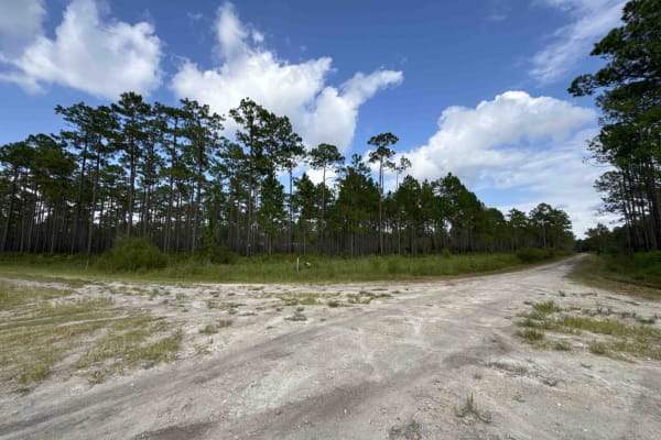
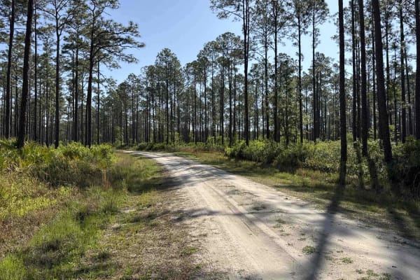
Beginner Off-Road Trails
Near Hahira, Georgia
Explore All Beginner Trails Near Hahira, Georgia
Beginner Off-Road Trails Near Hahira, Georgia
Discover the best beginner-friendly off-road trails near you. These easier, lower-rated trails are a great place to start — browse trail maps, check difficulty ratings, and find your next adventure.
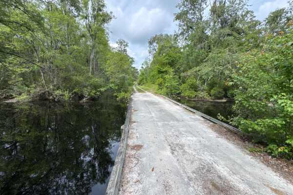
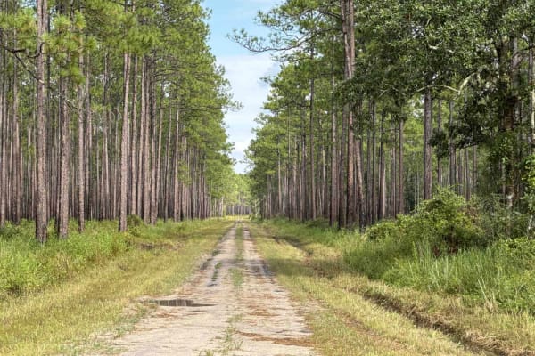
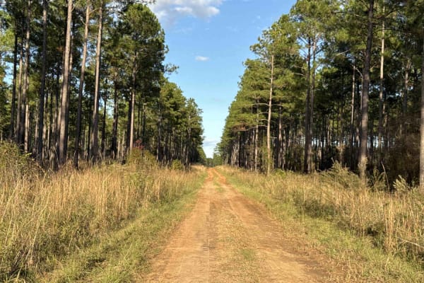
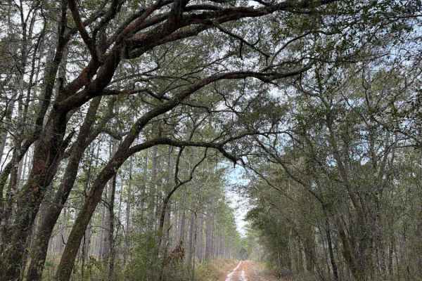
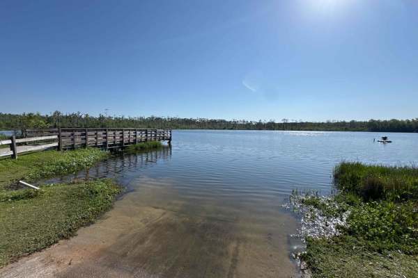
Little Suwannee Road - Osceola NF 291
The Little Suwannee Road, also known as Osceola National Forest Road 291, is a 12-mile road that starts at US-441. It takes you through the northwestern part of the Osceola National Forest from south to north and gives you access to several OHV trails. It's a dead-end road that ends shortly before t...
Learn more about Little Suwannee Road - Osceola NF 291
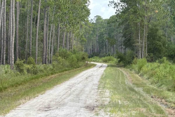
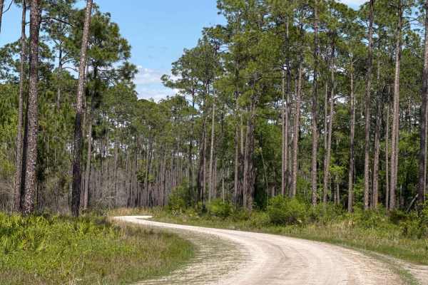
Mule Lot - Osceola NF 279
The Mule Lot Trail, also known as Osceola National Forest Road 279, is a 5-mile road that connects Little Suwannee Road at the north end and Sandhill Grade at the south end of the trail. It's the only road that connects the northwestern part of the Osceola National Forest with the main part. The roa...
Learn more about Mule Lot - Osceola NF 279
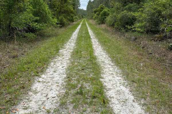
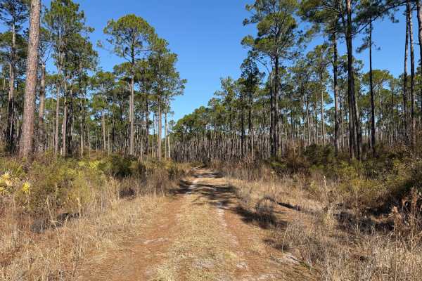
North East Needmore Road - Osceola NF
North East Needmore Road is a 5-mile road that starts at US-441 at the west end and FR 237 at the east end of the trail. It takes you through the northwestern part of the Osceola National Forest from west to east and gives you easy access to the main part of the forest. The road conditions are a mix...
Learn more about North East Needmore Road - Osceola NF
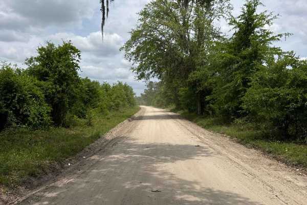
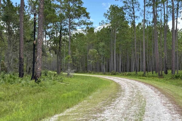
Sandhill Grade - Osceola NF 200
The Sandhill Grade Trail, also known as Osceola National Forest Road 200, is an 18-mile road that connects FR 237 at the west end and CR 250 at the east end. It takes you through the Osceola National Forest from west to east and gives you access to several OHV trails. Parts of the trail are in the J...
Learn more about Sandhill Grade - Osceola NF 200
Old Jacksonville Rd - Osceola NF 263
The Old Jacksonville Road, also known as Osceola National Forest Road 263, connects Highway 441 at the west end and 250A at the south end. 250A takes you to the Ocean Pond, a public Boat Ramp, and the Ocean Pond Campground. The road conditions are a mixture of packed sand, loose sand, and some deep ...
Learn more about Old Jacksonville Rd - Osceola NF 263
Mount Carrie - Osceola NF 234
The Mount Carrie Trail, also known as Osceola National Forest Road 234, is a 10-mile road that connects the Swamp Thing trail at the north end and CR 250 at the south end. It takes you through the Osceola National Forest from north to south and gives you access to several OHV trails. The road condit...
Learn more about Mount Carrie - Osceola NF 234
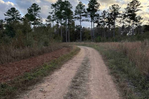
Mud Creek Road
The Mud Creek Road connects GA-62 at the north entrance and the Seven Bridge Road at the south end. The trail gives you access to the Gut Pit and several other trails in the Chickasawhatchee Wildlife Management Area. The road conditions are a mixture of packed sand, loose sand, and some deep holes t...
Learn more about Mud Creek Road
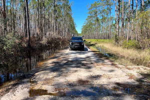
Greenfield
Greenfield is a well-maintained forest road in Osceola National Forest with many pockets of private residences along the road until passing West Tower Hunt Camp. West Tower Hunt camp is a popular location for setting out on more technical OHV trails within the area and can hold a lot of standing wat...
Learn more about Greenfield
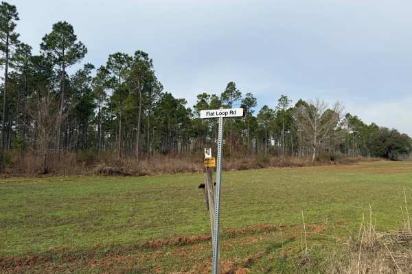
Flat Hole Loop
Flat Hole Loop runs through the southeastern quadrant of the Chickasawhatchee Wildlife Management Area (WMA). Only street-legal, registered, and licensed vehicles are permitted. Additionally, the Georgia Department of Natural Resources (GADNR) requires individuals to be in possession of the Georgia ...
Learn more about Flat Hole Loop
Pine Island Road
The Pine Island Road connects GA-62 at the north end and the Seven Bridge Road at the south end. The trail gives you access to the Mike Commander Shooting Range at the Chickasawhatchee Wildlife Management Area. The road conditions are a mixture of packed sand, loose sand, and some deep holes that ca...
Learn more about Pine Island Road
Drew Grade Trail - Osceola NF 262
The Drew Grade Trail, also known as Osceola National Forest Road 262, connects the Blue Horse Trail at the east end and the Church Grade Trail at the west end. It takes you through the Osceola National Forest from east to west. The road conditions are a mixture of packed sand, loose sand, some deep ...
Learn more about Drew Grade Trail - Osceola NF 262
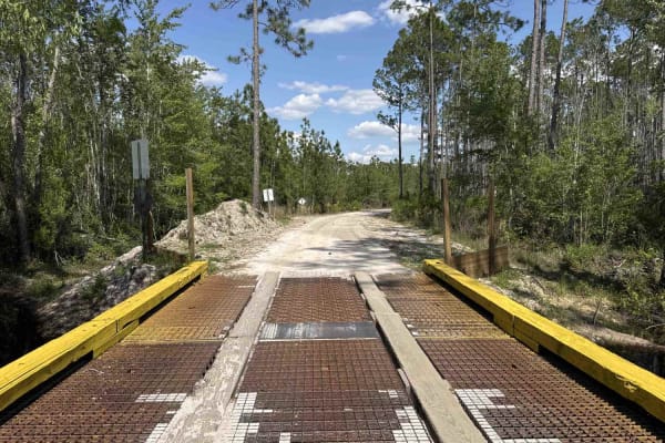
FR 250-EE
This trail runs through the Osceola National Forest (NF) and Wildlife Management Area (WMA). The trail is open to public access year-round unless otherwise posted. The trail is open to registered highway legal motor vehicles, all-terrain vehicles, recreational off-highway vehicles (side-by-sides), a...
Learn more about FR 250-EE
Black Top - FS 379
Black Top, also known as Apalachicola National Forest Road 379, connects US 319 at the west end and CR 363 at the east end. It takes you through the north-east part of the Apalachicola National Forest and gives you access to several trails in the area. The road conditions are a mixture of packed san...
Learn more about Black Top - FS 379
Blue Horse Trail - Osceola NF 232
The Blue Horse Trail, also known as Osceola National Forest Road 232, connects the Greenfield Trail at the south end and the Swamp Thing Trail at the north end. It takes you along the west boundary of The Big Gum Swamp. The road conditions are a mixture of packed sand, loose sand, and some deep hole...
Learn more about Blue Horse Trail - Osceola NF 232
FR 250-FF
This trail runs through the Osceola National Forest (NF) and Wildlife Management Area (WMA). The trail is open to public access year-round unless otherwise posted. The trail is open to registered highway legal motor vehicles, all-terrain vehicles, recreational off-highway vehicles (side-by-sides), a...
Learn more about FR 250-FF
Middle Prong - Osceola NF 232
The Middle Prong Trail, also known as Osceola National Forest Road 232, connects The Swamp Thing and Cobb's Place Trail at the west end and CR 250 at the east end. It takes you through the Osceola National Forest from west to east and gives you access to the Natural Area Wilderness Study Area. The r...
Learn more about Middle Prong - Osceola NF 232
Feeder - Osceola NF 217
The Feeder Trail, also known as Osceola National Forest Road 217, connects CR 100A at the south end and CR 250 at the north end. It takes you through the Osceola National Forest from north to south and gives you access to the Water Town Lake Boat Ramp and the Osceola Public Shooting Range. The road ...
Learn more about Feeder - Osceola NF 217
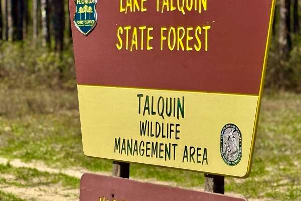
Turkey Flat Road
This freshly graded trail offers a smooth and easy ride, leading to a super cool 1800s-era cemetery on Florida State Forest land. Located within the Highway 20 Tract of the Lake Talquin State Forest, this area is rich in history and natural beauty. The surrounding forest provides a peaceful setting ...
Learn more about Turkey Flat Road
McCloskey-Still - Osceola NF 236
The McCloskey-Still Trail, also known as Osceola National Forest Road 236, connects CR 250 at the south end and US 441 (through NE Thomas Camp Rd) at the north end. It takes you through the Osceola National Forest from north to south and gives you access to several OHV trails. The road conditions ar...
Learn more about McCloskey-Still - Osceola NF 236
Water Town - Osceola NF 278
The Water Town Trail, also known as Osceola National Forest Road 278, connects the Feeder Trail at the west end and Coleman Trail at the east end. It takes you through the Osceola National Forest from west to east and gives you access to the Osceola Public Shooting Range. The road conditions are a m...
Learn more about Water Town - Osceola NF 278
Beginner ATV trails near Hahira, Georgia
Explore ATV-friendly trails near you. These trails are accessible for vehicles up to 50 inches wide, perfect for ATVs and smaller off-road machines.
Little Suwannee Road - Osceola NF 291
The Little Suwannee Road, also known as Osceola National Forest Road 291, is a 12-mile road that starts at US-441. It takes you through the northwestern part of the Osceola National Forest from south to north and gives you access to several OHV trails. It's a dead-end road that ends shortly before t...
Learn more about Little Suwannee Road - Osceola NF 291
Mule Lot - Osceola NF 279
The Mule Lot Trail, also known as Osceola National Forest Road 279, is a 5-mile road that connects Little Suwannee Road at the north end and Sandhill Grade at the south end of the trail. It's the only road that connects the northwestern part of the Osceola National Forest with the main part. The roa...
Learn more about Mule Lot - Osceola NF 279
North East Needmore Road - Osceola NF
North East Needmore Road is a 5-mile road that starts at US-441 at the west end and FR 237 at the east end of the trail. It takes you through the northwestern part of the Osceola National Forest from west to east and gives you easy access to the main part of the forest. The road conditions are a mix...
Learn more about North East Needmore Road - Osceola NF
Sandhill Grade - Osceola NF 200
The Sandhill Grade Trail, also known as Osceola National Forest Road 200, is an 18-mile road that connects FR 237 at the west end and CR 250 at the east end. It takes you through the Osceola National Forest from west to east and gives you access to several OHV trails. Parts of the trail are in the J...
Learn more about Sandhill Grade - Osceola NF 200
Beginner UTV/side-by-side trails near Hahira, Georgia
Find UTV and side-by-side trails near you. These trails accommodate vehicles up to 60 inches wide, ideal for UTVs, side-by-sides, and wider off-road rigs.
Little Suwannee Road - Osceola NF 291
The Little Suwannee Road, also known as Osceola National Forest Road 291, is a 12-mile road that starts at US-441. It takes you through the northwestern part of the Osceola National Forest from south to north and gives you access to several OHV trails. It's a dead-end road that ends shortly before t...
Learn more about Little Suwannee Road - Osceola NF 291
Mule Lot - Osceola NF 279
The Mule Lot Trail, also known as Osceola National Forest Road 279, is a 5-mile road that connects Little Suwannee Road at the north end and Sandhill Grade at the south end of the trail. It's the only road that connects the northwestern part of the Osceola National Forest with the main part. The roa...
Learn more about Mule Lot - Osceola NF 279
North East Needmore Road - Osceola NF
North East Needmore Road is a 5-mile road that starts at US-441 at the west end and FR 237 at the east end of the trail. It takes you through the northwestern part of the Osceola National Forest from west to east and gives you easy access to the main part of the forest. The road conditions are a mix...
Learn more about North East Needmore Road - Osceola NF
Sandhill Grade - Osceola NF 200
The Sandhill Grade Trail, also known as Osceola National Forest Road 200, is an 18-mile road that connects FR 237 at the west end and CR 250 at the east end. It takes you through the Osceola National Forest from west to east and gives you access to several OHV trails. Parts of the trail are in the J...
Learn more about Sandhill Grade - Osceola NF 200
The onX Offroad Difference
onX Offroad combines trail photos, descriptions, difficulty ratings, width restrictions, seasonality, and more in a user-friendly interface. Available on all devices, with offline access and full compatibility with CarPlay and Android Auto. Discover what you're missing today!
Open Trail Map