
Beginner Off-Road Trails
Near Gum Springs, Arkansas
Explore All Beginner Trails Near Gum Springs, Arkansas
Beginner Off-Road Trails Near Gum Springs, Arkansas
Discover the best beginner-friendly off-road trails near you. These easier, lower-rated trails are a great place to start — browse trail maps, check difficulty ratings, and find your next adventure.
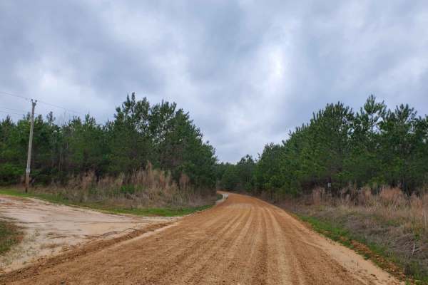
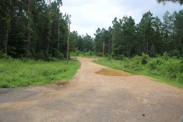
Highway 24 to Poison Springs WMA
This is a dirt and gravel road south of Highway 24. This road goes into the Poison Spring WMA. A camping permit is required and is free at the Poison Springs WMA website. This road can be slippery when wet. Some mild water crossings can be present during and after rains. Watch for wildlife crossing ...
Learn more about Highway 24 to Poison Springs WMA
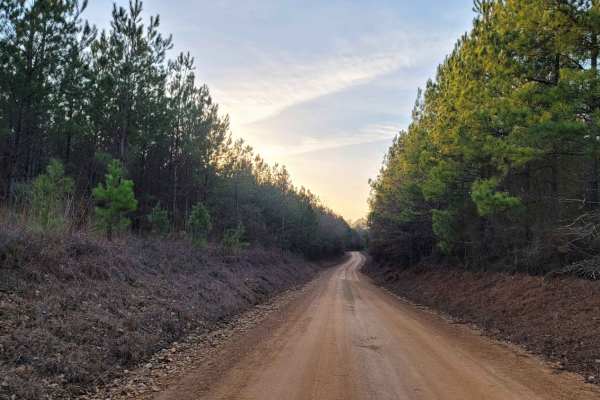
Country Route to White Oak Lake Group Campsite
This is a gravel and dirt road that leads to an awesome group campsite on White Oak Lake. A permit can be found online to camp in this free Poison Springs Forest. There are several campsites in this area. This particular campsite is on a hill right beside White Oak Lake. The later part of this route...
Learn more about Country Route to White Oak Lake Group Campsite
Poison Springs WMA - Campsite C-10 to C-29 and C-54
This dirt and gravel road takes you to dispersed campsites within the Poison Springs WMA area. Camping permits are required and are free at Poison Springs WMA website. Roads can be slick, and water crossing can be found after rains. Watch for wildlife to cross roads. There are creeks in the area.
Learn more about Poison Springs WMA - Campsite C-10 to C-29 and C-54
Primitive Camp and Shooting Range in Poison Springs WMA
White Oak State Park is a great place to stay while you explore the Poison Springs WMA. If you want full hookups and restrooms while you camp. While at White Oak State Park, ask the visitor center for a map to "The Little Grand Canyon." A must-see while in the area. You are close to the state park h...
Learn more about Primitive Camp and Shooting Range in Poison Springs WMA
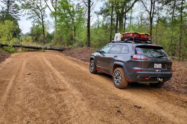
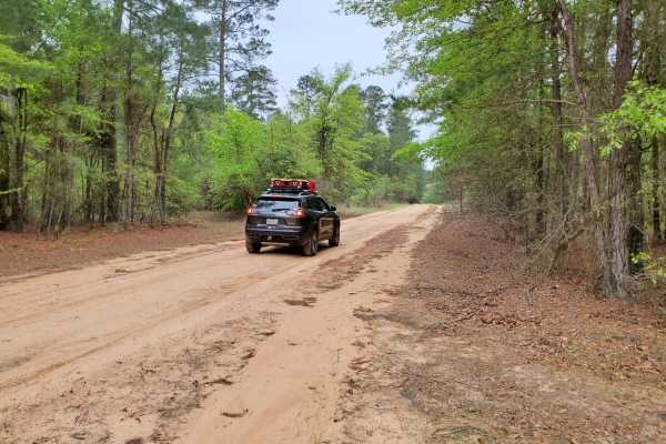
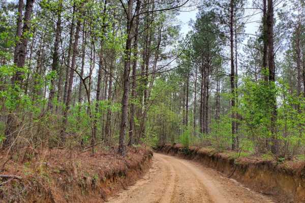
Potlatch Forest
The majority of these county roads are no longer maintained. The old gravel roads have a lot of sand and dirt in them now. Some areas are overgrown with limbs and trees over the road. There are some water crossing dependent on rain. These roads run between Nevada 23 Road and Highway 299. This land i...
Learn more about Potlatch Forest
The Arkansas Overland Route - Section 5 - Highway 76 to Highway 278
This trail is a mix of dirt, gravel, and asphalt. This area has some beautiful views and creeks. This is the 5th section of the Arkansas Overlanding Route that starts off HWY 82 (FALCON Bottoms Back Roads) trail. This section can be slick and muddy in sections when wet. Paved sections can be rough i...
Learn more about The Arkansas Overland Route - Section 5 - Highway 76 to Highway 278
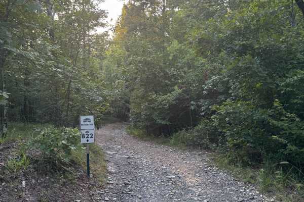
B22 Waterfall
B22 Waterfall is a 1-Diamond, two-way trail located in the B-section of Hot Springs Off-Road Park—an area designed with beginners in mind. At 0.2 miles long, this easy, scenic route is perfect for starting the day slow and soaking in the beauty of nature. The trail winds through tall wooded creek be...
Learn more about B22 Waterfall
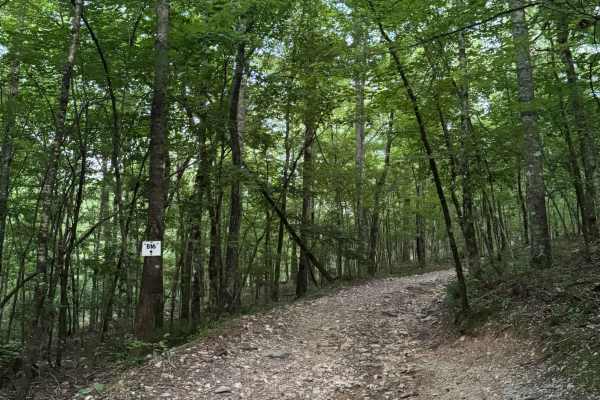
B16
B16 is a 1-Diamond, gravel trail located in the B-section of Hot Springs Off-Road Park, known for its scenic and beginner-friendly terrain. This 0.2-mile, heavily wooded route winds gently through the forest with a gradual 73-foot elevation gain, making it a comfortable trail for newcomers and natur...
Learn more about B16
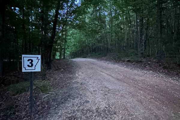
AR 3 - Main Park Road
Arkansas-3 is a mostly flat, gravel road that serves as a main connector across the B-section of Hot Springs Off-Road Park. Covering 0.3 miles, it links Arkansas-2 to B28 Powerline, while also providing access to scenic spots like B22 Waterfall and C4 Power Wagon. The trail passes through a mix of n...
Learn more about AR 3 - Main Park Road
B4 Grand Cherokee Challenge
This is an easy trail that links B28, which is a higher rating, but B28 is also a two-way, so you can also head to AR Highway 2. It has some off-camber sections that can be used to test your suspension. Gravel rocks with small inclines but can easily be done in 4WD.
Learn more about B4 Grand Cherokee Challenge
AR 2 - Main Park Road
This is the easy shortcut between the eastern side of the park and the main park entrance. It is a fairly easy trail but has a few washouts and off-camber sections. If you completed Rubicon Ridge D1, one of four Jeep Badge of Honor trails, this provides a quick and easy way to return to the park ent...
Learn more about AR 2 - Main Park Road
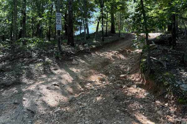
F6 Snake Early Exit
This is the early exit of the Badge of Honor trail F19-Snake. This early exit is a steep climb up onto highway two which you can then go onto highway five by turning left or back down to the main office by turning right from the exit. It is an extremely small passthrough.
Learn more about F6 Snake Early Exit
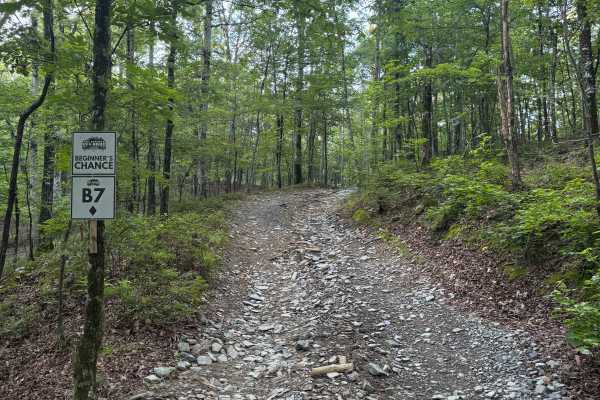
B7 Beginner's Chance
B7 Beginner’s Chance is a short, one-way trail rated as an easy 2-Diamond. It connects B1 Bulletproof Loop to B4, offering a quick and scenic transition between trails on the lower 800-Side of the Park.
The route is heavily wooded and shaded, creating a peaceful forest atmosphere. It's a quiet stre...
Learn more about B7 Beginner's Chance
F20 Exit Trail
Once you are done with either the Ravine or Gorge this trail will be the way to get back to the Lake Winder trail which you can use to access other trails. The trail is fairly easy with loose rock and a slow decline. Just don't be too heavy on the brakes and let the engine do the work.
Learn more about F20 Exit Trail
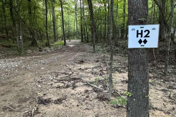
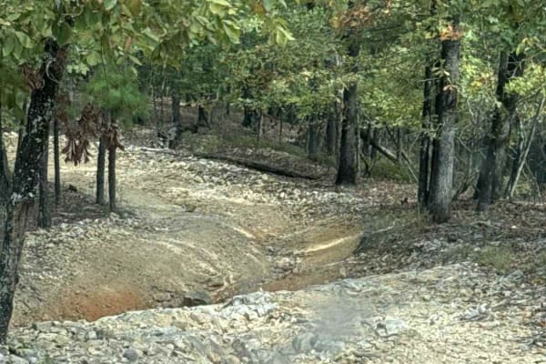
H2
H2 is a peaceful, scenic trail tucked away on the "400-Side" of Hot Springs Off-Road Park. It runs alongside Mill Creek Road for a stretch, dipping in and out of the water, and winds past several small waterfalls that are especially striking after a good rain. The trail includes one mild climb and f...
Learn more about H2
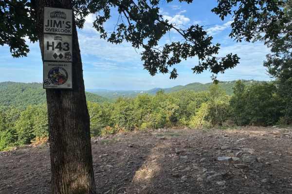
H43 Jim's Overlook
H43 Jim's Overlook is a 2-Diamond overlook trail located on the 400-Side of Hot Springs Off-Road Park. It's accessible via K6 Jaag'd Edge, H42, and Quartz Canyon, making it a popular destination for drivers exploring the upper trails of the Park. The overlook offers one of the most expansive panoram...
Learn more about H43 Jim's Overlook

B1 Bulletproof Loop
Easy trail that starts your adventure at HSOP. Loose rocks and one small incline. It's a short trail but links a larger network of trails and is a great test for your rig when you first enter the park, since it's next to the office. This is considered a beginner's trail.
Learn more about B1 Bulletproof Loop
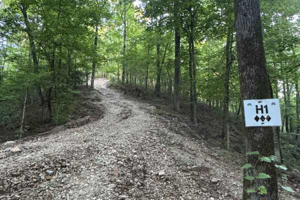
H1
H1 is a scenic, mostly shaded trail rated as a 2 to 3-Diamond by the Park, depending on direction and vehicle setup. It features a small rock ledge obstacle and serves as a two-way trail, offering flexibility for various routes across the 400-Side of the Park.
Along the way, drivers will pass a nat...
Learn more about H1

AR 1 - Main Park Road
This is the primary north-south trail leading out of the park entrance area and along the western side of the park. The trail is plenty wide enough for two vehicles and is fairly flat and smooth. The bulk of the park trails branch off to the right side. Fun Run trail - G3, Jeep Badge of Honor Trail,...
Learn more about AR 1 - Main Park Road
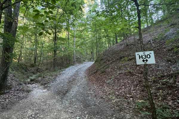
H30
H30 is a park-rated 2-Diamond, two-way trail that winds through a heavily shaded section of forest on the 400-Side of the Park. The trail connects to both H1 and H28, making it a useful access route for exploring the surrounding trail system and overlooks. The area is filled with lush vegetation, in...
Learn more about H30
Beginner ATV trails near Gum Springs, Arkansas
Explore ATV-friendly trails near you. These trails are accessible for vehicles up to 50 inches wide, perfect for ATVs and smaller off-road machines.
Country Route to White Oak Lake Group Campsite
This is a gravel and dirt road that leads to an awesome group campsite on White Oak Lake. A permit can be found online to camp in this free Poison Springs Forest. There are several campsites in this area. This particular campsite is on a hill right beside White Oak Lake. The later part of this route...
Learn more about Country Route to White Oak Lake Group Campsite
B22 Waterfall
B22 Waterfall is a 1-Diamond, two-way trail located in the B-section of Hot Springs Off-Road Park—an area designed with beginners in mind. At 0.2 miles long, this easy, scenic route is perfect for starting the day slow and soaking in the beauty of nature. The trail winds through tall wooded creek be...
Learn more about B22 Waterfall
B16
B16 is a 1-Diamond, gravel trail located in the B-section of Hot Springs Off-Road Park, known for its scenic and beginner-friendly terrain. This 0.2-mile, heavily wooded route winds gently through the forest with a gradual 73-foot elevation gain, making it a comfortable trail for newcomers and natur...
Learn more about B16
AR 3 - Main Park Road
Arkansas-3 is a mostly flat, gravel road that serves as a main connector across the B-section of Hot Springs Off-Road Park. Covering 0.3 miles, it links Arkansas-2 to B28 Powerline, while also providing access to scenic spots like B22 Waterfall and C4 Power Wagon. The trail passes through a mix of n...
Learn more about AR 3 - Main Park Road
Beginner UTV/side-by-side trails near Gum Springs, Arkansas
Find UTV and side-by-side trails near you. These trails accommodate vehicles up to 60 inches wide, ideal for UTVs, side-by-sides, and wider off-road rigs.
Country Route to White Oak Lake Group Campsite
This is a gravel and dirt road that leads to an awesome group campsite on White Oak Lake. A permit can be found online to camp in this free Poison Springs Forest. There are several campsites in this area. This particular campsite is on a hill right beside White Oak Lake. The later part of this route...
Learn more about Country Route to White Oak Lake Group Campsite
B22 Waterfall
B22 Waterfall is a 1-Diamond, two-way trail located in the B-section of Hot Springs Off-Road Park—an area designed with beginners in mind. At 0.2 miles long, this easy, scenic route is perfect for starting the day slow and soaking in the beauty of nature. The trail winds through tall wooded creek be...
Learn more about B22 Waterfall
B16
B16 is a 1-Diamond, gravel trail located in the B-section of Hot Springs Off-Road Park, known for its scenic and beginner-friendly terrain. This 0.2-mile, heavily wooded route winds gently through the forest with a gradual 73-foot elevation gain, making it a comfortable trail for newcomers and natur...
Learn more about B16
AR 3 - Main Park Road
Arkansas-3 is a mostly flat, gravel road that serves as a main connector across the B-section of Hot Springs Off-Road Park. Covering 0.3 miles, it links Arkansas-2 to B28 Powerline, while also providing access to scenic spots like B22 Waterfall and C4 Power Wagon. The trail passes through a mix of n...
Learn more about AR 3 - Main Park Road
The onX Offroad Difference
onX Offroad combines trail photos, descriptions, difficulty ratings, width restrictions, seasonality, and more in a user-friendly interface. Available on all devices, with offline access and full compatibility with CarPlay and Android Auto. Discover what you're missing today!
Open Trail Map