
Beginner Off-Road Trails
Near Clinton, Nebraska
Explore All Beginner Trails Near Clinton, Nebraska
Beginner Off-Road Trails Near Clinton, Nebraska
Discover the best beginner-friendly off-road trails near you. These easier, lower-rated trails are a great place to start — browse trail maps, check difficulty ratings, and find your next adventure.
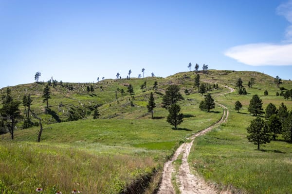
Little Wolves
The three trails that comprise this route are all at or just under 3 miles long. The first two-thirds (Little Wolf East and Highline) are well-maintained gravel;most of the last third is dirt - a portion of which washes out and creates deep, wide ruts. Several areas of the trail also collect runoff ...
Learn more about Little Wolves
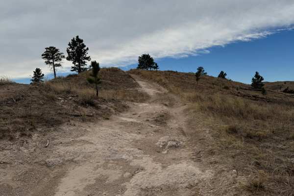
Highline Trail
This trail is a 2-track that's mainly comprised of hard pack dirt. There are minor to medium-sized washouts and ruts that can fill with mud after heavy rainfall. There are a few areas on the 213 section of this run that will put you in slight off-camber conditions. The majority of this run is in ope...
Learn more about Highline Trail
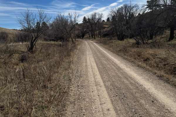
Kings Canyon Trail
The trail starts and ends on loose gravel. The center section of the trail is mainly comprised of 2-track hard pack natural dirt. There are several large 'whoops', ruts, and washouts along the center section where additional ground clearance would be preferred. The center section has the potential t...
Learn more about Kings Canyon Trail
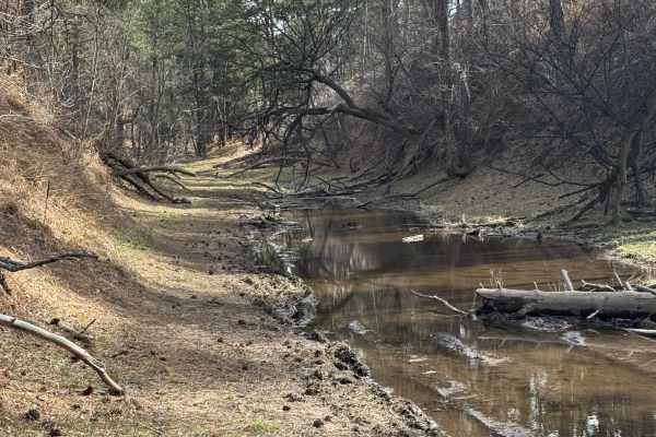
Strong Canyon Run
This is a two-part trail that's mainly 2-track and is comprised of hard-pack dirt. The trail starts off pretty tame when accessed from Kings Canyon, but conditions worsen after turning onto Trail 214. There are a few spots on 214 where off-camber conditions will reach 18-20 degrees, maybe more if yo...
Learn more about Strong Canyon Run
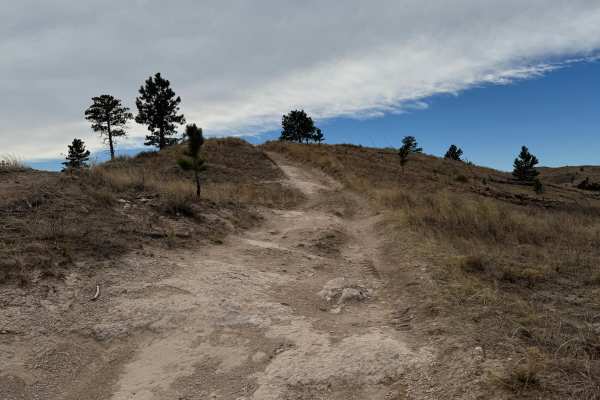
Outrider - FS 779
This is a 2-track trail that is very rough due to it being mainly composed of ruts and washouts. Be prepared to be bounced around quite a bit. It's an out-and-back that offers some amazing views of the area. The trail is mainly comprised of hard pack dirt, but there are a few areas where it becomes ...
Learn more about Outrider - FS 779
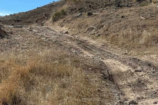
Coffee Mill Butte - FS 702
This is a 2-track trail that's mainly comprised of hard-pack dirt. The trail has ruts, washouts, and whoops that could fill with mud after rain. A few of the whoops could require a vehicle with extra ground clearance, as they are tall and steep. There is also a small section that's filled with loose...
Learn more about Coffee Mill Butte - FS 702
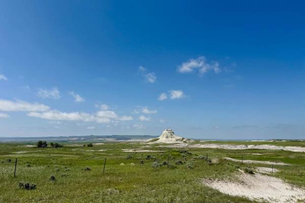
Sugarloaf Road
Sugarloaf Road is a scenic route that runs east-west about 9 miles south of the Nebraska-South Dakota border, connecting Toadstool Road in Sioux County, Nebraska, with Nebraska Highway 71 in Dawes County, Nebraska. The road weaves its way through buttes and rolling hills blanketed with mixed-grass p...
Learn more about Sugarloaf Road
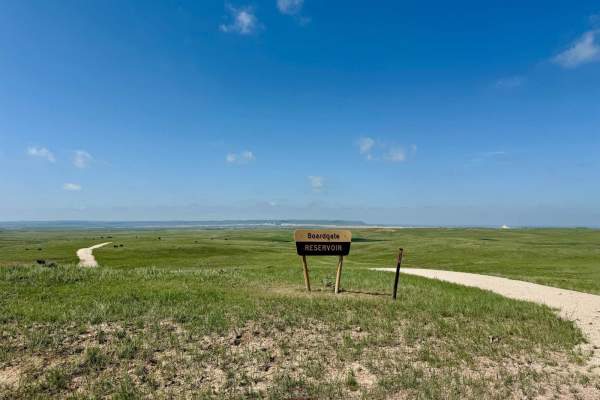
Boardgate (FR 910)
This short spur trail off Sugarloaf Road provides access to the 12-acre Boardgate Reservoir in the Oglala National Grassland. The trail itself has a sand and gravel surface. The trail is out-and-back, and has a turnaround area adjacent to the reservoir. Small washouts from seasonal rains are possibl...
Learn more about Boardgate (FR 910)
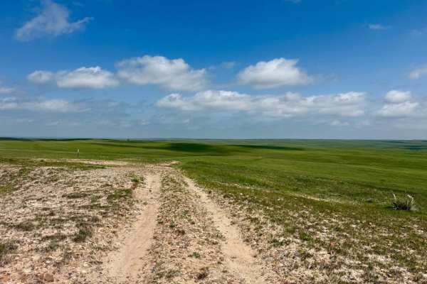
Prairie Hills - FR 939
This out-and-back spur trail off Sugarloaf Road is not quite a mile and a half in length, but it's well worth the drive. It's a sandy two-track through the grass for most of the trail, with a little bit of gravel and rock here and there. About 0.8 miles from the trailhead, a rise in elevation provid...
Learn more about Prairie Hills - FR 939
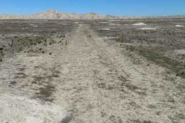
Sage Creek Conata West
This is a fun two-track dirt trail that gives you a glimpse into the grasslands and Badlands most people don't get to experience. You may encounter lots of prairie dogs and large herds of antelope. Do not attempt this trail if it is raining/snowing or if there has been moisture in the last week;it w...
Learn more about Sage Creek Conata West
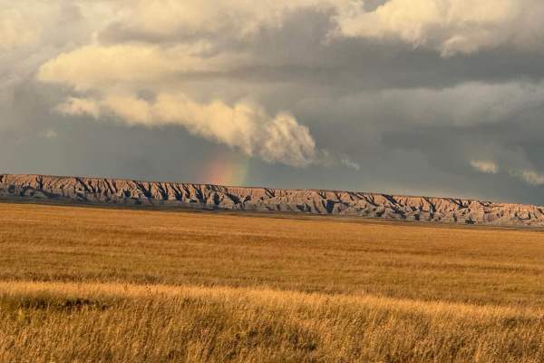
Conata Basin Road
Conata Basin Road is a two-lane gravel route that winds through the stunning expanse of Buffalo Gap National Grassland, leading straight into the heart of Badlands National Park. Beginning off SD-44 to the south, this scenic drive carries you northward, offering panoramic views of the wide-open prai...
Learn more about Conata Basin Road
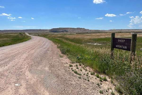
Sheep Mountain Table Road
This an easy, scenic dirt road that leads to some really cool overlooks of the south portion of Badlands National Park. It has 2 distinct sections with the first part being accessible to all vehicles and the second part only for high clearance 4WD vehicles. There are multiple places to stop and take...
Learn more about Sheep Mountain Table Road
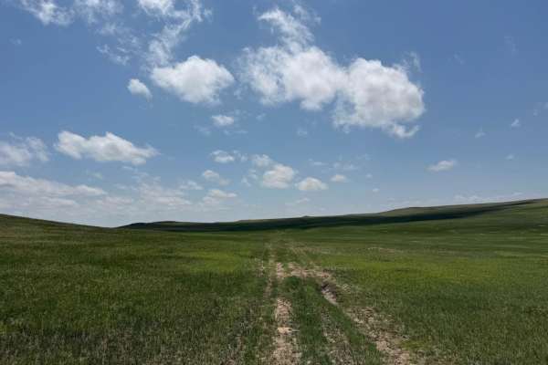
Conklin - FR 924
Conklin (Forest Road 924) is an out-and-back trail that runs north-south, meandering over rolling hills in the Oglala National Grassland. The trailhead is located a mile south of the South Dakota-Nebraska border on Hat Creek Road. The entire trail is two-track, on a grass-covered sandy surface that ...
Learn more about Conklin - FR 924
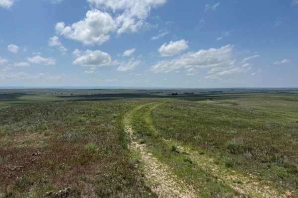
Prairie Dog - FR 925
Prairie Dog is an east-west trail that connects Hat Creek Road with Conklin (FR 924). The topography of the trail is very much like the others in the area, with rolling hills covered with mixed-grass prairie. The name of the trail is an obvious nod to the burrowing rodents that have created the thou...
Learn more about Prairie Dog - FR 925
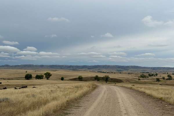
Orella Road
The road begins on the west end off of Hat Creek Road and continues east to Toadstool Road. The area is surrounded by ranch land goes through private property with cattle on the road. Unique geologic features can be seen Toadstool area of the Ogala National Grassland. Beautiful views of grasslands a...
Learn more about Orella Road
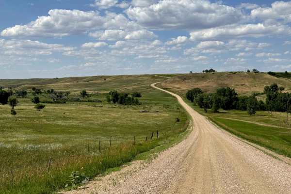
Spring Draw Rd
Spring Draw Rd is an accessible, well-maintained Gravel Road that connects Indian Creek Rd Hwy 44 and takes you through the northwest part of Buffalo Gap Natl Grassland. You might be able to see prairie dogs along the road. The rugged beauty of the Badlands draws visitors from around the world. Thes...
Learn more about Spring Draw Rd
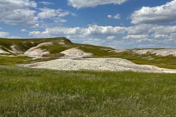
Indian Creek Rd
Indian Creek Rd is an easy well-maintained Gravel Road that starts in Scenic at the Bombing Range Rd and takes you through the north west part of Buffalo Gap Natl Grassland. You might be able to see prairie dogs along the road.The rugged beauty of the Badlands draws visitors from around the world. T...
Learn more about Indian Creek Rd
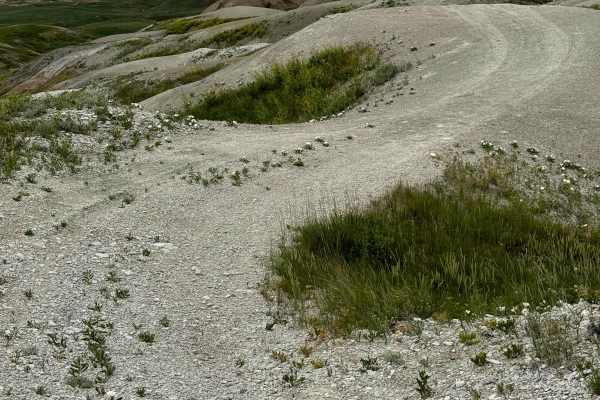
Bear Creek Spur
This is an out-and-back trail, with the trail ending at the border of neighboring private property. The trail starts behind a wire cattle gate, be sure to always shut the gate behind you. For the first mile, the trail snakes through a wide grassy valley of relatively soft loamy dirt, although you wo...
Learn more about Bear Creek Spur
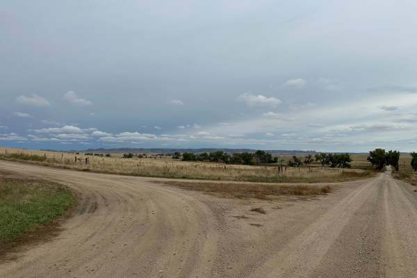
Hat Creek Road
Hat Creek Road can be accessed off of West Hat Creek Road, just northeast of the town of Harrison, and runs north to Montrose Road. This is a double-wide dirt road that is maintained and graded. Sections can become muddy in wet conditions. The surrounding area consists of large ranches, and you have...
Learn more about Hat Creek Road
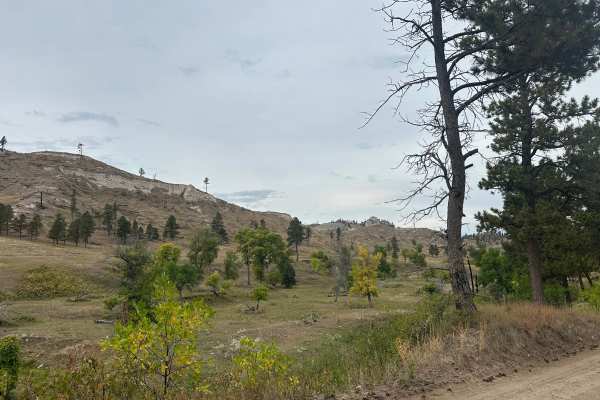
West Hat Creek Road
West Hat Creek Road can be accessed off of Highway 20 just east of the town of Harrison and runs north to Hat Creek Road. This is a double-wide dirt road that is maintained and graded. Sections can become muddy in wet conditions. The surrounding area consists of large ranches, and you have great vie...
Learn more about West Hat Creek Road
Beginner ATV trails near Clinton, Nebraska
Explore ATV-friendly trails near you. These trails are accessible for vehicles up to 50 inches wide, perfect for ATVs and smaller off-road machines.
Little Wolves
The three trails that comprise this route are all at or just under 3 miles long. The first two-thirds (Little Wolf East and Highline) are well-maintained gravel;most of the last third is dirt - a portion of which washes out and creates deep, wide ruts. Several areas of the trail also collect runoff ...
Learn more about Little Wolves
Highline Trail
This trail is a 2-track that's mainly comprised of hard pack dirt. There are minor to medium-sized washouts and ruts that can fill with mud after heavy rainfall. There are a few areas on the 213 section of this run that will put you in slight off-camber conditions. The majority of this run is in ope...
Learn more about Highline Trail
Kings Canyon Trail
The trail starts and ends on loose gravel. The center section of the trail is mainly comprised of 2-track hard pack natural dirt. There are several large 'whoops', ruts, and washouts along the center section where additional ground clearance would be preferred. The center section has the potential t...
Learn more about Kings Canyon Trail
Strong Canyon Run
This is a two-part trail that's mainly 2-track and is comprised of hard-pack dirt. The trail starts off pretty tame when accessed from Kings Canyon, but conditions worsen after turning onto Trail 214. There are a few spots on 214 where off-camber conditions will reach 18-20 degrees, maybe more if yo...
Learn more about Strong Canyon Run
Beginner UTV/side-by-side trails near Clinton, Nebraska
Find UTV and side-by-side trails near you. These trails accommodate vehicles up to 60 inches wide, ideal for UTVs, side-by-sides, and wider off-road rigs.
Little Wolves
The three trails that comprise this route are all at or just under 3 miles long. The first two-thirds (Little Wolf East and Highline) are well-maintained gravel;most of the last third is dirt - a portion of which washes out and creates deep, wide ruts. Several areas of the trail also collect runoff ...
Learn more about Little Wolves
Highline Trail
This trail is a 2-track that's mainly comprised of hard pack dirt. There are minor to medium-sized washouts and ruts that can fill with mud after heavy rainfall. There are a few areas on the 213 section of this run that will put you in slight off-camber conditions. The majority of this run is in ope...
Learn more about Highline Trail
Kings Canyon Trail
The trail starts and ends on loose gravel. The center section of the trail is mainly comprised of 2-track hard pack natural dirt. There are several large 'whoops', ruts, and washouts along the center section where additional ground clearance would be preferred. The center section has the potential t...
Learn more about Kings Canyon Trail
Strong Canyon Run
This is a two-part trail that's mainly 2-track and is comprised of hard-pack dirt. The trail starts off pretty tame when accessed from Kings Canyon, but conditions worsen after turning onto Trail 214. There are a few spots on 214 where off-camber conditions will reach 18-20 degrees, maybe more if yo...
Learn more about Strong Canyon Run
The onX Offroad Difference
onX Offroad combines trail photos, descriptions, difficulty ratings, width restrictions, seasonality, and more in a user-friendly interface. Available on all devices, with offline access and full compatibility with CarPlay and Android Auto. Discover what you're missing today!
Open Trail Map