
Beginner Off-Road Trails
Near Chatom, Alabama
Explore All Beginner Trails Near Chatom, Alabama
Beginner Off-Road Trails Near Chatom, Alabama
Discover the best beginner-friendly off-road trails near you. These easier, lower-rated trails are a great place to start — browse trail maps, check difficulty ratings, and find your next adventure.
Peninsula Grove
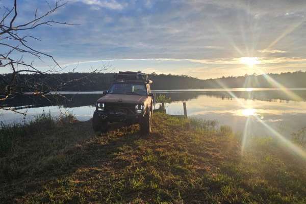
Entering the trail will be a gate that should be unlocked depending on seasonal closures. Be sure to close the gate upon entering and leaving. The trail is mostly grassy with a few small ruts and a mixture of dirt and sand. Vehicles the size of a Jeep Cherokee or Toyota Rav 4 can fit down the trail ...
Learn more about Peninsula Grove
South Tank Trail - FS 35000
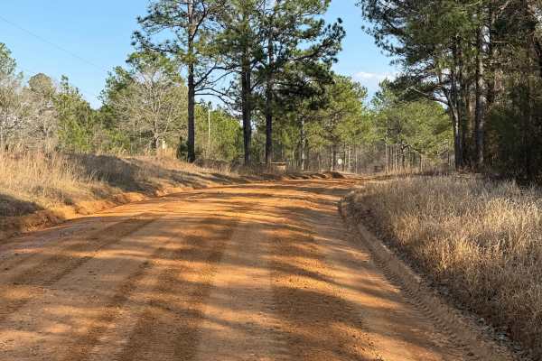
FS 35000 is a well-maintained 14-mile gravel road that runs east-west through the DeSoto National Forest. The road is well-traveled, with the western two-thirds running near/through the Mississippi National Guard's Camp Shelby Military Reservation. The eastern third offers a few easily accessible di...
Learn more about South Tank Trail - FS 35000
Right Branch - FS 308K
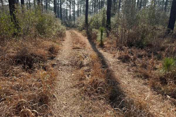
FS 308K is a short section of gravel road that leads to a pair of motorized use trails. The gravel portion is about a quarter of a mile long and is easily passable with any vehicle. The right branch, though mostly level, is more difficult due to downed trees and moderately deep mud holes. The mud ho...
Learn more about Right Branch - FS 308K
Ashe Lake Trail
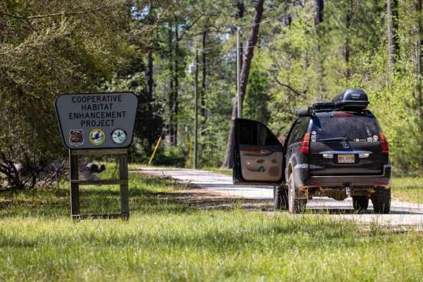
This trail begins at Ashe Lake Recreational Area. The recreation area has a beautiful lake, walking trail, and working bathroom! As you begin this trail there you will see that it is easily 2 full-size vehicles wide. There is a public shooting range off of the north side of the road around .2 miles ...
Learn more about Ashe Lake Trail
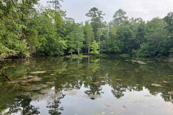
Gravel Landing
Gravel Landing is a scenic access point located within the Perdido River Wildlife Management Area along the Alabama–Florida border. The route to the landing follows a well-maintained gravel single-lane road that winds through pine forest and lowland habitat typical of the region. The trail is genera...
Learn more about Gravel Landing
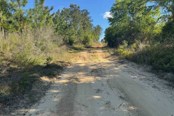
Duck Road Bypass
Bypass the Rocky Duck Road with an easy and scenic route through the coastal pine forests of South Alabama. Starts a little sandy, then moves to packed dirt. Most SUVs will have no issue on the trail. Has a nice overlook at the end. This trail will connect to Blue Lake Loop.
Learn more about Duck Road Bypass
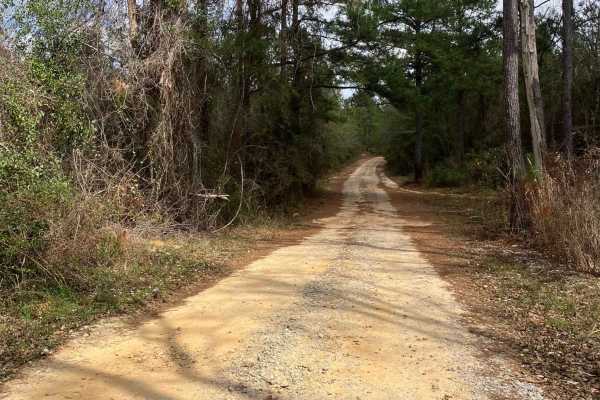
Blue Lake Loop
Blue Lake Loop is an easy and scenic route through the coastal pine forests of South Alabama. The trail follows a mix of sandy, grassy, and well-maintained gravel forest roads with mostly flat terrain, making it suitable for stock 4x4 or AWD vehicles in dry conditions. It’s an excellent choice for a...
Learn more about Blue Lake Loop
Beginner ATV trails near Chatom, Alabama
Explore ATV-friendly trails near you. These trails are accessible for vehicles up to 50 inches wide, perfect for ATVs and smaller off-road machines.
Peninsula Grove
Entering the trail will be a gate that should be unlocked depending on seasonal closures. Be sure to close the gate upon entering and leaving. The trail is mostly grassy with a few small ruts and a mixture of dirt and sand. Vehicles the size of a Jeep Cherokee or Toyota Rav 4 can fit down the trail ...
Learn more about Peninsula Grove
South Tank Trail - FS 35000
FS 35000 is a well-maintained 14-mile gravel road that runs east-west through the DeSoto National Forest. The road is well-traveled, with the western two-thirds running near/through the Mississippi National Guard's Camp Shelby Military Reservation. The eastern third offers a few easily accessible di...
Learn more about South Tank Trail - FS 35000
Right Branch - FS 308K
FS 308K is a short section of gravel road that leads to a pair of motorized use trails. The gravel portion is about a quarter of a mile long and is easily passable with any vehicle. The right branch, though mostly level, is more difficult due to downed trees and moderately deep mud holes. The mud ho...
Learn more about Right Branch - FS 308K
Ashe Lake Trail
This trail begins at Ashe Lake Recreational Area. The recreation area has a beautiful lake, walking trail, and working bathroom! As you begin this trail there you will see that it is easily 2 full-size vehicles wide. There is a public shooting range off of the north side of the road around .2 miles ...
Learn more about Ashe Lake Trail
Beginner UTV/side-by-side trails near Chatom, Alabama
Find UTV and side-by-side trails near you. These trails accommodate vehicles up to 60 inches wide, ideal for UTVs, side-by-sides, and wider off-road rigs.
Peninsula Grove
Entering the trail will be a gate that should be unlocked depending on seasonal closures. Be sure to close the gate upon entering and leaving. The trail is mostly grassy with a few small ruts and a mixture of dirt and sand. Vehicles the size of a Jeep Cherokee or Toyota Rav 4 can fit down the trail ...
Learn more about Peninsula Grove
South Tank Trail - FS 35000
FS 35000 is a well-maintained 14-mile gravel road that runs east-west through the DeSoto National Forest. The road is well-traveled, with the western two-thirds running near/through the Mississippi National Guard's Camp Shelby Military Reservation. The eastern third offers a few easily accessible di...
Learn more about South Tank Trail - FS 35000
Right Branch - FS 308K
FS 308K is a short section of gravel road that leads to a pair of motorized use trails. The gravel portion is about a quarter of a mile long and is easily passable with any vehicle. The right branch, though mostly level, is more difficult due to downed trees and moderately deep mud holes. The mud ho...
Learn more about Right Branch - FS 308K
Ashe Lake Trail
This trail begins at Ashe Lake Recreational Area. The recreation area has a beautiful lake, walking trail, and working bathroom! As you begin this trail there you will see that it is easily 2 full-size vehicles wide. There is a public shooting range off of the north side of the road around .2 miles ...
Learn more about Ashe Lake Trail
The onX Offroad Difference
onX Offroad combines trail photos, descriptions, difficulty ratings, width restrictions, seasonality, and more in a user-friendly interface. Available on all devices, with offline access and full compatibility with CarPlay and Android Auto. Discover what you're missing today!
Open Trail Map