
Beginner Off-Road Trails
Near Casa, Arkansas
Explore All Beginner Trails Near Casa, Arkansas
Beginner Off-Road Trails Near Casa, Arkansas
Discover the best beginner-friendly off-road trails near you. These easier, lower-rated trails are a great place to start — browse trail maps, check difficulty ratings, and find your next adventure.
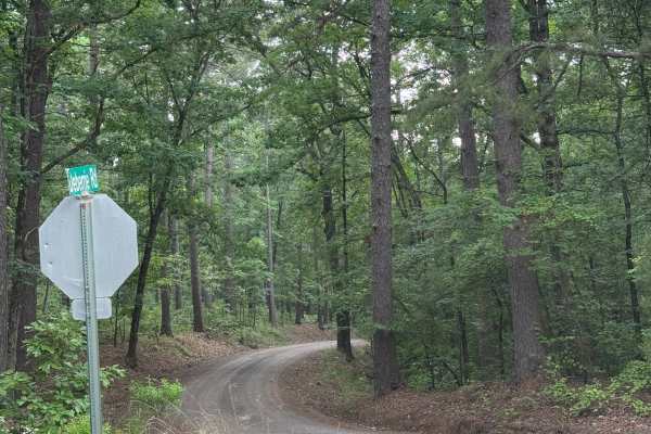
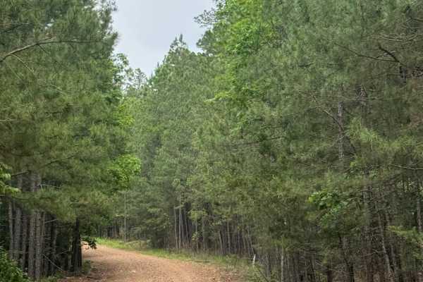
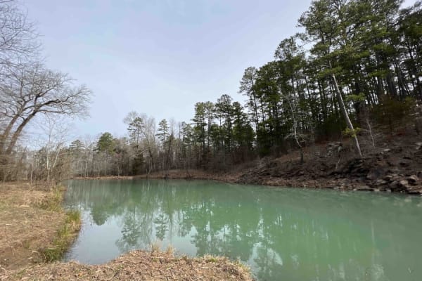
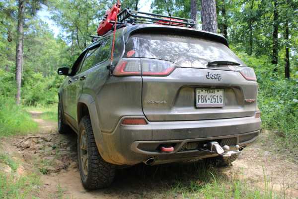
Wallace Bridge Road
Wallace Bridge Road is a beautiful gravel road that is woven through the Ouachita National Forest. This is a very well-maintained gravel road that passes through farmland in Deberrie, Arkansas, and runs along the Fourche LaFave River. This road is suitable for most vehicles as there are limited obst...
Learn more about Wallace Bridge Road

Long Caney 849 to South Fourche LaFave River
The Northern entrance into the Ouachita National Forest leads to a beautiful large quiet campsite on the South Fourche LaFave River. The road leading to this location is gravel when coming from the north. Once you turn right on Long Caney, it turns into a mud hole road all the way to camp. Lots of t...
Learn more about Long Caney 849 to South Fourche LaFave River
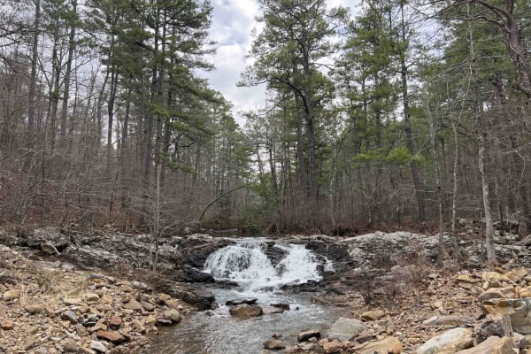
Main Mountain Road 83
Main Mountain Road features an easy gravel road with lots of campsites, views of the valley, small creeks, waterfalls, logging operations, and 4x4 trails to explore with quads and SxS. There is a hiking trail to Cove Mountain where there is also a campsite with a view. There are trees down all along...
Learn more about Main Mountain Road 83
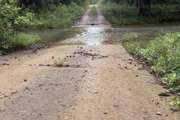
FS 29340
FS 29340 is a maintained gravel/dirt road that connects Long Caney Bypass to CR 182. Along the Ridgeline, you will get some fantastic views of the Ouachita National Forest and will often see Deer and other wildlife. There are a couple of low water bridges that are 6-12 inches deep, depending on the ...
Learn more about FS 29340
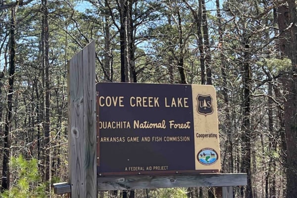
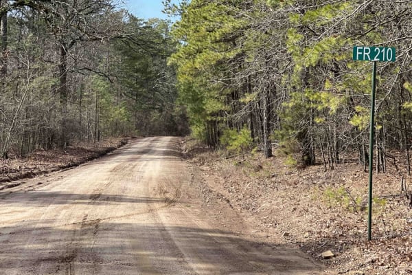
Cove Creek Lake/Link Mountain Road 210
This is an uneven, rocky, muddy road with several washouts and deep water areas when it's raining. This road may be impassable during heavy rains. Three campsites along this road are pretty nice. There is also a 4x4 trail that starts right after you cross the dam. There is a boat launch area at the ...
Learn more about Cove Creek Lake/Link Mountain Road 210
Blue Jay Hollow
Blue Jay Hollow is a gravel road in the Ouchita National Forest that winds through dense pines and rolling hills. This trail is 2 cars wide in most places making it easy for passing. There are no major obstacles along the way, and campsites are sparse as most roadside land is private property.
Learn more about Blue Jay Hollow
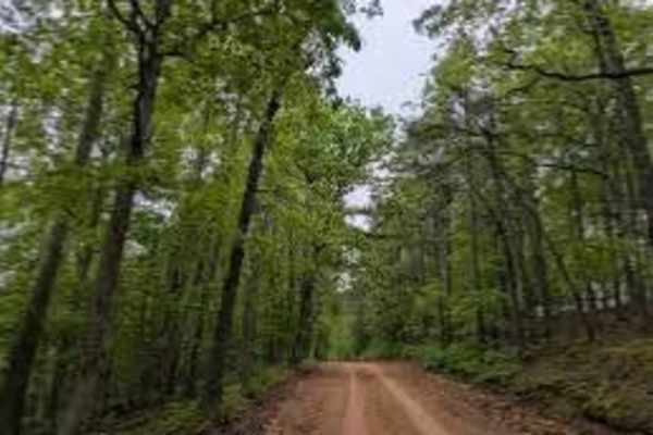
West Forked Mountain FR124
This is a maintained forest road. There are some rocky eroded sections at the north end but it is passable with a 2WD vehicle with good clearance. Along the trail are stunning views of Forked Mountain. There are sections with good views of the mountains, which are picturesque in the fall when the le...
Learn more about West Forked Mountain FR124

North Fork Road 86
This trail is an easy gravel road. Cell phone service was attainable along this route. Great pull-off campsites for trailers and overland rigs. Lots of trails to explore that branch off this road. Quads, SxS, and dirt bikes would be great up here as there are marked signs. Please note that if it is ...
Learn more about North Fork Road 86
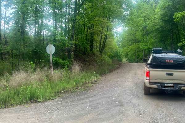
Long Caney bypass
This trail is a very easy, smooth trail. There is a small dip into a shallow creek crossing, but overall, a smooth, simple trail. It connects County Road 86 to County Road 849, also known as Long Caney Road. There are turnaround spots and it's wide enough for two vehicles.
Learn more about Long Caney bypass

Flatside Pinnacle
Flatside Pinnacle Road is an easy gravel road that weaves through the Ouachita National Forest. Under normal, dry conditions, this trail does not have any technical obstacles. In various places, the road may only be one lane wide, making it difficult to pass. This trail leads from Trail 86 on the no...
Learn more about Flatside Pinnacle
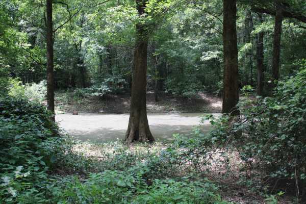
Hollis Trail 174
This route takes you mostly through privately owned property, however, the reward at the end is worth it all. It's a short 7-mile route to the South Fourche LaFave Watershed where there are trails that lead you down to the bank. Kayaking, canoes, and nonmotorized boats are allowed in this area. I de...
Learn more about Hollis Trail 174
Long Hollow Road 146
This route showcases some of Arkansa's most beautiful scenery like the Hogan Creek Bridge which is a beautiful creek that is pretty deep. There are lots of campsites with beautiful views of the ridges of the Ouachita NF. There is a deer camp at the 2.6-mile marker that even had its own outhouse to ...
Learn more about Long Hollow Road 146
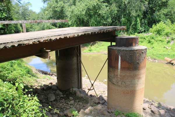
Petit Jean River Wildlife Mgmt Area
This gravel road leads to an old bridge, that has only a section left, on the Petit Jean River. This area is Petit Jean River Wildlife Management Area. This gravel road has several views of the Petit Jean River. A section of the bridge is still present on this side of the Petit Jean River. Standing ...
Learn more about Petit Jean River Wildlife Mgmt Area
North Fork Road/Trail 86
North Fork Road is a beautiful gravel trail that winds through the Ouachita National Forest. This trail provides access to many of Arkansas' hidden outdoor attractions. This road is heavily trafficked and has a few blind curves. There are no technical sections along this trail, so no 4WD is necessar...
Learn more about North Fork Road/Trail 86
Cane Island
This gravel road enters The Petit Jean Wildlife Management Area from Highway 10. The WMA encompasses 15,502 acres approximately 12 miles south of Dardanelle. Petit Jean River Wildlife Management area is located about 8 miles north of Ola on Highway 7 North. The designated area can be accessed from s...
Learn more about Cane Island
Link Mountain Road 210
Starting the trail to the east, it's an easy gravel road for the first 5 miles or so. Then it turns into a muddy mess with high ruts in the middle which make it hard for a low clearance vehicle to make it through certain sections. You can see this in the photo at mile 5.9. There are some really grea...
Learn more about Link Mountain Road 210
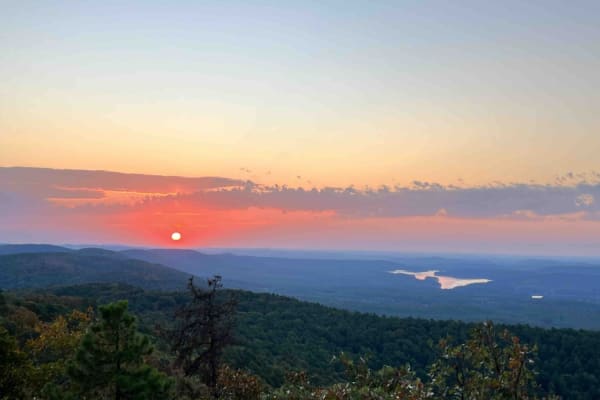
Crystal Mountain
Crystal Mountain spur road is the gateway to one of the most beautiful camping spots in Arkansas. With a peak of 1,680 feet, you can see for miles. At the top of this majestic peak, you have three camping spots that face the east. This makes for some of the most amazing sunrises Arkansas has to offe...
Learn more about Crystal Mountain
Bear Creek
This is an easy trail that is mostly gravel. The first part is not that scenic, but once you're halfway, it's a typical Ouachita Mountains trail. A horse camp is about three-quarters of the way from the north to the south. This intersects with a major thoroughfare road in the Ouachitas. The Trail is...
Learn more about Bear Creek
Oak Mountain Road
Oak Mountain Road is a short but beautiful trail within the Ouachita National Forest that provides beautiful views, good campsites, and fun drives. This short road starts on Highway 7 and connects to the Winona Scenic Drive. Expect a 2-track trail with a few washouts and mud holes along the way.
Learn more about Oak Mountain Road
Danville Mountain
These forest roads consist of F63D, F64E, 658D, and 658 and exits at Growly Road. Some of these roads are narrow and overgrown. A few places will require a bit of ground clearance. Depending on vehicle width scratches are possible. Washouts and ruts will require choosing a line if ground clearance i...
Learn more about Danville Mountain
Beginner ATV trails near Casa, Arkansas
Explore ATV-friendly trails near you. These trails are accessible for vehicles up to 50 inches wide, perfect for ATVs and smaller off-road machines.
Wallace Bridge Road
Wallace Bridge Road is a beautiful gravel road that is woven through the Ouachita National Forest. This is a very well-maintained gravel road that passes through farmland in Deberrie, Arkansas, and runs along the Fourche LaFave River. This road is suitable for most vehicles as there are limited obst...
Learn more about Wallace Bridge Road
Long Caney 849 to South Fourche LaFave River
The Northern entrance into the Ouachita National Forest leads to a beautiful large quiet campsite on the South Fourche LaFave River. The road leading to this location is gravel when coming from the north. Once you turn right on Long Caney, it turns into a mud hole road all the way to camp. Lots of t...
Learn more about Long Caney 849 to South Fourche LaFave River
Main Mountain Road 83
Main Mountain Road features an easy gravel road with lots of campsites, views of the valley, small creeks, waterfalls, logging operations, and 4x4 trails to explore with quads and SxS. There is a hiking trail to Cove Mountain where there is also a campsite with a view. There are trees down all along...
Learn more about Main Mountain Road 83
FS 29340
FS 29340 is a maintained gravel/dirt road that connects Long Caney Bypass to CR 182. Along the Ridgeline, you will get some fantastic views of the Ouachita National Forest and will often see Deer and other wildlife. There are a couple of low water bridges that are 6-12 inches deep, depending on the ...
Learn more about FS 29340
Beginner UTV/side-by-side trails near Casa, Arkansas
Find UTV and side-by-side trails near you. These trails accommodate vehicles up to 60 inches wide, ideal for UTVs, side-by-sides, and wider off-road rigs.
Wallace Bridge Road
Wallace Bridge Road is a beautiful gravel road that is woven through the Ouachita National Forest. This is a very well-maintained gravel road that passes through farmland in Deberrie, Arkansas, and runs along the Fourche LaFave River. This road is suitable for most vehicles as there are limited obst...
Learn more about Wallace Bridge Road
Long Caney 849 to South Fourche LaFave River
The Northern entrance into the Ouachita National Forest leads to a beautiful large quiet campsite on the South Fourche LaFave River. The road leading to this location is gravel when coming from the north. Once you turn right on Long Caney, it turns into a mud hole road all the way to camp. Lots of t...
Learn more about Long Caney 849 to South Fourche LaFave River
Main Mountain Road 83
Main Mountain Road features an easy gravel road with lots of campsites, views of the valley, small creeks, waterfalls, logging operations, and 4x4 trails to explore with quads and SxS. There is a hiking trail to Cove Mountain where there is also a campsite with a view. There are trees down all along...
Learn more about Main Mountain Road 83
FS 29340
FS 29340 is a maintained gravel/dirt road that connects Long Caney Bypass to CR 182. Along the Ridgeline, you will get some fantastic views of the Ouachita National Forest and will often see Deer and other wildlife. There are a couple of low water bridges that are 6-12 inches deep, depending on the ...
Learn more about FS 29340
The onX Offroad Difference
onX Offroad combines trail photos, descriptions, difficulty ratings, width restrictions, seasonality, and more in a user-friendly interface. Available on all devices, with offline access and full compatibility with CarPlay and Android Auto. Discover what you're missing today!
Open Trail Map