
Beginner Off-Road Trails
Near Berry, Alabama
Explore All Beginner Trails Near Berry, Alabama
Beginner Off-Road Trails Near Berry, Alabama
Discover the best beginner-friendly off-road trails near you. These easier, lower-rated trails are a great place to start — browse trail maps, check difficulty ratings, and find your next adventure.
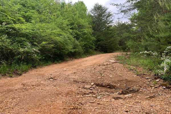
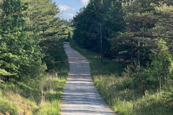
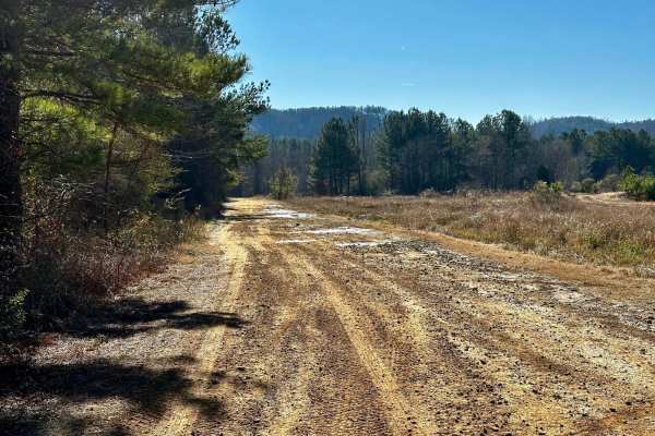
Turkey Creek Road
A picturesque drive through prime Alabama forest. Turkey Creek Road offers a great opportunity for wildlife viewing, photography, and getting away to the wilderness. Turkey Creek Road is a public dirt/gravel road that is mostly unmaintained, expect to encounter ruts, washouts and shallow mud. There ...
Learn more about Turkey Creek Road
Warrior Cemetery Road
Warrior Cemetery Road is one of the "main" access roads for the Mulberry Fork WMA. The road is mostly graded gravel and is easily traversed with any 4WD and higher 2WD vehicles. There are several small lakes for fishing along the path and the historic Warrior Cemetery is near the end of the road. Th...
Learn more about Warrior Cemetery Road
Camp Creek
An out and back trail offering access to Mulberry Fork WMA. There are opportunities for hunting, fishing, and photography, as well as a great lunch spot overlooking Bankhead Lake on the Black Warrior River at the end. There are several seasonal trails that are accessible from this trail.
Learn more about Camp Creek
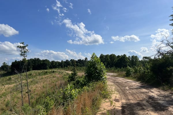
CR339
County Road 339 is a somewhat maintained public gravel road that offers great views of the surrounding area for those looking to get off the beaten path. Running from Alabama Highway 5 east to Rocky Plains Road, CR339 winds through prime Alabama Forestland, into creek bottoms, and along ridgetops. R...
Learn more about CR339
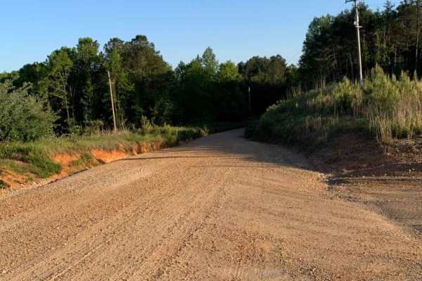
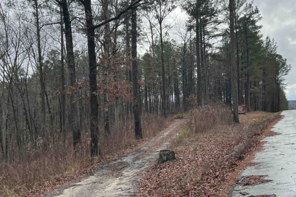
Meadow Creek Road
Meadow Creek Road or Winston County 357 is a maintained public gravel road running North from Highway 278 through Pine Timber Forestlands to Yankee Trace Road just before Highway 13. Meadow Creek Road offers an easy drive with ample opportunity for wildlife viewing as well as great views of the surr...
Learn more about Meadow Creek Road
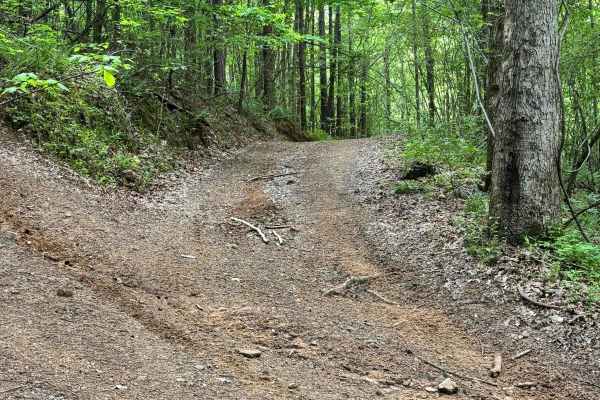
Fork Creek Road
Fork Creek Road or Winston County 440 is a public, mostly unmaintained gravel and dirt road. Surrounded by Timber Company Land, Fork Creek Road offers spectacular views of the surrounding area and some slightly technical obstacles, depending on season and maintenance. Road conditions can increase in...
Learn more about Fork Creek Road
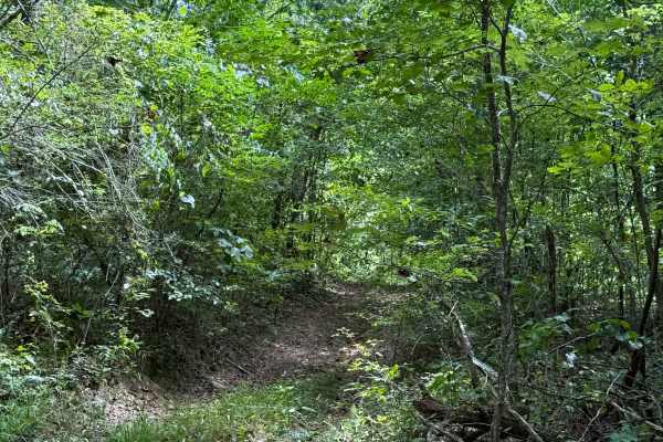
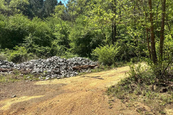
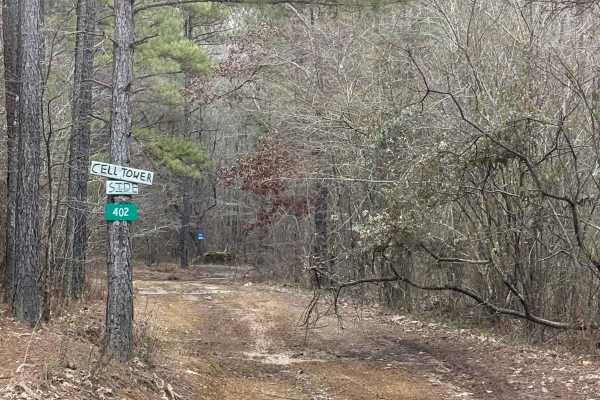
Cell Tower Dead End
This trail is by the cell tower, and is another way that used to fully take you up to the cell tower. This is now a dead-end trail, but it does have a lot of dirt bike trails around it. This trail is all deep in the woods with some tight areas to go around trees. The trail is somewhat overgrown at t...
Learn more about Cell Tower Dead End
USFS 142 - Moody Bend
USFS 142, "Moody Bend", is an out-and-back trail in Bankhead National Forest. Moody Bend offers wildlife viewing, hunting, hiking, and dispersed camping opportunities. There are two wildlife openings along the route and the entire route is part of the Payne Demonstration Area. There is an outdoor cl...
Learn more about USFS 142 - Moody Bend
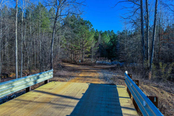
300 Main
Trail 300 Main is a practical and accessible route that connects to many one-way trails in the 300-series system. At the start, there is a bridge and creek where you can stop and explore the area on foot. Its manageable terrain and well-maintained width make it an ideal starting point for exploring ...
Learn more about 300 Main
Pavilion/Cell Tower Trail
The Pavilion/Cell Tower Trail offers a mix of terrain, starting with a dirt road that skirts the lower track obstacle course and transitions into a wooded path. Along the way, the trail provides a scenic and varied off-road experience, including a creek crossing and a few shallow water holes.
Learn more about Pavilion/Cell Tower Trail
303
Trail 303 starts off as just a dirt trail along a creek. It does not have any major obstacles to begin with, about half way through the trail it does have a steep grade up the mountain and back down with a couple of one and two foot ledges and ruts to work around.
Learn more about 303
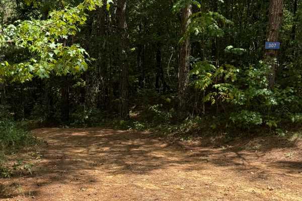
307
Trail 307 is a wooded route with several off-camber sections and a couple of switchbacks. Some ruts reach about two feet deep but can be straddled to cross, and there are no major rock or mud obstacles along the way.
Learn more about 307
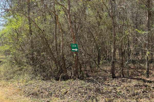
314
Trail 314 is a fun, moderately challenging trail on the south side of the park. This area tends to stay wetter than the north end, so you'll run into more mud, water crossings, and slick spots. The terrain is a mix of hard-packed dirt, loose rock from old washouts, and some standing water that can b...
Learn more about 314
301
Trail 301 is a very long trail that connects you to a lot of shorter, harder trails. It has a lot of off-camber areas and some large step-down ledges that are one and two feet tall. There are some mud holes along this route that aren't very deep. Some ruts are one and two feet deep as well.
Learn more about 301
308
Trail 308 was a long trail with a couple of muddy areas and a couple of deeper mud holes. There were several areas with a grade that weren't entirely super steep. Overall, this trail was pretty easy. This trail was all dirt through the woods.
Learn more about 308
Main Access Trail
The Main Access Trail is the backbone of Stony Lonesome OHV Park, offering both utility and adventure for all skill levels. Stretching from the entrance gate to the northeast, it serves as a central route connecting visitors to many of the park's key features and trails. Its standout attraction, "Li...
Learn more about Main Access Trail
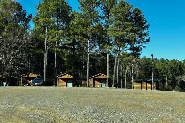
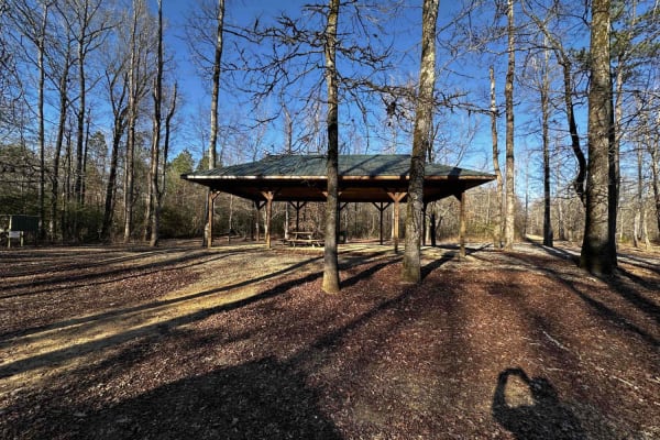
Campground Road
Campground Road offers a smooth, family-friendly drive with access to various accommodations. Visitors can choose from small and large cabins, camper parking with hookups, or a dispersed tent camping area for a more rustic experience. Amenities along the road include a playground, perfect for kids, ...
Learn more about Campground Road
304
Trail 304 was an easier trail with a couple of rock obstacles and a couple of ruts that were about 2-3 feet tall. There are a couple of muddy areas to work through. When you get towards the end, there is a y split, you will want to keep left up the rutted out path, rather than the right side.
Learn more about 304
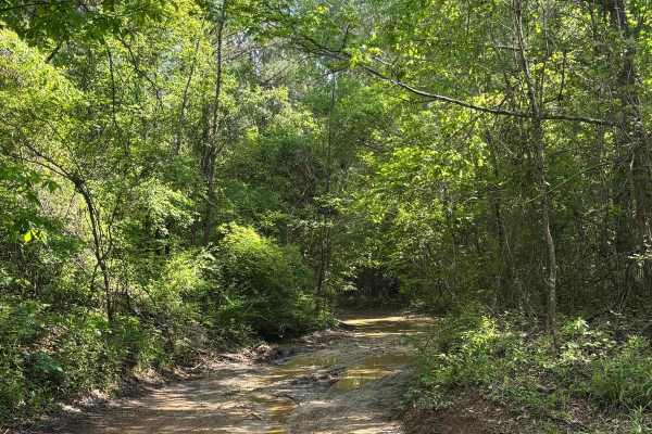
402
Trail 402 was a muddy trail with some mud holes along the route, but all of them had a bypass to work around them. Some of these bypasses had some smaller mudholes up to 12 inches deep. To get off of the bypass, there was a slanted grade that had to be crossed. This trail connects from landing zone ...
Learn more about 402
403
Trail 403 takes you from the main access trail to Trail 300, which is another main trail for this side of the park. There is a creek crossing and a couple of mud holes along the route. There are no major rock obstacles, and the creek is normally very low.
Learn more about 403
Beginner ATV trails near Berry, Alabama
Explore ATV-friendly trails near you. These trails are accessible for vehicles up to 50 inches wide, perfect for ATVs and smaller off-road machines.
CR339
County Road 339 is a somewhat maintained public gravel road that offers great views of the surrounding area for those looking to get off the beaten path. Running from Alabama Highway 5 east to Rocky Plains Road, CR339 winds through prime Alabama Forestland, into creek bottoms, and along ridgetops. R...
Learn more about CR339
Meadow Creek Road
Meadow Creek Road or Winston County 357 is a maintained public gravel road running North from Highway 278 through Pine Timber Forestlands to Yankee Trace Road just before Highway 13. Meadow Creek Road offers an easy drive with ample opportunity for wildlife viewing as well as great views of the surr...
Learn more about Meadow Creek Road
Cell Tower Dead End
This trail is by the cell tower, and is another way that used to fully take you up to the cell tower. This is now a dead-end trail, but it does have a lot of dirt bike trails around it. This trail is all deep in the woods with some tight areas to go around trees. The trail is somewhat overgrown at t...
Learn more about Cell Tower Dead End
300 Main
Trail 300 Main is a practical and accessible route that connects to many one-way trails in the 300-series system. At the start, there is a bridge and creek where you can stop and explore the area on foot. Its manageable terrain and well-maintained width make it an ideal starting point for exploring ...
Learn more about 300 Main
Beginner UTV/side-by-side trails near Berry, Alabama
Find UTV and side-by-side trails near you. These trails accommodate vehicles up to 60 inches wide, ideal for UTVs, side-by-sides, and wider off-road rigs.
CR339
County Road 339 is a somewhat maintained public gravel road that offers great views of the surrounding area for those looking to get off the beaten path. Running from Alabama Highway 5 east to Rocky Plains Road, CR339 winds through prime Alabama Forestland, into creek bottoms, and along ridgetops. R...
Learn more about CR339
Meadow Creek Road
Meadow Creek Road or Winston County 357 is a maintained public gravel road running North from Highway 278 through Pine Timber Forestlands to Yankee Trace Road just before Highway 13. Meadow Creek Road offers an easy drive with ample opportunity for wildlife viewing as well as great views of the surr...
Learn more about Meadow Creek Road
Cell Tower Dead End
This trail is by the cell tower, and is another way that used to fully take you up to the cell tower. This is now a dead-end trail, but it does have a lot of dirt bike trails around it. This trail is all deep in the woods with some tight areas to go around trees. The trail is somewhat overgrown at t...
Learn more about Cell Tower Dead End
300 Main
Trail 300 Main is a practical and accessible route that connects to many one-way trails in the 300-series system. At the start, there is a bridge and creek where you can stop and explore the area on foot. Its manageable terrain and well-maintained width make it an ideal starting point for exploring ...
Learn more about 300 Main
The onX Offroad Difference
onX Offroad combines trail photos, descriptions, difficulty ratings, width restrictions, seasonality, and more in a user-friendly interface. Available on all devices, with offline access and full compatibility with CarPlay and Android Auto. Discover what you're missing today!
Open Trail Map