
2025 Impact Report

Protecting Access for Generations
A snapshot of the work we took on in 2025—and the impact made along the way.
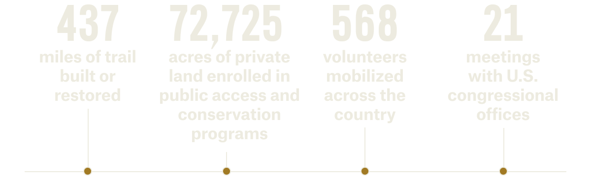
2025 Impact, At a Glance
![]()

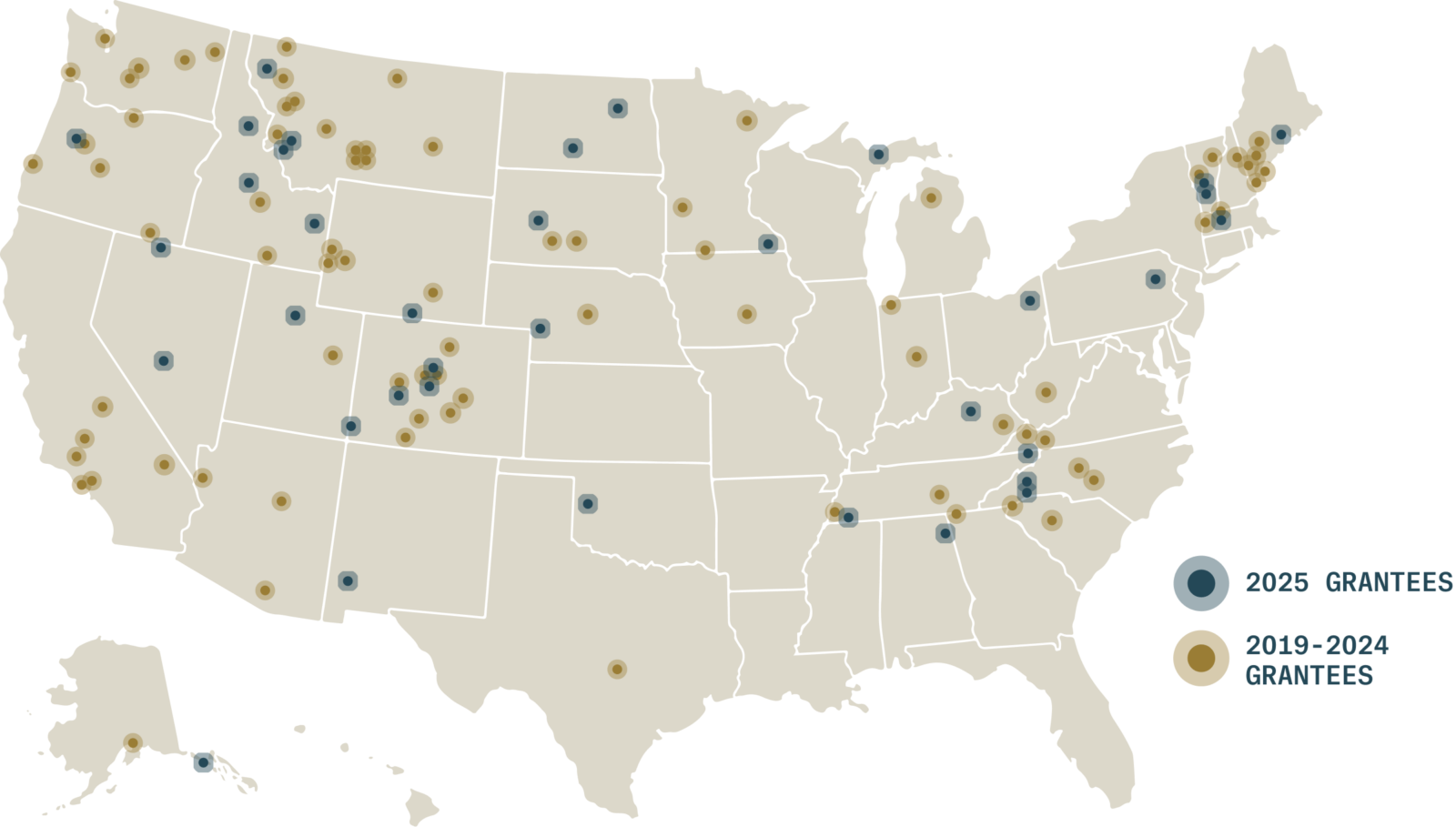
Adventure Forever Grant Project Locations
From rural trail systems to high-use recreation corridors, our 2025 Adventure Forever Grants supported projects in 23 states. Each point on the map represents a local solution shaped by the people who know those places best.
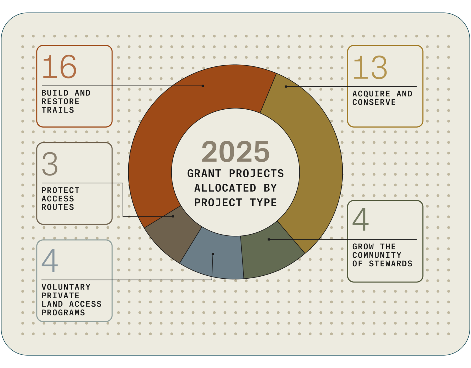
Types of Grant Projects
Our grants focus on five approaches: building and restoring trails, acquiring and conserving land, protecting access routes, supporting voluntary private land access, and growing stewardship at the community level.
DISPATCHES FROM THE FIELD

Featured Stories
These stories highlight what it looks like to show up for access and stewardship in real ways. Read the full report for details.
1
CREATING OPPORTUNITY
P.A.T.H. Program Reaches 140k Acres
Launched in 2023 and supported by onX, P.A.T.H. is administered by Pheasants Forever and Quail Forever to expand public hunting access while improving wildlife habitat on working lands. The program provides financial incentives that help landowners enroll acres into existing state walk-in access programs in SD, NE, ND, MI, OK, and has achieved 140,000 acres of newly accessible private land. For hunters, the result is more places to go. For wildlife, it means better habitat. For rural communities, it translates into economic activity.
2
MANAGING COMPLEXITY
Corner Crossing Nuance
A 10th Circuit Court ruling clarified that corner-crossing may be lawful under specific conditions, potentially opening access to more than 3 million acres of public land in 10th Circuit states (WY, CO, NM, UT, OK, and KS). While the decision marked progress, onX emphasized that GPS hardware is typically accurate to about 16 feet, underscoring why survey markers and careful judgment matter in the field. Through mapping and data, we reinforced that expanded access must be pursued ethically and exactly, with respect for private landowners and an understanding that opportunity and responsibility go hand in hand.
3
Participating in Policymaking
Advocating for Hunters
When public land access was at risk, we brought data and maps into the national conversation—engaging the outdoor community and policymakers to show what was at stake and why it mattered. We used geospatial expertise to help inform recreation and conservation policy, advance modernized access to data, and support keeping public lands in public hands. These efforts helped prevent public land sales during budget reconciliation, advance MAPLand and MAPWaters, and move progress forward on the EXPLORE Act.
4
PUTTING MORE SPOTS ON THE MAP
New BLM Lands in the App
The Hunt App now shows BLM National Conservation Lands, which complement existing Wilderness and Wilderness Study Areas. Together, these lands comprise 38 million acres of critical wildlife habitats, migration corridors, exceptional landscapes, and important cultural areas. Many of these places have location-specific management plans, and now each area’s regulations are at your fingertips.
5
ROLLING UP SLEEVES
BHA Fence Pulls + Trash Packouts
It takes a team, and we proudly support Backcountry Hunters & Anglers (BHA) with events that help preserve the beauty of the places we hunt while protecting wildlife from dangers like old barbed wire fencing. In 2025, these efforts removed 16 tons of trash, 34 miles of fencing, and 451 tires from the landscape.

About the onX Access and Stewardship Program

We support enhancing and preserving sustainable land and water access for outdoor recreation.

We support projects and community engagement that remediate human-caused degradation to restore ecological health.