Scouting for Black Bears
Brush up on black bear scouting tips and see how spring compares to fall.
Perspective on a Black Bear’s Territory
Black bear hunting is often about putting in the time, and black bear scouting can be trickier than for other game. Black bears can cover large territories, and they do not predictably circle back to preferred areas.
For comparison, analyses indicate that whitetail deer home ranges tend to be anywhere from just over 100 acres to just under two square miles (~1,300 acres). Studies estimate whitetail deer move about two miles per day (with bucks moving around five miles per day in the rut).
Meanwhile, in some areas, a male black bear’s home range can measure 290 square miles (that’s over 185,000 acres) on the high end, and they can travel 15 miles in a day. Where you spot bear sign in July is not likely where you’ll harvest a bear come September.
Seasonality Considerations
Spring Bear
When e-scouting for spring black bears, think about areas likely to carry budding signs of spring greenery. Check coulees and avalanche shoots in the early season, too, as bears may be scavenging for winterkill.
Black bears also like edge habitats. Scout for meadows or openings (i.e. places likely to have food) that butt up against timber lines (i.e. protection).
In the May to June timeframe, elk calves and deer fawns drop, and black bears may start to focus on these meat food sources. Likewise, if you focus your attention on where deer and elk are during this timeframe, you may find yourself a bruin.
Once you’ve narrowed in on a few bear-y spots on the map, when boots hit the ground, you’re primarily looking for four things:
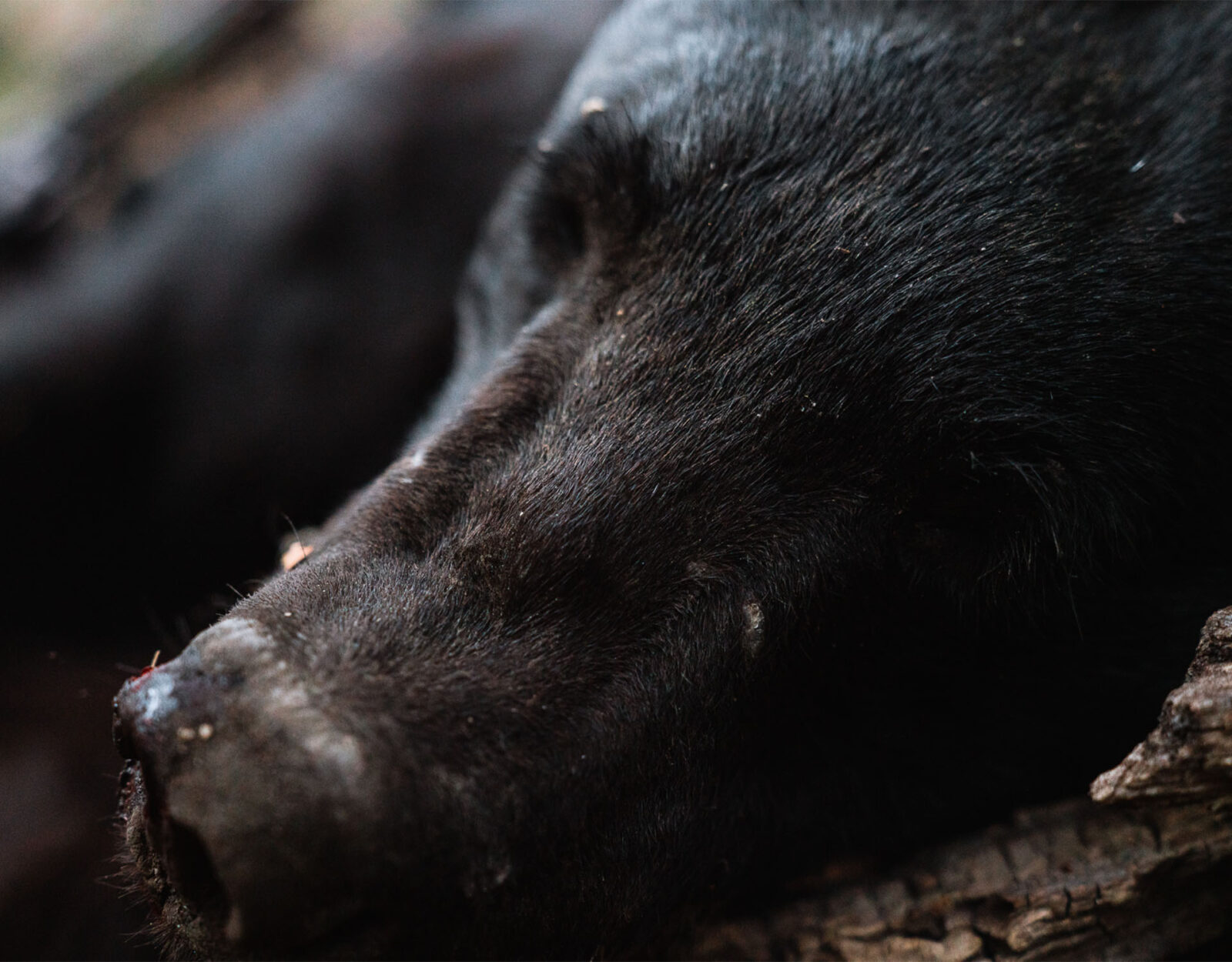
- Scat: Probably the most obvious and prevalent sign, bear droppings are a sign you’re on the right track.
- Tracks: Spend enough time searching for a bear, and you’re likely to find a track, especially if you choose to go out after a rain or early in the season when the ground is wet. If you live in an area with black bears and grizzlies, make sure you can spot the difference in paw print patterns between the two.
- Areas that look like they’ve been ransacked. As bears ramble through an area, they may tear apart logs, scrape bark off trees, overturn rocks, and trample small brush.
- Beds: Trickier to see, you may find bear beds in cool, shaded areas protected by cover.
You may find that black bears are more predictable in the spring than in the fall. Early in the spring, when a bear is phasing out of torpor, its appetite is actually said to be relatively small. A black bear might feed on a little grass, go back to its sleeping area, come back to the same feeding spot, and repeat. This pattern can lend itself to a level of predictability that is not seen in the fall when bears wander from food source to food source. If you find bear scat in the spring, the bear may still be in the area.
Another factor that can make spring black bear hunting more predictable, or at least more dynamic, than fall black bear hunting is the rut. In late spring, boars start cruising for sows, so you’re more likely to see activity throughout the day.
Fall Bear
Fall scouting looks much the same as spring. It’s all about finding a bear’s food sources, especially as they enter into hyperphagia. In some places, fall offers a lot of different types of food sources, so the trick is understanding which ones the bears prefer that year.
If you can find fresh bear scat, see if you can identify what’s in the droppings, and then go find that food source. Early in the fall season, berries are often a go-to. As the season progresses, food sources may transition to things like acorns. Look for water sources, too, especially during the hotter portions of the season.
E-Scouting Tips
Find the Right Elevation
In the early springtime, there will be a snow line in most states with a spring bear season. This means that high elevation, say above 6,000 feet, shouldn’t even be on your radar. Arizona is an exception due to the lack of snow in most areas. We’ve seen bears at up to 7,000 feet in early April there.
The bears are going to be below these snow lines where the fresh green-up is. And they’ll follow the grass right up the mountain as the snow melts throughout the season. At the beginning of spring (early April), focus between 3,000 to 5,000 feet. Later in spring (June/July), look at 6,000 to 9,000 feet.
Steep Main Drainages
Next, look for steep main drainages. Bears love canyons, as they usually offer solitude, feed, and water in the bottoms. Long steep grades will offer the ability to watch bears move up from the bottom toward the top as the season progresses.
Look for either main east/west running canyons or north/south canyons with a basin at the head. An east/west running canyon offers a south face and a north face on either side of the bottom. South faces are going to green up quicker than the dark dreary north faces will. This means bears will be feeding here at the start of spring. North faces offer ample bedding areas, and bears can also be found there. They will likely be at the bottom of those north faces in early spring.
North/south canyons with a basin at the head offer an east face and a west face along with an easy travel route, being the basin at the head, which is a south face. This setup allows a bear to go from feeding to bedding quite easily.
Focus on Broken Country
As you’re perusing satellite imagery, focus on “broken country”—terrain that has timbered areas as well as openings. The timbered areas are ideal for bears to lay down, but they also need feed, which is where the open areas come into play because that’s where the grasses will be.
Old burns are great places to look for bears because they offer a little of everything. You can use the Historic Wildfire Layer in the App to see where these old burns are, which year they occurred, and how many acres burned.
Look for Logging Roads
Old logging roads are bear magnets. Not only do they offer a bear an easy path of travel, but grasses sprout here as well. Bears can often be observed feeding along these logging roads, and they’re great spots to look for scat. These roads can be seen via satellite imagery and your onX Roads and Trails Map Layer will tell you if and when the road is open for travel. Closed roads are the best.
Identify Glassing Areas
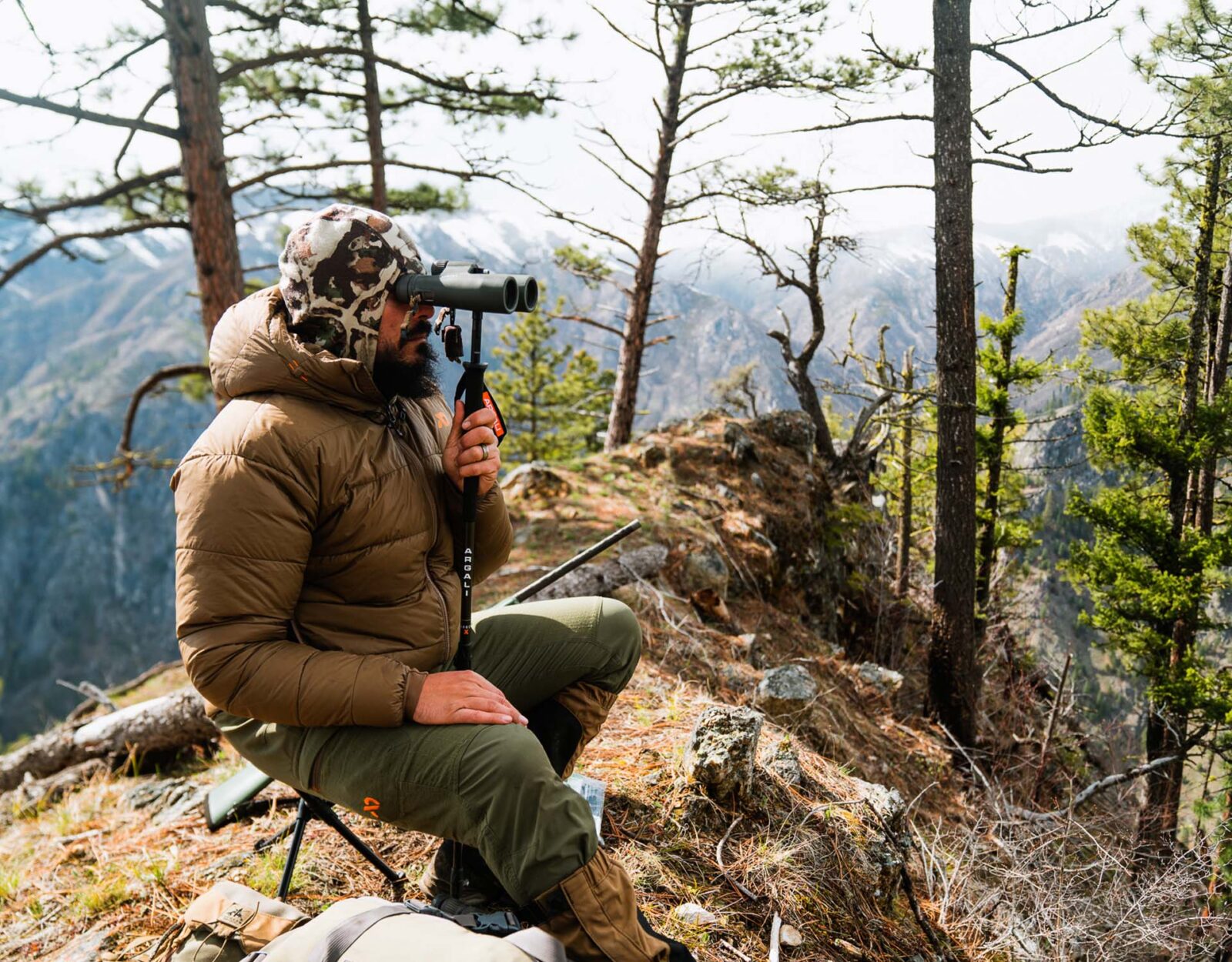
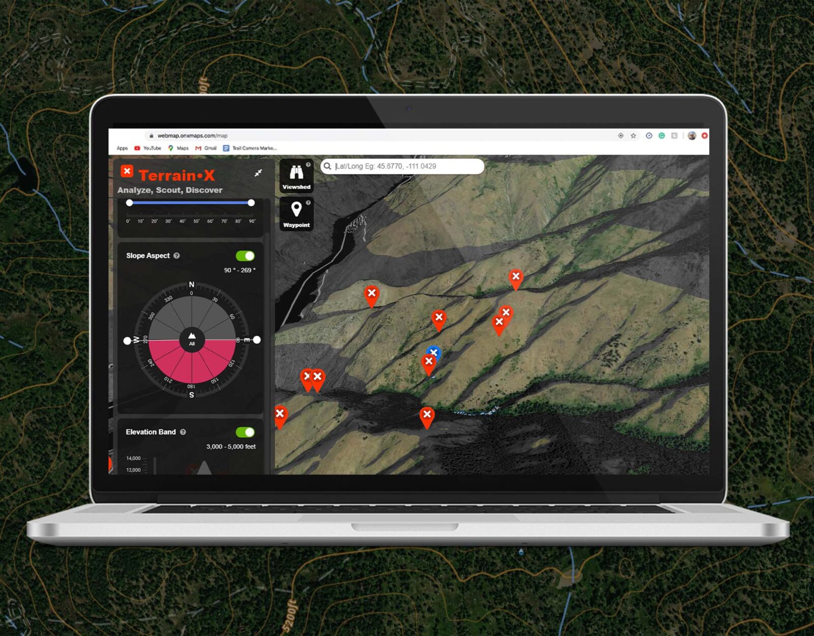
To get a commanding view of the area you want to scan, look for points or peninsula-like features that shoot out from a ridge. Cone peaks are also great, as a person can just keep rotating around the peak changing their view of glassing country.
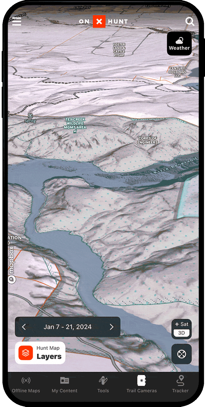
Use 3D Mode to see how the terrain is laid out from the perspective of your glassing knob. And to take it a step further, using the Viewshed feature in TerrainX (available on desktop to Elite Members) will show you what’s visible from any Waypoint you mark.
Assess Access Points
In spring, assessing access is vitally important in the mountain states as snow can impede access to certain areas early on. During that time of year, lower elevation access points—be it a trailhead or just a parking spot off the side of the road—are going to be more reliable. If you’re driving across the country, this is something huge to pay attention to. You don’t want to put all of your stock into an area, not knowing if you’ll be able to access it. On that note, have backup plans in place.
A great way to find out about the potentiality of accessing certain areas is by giving the U.S. Forest Service a call and asking. Elite Members can also use Recent Imagery in the App to see what the landscape looked like as recently as a couple of weeks ago; or, can scan back to the same timeframe for the year before to see what access and snow levels looked like then, as a way to predict what you might see now.
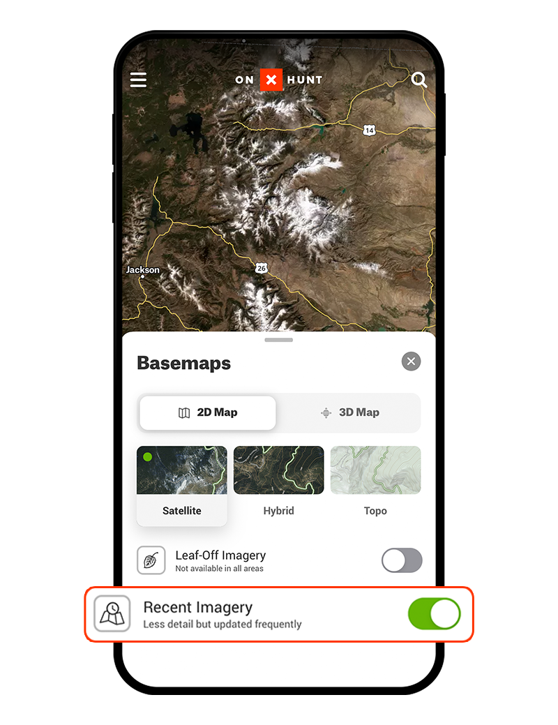
Elite Members can access Recent Imagery under the Basemaps menu.
From there, Elite Members can toggle back in time to see how terrain and snow levels tend to change over time.