Near Mount Hood Summit via South Side/Old Chute
Public Field Report: Mount Hood Eastside + Crater Environs View
Near Mount Hood Summit via South Side/Old Chute
Public Field Report: Mount Hood Eastside + Crater Environs View
Near Mount Hood Summit via South Side/Old Chute
Public Field Report: Mount Hood Eastside + Crater Environs View
Near Mount Hood Summit via South Side/Old Chute
Public Field Report: Mount Hood Eastside + Crater Environs View
Near Mount Hood Summit via South Side/Old Chute
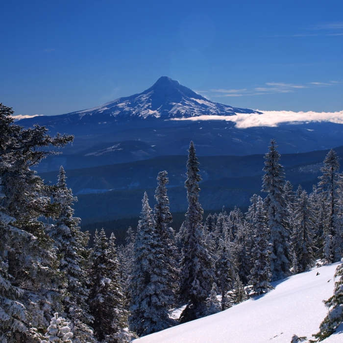
Mount Hood from Mount Defiance in winter

Looking for more photos?

View All Photos
View Map
Driving Directions
Classic Hike Route
Buy Now View in 3D

Mount Hood Summit via South Side/Old Chute

No rating
The standard line up Oregon's highest peak follows a climbers' track above Timberline Lodge to the Hogsback ridge, then climbs a steep, often icy chute through the crater's bergschrund to the summit. It's one of the most-climbed glaciated peaks in the world, but conditions above the Hogsback turn serious fast, and solid self-arrest skills are non-negotiable.
7
mi
Distance
5,454
ft
Gain
extreme
Difficulty
Regional Classic
A must do route for the area handpicked by local experts.
ScenicViews
Access Issues
A Climbing Permit ($20 for 3 days or $50 annual) is required above 9,500 feet, plus a free wilderness permit May 15–October 15. Winter parking needs a Sno-Park permit.

Route Details

Flatter
Steeper
7mi
Distance
5,454ft
Elevation Gain
5,454ft
Elevation Loss
--%
Max Grade
11,246ft
High Point
5,878ft
Low Point
Path Type
There and Back
Description
The South Side via the Old Chute is the most popular mountaineering route on Mount Hood, offering a challenging ascent of Oregon's highest peak. This is a technical climb, not a standard hike or scramble, requiring specialized equipment such as crampons, an ice axe, and a helmet, along with proficiency in self-arrest techniques. Starting from Timberline Lodge at 5,878 feet, the route gains approximately 5,454 feet of elevation over a 7-mile round-trip climb. The initial portion of the climb follows the climbers' path up the Palmer Snowfield, passing the top of the Palmer Chairlift at approximately 8,540 feet. Above the chairlift, the route continues past Triangle Moraine and Crater Rock, leading into the Devils Kitchen—an area marked by active, sulfur-emitting fumaroles. From Devils Kitchen, climbers ascend the Hogsback, a prominent snow ridge that leads toward the summit crater. At the top of the Hogsback, the route crosses the bergschrund, which can vary significantly in difficulty throughout the climbing season. The climb then ascends the Old Chute, a steep, 40- to 50-degree snow and ice gully that leads to the crater rim. A short, exposed traverse along the summit ridge brings climbers to the true summit at 11,240 feet. Due to increased risks of rockfall, icefall, and softening snow as the sun warms the mountain, starting around midnight to 2:00 AM and planning an early descent is standard safety practice.

Route Conditions

Report Conditions
No Condition Reports
Report Conditions

Nearby Hike Routes

Pacific Coast Trail: Mount Hood Wilderness

Hike Route

Pacific Coast Trail: Mount Hood Wilderness

Views
extreme
28.39 mi
+7,541 ft
Mountaineer Loop Trail #798

Hike Route

Mountaineer Loop Trail #798

Views
strenuous
2.78 mi
+1,118 ft
Paradise Park Loop 757 via Pacific Crest Trail

Hike Route

Paradise Park Loop 757 via Pacific Crest Trail

Views
strenuous
12.24 mi
+2,886 ft
Timberline Lodge to Zig Zag Canyon

Hike Route

Timberline Lodge to Zig Zag Canyon

Views
moderate
4.64 mi
+923 ft
PCT: Timberline Lodge to Hwy 35 Out and Back

Hike Route

PCT: Timberline Lodge to Hwy 35 Out and Back

Views
strenuous
5.01 mi
+15 ft
Government Camp Loop

Hike Route

Government Camp Loop

Fall Colors
moderate
4.85 mi
+460 ft
Contributors
onX Maps, Inc
