Near Banzai Pipeline Trace
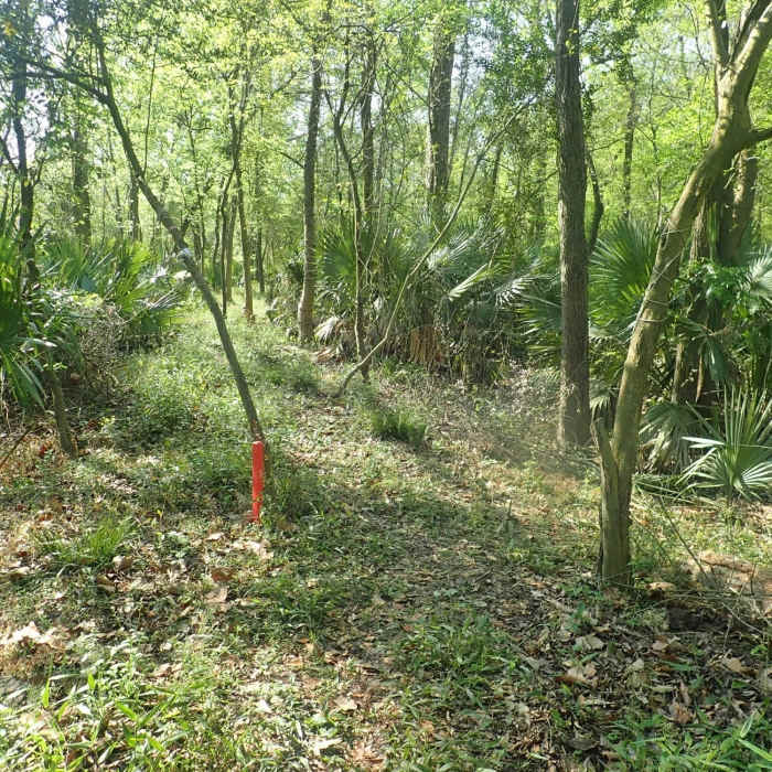
The south end of Malsbury. There is an orange stake to help you not miss the turn, as well as rope wrapped around 2 trees. Go straight/south 550 feet and you're at Banzai pipeline. Turn right and you're headed for Bauer Trail. GPS: 29.81982, -95.58898
Near Banzai Pipeline Trace
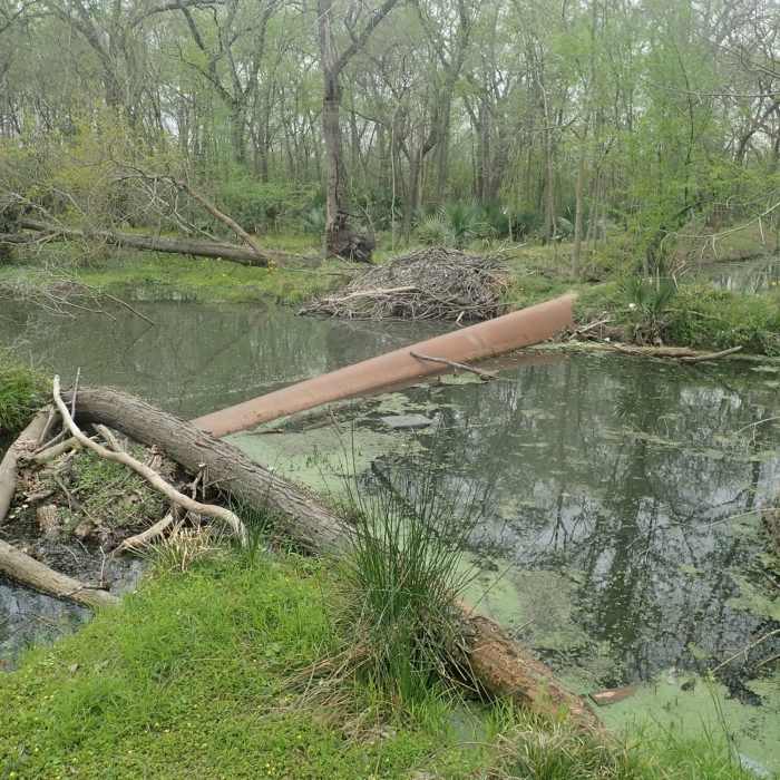
The pipeline - an option for crossing Turkey Creek. It's big enough that it isn't difficult at all to walk across. The difficulty is dealing with the log jam on the east side. GPS coordinates: 29.81815 -95.58837
Near Banzai Pipeline Trace
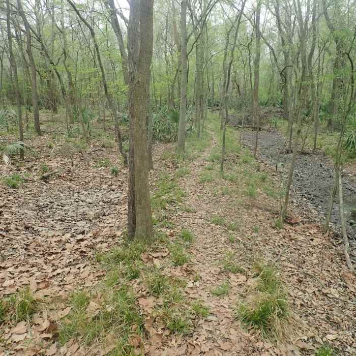
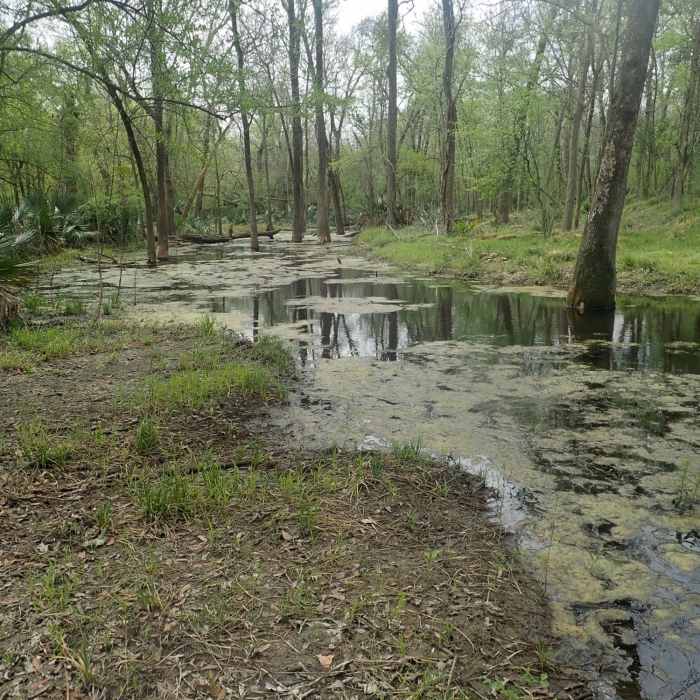
The trail running northwest from the pipeline crossing of Turkey Creek.
Near Banzai Pipeline Trace
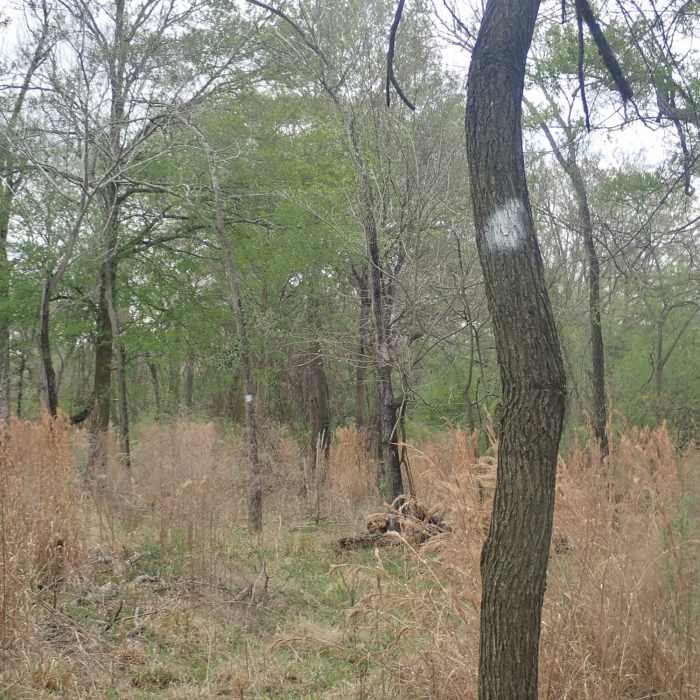
There are helpful white paint trail marks on the Banzai Trail, but they are only on the west side of the trees. Great for hiking from Turkey Creek east towards the dike. But if hiking from the dike going west to Turkey Creek, you don't see them.
Near Banzai Pipeline Trace
Turkey Creek

Looking for more photos?

View All Photos
View Map
Driving Directions
Hike Trail

Banzai Pipeline Trace

3.5 (2 Ratings)
This east-west trace through the brush crosses Turkey Creek at the Banzai Pipeline in Addicks Reservoir.
1.2
mi
Distance
24
ft
Gain
moderate
Difficulty
River/Creek
Access Issues
This is a trace in Addicks Reservoir that is not maintained. Please comply with Corps of Engineer's regulations by not disturbing the ground or vegetation. Vehicles are prohibited. Please refer to the "Addicks Reservoir" page for area-wide information. Note that the Corps of Engineers may close areas to access for wildlife control operations. Look for signs at the entrances to Noack Trail and Miles Trail and please do not enter the area if marked as closed. Eastern access may not be mark

Route Details

Flatter
Steeper
1.18mi
Distance
24ft
Elevation Gain
0ft
Elevation Loss
15%
Max Grade
114ft
High Point
88ft
Low Point
Path Type
Point to Point
Description
This is a natural-surface path that provides an east-west crossing of Turkey Creek using the Banzai Pipeline. The east end is at the Addicks Dam and the west end is a legacy road in Addicks Reservoir. The path remains muddy for a time after rains. The lowest and wettest section is the eastern section, just west of the dam. Users should always be prepared for mosquitoes. The western end of the path is accessed by the Bauer Trail where an improvised bridge crosses the Bauer Trail bar ditch. Beginning at the eastern bend of the Bauer Trail, the trace generally follows an elevated bank until meeting the Malsbury Trace where it turns sharply south along the irrigation ditch to the Banzai Pipeline. The pipe stability has recently been undermined by the beaver pond in the area, and it is not always passable. On the east side of Turkey Creek, the trace passes through yaupon stands then crosses the low-lying ground where the earth for the dam was sourced. The east end of the trace is at the Addicks Dam Road Southeast.

Route Conditions

Report Conditions
No Condition Reports
Report Conditions

Nearby Hike Routes

Terry Hershey Hike and Bike Trail

Hike Route

Terry Hershey Hike and Bike Trail

Birding
easy
13.34 mi
+165 ft
Houston Arboretum Walking Loop

Hike Route

Houston Arboretum Walking Loop

Birding
easy
2.37 mi
+2 ft
Cypress Creek Trail

Hike Route

Cypress Creek Trail

Family Friendly
moderate
7.72 mi
+42 ft
Cypress Greenway Trail

Hike Route

Cypress Greenway Trail

Family Friendly
moderate
12.84 mi
+63 ft
Keith-Wiess Park Loop

Hike Route

Keith-Wiess Park Loop

Birding
easy
2.05 mi
+15 ft
Brazos Bend State Park Figure Eight Loop

Hike Route

Brazos Bend State Park Figure Eight Loop

Birding
easy
4.1 mi
+15 ft
Contributors
Bryan Dotson
