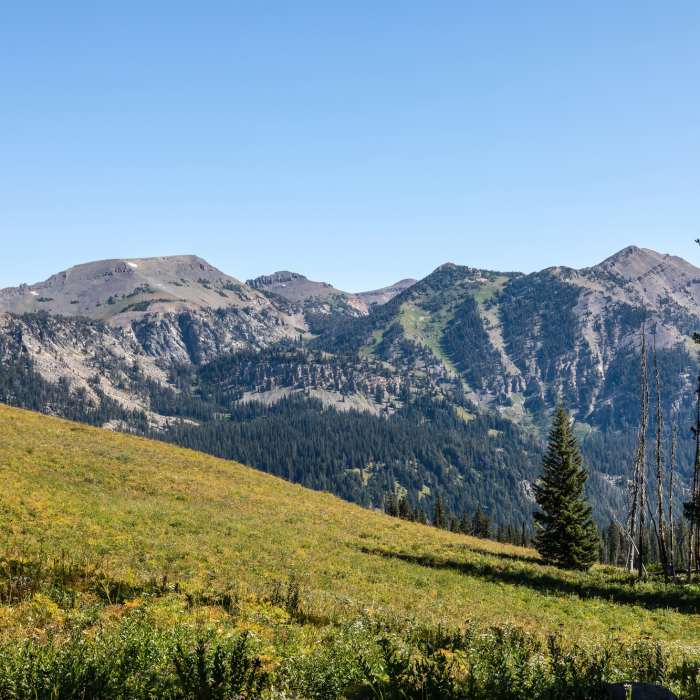
Near South Fork Granite Canyon
Mount Hunt

Looking for more photos?

View All Photos
View Map
Driving Directions
Hike Trail

South Fork Granite Canyon

3.5 (2 Ratings)
Great views to be had on this trail that are generally accessed from the tram.
1.8
mi
Distance
52
ft
Gain
moderate
Difficulty
BirdingFall ColorsRiver/CreekViewsWildflowersWildlife

Route Details

Flatter
Steeper
1.76mi
Distance
52ft
Elevation Gain
804ft
Elevation Loss
25%
Max Grade
8,846ft
High Point
8,037ft
Low Point
Path Type
Point to Point
Description
Generally used as part of the Granite Canyon Tram Route, !Granite Canyon's South Fork descends directly to Granite Canyon itself from the Rendezvous Mountain trail. If you're travelling south to north, the orientation of this trail opens up some amazing views of the east/west mountains - most notably Mount Hunt (10,749') and Prospectors Mountain (11,241'), both to the northeast. As you near Granite Canyon, keep an eye out for the Upper !Granite Canyon Patrol Cabin. The singly-story log cabin was built around 1935 on a log sill foundation using 14-inch logs and was put on the National Register of Historic Places on August 19, 1998. Additionally, the entire Granite Canyon area is teeming with wildflowers during the late Spring/early Summer months, so try to hit it then

Route Conditions

Report Conditions
Anonymous Adventurer
All Clear
Looking for more condition reports?
View History

Nearby Hike Routes

Granite Canyon - Tram Route

Classic Hike Route

Granite Canyon - Tram Route

Birding
strenuous
12.63 mi
+750 ft
Teton Crest Trail

Hike Route

Teton Crest Trail

Lake
extreme
34.9 mi
+6,699 ft
Cody Peak

Hike Route

Cody Peak

Views
strenuous
2.96 mi
+1,334 ft
Rendezvous Mountain Hillclimb

Classic Hike Route

Rendezvous Mountain Hillclimb

Less Crowded
strenuous
11.01 mi
+4,203 ft
Classic Teton Crest Trail

Classic Hike Route

Classic Teton Crest Trail

Birding
strenuous
37.64 mi
+8,530 ft
Granite Canyon Loop

Hike Route

Granite Canyon Loop

Views
extreme
20.49 mi
+3,854 ft
Contributors
Tom Robson
