Near BST: Terrace Hills Road Alternative
On the Bonneville Shoreline Trail above City Creek
Near BST: Terrace Hills Road Alternative
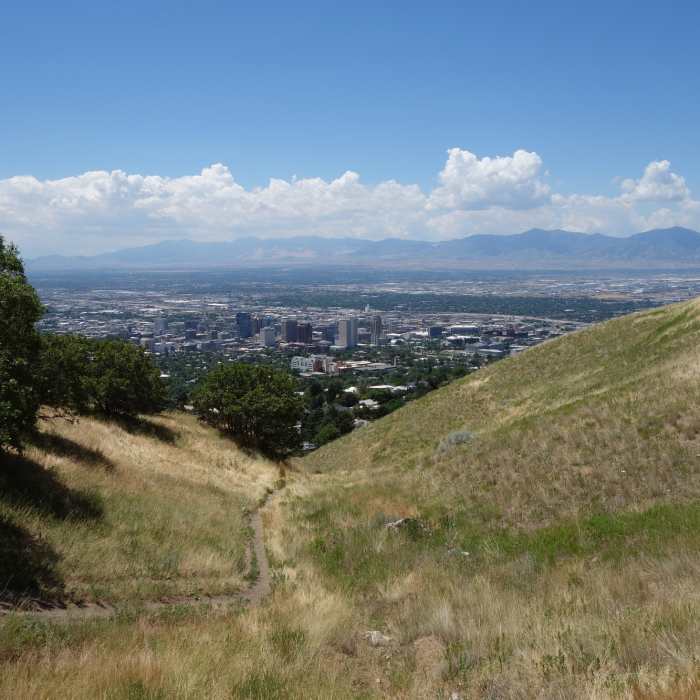
Downtown Salt Lake City seen from the Bonneville Shoreline Trail.
Near BST: Terrace Hills Road Alternative
Downtown Salt Lake City seen from the Bonneville Shoreline Trail just above East Edgehill Road.

Looking for more photos?

View All Photos
View Map
Driving Directions
Hike Trail
Buy Now View in 3D

BST: Terrace Hills Road Alternative

3.0 (1 Rating)
A Bonneville Shoreline Trail access trail from Terrace Hills Rd.
0.7
mi
Distance
307
ft
Gain
moderate
Difficulty
Family FriendlyViewsWildflowers

Route Details

Flatter
Steeper
0.69mi
Distance
307ft
Elevation Gain
126ft
Elevation Loss
45%
Max Grade
5,528ft
High Point
5,300ft
Low Point
Path Type
Point to Point
Description
This short route provides access to the Bonneville Shoreline Trail (BST): Dry Creek to City Creek from the Terrace Hills Dr area of the Avenues neighborhood and can be used as an alternate route in this area.

Route Conditions

Report Conditions
Anonymous Adventurer
All Clear
Anonymous Adventurer
All Clear
Anonymous Adventurer
All Clear
Anonymous Adventurer
All Clear
Looking for more condition reports?
View History

Nearby Hike Routes

Avenues Twin Peaks

Hike Route

Avenues Twin Peaks

Views
moderate
3.68 mi
+1,149 ft
City Creek to Ensign Lookout

Hike Route

City Creek to Ensign Lookout

Views
moderate
4.67 mi
+976 ft
Ensign Peak

Hike Route

Ensign Peak

Views
easy
1.05 mi
+404 ft
Ensign Peak Trail

Hike Route

Ensign Peak Trail

Family Friendly
moderate
1.03 mi
+404 ft
Pioneer Lime Kilns

Hike Route

Pioneer Lime Kilns

Dogs Allowed
easy
0.33 mi
+95 ft
Lower City Creek Loop

Hike Route

Lower City Creek Loop

Dogs Allowed
easy
2.88 mi
+372 ft
Contributors
Matthew Kidd
