


Ready to explore this trail?
View Trail Map in AppRegional Classic
A must do route for the area handpicked by local experts.
No permit is required to park or hike, though wilderness regulations apply in the Mount Sneffels Wilderness.
High-clearance, four-wheel-drive vehicles are required to reach the Yankee Boy Basin and Wrights Lake Trailheads; standard vehicles must park at the Mount Sneffels Trailhead.
Path Type
Loop
This route starts and ends at the Mount Sneffels Trailhead after reaching the summit of Mount Sneffels.
Begin by hiking northwest up the 4WD-access Yankee Boy Basin Road for 0.9 miles to the Wrights Lake Trailhead. Keep right and continue on the 4WD road. At 1.5 miles, reach an intersection and keep right again to maintain Yankee Boy Basin Road. At 1.7 miles, reach the Yankee Boy Basin Trailhead lot and continue straight onto the Blue Lakes Trail.
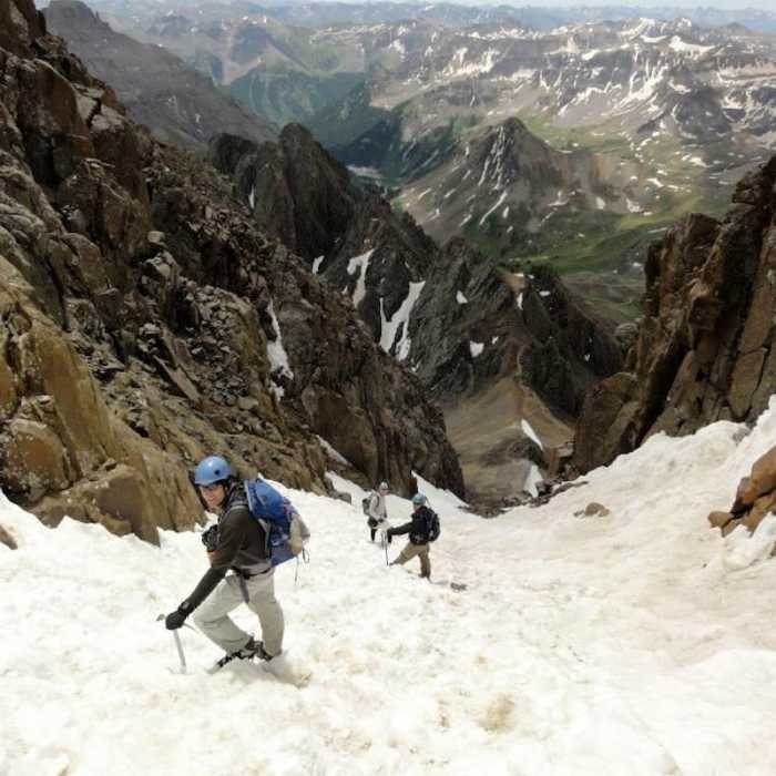
Reach the intersection with the Mount Sneffels southern route at 2.1 miles and bear left to remain on the Blue Lakes Trail. Reach the Blue Lakes saddle at 2.5 miles. Turn right at the pass and follow the Southwest Ridge. Scramble northwest up the ridge through rocky gullies and notches, climbing 1,150 vertical feet to the summit at 3.0 miles.
Crux: The Southwest Ridge between Blue Lakes Pass and the summit of Mount Sneffels is the technical heart of the route — a series of talus gullies, narrow notches, and exposed traverses where route-finding is genuinely difficult. Stay within 50–100 feet of ridge proper at all times; if the terrain becomes truly hard, you've drifted off route.
To descend, head southeast down the South Slopes route through the narrow V-notch and down the main gravel gully.
Crux: The summit descent begins with a narrow gully leading to a V-notch in the rock at roughly 14,000'. Popping through this notch and angling right requires careful body positioning — it's a distinct Class 3 move separate from the SW Ridge route-finding section, and easy to fumble on tired legs. Beyond the V-notch, the gully funnels into a comically steep, loose-gravel chute with no switchbacks that punishes ankles and demands slow, deliberate steps.
Continue down the Mt. Sneffels Trail to rejoin the Blue Lakes Trail junction at 3.6 miles, then follow the 4WD road back to the lower Mount Sneffels Trailhead.
No Condition Reports
Mount Sneffels Southwest Ridge
Mount Sneffels Southwest Ridge
Mount Sneffels South Slopes
Mount Sneffels South Slopes
Weehawken Trail #206 to Alpine Mine and Overlook
Weehawken Trail #206 to Alpine Mine and Overlook
Blaine Basin
Blaine Basin
Mt Sneffels Via Blue Lakes
Mt Sneffels Via Blue Lakes
Upper Blue Lakes
Upper Blue Lakes
Contributors

