Lower Barracks Trail - BLM20

Total Miles 5.7
Technical Rating
5 Moderate
Best Time Spring, Summer, Fall
Trail Type High-Clearance 4x4 Trail
Accessible By
Open Trail Map

Trail Overview

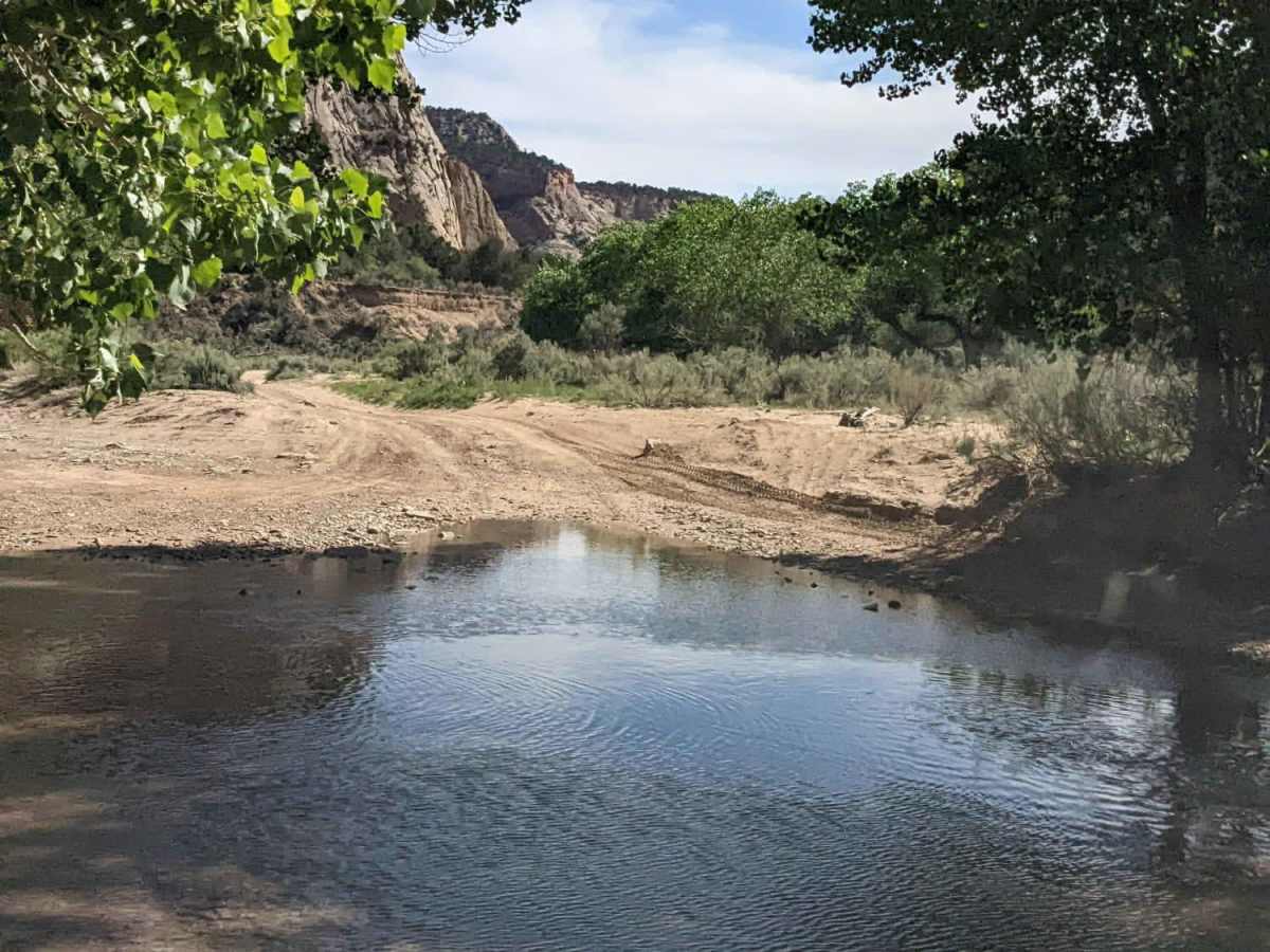
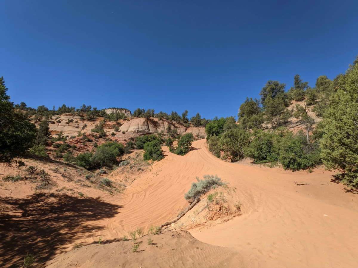
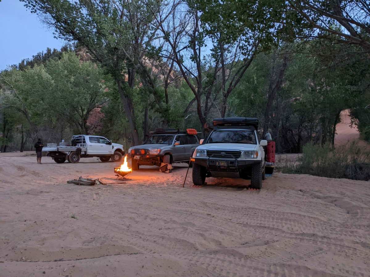
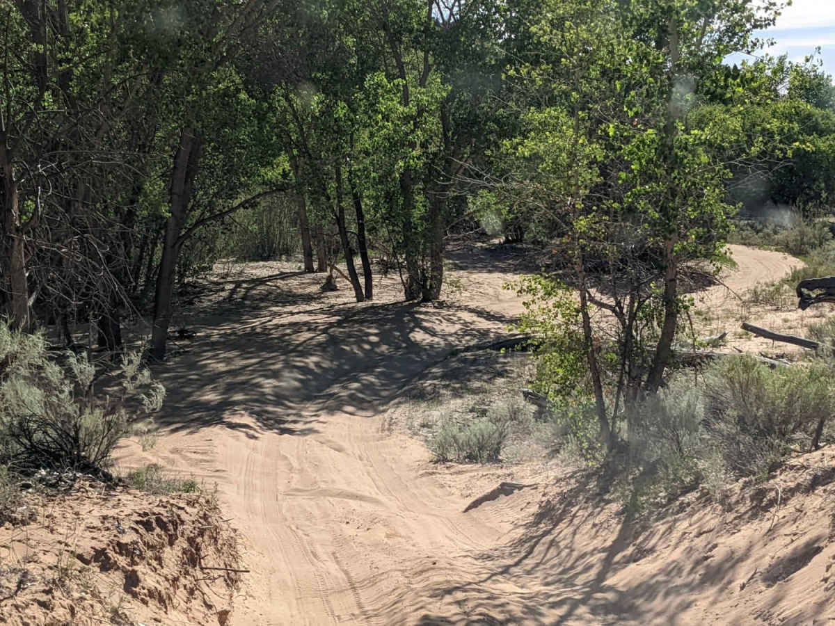
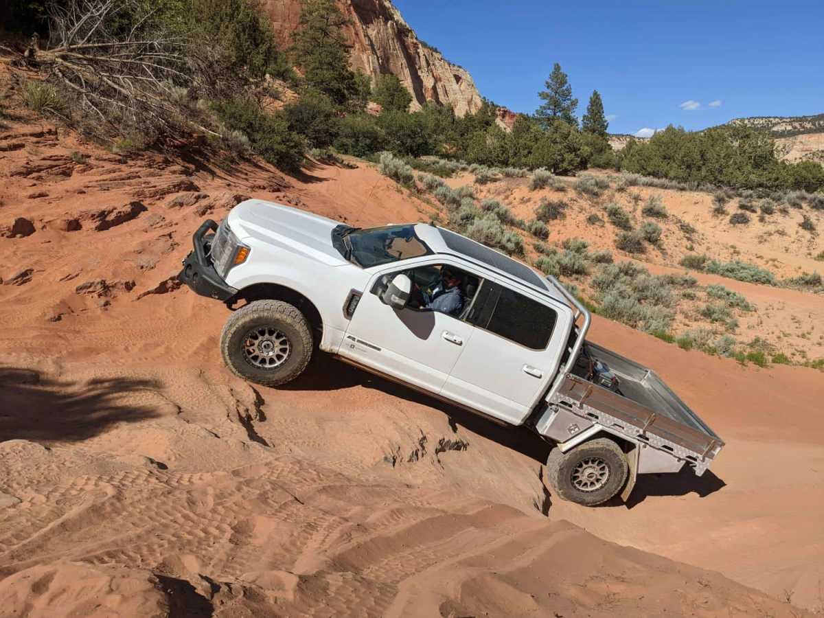
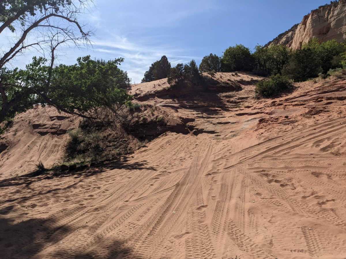
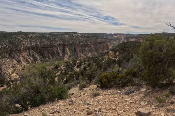
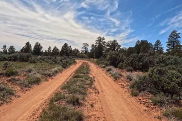
This is a sandy eleven-mile out-and-back version of the longer Barracks Trail that stays meanders along the East Fork of the Virgin River. This segment turns back at a challenging soft sand hill climb rated as a seven (7) in difficulty. Heavy overland rigs and dual-sport touring bikes should not attempt this climb. It is only for lighter 4x4s, SXS, motos, etc. It is important to note that we have seen rattlesnakes on two different occasions at the hill climb. Be snake aware. The lower segment includes numerous water crossings and two smaller, sandy rock challenges - the more difficult one is rated as a five (5) - that have alternate routes. There are numerous shaded riverside campsites along this route. The Lower Barracks Trail is a fun trail. I have run it numerous times in both directions. If dropping down the sand hill, I would rate the whole trail as 4-5. If climbing the sand hill, it becomes a 7-8 with the loose sandy climb as the worst obstacle with a few 4 and 5 rated obstacles above and below the climb. The climb itself is such soft, deep sand that tires need to be deflated into single digits. Vehicles frequently get stuck here, and if you slide off of the main track, it is easy to slide down into a hole that will require a more complicated multi-pull extraction. Heavy overland rigs and dual-sport touring bikes should not attempt this climb. It is only for lighter 4x4s, SXS, motos, etc.

Photos of Lower Barracks Trail - BLM20

Difficulty

Rated 5 for the loose, off-camber challenge. The rest of the trail is a 3.

Technical Rating

5

Status Reports

Add Status Report
Roger Robert's
May 17, 2026
Open
David Dunn
May 16, 2026
Open
Water levels are really low and the banks are well worn it making it an easy ride. The one rock obstacle has the optional bypass (next to the tree) is getting well worn in but still very doable. Make sure you know how to read the corners as the mud holes still exist.
Mike Berg
May 13, 2026
Open
Trail was a blast, water level was rather low, but we're able to play hard in the water. Left sand hill for the big boys.
Tyler Housley
Apr 22, 2026
Open
Doug Turnquist
Mar 10, 2026
Open
It was a good river water level for this trail this trip - deep enough to have fun but not too deep to be dangerous. The flow was 60 CFPS for future reference. There were a couple of steep drop-offs from the shore to the river that required 4X4 use, but there were bypasses for easier options if preferred.
Christine Hammack
May 07, 2025
Open
this is a photo of the sand hill taken from acrosd the canyon. It's no joke, if you don't have the right vehicle you're better off running it in the opposite direction so you go down the sand hill.
Steve H
May 04, 2025
Open
I drove with a group of trucks - a 100 series Land Cruiser, a lifted Lexus GX on 35’s, Jeep Rubicon, Isuzu trooper, Honda Passport, and Isuzu VX’s. We drove it south from Belly of the Dragon trailhead. It’s a fairly easy trail with a few mildly off-camber and rutted spots. The branches can get tight so expect some pin-striping. There’s a pretty gnarly up-hill spot that all but one of us winched at the top. To get up would require lockers and 35”+ tires.
RJ strayer
Mar 29, 2025
Open
Stunning canyon views with multiple river crossings. Started from Belly of the Dragon Trailhead. I was in a two seater Can-Am with mud tires and I could make it up the sand wash no problem, my friend that had a four-door Can-Am with rock crawling tires couldn’t make it up the sand, but we could make it up the alternate route… subsequently a local told us to go back towards belly of the dragon and take another trail route that brought us over towards coral pink sand dunes, a staging area called Elephant Cove via dirt roads, and we hit this trail number 20 from the south to go north and we ended up coming down those sand shoots by far one of the funniest rides I’ve had in a long time
Brock Dahlin
Mar 25, 2025
Open
Water crossings were good, had to pick lines carefully due to many entry and exit points on the water crossings has 2 plus feet deep holes along with ruts.
Brandon Bolander
Jan 19, 2025
Open
We came at this from the south, entered by going down the sand hill. the river crossing got dicey due to some ice on the banks. We caught some ice sheets lodged in our front panel as we came out from the river that damaged our radiator. Going to buy a proper skid plate now, would have saved us a big headache.
Sean b
Nov 24, 2024
Open
If you start at belly of dragon your on a private road for first part than the beauty starts and the multiple shallow (12”-18”) river crossing. Sand Hill is no joke going up, hammer down going up. You can come around from the south and down sand hill and not as difficult
Robert Adeky
May 29, 2024
Open
Majority of the trail is easily accessible. Towards the end you’ll run into steep climbs with rocks and the final obstacle The Sand Hill. Some water crossings have narrow entry and exit points. Some have a straight drop off so I highly recommended getting out and scouting before proceeding. Lots of bypasses for the river crossings
jeff neubauer
Apr 20, 2024
Open
Beautiful scenic trail. Tried to make the sand hill climb a couple times and was unsuccessful.
Brad Hart
Mar 29, 2024
Open
More challenging than expected. Lots of water crossings, a couple with narrow and deep exit/entry points. Only saw one other vehicle, but lots of SxS’s.
Ken Komaromi
Mar 24, 2024
Open

Lower Barracks Trail - BLM20 Trail can be accessed by the following ride types:

  • Single Track
  • 50 Inch
  • 60 Inch
  • High Clearance

Lower Barracks Trail - BLM20 Map

The onX Offroad Difference

onX Offroad combines trail photos, descriptions, difficulty ratings, width restrictions, seasonality, and more in a user-friendly interface. Available on all devices, with offline access and full compatibility with CarPlay and Android Auto. Discover what you're missing today!

Open Trail Map