Hog Canyon 1 East - Mosdell Hill+ (BLM HC1Z)

Total Miles 3.7
Technical Rating
5 Moderate
Best Time Summer, Fall, Spring
Trail Type Full-Width Road
Accessible By
Open Trail Map

Trail Overview

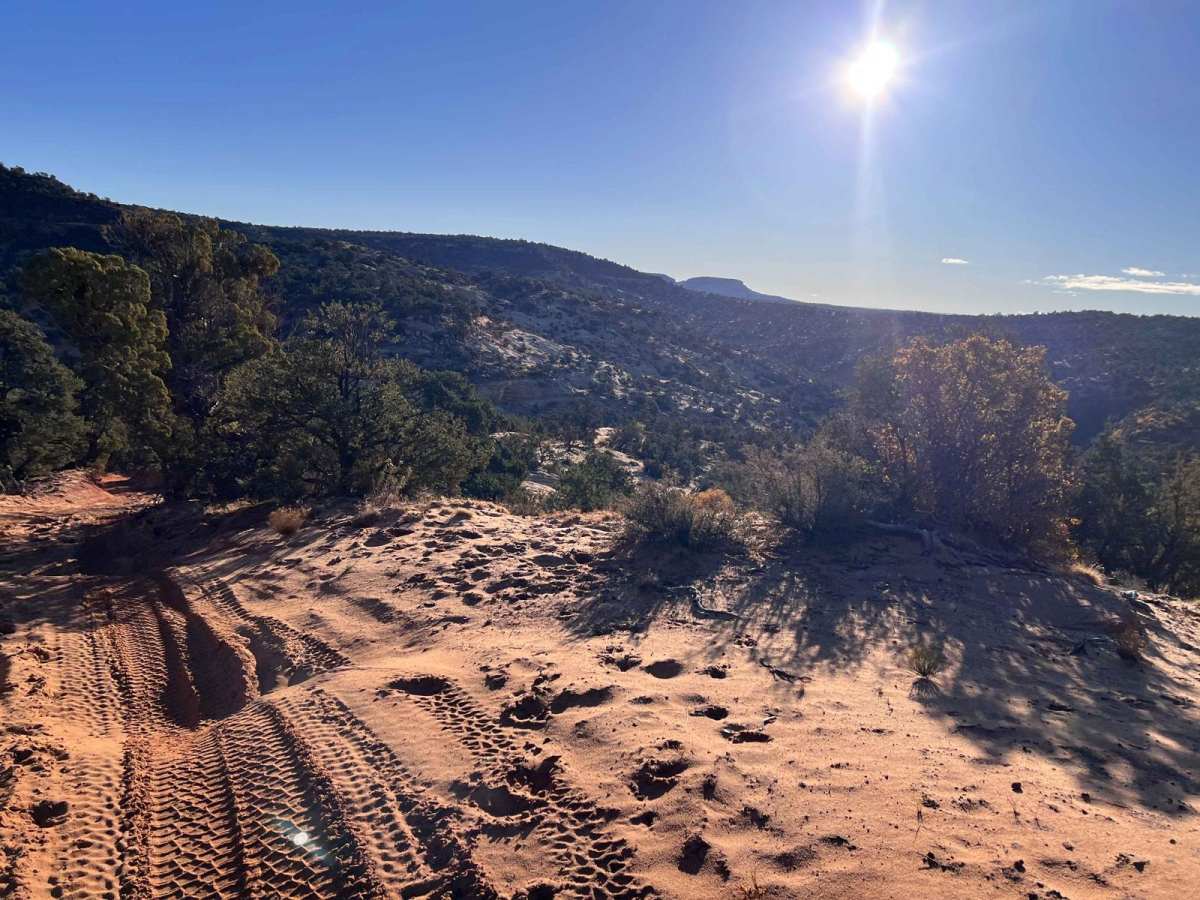
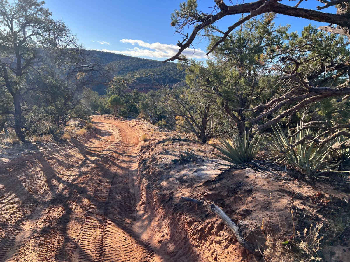
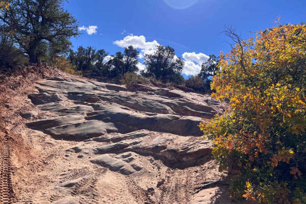
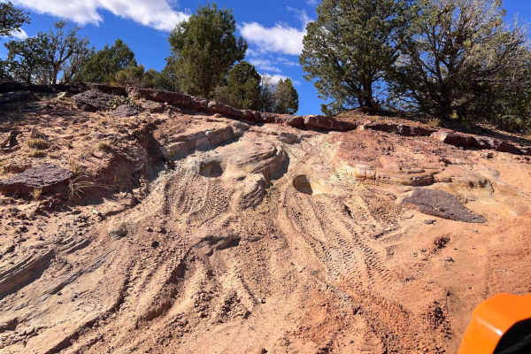
This trail begins approximately 3.3 miles from the HC trailhead at the top of a hill, where the terrain changes markedly. The trail starts with a descent into a canyon, a fun short climb, and then a challenging climb up Mosdell Hill. The climb up Mosdell Hill, for many, is often the introduction to HC's famed rock features. This challenging hill provides opportunities to test your comfort with off-camber and steep, rock-faced climbs. A second challenging area will be encountered approximately one mile from the eastern end of the trail and the east entrance to HC. This section of the trail provides access to HC 4, 5, 6, and 7. In addition, many exciting and beautiful area trails can be accessed from the eastern entrance to HC. Just so you know, HC is a set of defined trails, AKA a trail park. These defined trails vary in difficulty to provide challenges for all types of vehicles and skill levels. It is also a great area to learn new skills on these trails. HC is NOT an open-riding area. You are expected to stay on the defined trails and, unfortunately, create new trails. In addition, please do not build upon someone else's desecration of the area by riding on trails or bypasses that others have created. Please obey all BLM-posted signs. OnX asks everyone to support the Tread Lightly principles.

Photos of Hog Canyon 1 East - Mosdell Hill+ (BLM HC1Z)

Difficulty

This trail provides a great introduction to slick rock, rock ledges, and operating in off-camber situations. It also lets you judge your comfort level in these situations. Exercising care and judgment concerning your vehicle's capabilities and your skill level in these situations is important. While the trail is mostly a 4, the two technical sections are definitely at a higher level. Coming down Mosdell Hill, it is very easy to take body damage at the rock outcropping. HC is not for everyone. There are many other fantastic trails in the area. Usage and weather can and do change the trail's level of difficulty. Over the last few years, many of these trails have become markedly harder. The ratings in this app are done at a point in time.

Technical Rating

5

Status Reports

Add Status Report
Mean Joe
Nov 01, 2025
Open
The trail was in good condition with the exception of some pretty rough washboard in spots. As mentioned in previous reviews, Mosdell Hill is really what gives this trail it's difficulty ratings. It definitely looks a bit intimidating at first glance, but we crawled right up the hill without challenge. I still don't think I'd try it in a stock Tacoma as is mentioned below. The trickiest part, in my opinion, is the final ledge at the top which can get a bit tippy if you chose the wrong line. You can easily do the rest of the trail if you can do Mosdell Hill. We ran this trail in both directions.
Doug Turnquist
Jan 18, 2025
Open
The trail was in good condition—no surprises. The primary obstacles are in the first mile heading west to east. After the first mile or so, it's primarily equivalent to a forest service road with tight turns and a few small inclines/declines.
The Black Pearl A
Jan 05, 2025
Open
Beginning of the trail is great with some simple sandy slopes. As you progress to Mosdell trail it gets extremely rough with large boulder obstacles and sharp sandy turns. The slopes become extremely steep exceeding 30 degrees in some areas. There are roughly three major obstacles within Mosdell trail that are steep slopes covered in large drops and even larger rocks. Overall, a difficult but doable trail on a stock Tacoma. Be wary of some of the edges on the slopes as the sand isn’t compacted and very loose.

Hog Canyon 1 East - Mosdell Hill+ (BLM HC1Z) Trail can be accessed by the following ride types:

  • Single Track
  • 50 Inch
  • 60 Inch
  • High Clearance
  • Full Width

Hog Canyon 1 East - Mosdell Hill+ (BLM HC1Z) Map

The onX Offroad Difference

onX Offroad combines trail photos, descriptions, difficulty ratings, width restrictions, seasonality, and more in a user-friendly interface. Available on all devices, with offline access and full compatibility with CarPlay and Android Auto. Discover what you're missing today!

Open Trail Map