LR White - SCAR Alternate

Total Miles 9.8
Technical Rating
3 Easy
Best Time Spring, Summer, Fall, Winter
Trail Type Full-Width Road
Accessible By
Open Trail Map

Trail Overview

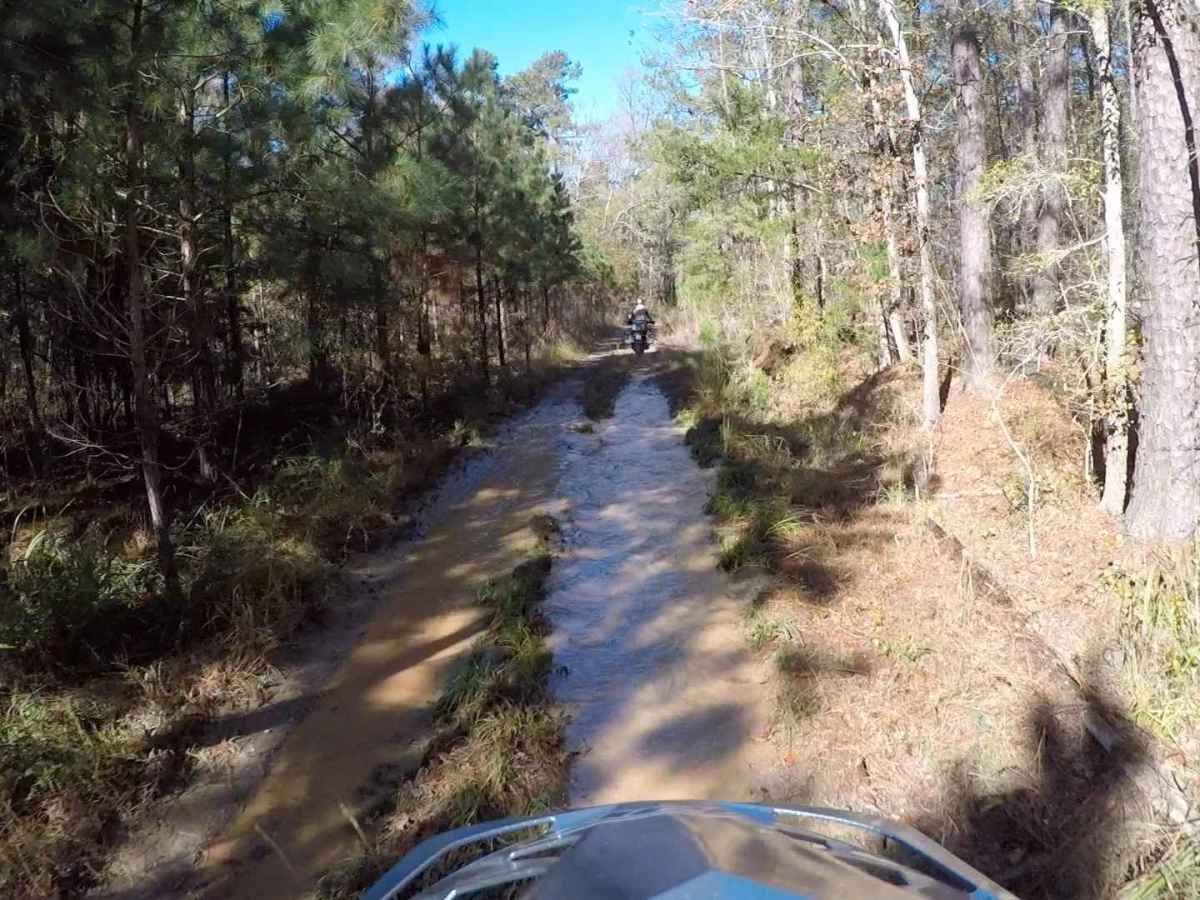
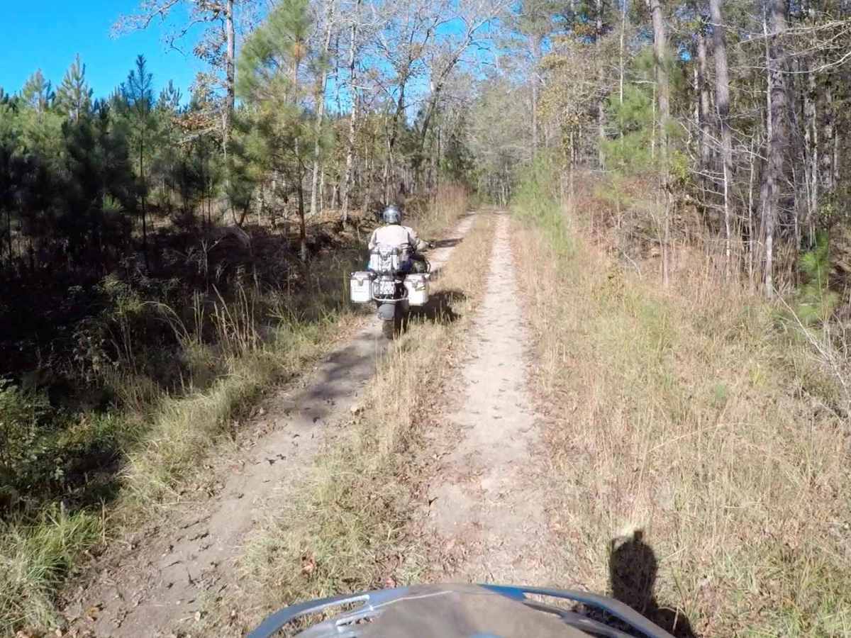
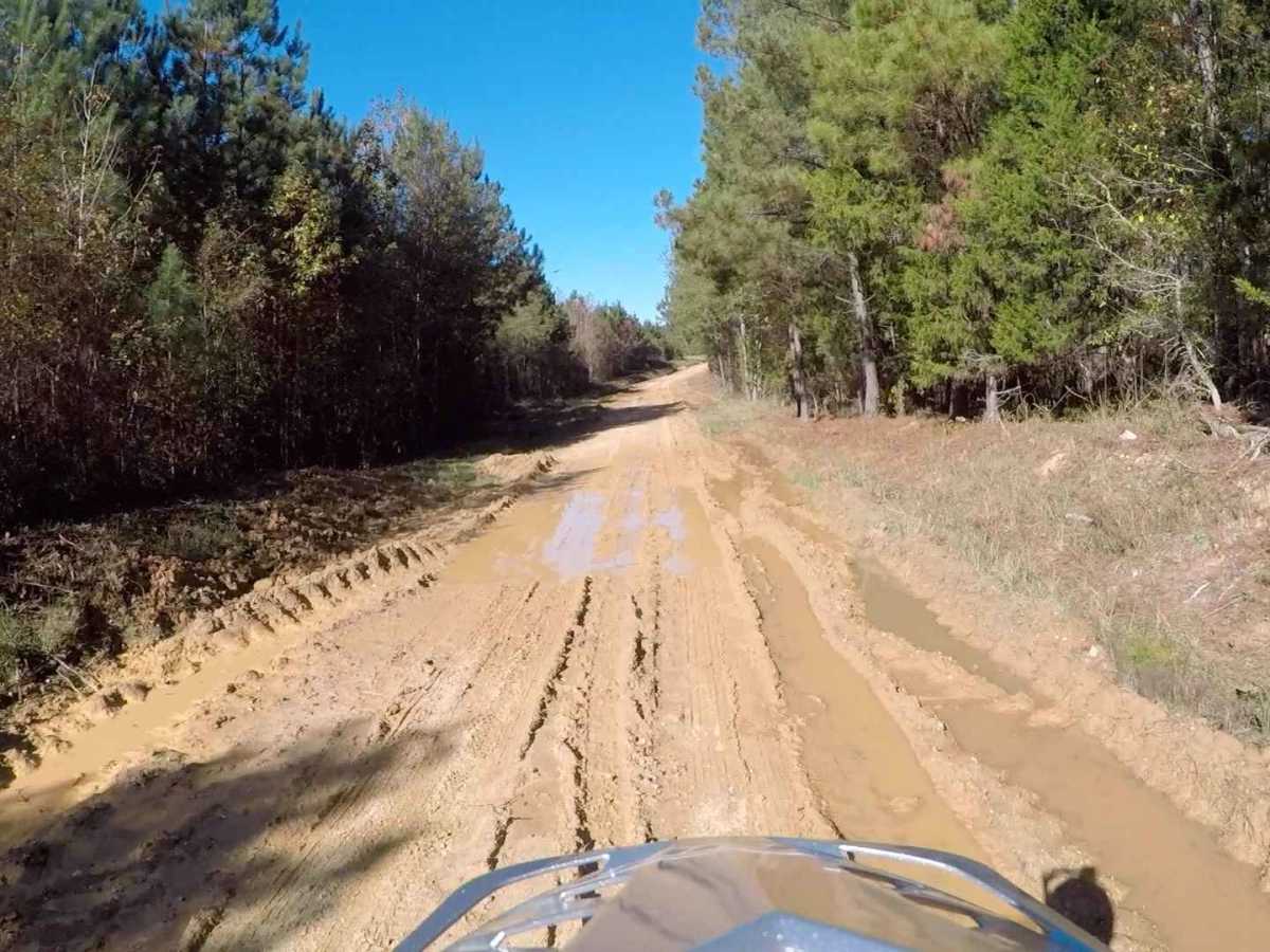
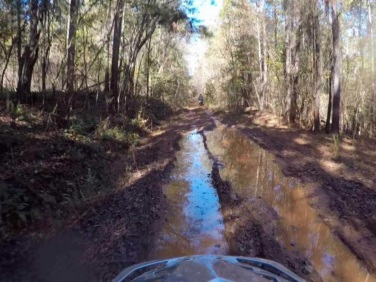
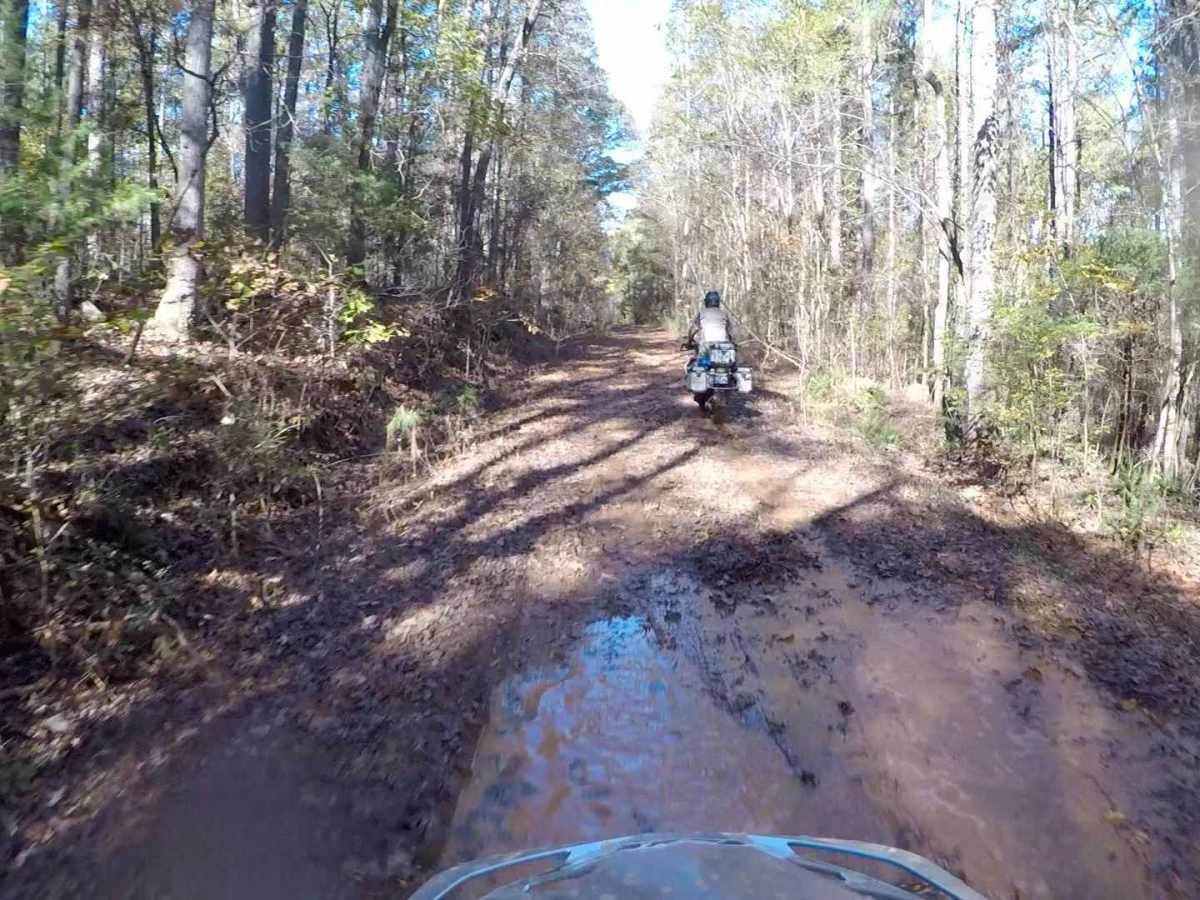
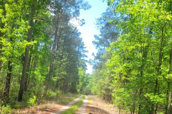
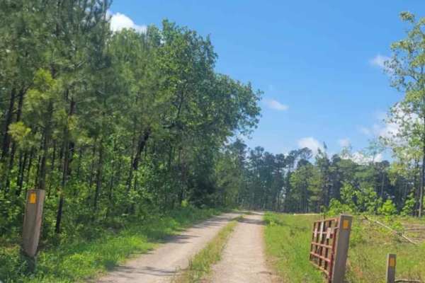
This section of the South Carolina Adventure Route is found southeast of McCormick. It consistently contains sections of shallow mud and standing water across the road, as well as significant encroachment of tree limbs. If you're looking for a more adventurous track, you'll find it here. This trail is prone to damage during wet conditions which could lead to closure. Please avoid traveling this route when mud and standing water are present. If you must traverse it, make sure to air down to improve flotation and drive with care to avoid creating ruts and damaging the surroundings. We're relying on you to help keep this trail open! About the SCAR: the South Carolina Adventure Route loops through approximately 1,000 miles of rural South Carolina. Along this route, you'll enjoy the Blue Ridge Mountains, the Atlantic Ocean, diverse forests, cotton fields, state parks, historical sites, and quaint towns. The SCAR also connects to the Smokey Mountains 500, the Georgia Traverse, and the Trans-America Trail (TAT), providing riders on those trails with a scenic route to the Atlantic coast at Edisto Beach. The roads along the SCAR are a mix of pavement and dirt, 60% and 40% respectively, with the surface alternating between gravel, dirt, clay, and sand. The route is not exceptionally technical, but dry conditions can leave the sandy roads loose, while wet conditions can leave the mud and clay roads slick and rutted. Travelers should expect to encounter deep sand and sizable mud holes in the worst conditions.

Photos of LR White - SCAR Alternate

Difficulty

This trail consistently contains mud and standing water.

Technical Rating

3

Status Reports

Add Status Report
Ethan Hughes
Oct 12, 2025
Open
Aaron Dargis
Sep 27, 2025
Open
Michael Sullivan
May 24, 2025
Open
Dry with some fair ruts. The trail is really narrow in places due to spring growth. Even though it was dry overall there were several shallow mud holes. As mentioned, one part of this road is a gravel forest road and the other half is a narrow, dirt/mud trail that in most places is only wide enough for one vehicle. After rain it would be a much more difficult road.
Jason Shealy
May 24, 2025
Open
Dan Coates
Mar 17, 2025
Open
I pulled out the chainsaw and cleared the tree. The trail is clear now.
andrew b
Feb 23, 2025
Open
Ben Craps
Dec 21, 2024
Open
Justin Matthew
Nov 25, 2024
Open
Trees down blocking this segment near where LR White meets Gilchrist. Ongoing construction requires a detour to start LR White.
Aric Baker
Sep 16, 2023
Open

LR White - SCAR Alternate Trail can be accessed by the following ride types:

  • High Clearance
  • Full Width

LR White - SCAR Alternate Map

The onX Offroad Difference

onX Offroad combines trail photos, descriptions, difficulty ratings, width restrictions, seasonality, and more in a user-friendly interface. Available on all devices, with offline access and full compatibility with CarPlay and Android Auto. Discover what you're missing today!

Open Trail Map