3 trails found in Oregon
Which "round top road" are you looking for?
We found 3 off-road trails in Oregon matching your search. Pick the one you're looking for below.
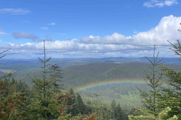
Round Top Road
You will be in for a real treat once you get to the top of this one. Be prepared for breathtaking views. If you have a significant other, take them up here for a chance to look down on the valley. Summer is this one's time to shine, but all other seasons are good too. If going in the snow, make sure...
Learn more about Round Top Road
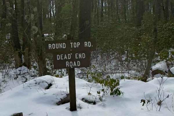
Round Top Road
Round Top Road is a graded gravel road. It is an easy ride in the summer months, however there is no winter maintenance. During times of rain, snow, and ice the road will become harder to travel on. Round Top Road is within Bald Eagle State Forest. Round Top Road is a dead-end road. It ends at a gat...
Learn more about Round Top Road
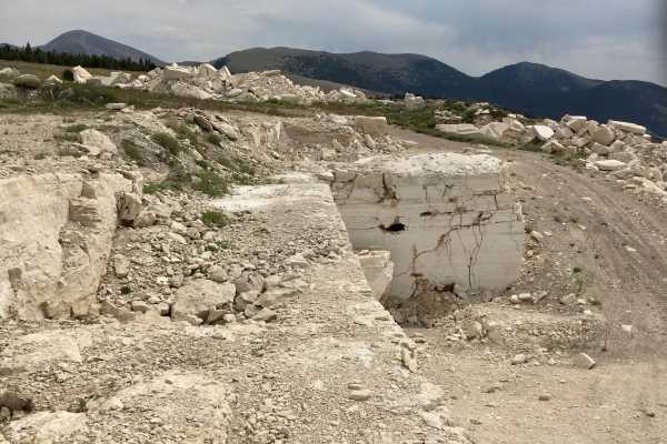
Round Top Road
This short road connects West Fork Ridge Road to Bannack Pass Road, also known as the Bannack Stage Road. Round Top Road also passes through a quarry for travertine, a starkly white rock used in the building industry. The road is a single lane, mostly rock road, but is easily navigated by any high-c...
Learn more about Round Top Road