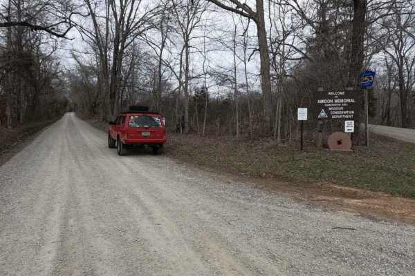
Amidon Conservation Area Road

Total Miles 3.9
Technical Rating
5 Moderate
Best Time Spring, Summer, Fall
Trail Type Full-Width Road
Accessible By
Open Trail Map

Trail Overview

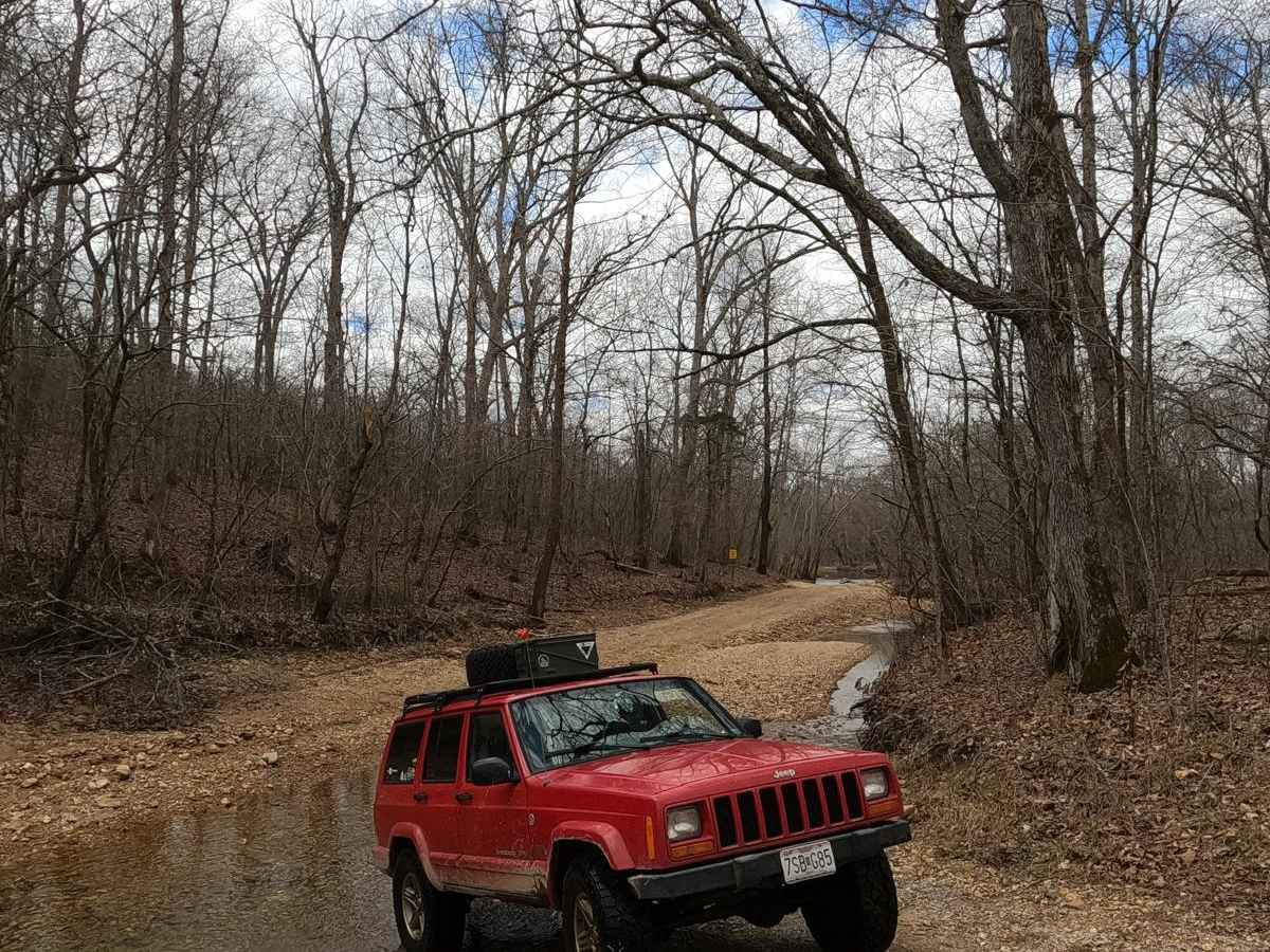
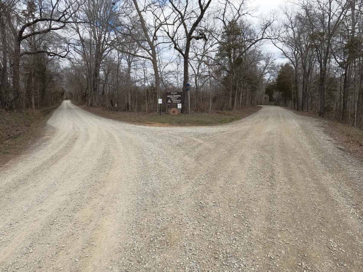
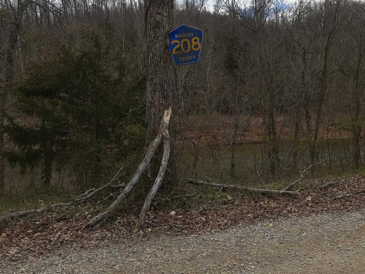
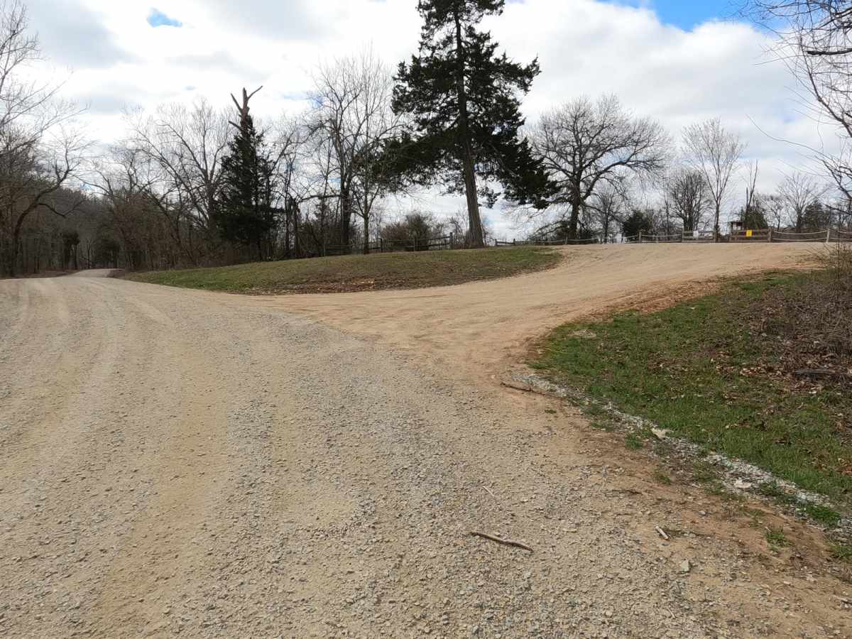
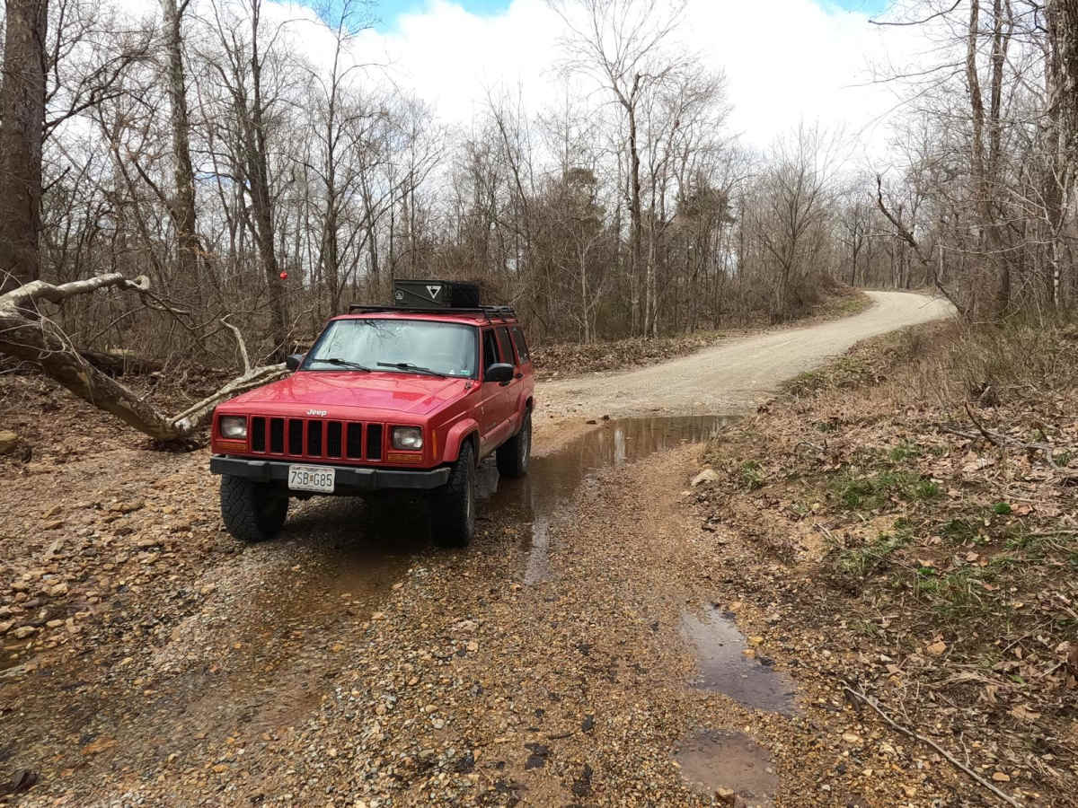
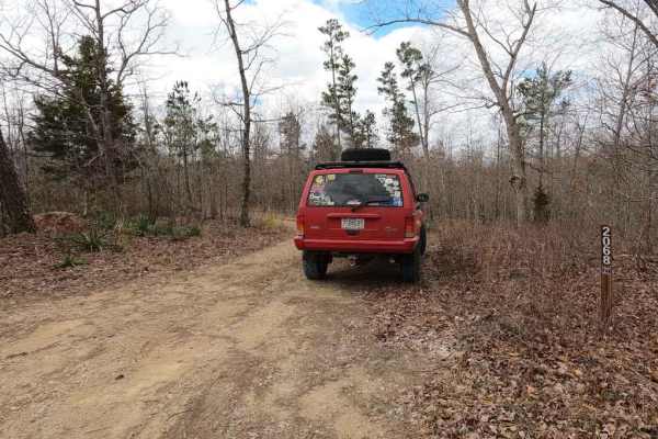
The Amidon Conservation Area Road is a gravel-based road, compromised of the Madison County 208, and the Bollinger County 928, that cuts through the center section of the Missouri Department of Conservation area of the same name. The land that this is cutting through is primarily used for various types of hunting and fishing, but this road is for the offroaders that want to try their rig at creek/river crossings and loose rock. The road features 6 creek crossings through the Upper Castor River, with one nearing 12-18" deep on a normal day. Warning, if the conditions are rainy it could be more like 30" in depth. The water is swift and should be observed before entry, higher air intakes are recommended. on the Bollinger County half of the road, you climb a mild-grade hill to get to the eastern end.

Photos of Amidon Conservation Area Road

Difficulty

The ends of the road feature a more maintained gravel and are very easy to drive, whereas the center section features course creek bottom gravel and is to some effect unmaintained at times, and can feature large washes and ruts, and mounding. The creek crossings are the biggest obstacles, the main crossing being 70 feet long and varying from 12-30" depending on the conditions. The smaller crossings probably range from 6-18" depending on the conditions. A higher placed air intake is recommended. Rocks in the water can be deceptively large and should be looked for, and the creek bed rock is loose and ever-changing, a little forward momentum is helpful. The dry sections of the road can feature randomly place large rocks and should be watched out for.

Technical Rating

5

Status Reports

Add Status Report
Mark Rankin
Apr 30, 2026
Open
Easy gravel road. Do stop at pink rocks, Amiden park. Nice drive. No challenges at all.
Dylan Schmitt
Sep 06, 2025
Open
Kristian H
Sep 06, 2025
Open
All the creeks were pretty low. The big crossing was 1215 inches at best.
Neagley JLURX
Jul 04, 2025
Open
Nice trail with water crossings. Street tires on one of our jeeps spun quite a bit crossing one of the rivers. Take time to take a swim in the beautiful river.
Rick Buckley
Mar 16, 2025
Open
This trail has a few water crossings. most very small. One larger cross was roughly 16" deep. Smooth gravel for the entire trail. Only rated 2 due to the one water crossing. not the 5 I was hoping for!
Angie Sheets
Mar 08, 2025
Open
Jacob Easler
Jan 01, 2025
Open
me myself
Nov 01, 2024
Open
mark saz
Jun 08, 2024
Open
Chris Menz
Jan 12, 2024
Open
current high levels of water, beware.
Jon M
Apr 22, 2023
Open
Chris Menz
Mar 25, 2023
Open

Amidon Conservation Area Road Trail can be accessed by the following ride types:

  • High Clearance
  • Full Width

Amidon Conservation Area Road Map

The onX Offroad Difference

onX Offroad combines trail photos, descriptions, difficulty ratings, width restrictions, seasonality, and more in a user-friendly interface. Available on all devices, with offline access and full compatibility with CarPlay and Android Auto. Discover what you're missing today!

Open Trail Map