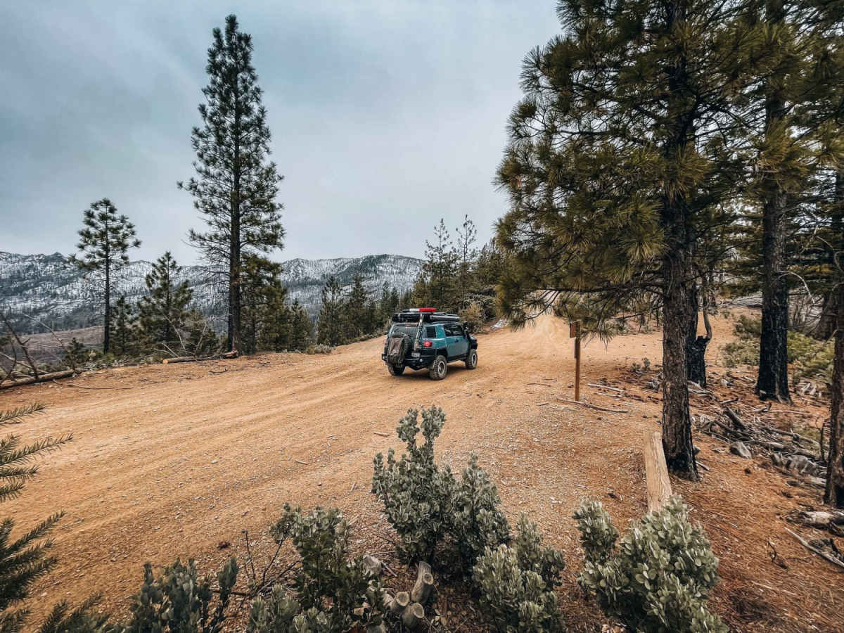
Jared Bowman
Dec 16, 2025
2005 Toyota 4Runner
Open
Muddy/Wet
No snow on the trail as of yet. Although I passed through during the start of a storm. Very wet throughout the whole trail. You can tell they’ve had a lot of downed trees. Had to squeeze through a couple tight areas that had downed trees (nothing blocking the trail)
Mike Sheehan
Nov 22, 2025
2025 Jeep Gladiator
Open
Normal
Rained about 48 hours earlier but trails were surprisingly dry other than some puddles. No dust! Easy, well maintained for westernmost 15 miles or so. Not particularly difficult, just lots of ruts and puddles after that. Bailed out due to time of day and took road 16N01 to get back to pavement. Big tree cross the road, which appears to have fallen very recently-but you can get around it. Reported to ranger station email so hopefully they address it soon. Look forward to completing the trail when I have more time-and a chainsaw.
Jed R
Nov 17, 2025
2023 Ford Bronco
Open
NormalMuddy/WetRough/Deteriorated
First time attempting this trail. A lot of rain in recent days so anticipated slick conditions w/lot of water crossings & deep puddles. Started from UpperLake going East, very easy & wide road for the 1st 10 miles, going up & over some ridges & down into valleys. Increasing number of deep ruts, steep sections and slick mud the further you went. By about 15-20 miles, started getting tighter and more pinstriping. At 23 mile mark starting to head up another ridge I turned around because it was so overgrown my truck was barely fitting through. Was happy to turn back. Found a different route out, turned south on Twin Valley Road which was more maintained than the previous 5-8 miles I’d been doing, with 1 sketchy spot where the road is off-camber, has a tree overhanging which reduces clearance, collapsing 15ft into a creek and supported by a few slippery logs. Changed my pants after that obstacle. Anything bigger than my 2door bronco probably wouldn’t make it. Beautiful views the entire time.
Oded F
Sep 13, 2025
Open
NormalDustyRough/Deteriorated
Pretty empty. A couple mud patches and lots of ruts. Fun riding for a pair of loaded adventure bikes. Watch out for fallen trees on the sides of the trail, they will grab you.
scott .
Aug 03, 2025
Open
Dusty
took the trail from letts lake down to upper lake. trail was pretty easy couple spots with some big ruts. took up about 4 hours. fun trail
Anthony Diaz
Aug 02, 2025
Open
Dusty
We started from Wolf Creek. The trail was being graded on our away up. I am running stock tires and no lift on my LX470. I had no clearance issues, did not need 4LO, and did not use my diff locker.
Anthony Diaz
Jun 27, 2025
2000 Lexus LX
Open
DustyWashboard
This was an easy trail and we started from just above upper lake. So we came in on the West side of the trail. My group and I only did the first half just past Dry Oak Camp and where it splits to go back to upper lake. I was in my stock LX470 and there was no clearance issue and never came close needing my locker. It was 90 degrees on the trail and it felt hot for the kids. Sun went down around 8:30 pm.
Matt Merkley
Jun 20, 2025
2023 Toyota 4Runner
Open
DustyRough/DeterioratedWashboard
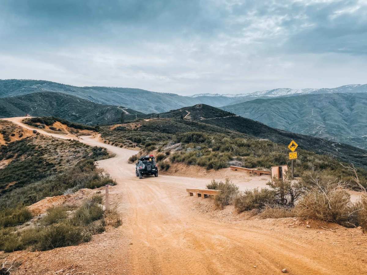
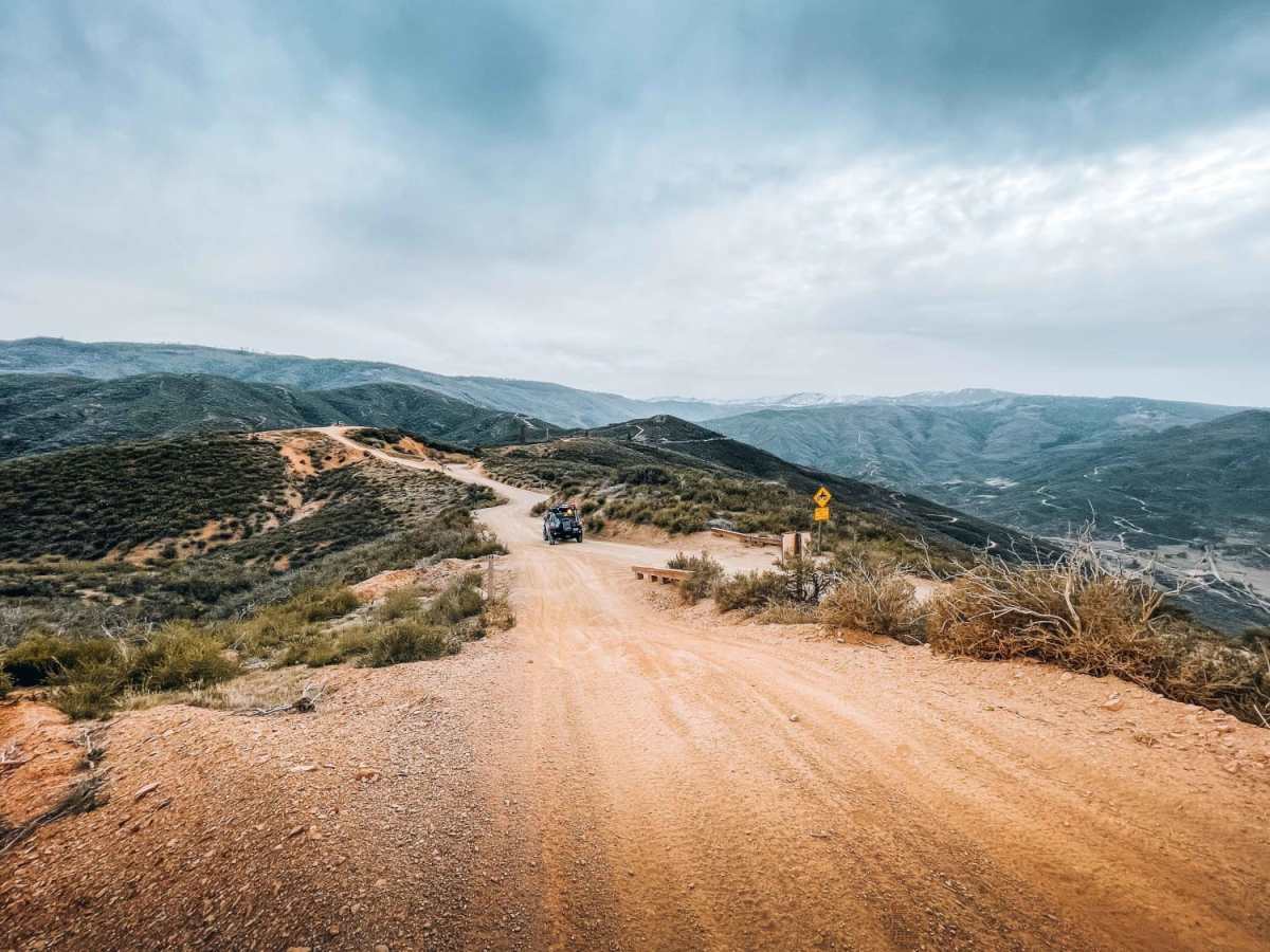
Traveled east-to-west, did it one day. Beginning and end are decent fire roads and not difficult at all. Middle section is very rutted in some sections, offering some fun obstacles for long parts of the trail. Some sections are dug out and would make a stock 4x4 struggle due to clearance and traction. Weather was perfect, but the trail is very dusty. We had to keep a good-sized gap between us so that the rear vehicle could see at all. Stopped at Lett’s lake for lunch (highly recommended), then took the Linger Longer trail back to the MDC route which was also really fun. There is a very long stretch of trail with intermittent sections that have lots of brush that will pin stripe the hell out of your vehicle, and there are no options to navigate around it. It goes on forever with the nails on chalkboard sounds…. Bottom line - fun trail with moderate difficulty in the middle, but do it just once.
nicholo P
May 24, 2025
2024 Toyota Tacoma
Open
NormalDusty
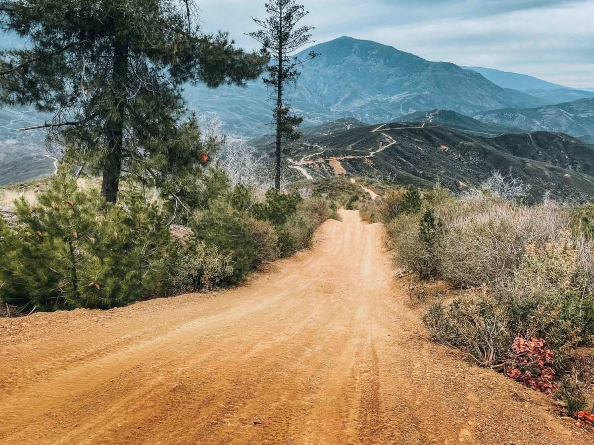
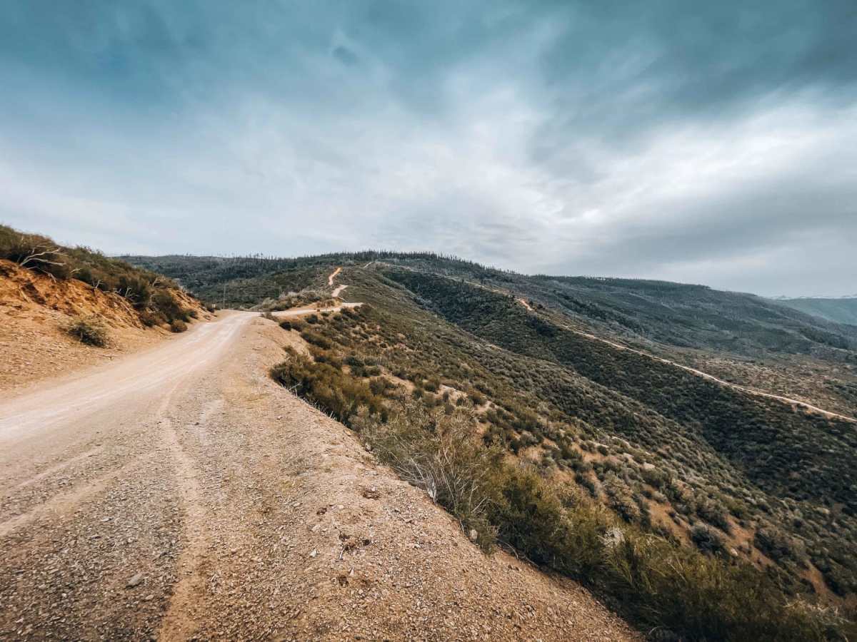
Started from the north east point and did about 2/3 of it. Took about 5hrs and took a side trail out. If you care about your paint job, this trail will make you change that attitude. Some parts were so overgrown, the opening was only 3ft wide. Lots of downed trees and branches sticking out, so keep an eye on where you place your tires. Wouldn’t take anything bigger than a midsize truck here. It’s not too difficult, but it’s long. I think it would be 9 hrs to do the whole thing. First half from the north east is easy, saw a Camry and a Matrix there. Once you get to the high point, it gets harder.
Chris paras
May 17, 2025
2025 Jeep Gladiator
Open
NormalRough/Deteriorated
Trail has overgrown trees/bushes. Definitely got some pin stripping to for about a mile in the middle of the trail.
Alex V
May 03, 2025
Open
NormalDustyMuddy/Wet
Trail was super fun. No creek crossings. One bad muddy rut that got me since l'm not 4x4.
One other spot got me that was to steep for my 2 wheel drive and I didn't have enough low power. It's ok for any other car. Really only the deep muddy rut towards the end. Ran West to east.
Eddie Hernandez
Apr 19, 2025
Open
Rough/Deteriorated
If you doing the whole trail I would recommend 2 days to do all of it. If you love your paint on your vehicle stay away from this trail. There are some parts of the trail that it reduces to dramatically. My truck got hella scratch but if you don’t mind it then it’s a go. Just watch out for the random holes along the trail. I got stuck on one of them I didn’t see it and my truck dived in nose in. Took a couple of wood and a pull from my buddy to get me out of there. There’s a flat area that’s perfect for camping right in the middle of the trail. And more spots that are really nice .
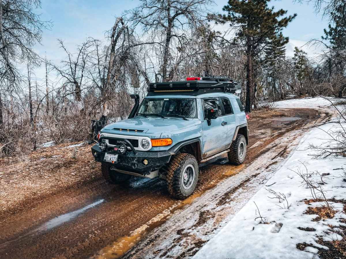
Alan Loyola
Mar 17, 2025
Open
Muddy/WetSnow/IceRough/Deteriorated
Took this trail during a rainy day. the first part was not bad, until I got to to the first high point. Once I started the decent, I had to go through a lot of areas where there is water running down on the road, or has been running down the middle of the road and now there is a huge ditch. it's supper muddy and hard to keep the car on your line. I did not run into any downed trees, but did go through a lot of flooded areas. once I got down to the river, I ran into a piece of the road that was washed out.
Broderick Petrucciani
Feb 15, 2025
Open
Muddy/WetSnow/Ice
Went in the middle of a torrential downpour rain storm and really wasn’t that sketchy at all. If you have my tires and air down, you’re gonna be just fine. The most aggressive terrain we hit was a few down trees or branches, which we cut out of the way and some parts of the trail were rutted outs Hit a little bit of snow at the very top. If you like the paint on your car, don’t do this trail because there’s about 2 miles of pinstripes. Did the trail west to east which we felt was the best way. A few water crossings. The one that was the biggest, and the deepest is pictured in this post so not that bad especially during a storm. A ton of little camp spots along the way. This looks like it would be a breeze in the spring summertime. If you’re into a scenic ride I highly recommend this one. I’m in a Jeep wrangler on 40s with 6in lift and my buddy is in a gladiator on 37s with 2” lift
Chris Proctor
Jan 19, 2025
Open
Normal
Planned to travel to Letts Lake from Yuba City area using On X. The way that it sends you using a National Forest road, then instructs you to take a right onto a "Most Difficult" trail that looked pretty sketchy. Reccomend continuing on NF road and making your way to intersect this trail and take it up to the trail leading to Letts Lake. Portions of the trail I was on was mostly dry, a couple of water crossings of less than 6" and a few spots with large washed out portions. SUV might be ok, but reccomend something with a little more clearance. Definitely not a sedan friendly.