Chris Wills
May 22, 2026
2025 Chevrolet Colorado
Open
Dusty
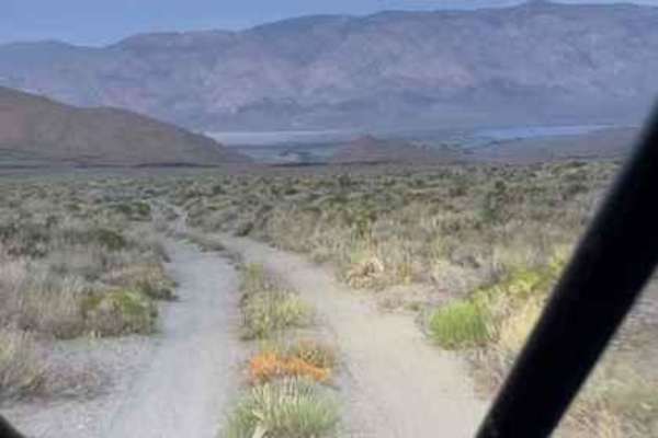
Great trail, so beautiful up there. A few hairy sections I had to get out and spot but managed them with my Colorado with a 2 inch lift without banging. Able to plot a route onto the 9S18.
Randy Boelkes
Mar 25, 2026
2022 Ford Bronco
Open
Great trail, we had a lot of fun! Lucky to find this almost snow free in March. We ran it from south to north. Initial section is flat easy road and then a graded rocky cruise up the canyon until reaching Badger Flats. The trail becomes steeper, narrower and more challenging until reaching Papoose Flats where you’ll find great campsites. The views of the Eastern Sierras are amazing. The ride out from Papoose to BP-DV highway was mostly an easy trail. Dry conditions like this make the trail more of a 5/10, but snow on trail could make this much more challenging.
Conor Kelly
Feb 28, 2026
2024 Ford F-Series
Obstructed
Deep Snow
Started from north end around noon. Good weather but still some snow in pockets. About 2 miles in, about 200 feet after the pinch rocks there was a ton of snow with some edge exposure on a corner which stopped us. Where the snow was melting the ground was saturated so had to watch wheel placement.
Alec Trueblood
Oct 09, 2025
2006 Toyota Tacoma
Open
NormalWashboard
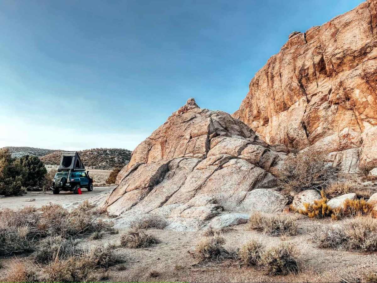
The ride from Independence is about 20 miles and 2 hours, with the first 7 being pavement, then a couple miles of broken pavement, then 11 miles on a rocky, washboard road with many sharp and pointy rocks. The drive in is not that scenic and pretty uncomfortably bumpy, unless you air down, which I did not. Highlights are pine trees and flowers along the way. The drive out is scenic, looking West to the Sierra. It was not my favorite road due to getting all shook up. We camped at Badger flat with a great view of the Sierra. The first campsite on a spur off to the right is where you find a good view, but also heavy wind and human waste left by barbarians. Hellishly windy all night, and so would not camp here again. Come on a calm day or choose to camp further into the flat to reduce wind.
Terry Tucker
Oct 06, 2025
2022 Jeep Gladiator
Open
Rough/Deteriorated
Mazourka Canyon, enter the trailhead at Independence. It is approximately 38 miles total if you stay on the main trail and keep to the western trail and stay off the rocky narrows. The trail is relatively easy from Independence to Coordinates, 36.96789, -118.10044. This coordinate is a nice large, dispersed camping area. Follow the trail north for another 1/2 mile and there are also more great camp sites along that way. After the dispersed camping at the coordinate (Badger Flats), the road gets technical and you really should consider using spotters if you are not high clearance. After this the trail gets very rocky, narrow and deteriorated. From the coordinate i gave above to the hard stand road that leads back to Big Pine, it will take you approximately 5 to 6 hours to complete the trip. Total time from Independance to the hard stand road is about 7-8 hours.
Rob Thompson
Jul 11, 2025
2017 Toyota 4Runner
Open
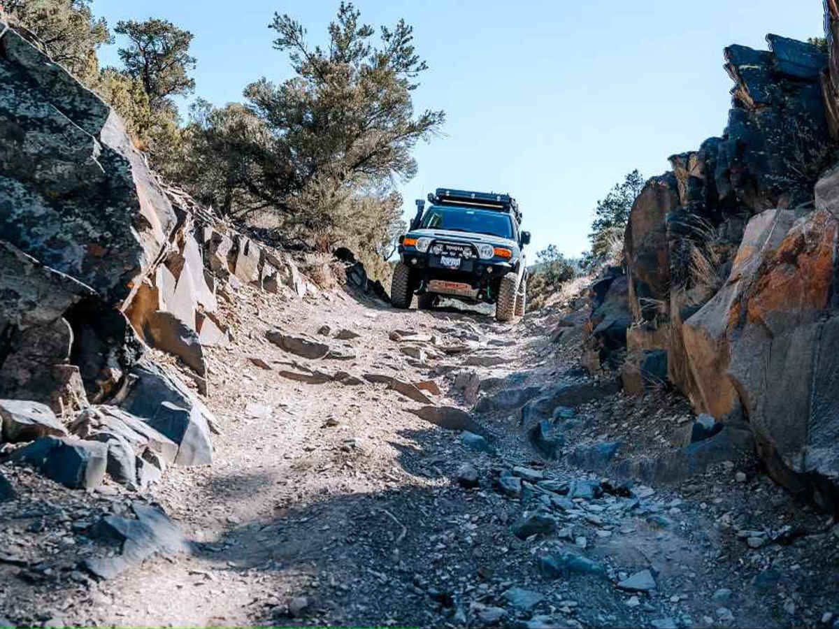
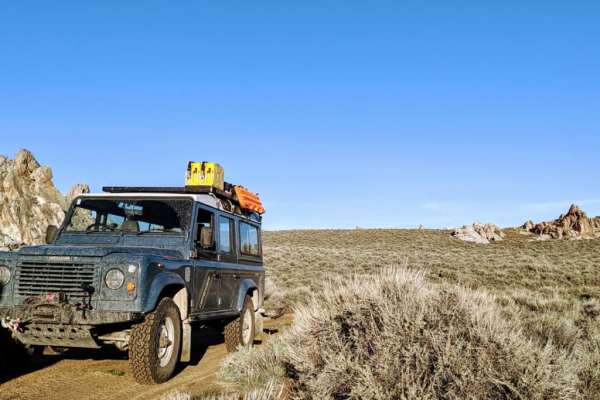
Came in through the north off 9S18 only 1 section required 4 low. See pics. Steep and about a 12-18" rock ledge. Looks like some folks have done some trail repair to make it easier.
Stock 4x4 could make it going very slow with some scrapes and bangs. If ya got 33's or up it's easy no prob. Would hesitate bringing a full size truck through here.
The switch backs have eroded some, but good 10" berm on the edges of the cliff side keeps ya on the trail.
Did not do the south section, just the north. No one else on the road and had all of Papoose Flat to ourselves.
Francis m
May 24, 2025
2003 Lexus LX
Open
DustyNormal
Pretty easy trail, ended up being much longer than anticipated. We spent the night just after the loop on the west side but it's possible to do it one day. There were a couple of steep sections but nothing too serious. My vehicle has minimal modifications and it was an overall good challenge for a novice driver!
JASON RICE
May 24, 2025
2025 Jeep Gladiator
Open
Past badger flat it definitely gets rocky. Good news is there was no one on this portion of the trail. Views and weather up above 9000ft are awesome.
Jay Mendoza
Apr 03, 2025
2019 Toyota Tacoma
Open
NormalSnow/Ice
Trails are normal to partly rutted with occasional patches of snow/ice.
Angel Hernandez
Feb 23, 2025
2022 Jeep Wrangler
Obstructed
Deep Snow
First 10 miles or so you won’t encounter any snow once you get to mile 12 or so you’ll have to drive through snow that’s only a few inches deep, some sections are of chamber that’ll make you slide a bit, had to turn back at mile 14/15 as snow was about 2 feet deep.
Tim M
Oct 06, 2024
2022 Ford Bronco
Open
NormalDusty
Earns the 5 rating for the one section that is loose rocky steep and a bit off camber and used 4lo. Otherwise easy. We went S to N. Stunning views across to Sierras. The trail gets more amazing as you travel north. One deep rutty section requires some clearance at risk of getting high centered in the dusty ruts
Jerry Hutchins aka "Photojeeper"
Oct 02, 2024
2021 Jeep Wrangler
Open
NormalDusty
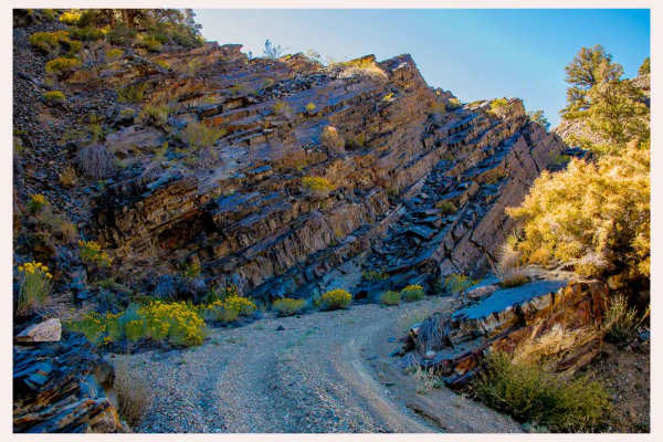
The trail was as good and somewhat technical as it was in 2014 in my YJ and I did the switchbacks. This time I did the "Rocky Narrows" which is a much more interesting and technical trail. Will do this section again and make it a longer trip then the one night. I used 4Hi mostly but there are times I needed 4Lo for speed control. Lockers were not used and I was aired down to 14psi.
g spot
May 02, 2024
2016 Toyota Tacoma
Open
NormalDusty
Trail was in good condition, great trail, fun with great views. It’s relatively easy but just a few spots where you need to be careful to avoid damage. Papoose flats was definitely fun to drive through. Trail can get a bit narrow so expect some trail stripes, some narrow switchbacks also. Took about 4 hr to complete South to North with lots of stopping to admire the amazing views, & airing up/down. Didn’t see a single other vehicle the whole trail. Lots of sharp black rock so bring sidewall repair + plug & spare. Completed driving a stock Tacoma trd off road w/ 32” tires.
Mark Mason
May 02, 2024
2024 Jeep Wrangler
Open
Dusty
We came in on Rocky Narrows trail and exited on this trail. The trail is in good condition. It only took us 40 minutes to get out (downhill) going in would be a little longer (uphill).
Ashton Fera
Oct 28, 2023
2021 Toyota 4Runner
Open
Rough/Deteriorated