Jason
Oct 19, 2025
Open
DustyRough/Deteriorated
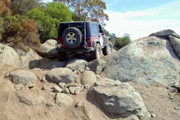
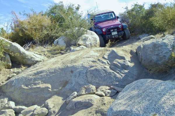
From the entry in the northeast, we went clockwise. Eastern half of the trail is pretty easy going, manageable with any stock 4wd with a bit of clearance. However, the western half of the loop is extremely overgrown. Expect heavy pinstriping, even on mid-size vehicles. Northern most point of the trail (less than 0.5 miles from start if you go the other way) has the big rock climbing obstacle which is pretty much impassable to a stock vehicle and is by far most difficult section in an otherwise straightforward trail. Recommend going CCW to check to see if you can traverse this point if you are unsure, rather than going CW and having to backtrack the whole loop.
Kyle SR
Oct 18, 2025
Open
NormalMuddy/Wet
Started at 4 corners staging area, went down corral canyon road to peacemaker. Got about 1/3 of the way up peacemaker before turning around. Connected to go clockwise around Los pinos toward Espinosa. Trail was more mellow than last time, the V notch before the rock section was gone. Only saw 1 jeep on the trail coming the other way. Fun trial, decent amount of mud.
Kurt jellison
Oct 04, 2025
Open
Normal
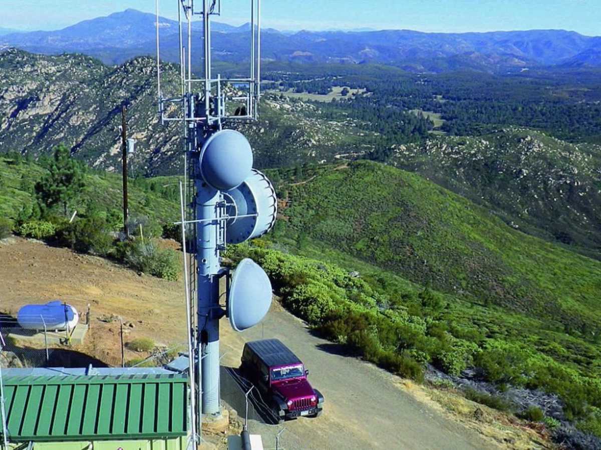
Going up towards the tower from the west brush was pretty tight one indigenous granite Boulder area mile from Lookout Tower Rubicon on 35 had no problem
Milo Smallman
Jul 27, 2025
Open
NormalDusty
Very fun at the end of the trail. The first 3/4 were just dirt and a bit boring. I struggled a bit but made it through on 33s with open diffs.
Harry & Shannon Xterra
Jul 04, 2025
2011 Nissan Xterra
Open
Rough/Deteriorated
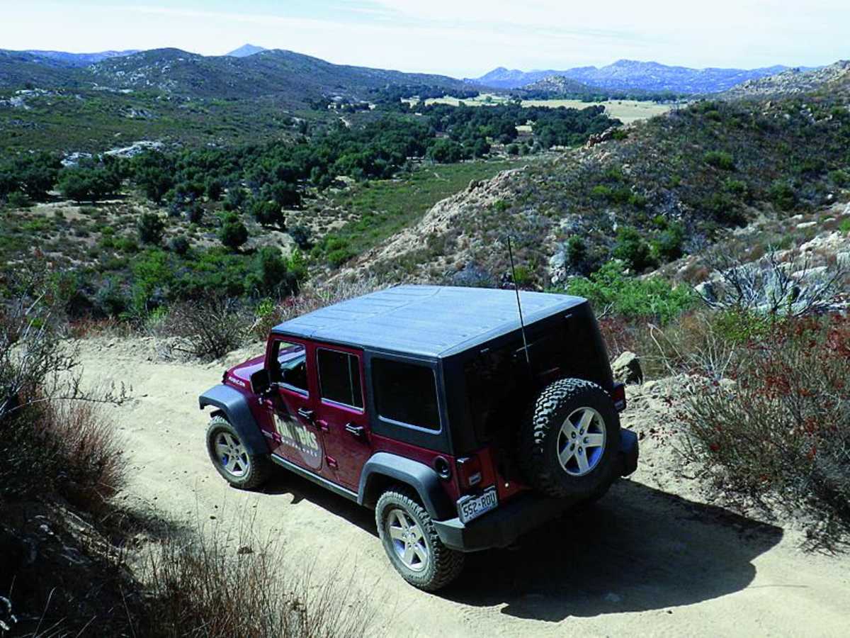
Went clockwise (the harder direction as you're climbing the boulders on Espinosa Trail). As always on this trail the brush is very tight so you will have pinstriping. My Titan Swapped Xterra on 35s was able to make it up the main obstacle on Espinosa Trail (without engaging my lockers) but our lifted Jeep Rubicon had issues due to the mud even with F/R lockers (briefly high centered) and we had to turn around (going downhill in the X was pretty simple)
Kyle SR
Jun 07, 2025
Open
NormalDustySnow/IceRough/Deteriorated
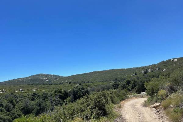
Started off buckman springs towards 4 corners. Ran clockwise from that point. First 75% of the trail is a fire road (no challenge to stock vehicles), last 25% of the trail is more challenging, less wide, and rocky. Ran the entire trail 21' Tacoma 4x4 open diffs on 32's on mid travel kit. First rock step is more challenging and the second one is off camber. Recommend a spotter. We also hit a piece of bronco flats on the way up which requires a seriously built rig. Made it maybe .25mile before turning around. Couple dirt bikes, 1sxs, and 1 jeep.
Nick C
May 24, 2025
Open
DustyRough/Deteriorated
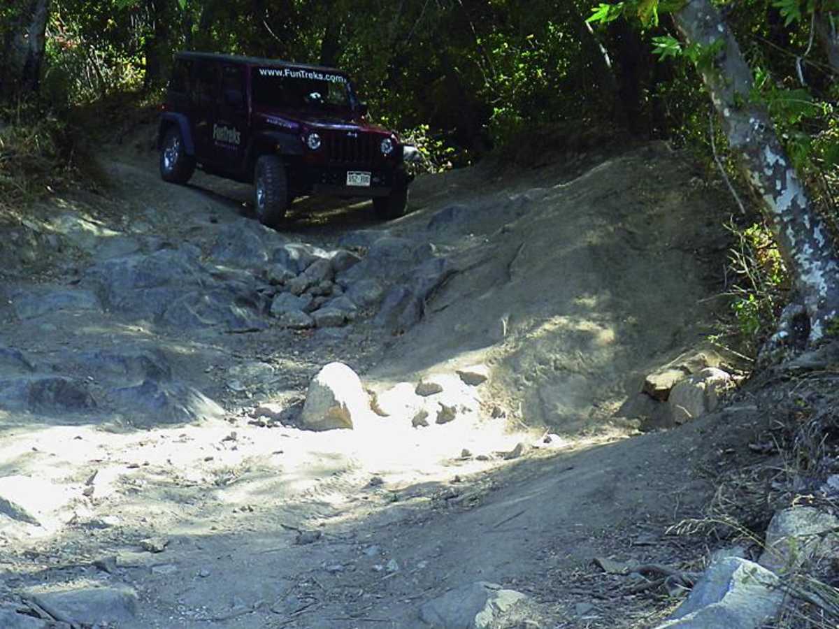
This trail is now no longer able to fit a full size truck and anyone that’s worried about their paint shouldn’t bother. This has been seriously neglected and is so over grown most quads and dirt bikes will have trouble getting past spots. I tried to go clockwise around the loop, I marked the point that started getting very over grown putting nice pinstripes down both sides and the roof of my truck. Put my rock sliders and skid plates to good work. I was not going to try to climb the (stairs) a ran into without a spotter so I had to turn around. So as a reference, looking at my tacks (in blue) the marker shows where it got really bad and where it ends shows the rock stairs that turned me around. The trail is fun but in desperate need of an overhaul.
Ed B
May 13, 2025
2022 Toyota Tacoma
Open
NormalDusty
Most of this loop is pretty low difficulty and wide open. I was able to handle in a stock Tacoma 4x4. From the staffing area I went clockwise. Once you pass the sign about the prior fires it narrows and becomes more difficult. I got to a point just before reaching the Los Pinos lookout where I had to turn around as it was impassible with the stock vehicle.
mark smith
May 03, 2025
Open
William Bryan
Mar 20, 2025
Temporarily Closed
Seasonal Closure
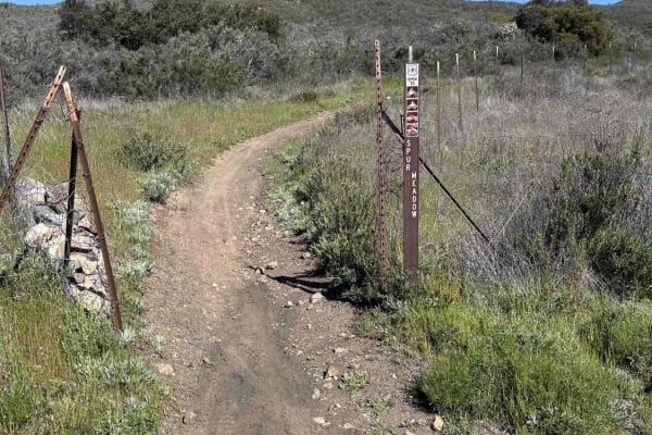
Gate closed to long loop
gonz al
Dec 07, 2024
2024 Ford Ranger
Open
Rough/Deteriorated
Overgrown. I won’t go again. Scratched both sides pretty bad.
AJ Brown
Nov 30, 2024
2023 Ford Bronco
Open
Rough/Deteriorated
trail is overgrown in some spots so be prepared to scrap your vehicle. the drop off was difficult without a spotter so recommend you go with someone that can help navigate down or up.
Brian S.
Nov 10, 2024
Open
Rough/Deteriorated
I did the loop counter clockwise, there is a poorly maintained paved road up to the lookout tower. The ride down from the lookout tower on Los Pinos trail is manageable and has some great views. But Espinoza trail is way more eroded with bigger rocks exposed than the last time I did this one back in 2010. A few downed trees with near by rocks cause some tight spots. The main obstacle before the gigantic rock is heavily eroded with bigger rocks exposed. Bounced off the skid plates and rock sliders a lot on the way down this trail but made it through ok. This part of the trail is also overgrown so expect pin stripping. The last part of the loop is a mostly rutted out dirt road, and then it ends as it begins on a paved road back to the Four Corners staging area.
Andrew Padilla
Oct 20, 2024
2023 Jeep Wrangler
Open
Normal
Started at the staging area and went clockwise ending with the lookout. Pretty easy until we reached the only real obstacle and then it was pretty overgrown. If you are ok with pinstripes it leads to an awesome view from up top.
mario fajardo
Sep 01, 2024
2023 Toyota Tacoma
Open
Rough/Deteriorated
Fun trail, 4x4 required. Some spots can look challenging but pick the right lines and you’re good. Watch out for bikes!