Jojoba Wash

Total Miles 7.9
Technical Rating
5 Moderate
Best Time Spring, Fall, Winter
Trail Type Full-Width Road
Accessible By
Open Trail Map

Trail Overview

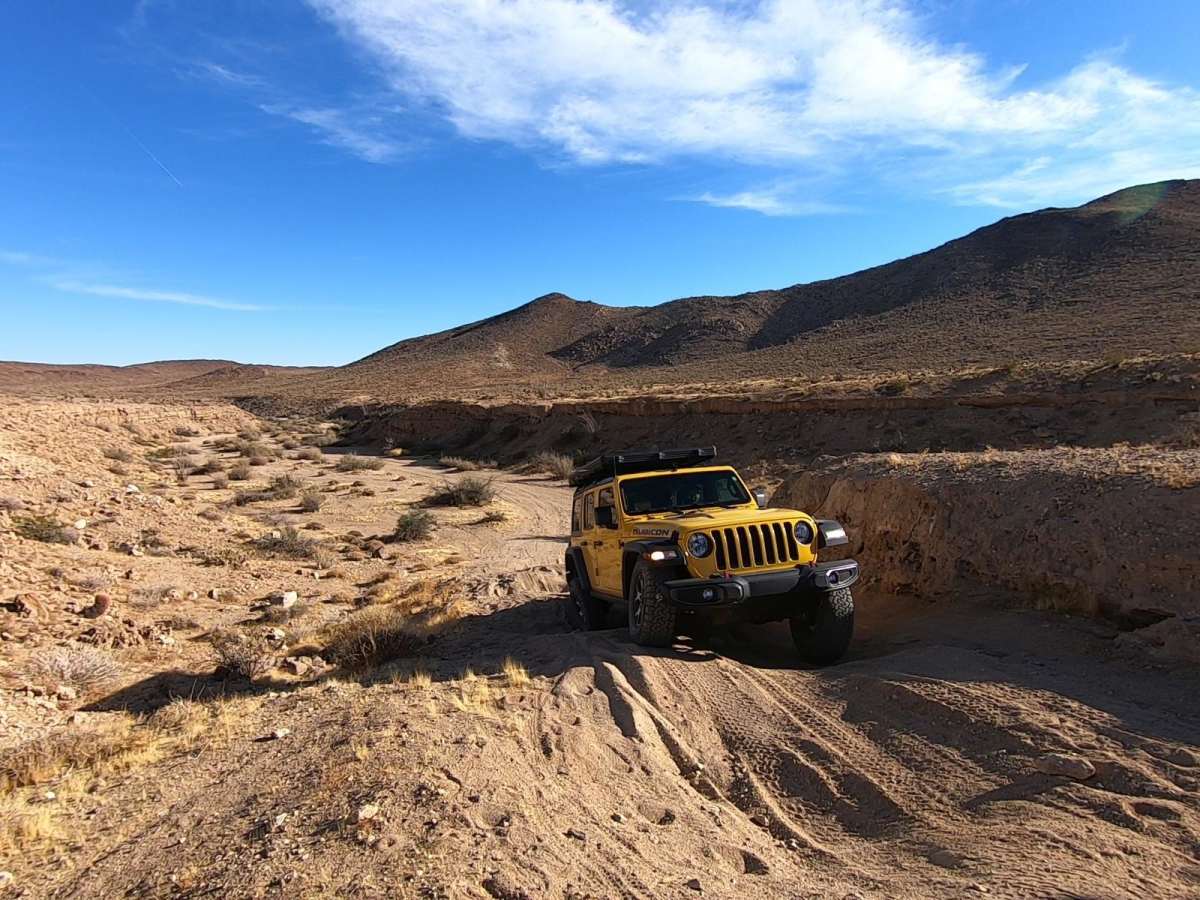
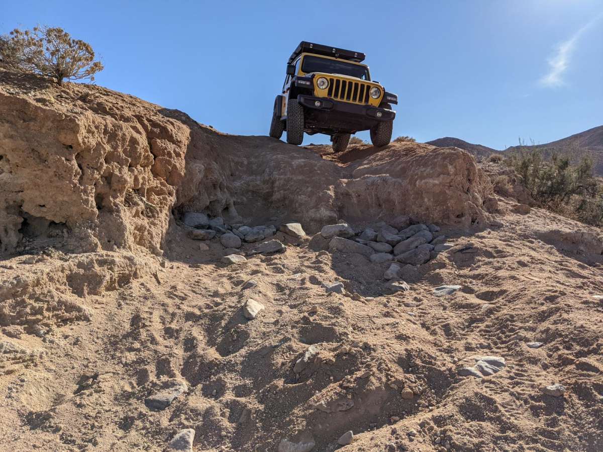
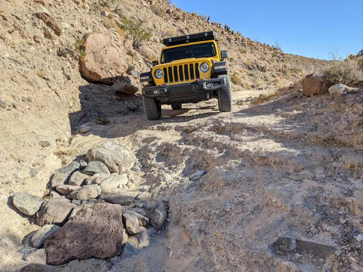
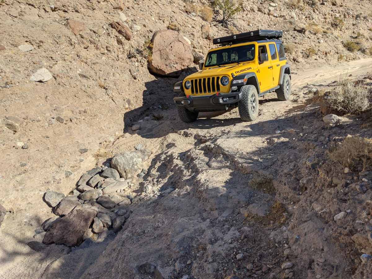
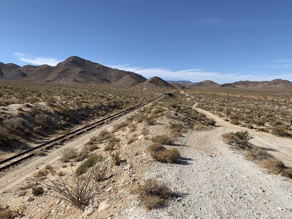
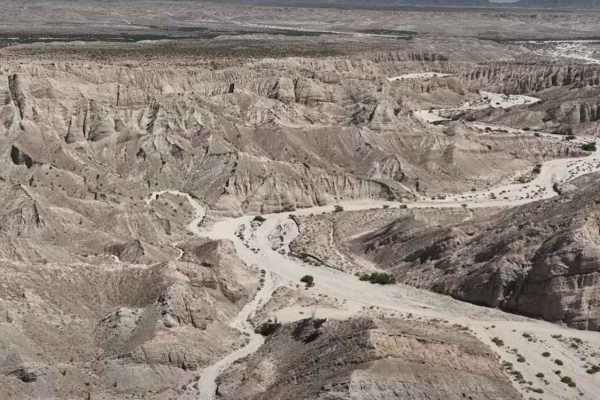
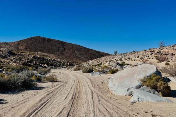
Jojoba Wash is a one-way trail for street legal vehicles in the southern portion of Anza-Borrego Desert State Park and is best travelled in conjunction with the Mortero Wash Trail in order to create a loop. Jojoba Wash Trail starts at the end of the Mortero Wash Trail near the abandoned Carrizo Gorge railway line, and ends at a paved highway. Although the northern and southern portions of the trail can technically be travelled in either direction, the trail is designated as one-way by park rangers due to a steep descent into the wash when transiting from south to north. Traveling in a reverse direction can result in significant environmental impacts from vehicles attempting to climb the ledge exiting the wash. This descent into the wash is the most significant obstacle on the trail, and drivers should carefully examine the various lines before committing. Other trail obstacles consist of a narrow rocky canyon, soft sandy washes and scattered basketball-sized rocks. When traveled in the authorized direction, the trail is suitable for stock high-clearance 4x4 vehicles, but low tire pressure is recommended to avoid getting stuck in the soft sand of the wash. One point of interest along the trail is Piepkorn Slot, a narrow canyon named after Mark Piepkorn who suffered a heart attack on the trail in November 1996. A small memorial plaque can be found on a rock near the canyon. Due to high summer temperatures, this trail is best traveled between October and May. Higher traffic can be expected throughout the area between February and April due to desert flower blooming season. Since a portion of the trail follows a wash, it is not recommended during wet weather due to the risk of flash flooding. Cellular signal is limited along the trail but can be found closer to the paved highway where the trail ends.

Photos of Jojoba Wash

Difficulty

Although this trail is not particularly technical, negotiating the ledge dropping into Jojoba Wash can be treacherous if not done carefully. For this reason, the trail is considered moderately difficult.

Technical Rating

5

Status Reports

Add Status Report
Shawn Lucero
Jun 08, 2026
Open
Fairly easy for most rigs with at least a small lift and 33'' tires. The map shows you go immediately right when the road splits in 2 but that path has been completely destroyed. When you get to the fork in the road make a right and go down the wash a little bit till you see a hill on your right with a couple fun shelf lines you can crawl with one super easy bypass line. Once you get to the top it connects you to the rest of the trail (that's beyond deteriated) that's mapped by OnX. Once you get in that canyon you'll be in some tight but easy rock crawling that lasts maybe 500 yards. after that you are back in a wash in the washboard twisty stuff. Very easy trail maybe a 3/10
Mike Dubya
Mar 05, 2026
Open
Routing of the trail has changed and needs to be re-mapped. The original trail at 32.78579, -116.14448 has been washed out and an alternate route to the right follows Goat Canyon Trail to the top of Jojoba Drop at 32.78919, -116.14607. The trail resumes to the left (South) in Jojoba Wash.
Roetta Tyer
Jan 11, 2026
Open
The only issue we had was the road does not turn left right after the canyon as shown in onx. We continued on goat canyon trail and then went down a hill to reconnect with jojoba wash trail. It looks like this is what everyone does
Aiden Mac
Sep 20, 2025
Open
Mostly loose sand in the wash. There were some tight parts where my buddies Tacoma rubbed rims and theres some steep angles getting into certain parts of the wash.
J Hoofty
Dec 07, 2024
Open
Some thick soft sand towards the southern end of the wash. 4x4 recommend.
Mike Eisenbraun
Jul 01, 2024
Open

Jojoba Wash Trail can be accessed by the following ride types:

  • High Clearance
  • Full Width

Jojoba Wash Map

The onX Offroad Difference

onX Offroad combines trail photos, descriptions, difficulty ratings, width restrictions, seasonality, and more in a user-friendly interface. Available on all devices, with offline access and full compatibility with CarPlay and Android Auto. Discover what you're missing today!

Open Trail Map