Trail Overview
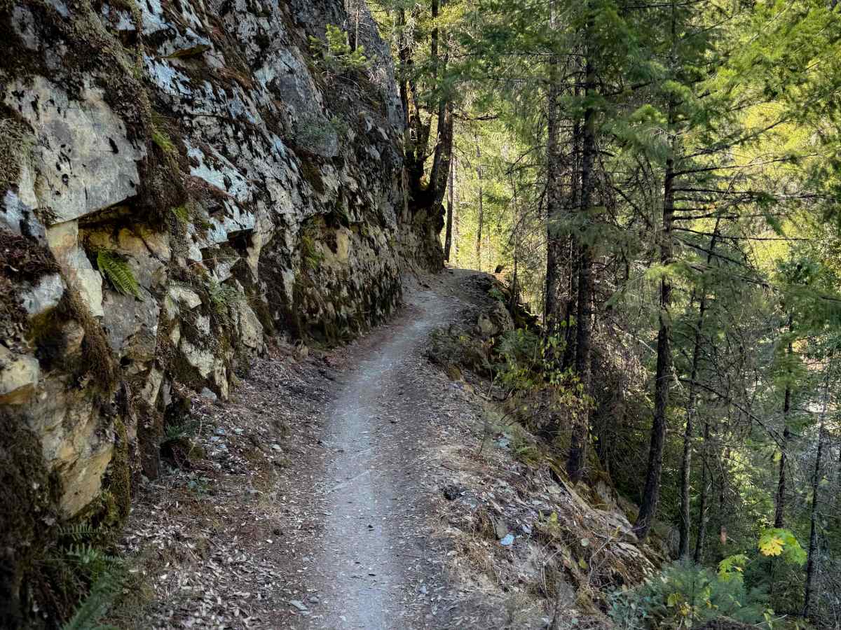
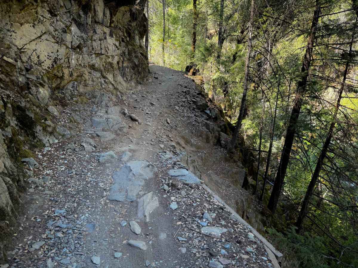
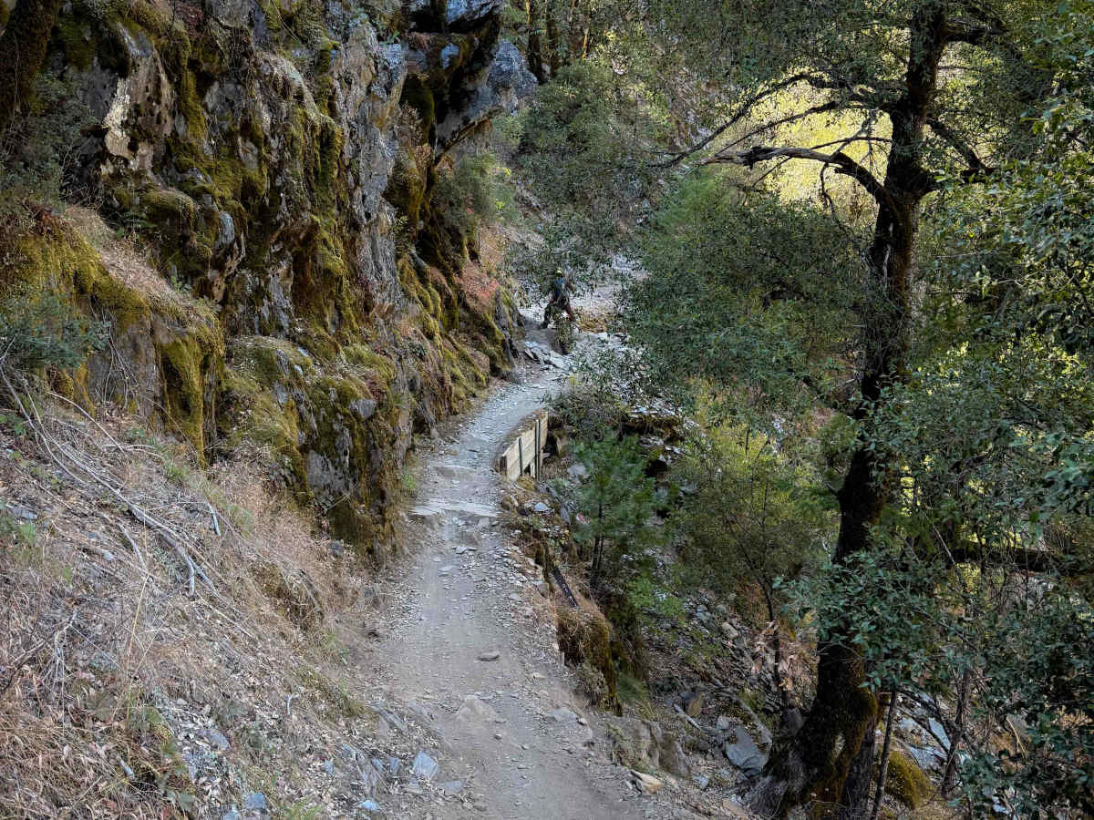
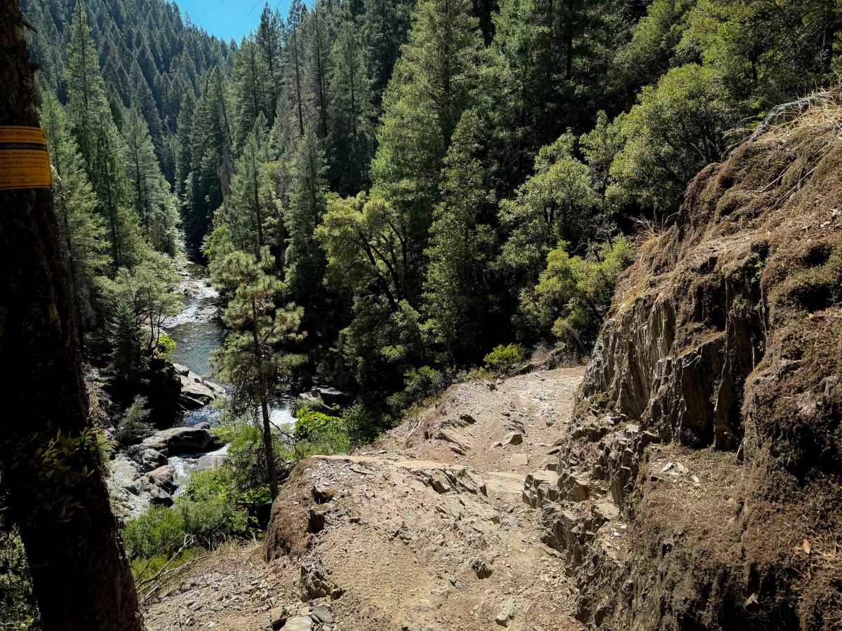
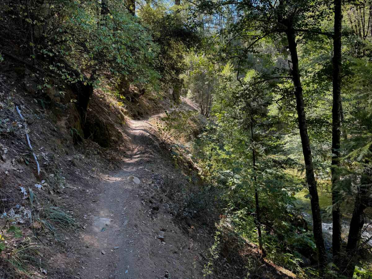
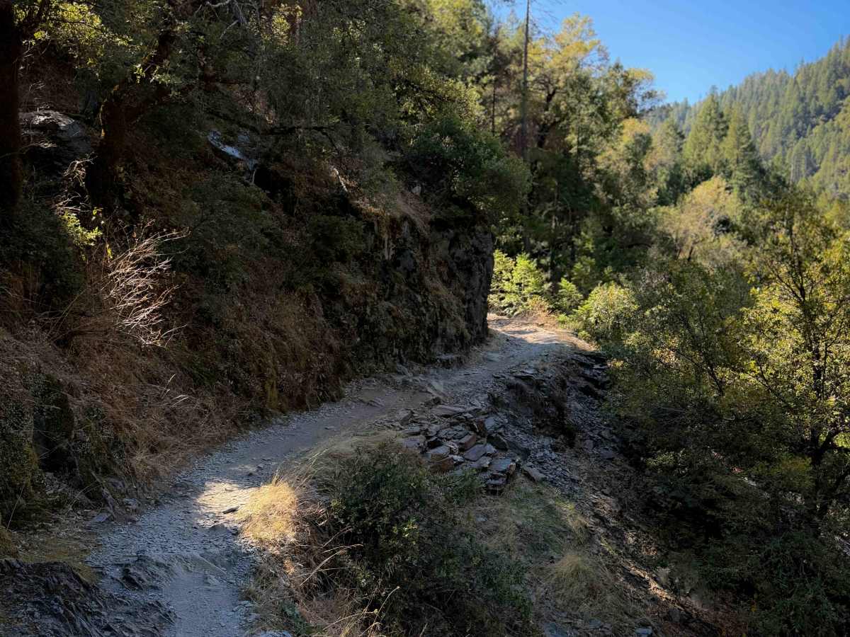
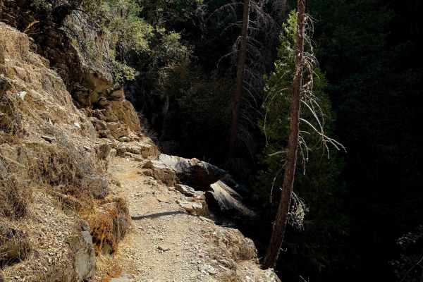
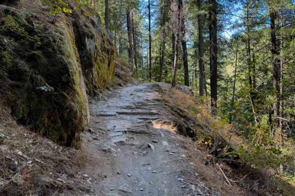
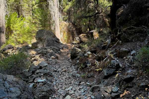
First Divide is a fun moto route near Downieville that is also popular with downhill mountain bikers, and is part of the 15-mile-long “Downieville Downhill” that goes from Packer Lake Saddle to Downieville. It drops over 1,200 feet in 3.3 miles from north to south. This trail is very exposed and shelfy, and should only be ridden by more experienced riders comfortable with this type of terrain. The trail is cut into the edge of the hillside, paralleling high above Lavezzola Creek for the north half, then above Pauley Creek for the south half. The trail is very narrow, often next to a tall mossy rock wall. A lot of the trail is smooth, but there are also a lot of spots with embedded rock that makes it even more technical in the exposed sections. There are small ledges and stair steps that you must ride over. There are some spots that would be very high consequence if you went off trail. The views over the edge are fantastic, overlooking the creek, and it’s a really unique terrain. There are some blind corners, and the trail does allow two-way traffic, but it’s likely that most riders will be riding downhill from north to south. It will be difficult to pass in spots. This trail is closed 1/1 – 3/31.
Difficulty
This trail has significant cliff exposure, narrow segments along the hillside, and moderate rock ledges within the narrow segments, all making it pretty technical. This trail is not ideal for beginners or anyone scared of heights due to the exposure, and riders should take this seriously because there have been multiple fatal accidents on the Downieville Downhill route in recent years.