
Dirt Bike Trails
Near Stanton, Tennessee
Explore All Dirt Bike Trails Near Stanton, Tennessee
Dirt Bike Trails Near Stanton, Tennessee
Discover the best dirt bike trails near you. Browse trail maps, check difficulty ratings, and find your next adventure — whether you're looking for a quick ride or an all-day expedition.
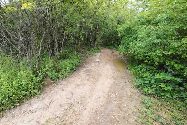
Burnett Trail
A trail mostly in the woods with some rolling hills, a few washouts, a steep hill with a washout, and a ditch crossing. It's a fun trail that's manageable for experienced riders. Beginners need to be accompanied by experienced riders because of the washouts. Lots of beautiful scenery with some over...
Learn more about Burnett Trail
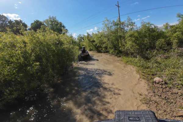
Anaconda Loop
A trail that is dry in some areas and has deep water in other areas. An overall flat trail with not many obstacles along the way, other than the water crossings. One of the water crossings is in a curve that comes out under a bridge. It is a good idea to bring other riders on this trail who have wen...
Learn more about Anaconda Loop
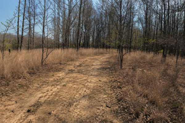
Ark Island Trail
This is a fairly easy trail with not many obstacles. There are a few small mudholes with easy bypasses around them and some minor washouts. The trail is a nice casual trail for all levels of riders. This is trail is lots of fun going in and out of the wooded areas. Riders can ride this trail fairly...
Learn more about Ark Island Trail
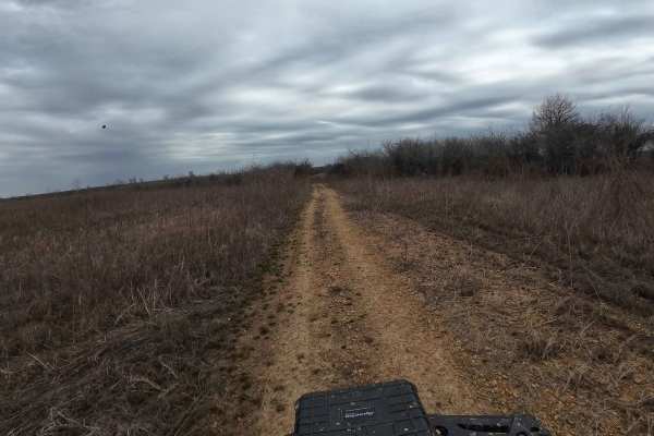
Hurricane Creek Trail
This trail is in the Arkabutla Lake Bottoms. This part of the lake does not flood due to the shutdown of the dam. The terrain is fairly flat with some small ruts, but nothing major. The trail does retain some water and makes it swampy in areas, but it's always pretty shallow and passable. Make sure ...
Learn more about Hurricane Creek Trail
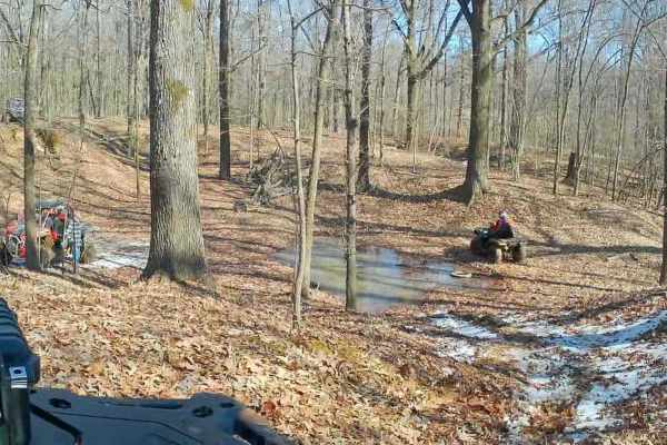
Crawford's Point Trail
The trail starts at the Pleasant Hill Public Use Area. Follow the boat ramp to the end where there's a dirt trail and go south. Follow it around until you see the trail veering to the left. You will enter the woods from there on a good trail and follow it through rolling hills, small ditch crossings...
Learn more about Crawford's Point Trail
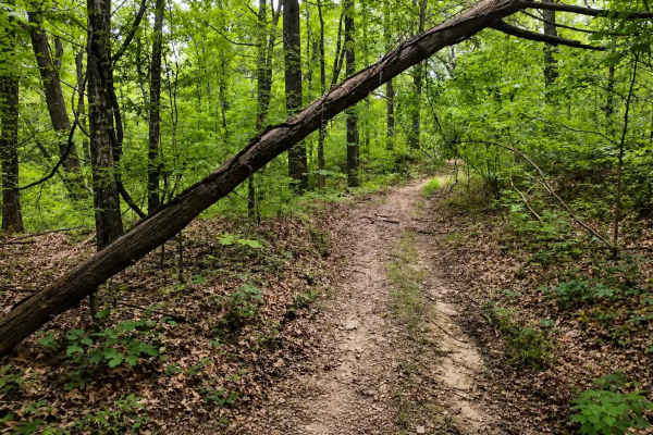
Bushwhacker Loop
A beautiful scenic trail that is mostly smooth with few obstructions. This is the ideal trail for beginners and experienced riders. Lots of trees of all sorts and some open areas with brush on both sides of the trail. Take this trail for a nice relaxing ride through the woods with great places to st...
Learn more about Bushwhacker Loop
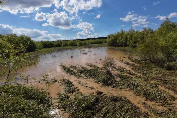
Panther Creek Trail
Good smooth trail in most places along the edge of the woods and the lake bottom. However, there are 3 places to use caution. There are 2 swampy areas that can be challenging to maneuver. There are deep ruts in the middle to stay on the outside tracks in the water. There is also about halfway down t...
Learn more about Panther Creek Trail
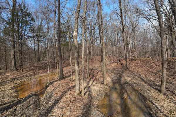
Wolf Creek Trail
Starts as a hard ground trail entering the woods with shallow puddles and ruts. Ruts are not deep on this trail, so they're manageable. There is a small creek named Wolf Creek. It is shallow and not too soft. The rest of the trail goes deep into the woods through various rolling hills, but none too ...
Learn more about Wolf Creek Trail
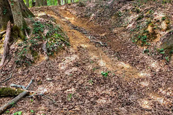
Old Ruins Trail
This is a beautiful trail with plenty of exploration. There's an old ruined homestead that has many rooms with rotted-out floors and a few small buildings behind it. The trail takes you up a small, steep hill and bends to the right before going down another small hill. The trail comes out to the lak...
Learn more about Old Ruins Trail
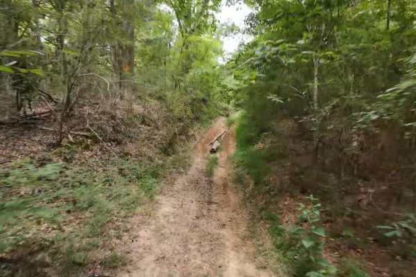
Wheeler Woods Trail
A good, fun-filled adventure trail for semi-experienced and experienced riders. This trail offers rolling hills, mud holes, washouts, and ditch crossings. Fairly easy trail for seasoned riders with a few obstacles along the way. Riders can make a slow, casual ride or can ride fast over most of the ...
Learn more about Wheeler Woods Trail

Woods
Woods Trail is a narrow gravel route characterized by large, chunky rocks that create a noticeably loose driving surface. Traction can vary throughout the trail due to the size and depth of the gravel, requiring steady throttle control and attention to steering input. The road narrows to a single la...
Learn more about Woods
Thorn
Thorn Trail is a mixed gravel and dirt route that offers a scenic and slightly more engaging drive for those exploring the area. The surface varies between compacted gravel and dirt, with sections that can become soft depending on recent weather. A large open expanse along the trail provides an exce...
Learn more about Thorn
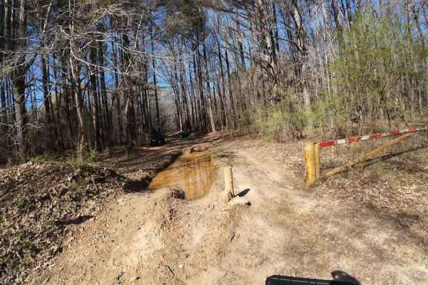
South Lake Trail
A challenging trail on the south side of Arkabutla Lake in Mississippi. This trail is mostly in wooded areas and some lake bottom areas. This is a challenging trail due to all of the deep ruts, water crossings, and some washouts. Inexperienced riders should ride with experienced riders to help guide...
Learn more about South Lake Trail

Hickahala Creek Trail
Start off in a wide area outside the parking area. From there, take the trail riding along the creek banks. It can be muddy at times, but it's hard ground. About half a mile down the trail, the trail becomes sandy. There are 2 small ditches to cross with very shallow water running in them. The ditch...
Learn more about Hickahala Creek Trail
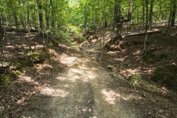
SIP Off Road Trail
The trail starts in the woods, riding alongside a small creek. The trail then turns into rolling hills that are easy and some that are technical with a steep grade. Three of the hills have slight washouts or ruts. Patience is important, and you must be mindful when approaching those hazards. The tra...
Learn more about SIP Off Road Trail
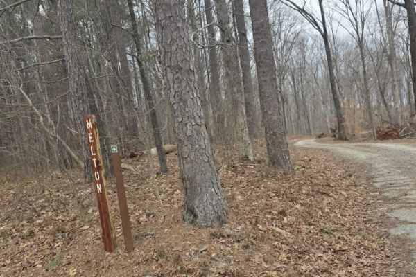
Melton
Melton Trail is an easy mixed-surface route featuring gravel and dirt with a solid, well-maintained base. Recent grading has introduced sections of larger gravel and fresh dirt, providing consistent traction under normal conditions. The trail experiences moderate elevation changes, gaining approxima...
Learn more about Melton

Shiloh Trail
Shiloh Trail is an easy mixed-surface route located within Natchez Trace State Park, offering a quiet drive through wooded terrain with gentle elevation changes. The surface consists of dirt, gravel, and occasional sandy stretches, creating a varied but approachable experience for most drivers. Larg...
Learn more about Shiloh Trail
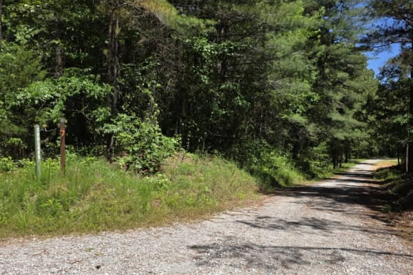
Cub Lake Trail
Tucked within the serene expanse of Natchez State Forest, this off-road trail offers a peaceful drive ideal for beginners and those looking for a more relaxed adventure. The road is well-graded with dirt and gravel, making for smooth travel without technical obstacles. Towering mature trees line the...
Learn more about Cub Lake Trail
ATV trails near Stanton, Tennessee
Explore ATV-friendly trails near you. These trails are accessible for vehicles up to 50 inches wide, perfect for ATVs and smaller off-road machines.
Burnett Trail
A trail mostly in the woods with some rolling hills, a few washouts, a steep hill with a washout, and a ditch crossing. It's a fun trail that's manageable for experienced riders. Beginners need to be accompanied by experienced riders because of the washouts. Lots of beautiful scenery with some over...
Learn more about Burnett Trail
Anaconda Loop
A trail that is dry in some areas and has deep water in other areas. An overall flat trail with not many obstacles along the way, other than the water crossings. One of the water crossings is in a curve that comes out under a bridge. It is a good idea to bring other riders on this trail who have wen...
Learn more about Anaconda Loop
Ark Island Trail
This is a fairly easy trail with not many obstacles. There are a few small mudholes with easy bypasses around them and some minor washouts. The trail is a nice casual trail for all levels of riders. This is trail is lots of fun going in and out of the wooded areas. Riders can ride this trail fairly...
Learn more about Ark Island Trail
Hurricane Creek Trail
This trail is in the Arkabutla Lake Bottoms. This part of the lake does not flood due to the shutdown of the dam. The terrain is fairly flat with some small ruts, but nothing major. The trail does retain some water and makes it swampy in areas, but it's always pretty shallow and passable. Make sure ...
Learn more about Hurricane Creek Trail
UTV/side-by-side trails near Stanton, Tennessee
Find UTV and side-by-side trails near you. These trails accommodate vehicles up to 60 inches wide, ideal for UTVs, side-by-sides, and wider off-road rigs.
Burnett Trail
A trail mostly in the woods with some rolling hills, a few washouts, a steep hill with a washout, and a ditch crossing. It's a fun trail that's manageable for experienced riders. Beginners need to be accompanied by experienced riders because of the washouts. Lots of beautiful scenery with some over...
Learn more about Burnett Trail
Anaconda Loop
A trail that is dry in some areas and has deep water in other areas. An overall flat trail with not many obstacles along the way, other than the water crossings. One of the water crossings is in a curve that comes out under a bridge. It is a good idea to bring other riders on this trail who have wen...
Learn more about Anaconda Loop
Ark Island Trail
This is a fairly easy trail with not many obstacles. There are a few small mudholes with easy bypasses around them and some minor washouts. The trail is a nice casual trail for all levels of riders. This is trail is lots of fun going in and out of the wooded areas. Riders can ride this trail fairly...
Learn more about Ark Island Trail
Hurricane Creek Trail
This trail is in the Arkabutla Lake Bottoms. This part of the lake does not flood due to the shutdown of the dam. The terrain is fairly flat with some small ruts, but nothing major. The trail does retain some water and makes it swampy in areas, but it's always pretty shallow and passable. Make sure ...
Learn more about Hurricane Creek Trail
The onX Offroad Difference
onX Offroad combines trail photos, descriptions, difficulty ratings, width restrictions, seasonality, and more in a user-friendly interface. Available on all devices, with offline access and full compatibility with CarPlay and Android Auto. Discover what you're missing today!
Open Trail Map