
Dirt Bike Trails
Near Shelby, Montana
Explore All Dirt Bike Trails Near Shelby, Montana
Dirt Bike Trails Near Shelby, Montana
Discover the best dirt bike trails near you. Browse trail maps, check difficulty ratings, and find your next adventure — whether you're looking for a quick ride or an all-day expedition.
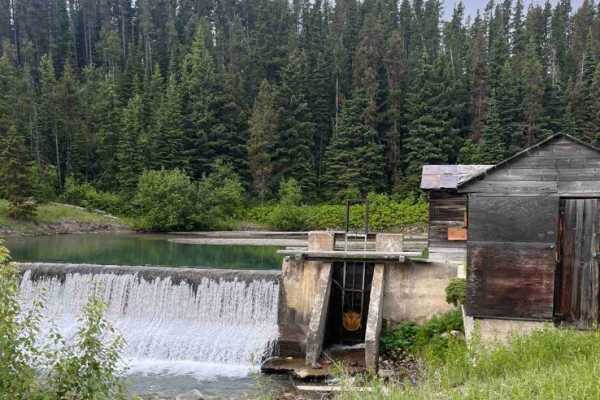
Junior Dam
This is an out-and-back route to a waterfall and scenic area. There is an old pumphouse station along a dam structure. There are very scenic views and a quick little run to get your tires dusty if you are in the area. Be advised that it is not on public property for the majority of the trail, so mak...
Learn more about Junior Dam
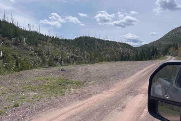
Skyland
Skyland (Forest Service Road 569) is an easy, scenic 8-mile gravel road winding through the Flathead National Forest near Marias Pass. Starting near a creek and small waterfall, the route climbs gently from 4,918 feet to a peak of 5,593 feet. The well-maintained, flat surface features minimal techni...
Learn more about Skyland
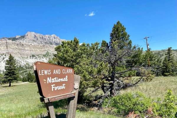
Sun Canyon Road
This is a two-lane dirt road that gives you access to amazing views, campgrounds, ATV trails, hiking and packing trails, picnic sites, and ending at the amazing Gibson Reservoir. From the Gibson Reservoir, you can access the Bob Marshall Wilderness by foot, boot, or horse. This is a nice and easy dr...
Learn more about Sun Canyon Road
ATV trails near Shelby, Montana
Explore ATV-friendly trails near you. These trails are accessible for vehicles up to 50 inches wide, perfect for ATVs and smaller off-road machines.
Junior Dam
This is an out-and-back route to a waterfall and scenic area. There is an old pumphouse station along a dam structure. There are very scenic views and a quick little run to get your tires dusty if you are in the area. Be advised that it is not on public property for the majority of the trail, so mak...
Learn more about Junior Dam
Skyland
Skyland (Forest Service Road 569) is an easy, scenic 8-mile gravel road winding through the Flathead National Forest near Marias Pass. Starting near a creek and small waterfall, the route climbs gently from 4,918 feet to a peak of 5,593 feet. The well-maintained, flat surface features minimal techni...
Learn more about Skyland
Sun Canyon Road
This is a two-lane dirt road that gives you access to amazing views, campgrounds, ATV trails, hiking and packing trails, picnic sites, and ending at the amazing Gibson Reservoir. From the Gibson Reservoir, you can access the Bob Marshall Wilderness by foot, boot, or horse. This is a nice and easy dr...
Learn more about Sun Canyon Road
UTV/side-by-side trails near Shelby, Montana
Find UTV and side-by-side trails near you. These trails accommodate vehicles up to 60 inches wide, ideal for UTVs, side-by-sides, and wider off-road rigs.
Junior Dam
This is an out-and-back route to a waterfall and scenic area. There is an old pumphouse station along a dam structure. There are very scenic views and a quick little run to get your tires dusty if you are in the area. Be advised that it is not on public property for the majority of the trail, so mak...
Learn more about Junior Dam
Skyland
Skyland (Forest Service Road 569) is an easy, scenic 8-mile gravel road winding through the Flathead National Forest near Marias Pass. Starting near a creek and small waterfall, the route climbs gently from 4,918 feet to a peak of 5,593 feet. The well-maintained, flat surface features minimal techni...
Learn more about Skyland
Sun Canyon Road
This is a two-lane dirt road that gives you access to amazing views, campgrounds, ATV trails, hiking and packing trails, picnic sites, and ending at the amazing Gibson Reservoir. From the Gibson Reservoir, you can access the Bob Marshall Wilderness by foot, boot, or horse. This is a nice and easy dr...
Learn more about Sun Canyon Road
The onX Offroad Difference
onX Offroad combines trail photos, descriptions, difficulty ratings, width restrictions, seasonality, and more in a user-friendly interface. Available on all devices, with offline access and full compatibility with CarPlay and Android Auto. Discover what you're missing today!
Open Trail Map