
Dirt Bike Trails
Near Seltzer, Pennsylvania
Explore All Dirt Bike Trails Near Seltzer, Pennsylvania
Dirt Bike Trails Near Seltzer, Pennsylvania
Discover the best dirt bike trails near you. Browse trail maps, check difficulty ratings, and find your next adventure — whether you're looking for a quick ride or an all-day expedition.
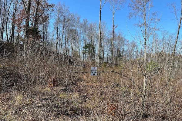
St. Keirns 43
This dead-end trail continues on off of the property but please do not trespass onto others properties. Trail 43 is a brushy trail with water puddles, stumps, and small rocks. At certain times of the year it is massively overgrown and is not easily traversed with a full-size vehicle.
Learn more about St. Keirns 43
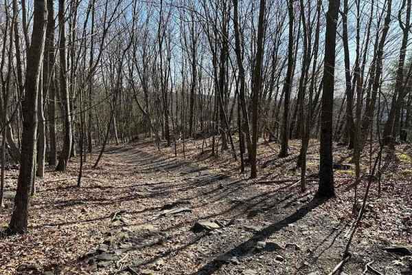
St. Keirns 32
St. Keirns 32 leads to trail 31 and heads to 18 running north. It is a wooded trail with a side loop trail that was an old camping area. The trail has some rockier areas but they can be driven by a novice rider.
Learn more about St. Keirns 32
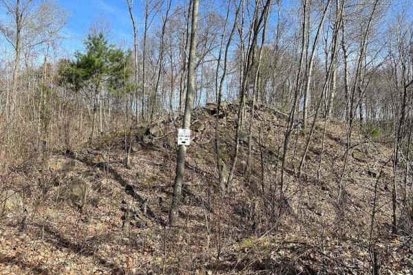
St. Keirns 14
This is a dead-end trail. There was a way on one side to connect to a coal dirt play area but now this is active mining. Please stay out of the active mining area. The rest of the trail is a slightly rocky trail that leads to a turn-around dead end.
Learn more about St. Keirns 14
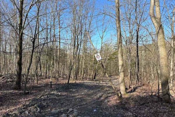
St. Keirns 15
St. Keirns 15 goes off of the property. The trail looks like it just continues, but it goes to an area that is not open to riding. Please do not trespass off of the property. Stay on the designated trails. The trail is rocky and goes from an open powerline to a wooded trail.
Learn more about St. Keirns 15
St. Keirns 33
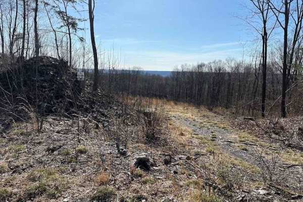
St. Keirns 33 is the connector trail for 31 to connect to 18. Prior to timbering and active mining, 31 continued; now with both happening, this is the only way to connect. It is a narrow trail that twists between two dirt mounds and up to trail 18.
Learn more about St. Keirns 33
St. Keirns 114
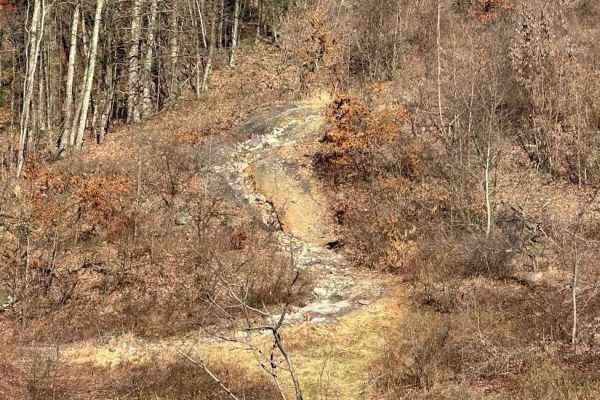
St. Keirns 114 is a very rocky steep hill with loose terrain and technical spots. This trail will take some careful driving and good line choices. There is also a field area with some muddy ruts to add to the fun. There are lots of fun areas to play on this trail.
Learn more about St. Keirns 114
St. Keirns 16
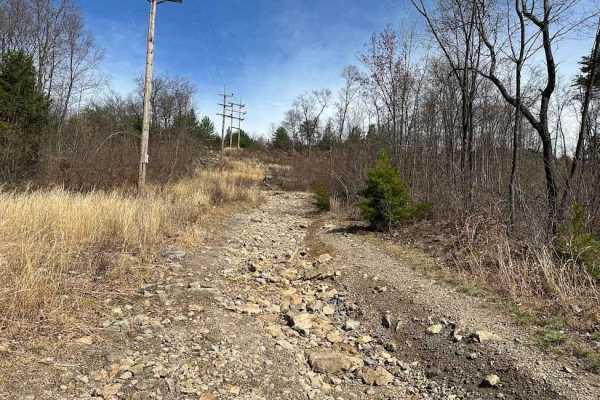
St. Keirns 16 has multiple things to see. One side dead-ends at a black trail, the other at the Minersville Route. On the north side of the trail, there are old coal mines to look at. It is a nice part of local history. The south side is a wider trail with just small rocks.
Learn more about St. Keirns 16

St. Keirns 31
St. Keirns 31 is now a dead end on both sides from active mining areas. Please pay attention and do not cross into the active mining areas. This trail has some technical spots with washouts and rockier areas. It is passable with a stock vehicle but will be challenging.
Learn more about St. Keirns 31
Darkwater 40
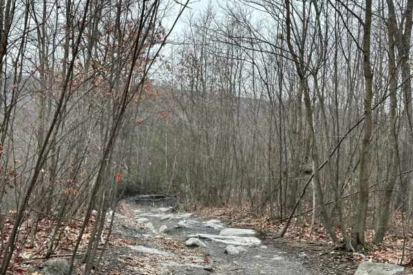
This small loop is the start of the big rock garden on top of the hill. This area is used for rock crawling competitions and is a nice area to play on. The area is not for stock or lesser-built vehicles even though this trail is suitable for those.
Learn more about Darkwater 40
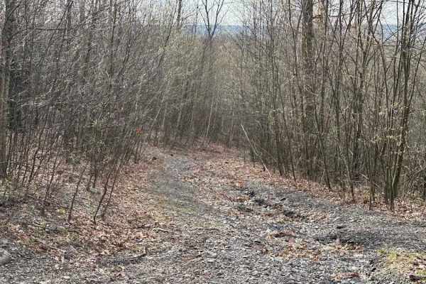
Darkwater 76
Darkwater 76 is a brushy trail that is difficult to find on both ends. It is supposed to go from Trail 29 to 20 and it is very overgrown. It is easiest to see off of 29 but it looks more like a washout than a trail. It is full of brush, small rocks, and washouts.
Learn more about Darkwater 76
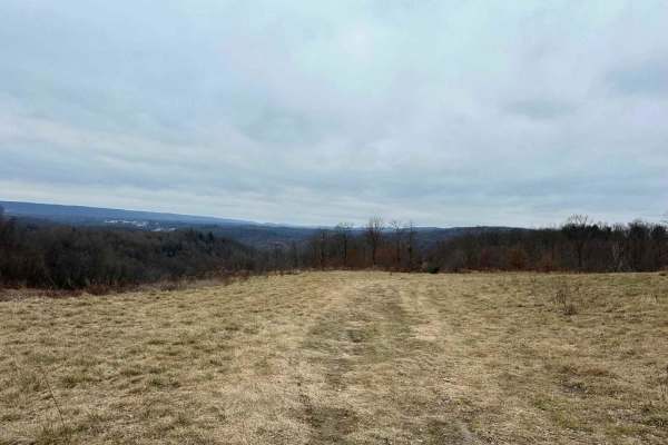
Darkwater 41
Darkwater 41 is an easier trail that cuts across the north side of the event area/camping area. This trail has some dips and puddles but is an easier way to get across this open area. This is a great way around the main road that gets congested.
Learn more about Darkwater 41
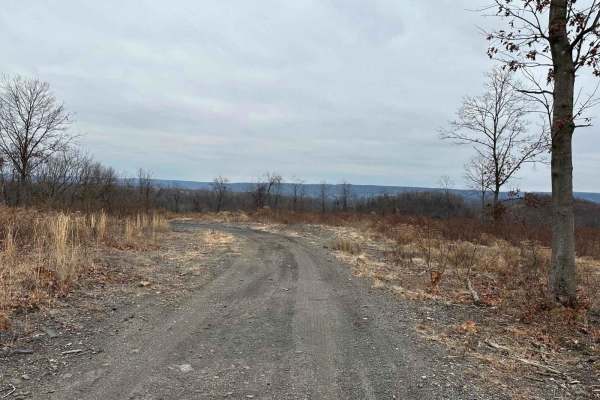
Darkwater 44
Darkwater 44's terrain goes from a smooth coal-packed surface to a typical dirt trail. Small rocks are scattered throughout. Keep a lookout for the scenic overlook--look for the large rock barriers! Washouts and very slight up-and-down hills complete this wooded and open area trail.
Learn more about Darkwater 44
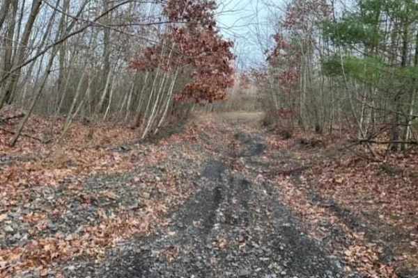
Darkwater 35
Darkwater 35 starts out as a descent trail. It is a pretty steep hill with a washout in the middle. The washout forms towards the top of the hill and can be hard to navigate. There is no working around it and it changes constantly. Use caution!
Learn more about Darkwater 35
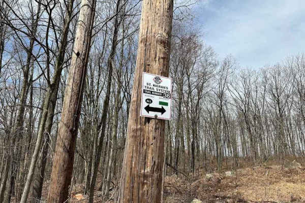
St. Keirns 36
St. Keirns goes from trails 16 to 19. It is a long hill that has easier spots and more challenging spots. Watch for rockier areas that will force you to slow down a little and pick lines. It is a hard green-level trail, so it can be driven with stock vehicles or by novice riders.
Learn more about St. Keirns 36
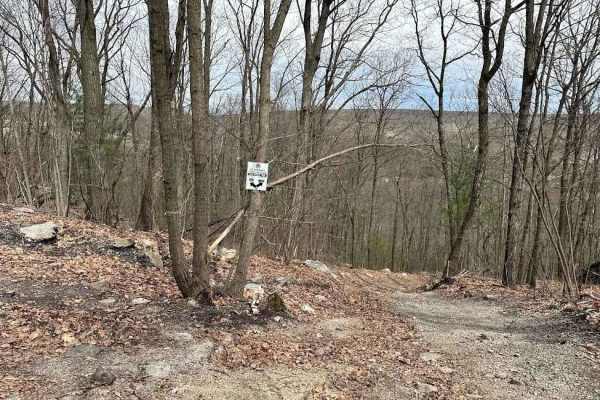
St. Keirns 19
Trail 19 is a long trail that covers a big area. On one side it starts at the 82 and Mount St. Keirns trail intersection, and on the other side, it connects to trail 16. The trail is semi-flat with some random rocks here or there but is easy to drive.
Learn more about St. Keirns 19
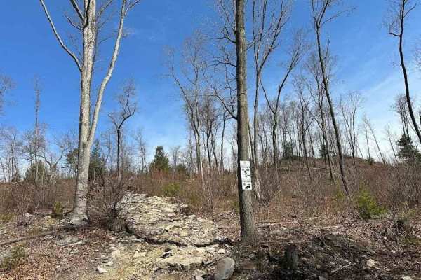
St. Keirns 38 Blue
This trail section is an alternate but is a very rocky hill with loose terrain. It will take some finesse to get through. It is the shortcut between 16 and 36 going up or down the hill. The trail changes often with erosion and use.
Learn more about St. Keirns 38 Blue
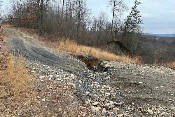
Slurry Hill
Slurry Hill is a challenging hill with a large electric line for the dragline running up it. This trail is very washed out with deep ruts most of the way through it. These ruts can be 2-3 feet deep and weave through the trail all the way down. You have to be careful of the electric line also.
Learn more about Slurry Hill
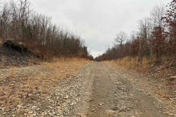
Darkwater 42
Darkwater 42 is a short trail connection in the field/camping area. It connects between Trail 41 and Trail 21. The trail is a smooth road type of trail with little to no obstacles. The main use of this trail is just to get from 21 to the event area and vice versa.
Learn more about Darkwater 42
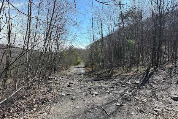
St. Keirns 18
This trail skirts the very edge of active mining, so be careful to stay out of the mining area. This is a very rocky hill and a semi-rocky flat area that leads to many fun trails. Trail 18 was always a main trail section but looks a lot different from the timbering and mining.
Learn more about St. Keirns 18
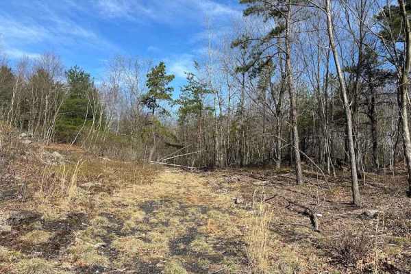
Road to Nowhere
This very overgrown trail is a dead end to an old camping area. Driving down this trail, there are plenty of stumps, branches, rocks, and other debris that will try to damage your vehicle. It is not very easy to follow anymore since it doesn't get run very often.
Learn more about Road to Nowhere
ATV trails near Seltzer, Pennsylvania
Explore ATV-friendly trails near you. These trails are accessible for vehicles up to 50 inches wide, perfect for ATVs and smaller off-road machines.
St. Keirns 43
This dead-end trail continues on off of the property but please do not trespass onto others properties. Trail 43 is a brushy trail with water puddles, stumps, and small rocks. At certain times of the year it is massively overgrown and is not easily traversed with a full-size vehicle.
Learn more about St. Keirns 43
St. Keirns 32
St. Keirns 32 leads to trail 31 and heads to 18 running north. It is a wooded trail with a side loop trail that was an old camping area. The trail has some rockier areas but they can be driven by a novice rider.
Learn more about St. Keirns 32
St. Keirns 14
This is a dead-end trail. There was a way on one side to connect to a coal dirt play area but now this is active mining. Please stay out of the active mining area. The rest of the trail is a slightly rocky trail that leads to a turn-around dead end.
Learn more about St. Keirns 14
St. Keirns 15
St. Keirns 15 goes off of the property. The trail looks like it just continues, but it goes to an area that is not open to riding. Please do not trespass off of the property. Stay on the designated trails. The trail is rocky and goes from an open powerline to a wooded trail.
Learn more about St. Keirns 15
UTV/side-by-side trails near Seltzer, Pennsylvania
Find UTV and side-by-side trails near you. These trails accommodate vehicles up to 60 inches wide, ideal for UTVs, side-by-sides, and wider off-road rigs.
St. Keirns 43
This dead-end trail continues on off of the property but please do not trespass onto others properties. Trail 43 is a brushy trail with water puddles, stumps, and small rocks. At certain times of the year it is massively overgrown and is not easily traversed with a full-size vehicle.
Learn more about St. Keirns 43
St. Keirns 32
St. Keirns 32 leads to trail 31 and heads to 18 running north. It is a wooded trail with a side loop trail that was an old camping area. The trail has some rockier areas but they can be driven by a novice rider.
Learn more about St. Keirns 32
St. Keirns 14
This is a dead-end trail. There was a way on one side to connect to a coal dirt play area but now this is active mining. Please stay out of the active mining area. The rest of the trail is a slightly rocky trail that leads to a turn-around dead end.
Learn more about St. Keirns 14
St. Keirns 15
St. Keirns 15 goes off of the property. The trail looks like it just continues, but it goes to an area that is not open to riding. Please do not trespass off of the property. Stay on the designated trails. The trail is rocky and goes from an open powerline to a wooded trail.
Learn more about St. Keirns 15
The onX Offroad Difference
onX Offroad combines trail photos, descriptions, difficulty ratings, width restrictions, seasonality, and more in a user-friendly interface. Available on all devices, with offline access and full compatibility with CarPlay and Android Auto. Discover what you're missing today!
Open Trail Map