Dirt Bike Trails
Near Sauk Centre, Minnesota
Explore All Dirt Bike Trails Near Sauk Centre, Minnesota
Dirt Bike Trails Near Sauk Centre, Minnesota
Discover the best dirt bike trails near you. Browse trail maps, check difficulty ratings, and find your next adventure — whether you're looking for a quick ride or an all-day expedition.
Trailhead Parking to Genola
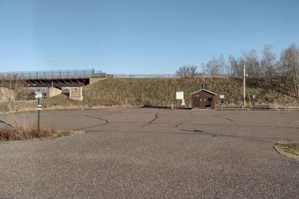
This section of Soo Line South is an easy trail with a great parking lot at the trailhead that has lots of room for trailers. The parking lot has security cameras and two vault-type restrooms. The parking lot and first few hundred feet of trail going up the hill from the parking lot's northwest end ...
Learn more about Trailhead Parking to Genola

Genola to Hillman
Genola to Hillman on the Soo Line South Trail is a section of converted rail grade that is 12 miles long and takes about 40 minutes with an average speed of 19.6 mph. This section of the Soo Line South Trail is provided by Morrison County and maintained by the Eastern Morrison County 4 Wheelers Club...
Learn more about Genola to Hillman
Meeker County OHV Park Outer Loop
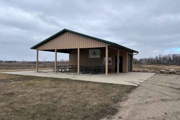
Narrow and winding trails travel through this 40-acre parcel of woods. There is a youth training area on site, as well as a picnic shelter area, restroom facilities, and plenty of parking. There is a constructed mud pit area and good cell service. Standard Minnesota ATV permits/licenses are required...
Learn more about Meeker County OHV Park Outer Loop
Outer Loop
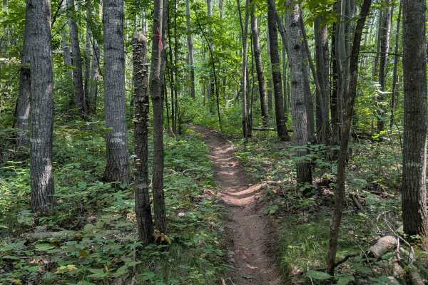
Located just east of Brainerd, Minnesota, this loop is part of the Miller Hills trail system. This outer loop snakes around the outer bounds of the North East section of the trail. The single track trail features many tight turns, lots of exposed rocks, ruts, and steep hills. Many fallen trees and a...
Learn more about Outer Loop
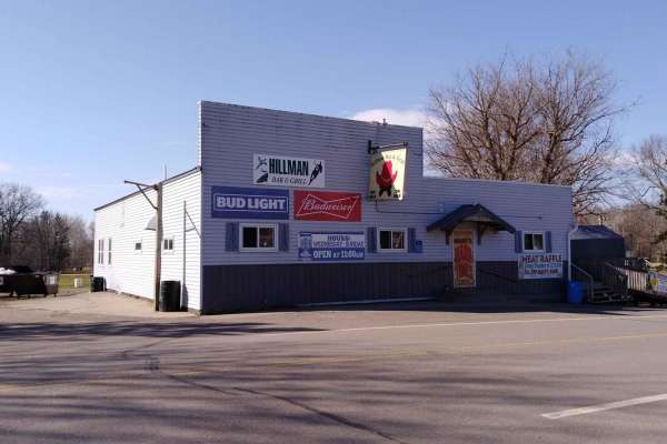
Hillman to Onamia
Hillman to Onamia on the Soo Line South Trail is a section of converted rail grade. At 12 miles long, it takes about 30 minutes with an average speed of 24.1 mph. This section of the Soo Line South Trail is provided by Mille Lacs County and maintained by the Mille Lacs Drift Skippers Snowmobile/ATV ...
Learn more about Hillman to Onamia
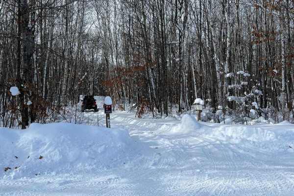
Spider Lake
This trail is a nice test loop during the winter to see if you should really venture around spider lake while winter wheeling. On the day we visited, there were 8-12 inches of fresh snow, and rigs on 3" lifts and 33" tires were struggling some. This time though it was primarily about sticking to the...
Learn more about Spider Lake
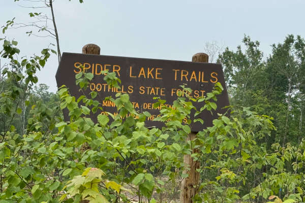
Spider Lake Trails
Spider Lake OHV trails are located within the Foothills State Forest. The Spider Lake system has 26 miles of trails to ride, which include many separate loops that wind through the dense forest. They are primarily gravel with occasional rocky sections; the trails have moderate hills and curves throu...
Learn more about Spider Lake Trails
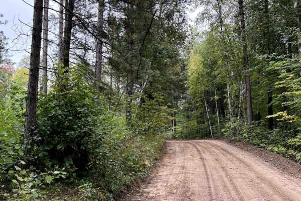
Bull Run Trail
Bull Moose Trail is an incredibly beautiful forest road with access to many activities besides trail riding. This road provides fishing access to two different backwoods lakes and plenty of dispersed camping. One lake has a small beach and appears to be fairly deep. The drive out to the two lakes at...
Learn more about Bull Run Trail
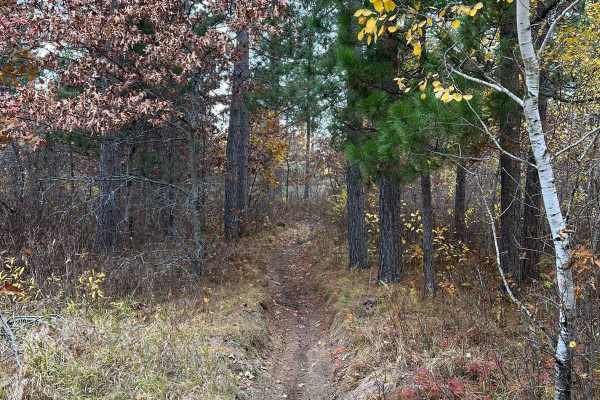
Finn Lake Loop
This trail parallels a pretty lake toward the western section of the Huntersville trail system. The trail has some small hills and whoops, as well as some sharper, windy sections that appear to be rutted/wet on occasion. Those sections might have just been cleaned up from downed trees. Overall, it's...
Learn more about Finn Lake Loop
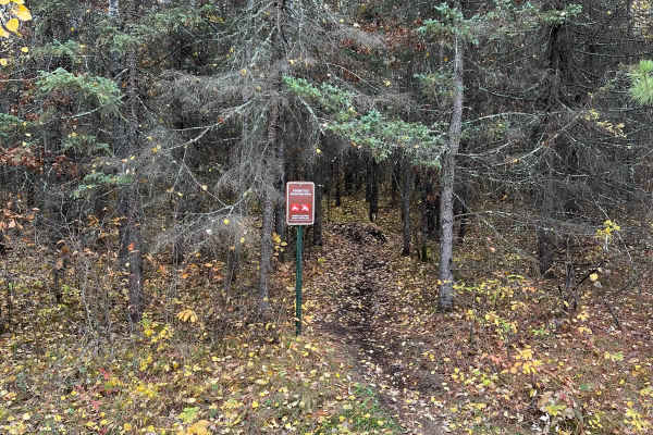
Central Huntersville Cut Through
This single-track route is a borderline direct cut-through from many western/central forest roads to the primary Huntersville forest road. The trail winds through some pretty dense evergreen sections with lots of roots. There is also a wooden bridge that assists in passing a wet marsh section given ...
Learn more about Central Huntersville Cut Through
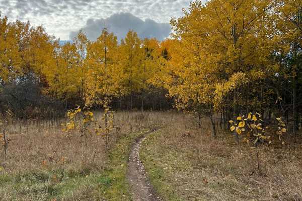
Scenic River Overlook Single Track
This trail is nothing too special as far as terrain goes, but there is a really nice seating and lookout space right near the river. There is space for bikes to pull off and enjoy the scenery. There is some small debris and whoops on the trail, but it's overall tame. Compared to nearby singletrack ...
Learn more about Scenic River Overlook Single Track
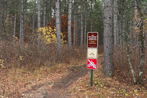
Huntersville Southeast Leg
This trail is really nice. There are areas of open forest where you can ride faster and other areas where it winds through the trees. There were no notable obstacles. Compared to nearby Paul Bunyan and Spider Lake Trails, this trail system is generally narrower but has fewer obstacles, fewer incline...
Learn more about Huntersville Southeast Leg
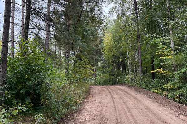
Bull Run Trail Extension
This section of road seems to be tended to on occasion. Regardless, its a fairly wide trail with a few shoot off trails and campsites. One trail shoots off and connects up with a very long dirt bike/ATV trail. Overall the trail is tame with some pretty evergreens and small lakes. Note on Trail Ridin...
Learn more about Bull Run Trail Extension
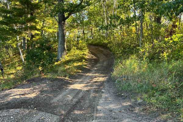
Cut Lake Scenic Drive
This is one of the best trails in the Spider Lake, Foot Hills Park area. Don't ruin this gem! You drive off a beach and drive on small hills next to the lake with an incredible view. You'll experience some nice rolling spots within the trail. It is overall smooth and some areas with water but super ...
Learn more about Cut Lake Scenic Drive
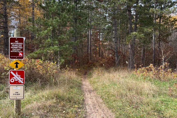
Huntersville Southwestern Trail
This trail is a Huntersville sampler. There are super dense forest sections where you have to slow down to thread trees, sections of many whoops, somewhat washed-out trails that are sandy, and some trail sections hit by the forestry service with roots, sticks, and stumps. Compared to nearby singletr...
Learn more about Huntersville Southwestern Trail
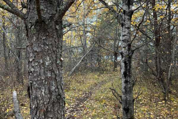
Huntersville Western Central Trail Start
This trail is one of two options if starting the western central Huntersville trails directly north of the system as opposed to near the river. This trail is pretty standard as wider single track with a few whoops and small debris in the trail, but overall it's quite smooth and easy. Compared to nea...
Learn more about Huntersville Western Central Trail Start
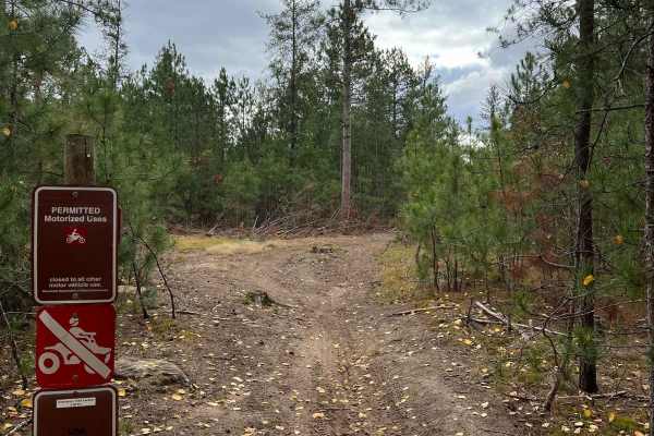
Circle Farm Trail
This trail has many diverse woods sections: areas with new growth, narrow trees, then open mature forest. The trail has very few rocks and roots, just many whoops. Compared to nearby singletrack Paul Bunyan and Spider Lake Trails, this trail system is generally narrower but has fewer obstacles, fewe...
Learn more about Circle Farm Trail
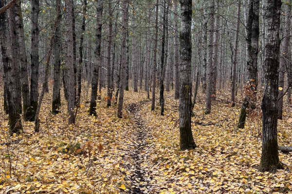
Huntersville Western Single Track Loop
This trail is a really pretty route through multiple wooded region types. There are a few large logging sections and a brief section of wider forest road, in addition to some occasional rocks, but otherwise there's little debris beyond some roots or sticks. Some sections are quite narrow but overall...
Learn more about Huntersville Western Single Track Loop
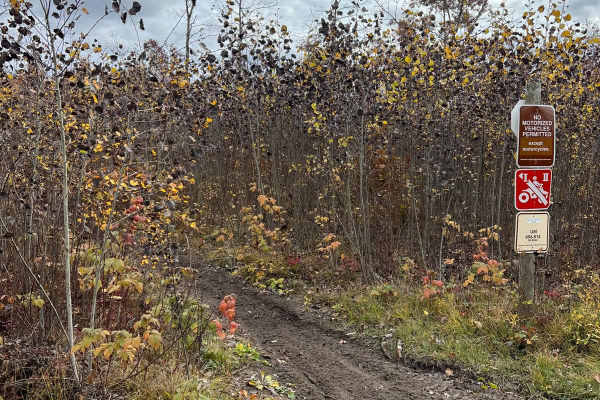
Huntersville Western Loop Parking Lot Jaunt
This trail is a nice connection route between the western parking area and the western dirt bike only loop. There is also a small gravel pit space near the junction in the middle. The trail is overall smooth with very little debris and a few whoop sections. Compared to nearby singletrack Paul Bunyan...
Learn more about Huntersville Western Loop Parking Lot Jaunt
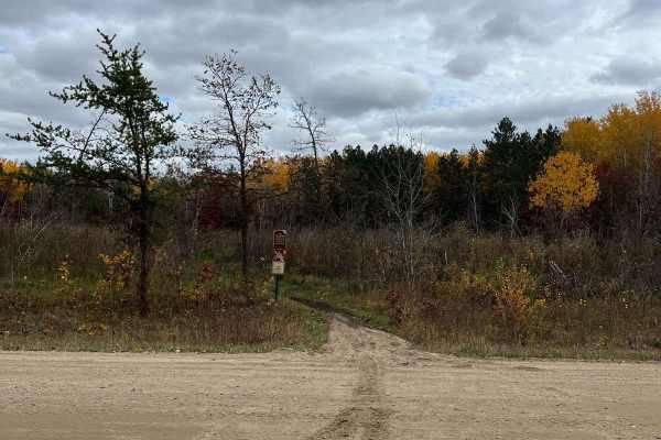
Huntersville Western Trailhead - East Leg
This is a nice, flowy, wooded section of trail with sections of heavy whoops but wide enough trees to keep some speed. It's a good option if you want to hit many central trails from the trailhead parking area. Compared to nearby singletrack Paul Bunyan and Spider Lake Trails, this trail system is ge...
Learn more about Huntersville Western Trailhead - East Leg
ATV trails near Sauk Centre, Minnesota
Explore ATV-friendly trails near you. These trails are accessible for vehicles up to 50 inches wide, perfect for ATVs and smaller off-road machines.
Trailhead Parking to Genola
This section of Soo Line South is an easy trail with a great parking lot at the trailhead that has lots of room for trailers. The parking lot has security cameras and two vault-type restrooms. The parking lot and first few hundred feet of trail going up the hill from the parking lot's northwest end ...
Learn more about Trailhead Parking to Genola
Genola to Hillman
Genola to Hillman on the Soo Line South Trail is a section of converted rail grade that is 12 miles long and takes about 40 minutes with an average speed of 19.6 mph. This section of the Soo Line South Trail is provided by Morrison County and maintained by the Eastern Morrison County 4 Wheelers Club...
Learn more about Genola to Hillman
Meeker County OHV Park Outer Loop
Narrow and winding trails travel through this 40-acre parcel of woods. There is a youth training area on site, as well as a picnic shelter area, restroom facilities, and plenty of parking. There is a constructed mud pit area and good cell service. Standard Minnesota ATV permits/licenses are required...
Learn more about Meeker County OHV Park Outer Loop
Hillman to Onamia
Hillman to Onamia on the Soo Line South Trail is a section of converted rail grade. At 12 miles long, it takes about 30 minutes with an average speed of 24.1 mph. This section of the Soo Line South Trail is provided by Mille Lacs County and maintained by the Mille Lacs Drift Skippers Snowmobile/ATV ...
Learn more about Hillman to Onamia
UTV/side-by-side trails near Sauk Centre, Minnesota
Find UTV and side-by-side trails near you. These trails accommodate vehicles up to 60 inches wide, ideal for UTVs, side-by-sides, and wider off-road rigs.
Trailhead Parking to Genola
This section of Soo Line South is an easy trail with a great parking lot at the trailhead that has lots of room for trailers. The parking lot has security cameras and two vault-type restrooms. The parking lot and first few hundred feet of trail going up the hill from the parking lot's northwest end ...
Learn more about Trailhead Parking to Genola
Genola to Hillman
Genola to Hillman on the Soo Line South Trail is a section of converted rail grade that is 12 miles long and takes about 40 minutes with an average speed of 19.6 mph. This section of the Soo Line South Trail is provided by Morrison County and maintained by the Eastern Morrison County 4 Wheelers Club...
Learn more about Genola to Hillman
Meeker County OHV Park Outer Loop
Narrow and winding trails travel through this 40-acre parcel of woods. There is a youth training area on site, as well as a picnic shelter area, restroom facilities, and plenty of parking. There is a constructed mud pit area and good cell service. Standard Minnesota ATV permits/licenses are required...
Learn more about Meeker County OHV Park Outer Loop
Hillman to Onamia
Hillman to Onamia on the Soo Line South Trail is a section of converted rail grade. At 12 miles long, it takes about 30 minutes with an average speed of 24.1 mph. This section of the Soo Line South Trail is provided by Mille Lacs County and maintained by the Mille Lacs Drift Skippers Snowmobile/ATV ...
Learn more about Hillman to Onamia
The onX Offroad Difference
onX Offroad combines trail photos, descriptions, difficulty ratings, width restrictions, seasonality, and more in a user-friendly interface. Available on all devices, with offline access and full compatibility with CarPlay and Android Auto. Discover what you're missing today!
Open Trail Map