
Dirt Bike Trails
Near Saginaw, Michigan
Explore All Dirt Bike Trails Near Saginaw, Michigan
Dirt Bike Trails Near Saginaw, Michigan
Discover the best dirt bike trails near you. Browse trail maps, check difficulty ratings, and find your next adventure — whether you're looking for a quick ride or an all-day expedition.
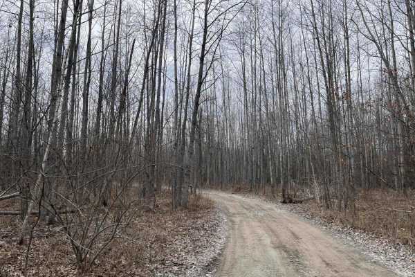
West Isabella Bypass
A scenic, easy-going trail through the woods in the Gladwin Forest area west of Midland. One of the few dry trails in the area, especially in the spring. The trail winds through woods and wetland. There has been some logging on the trail. The trail is mostly one vehicle wide, though there are severa...
Learn more about West Isabella Bypass
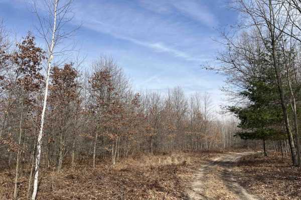
Sandy Puddles
This is an out-and-back sandy two-track trail through dense woods with several large water holes along the way. Some of the water holes are 12 to 18 inches deep, depending on the season, and have soft sandy bottoms that may be difficult to get good traction in. There is a large clearing in the woods...
Learn more about Sandy Puddles
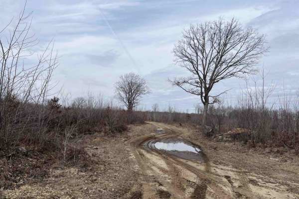
Lone Oak
This out-and-back trail starts off as a two-track through a logged area with a few lone oak trees still standing before getting sandier and heading into the woods. The first half of the trail is fairly dry, but near the end, there are several large water holes. Depending on the season and weather, t...
Learn more about Lone Oak
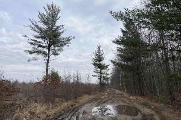
West Olson Trail
The trail starts at the intersection of West Olson Road and Geneva Road. There are large yellow turn signs on either side of the trail marking the normal roads. It is 1 to 2 vehicles wide with numerous mud holes, though most were not very deep, even in the spring, no more than a few inches. This cou...
Learn more about West Olson Trail
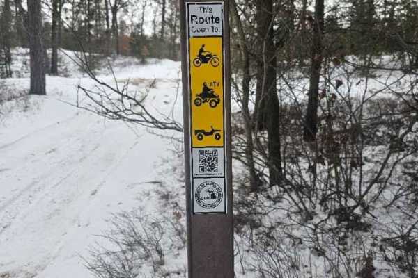
Gladwin ORV Route
Michigan DNR ORV Route is open to full-size, 50-inch, and motorcycles with ORV permits and Trail permit stickers. This is a small ORV Route but is surrounded by many more miles of 50-inch trails. The trail itself is fairly flat, with rolling whoops through a wooded area.
Learn more about Gladwin ORV Route
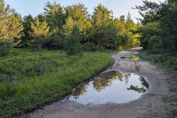
The Flats Trail
This Trail is a spur off Michigan Road with one shallow water hole after another. The deepest ran about 18 inches, but the average was about 12 inches; all have pretty solid bottoms. The trail maintains a minimum of one full-size vehicle wide. Explorers will find a handful of open areas big enough...
Learn more about The Flats Trail
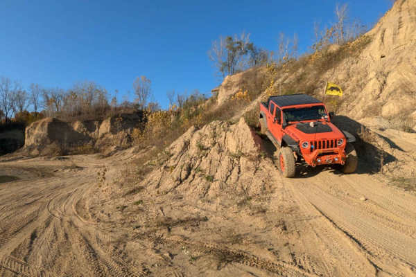
The Fish Bowl
This is an easy trail that loops around the wall edge of the open riding area in the far back corner of the park. The open riding area can be very mucky if it's been raining. This would be a good challenge for those who like to play in the mud.
Learn more about The Fish Bowl
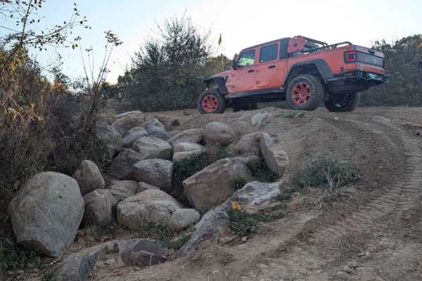
The Highway
This trail starts in the Northwest Corner area or off of West Side Drive. It is a multi-directional trail that runs through the trees with a couple of hills. If you're a full-size vehicle and like your paint job, this is not the trail for you. Expect some of that good ol' Michigan pinstriping. There...
Learn more about The Highway
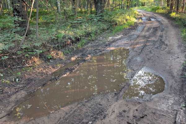
Stelmach Trail
This Trail is an out-and-back trail that no longer connects to Steimech Road at the south. Even though this Trail isn't going anywhere specific, it will still make for a good time. The dead end at the south end is in a wooded area that is a wetland. With that said, along the way you will find mult...
Learn more about Stelmach Trail
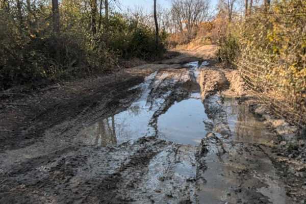
Mine View Trail
This trail is an in-and-out trail. Use caution at the end, there is a severe drop-off that is unpassable. There is also a good-sized mud hole that could be very very deep if it's been wet. We drove this trail when it was very dry and the mud hole still looked very deep and mucky.
Learn more about Mine View Trail
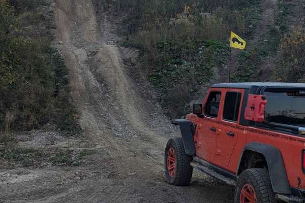
Bad Influence
This trail is a multi-directional bumpy, steep hill climb or descent. It branches off of the West Point Hill Climb. It does level off in the middle for a second, so if you need to slow your momentum in either direction, you can. This trail would require some horsepower if it was muddy.
Learn more about Bad Influence
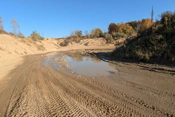
Katy's Loop
This trail is sandy with little rocks and loops around the far back area of the park. It's easy to drive and in most areas wide enough for two vehicles. There is a section near the Northwest Corner that has standing water. The water can be deep if it's been wet. Be cautious. The trail currently dead...
Learn more about Katy's Loop
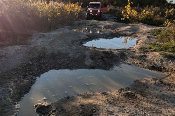
West Point Hill Climb
This trail is multi-directional, steep, and with large bumps causing your vehicle to articulate. Either entrance to this trail can be located along the South Rim Trail. The trail is very rutted. There was standing water on the trail and it has been dry. The trail would be very challenging if it was ...
Learn more about West Point Hill Climb
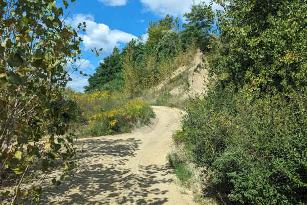
Cat Walk
This sandy trail can be found at the bottom of the Electric Slide and runs to the back portion of the park. It is sandy and there is a small rock in the middle of the trail creating a small washout. It's a great way to see the back side of the park and avoid traffic along the main hall road to the b...
Learn more about Cat Walk
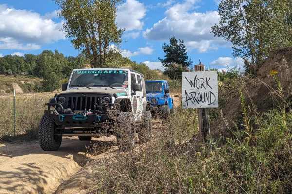
Work Around
Work Around is a very short trail that runs along the edge of the property and backs up to the area that is still being mined. It can be picked up at the end of Cat Walk and continues to the back of the park. It's more of a transition trail than a trail of substance. It does run along the top of a w...
Learn more about Work Around
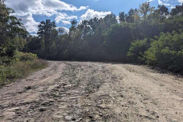
South Rim
South Rim is the main hall road that runs from the middle of the park to the back area. Many trails branch off of this road. There are some areas that are rutted and muddy, For the most part, this trail is wide enough for two vehicles and has two-way traffic.
Learn more about South Rim
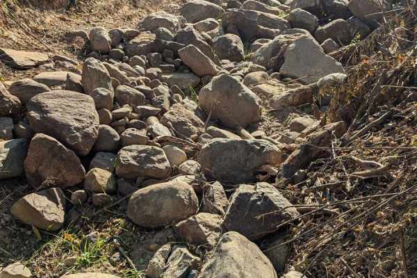
Catwalk Bypass and Rock Crawl
This sandy trail runs between Catwalk and Sweet Water. Once you get near The Sloppy Joe Bypass, the trail turns uphill and becomes a rock crawl. 12" and bigger rocks closely layered together making for a fun rock crawl. This rock crawl is great for someone new to crawling.
Learn more about Catwalk Bypass and Rock Crawl
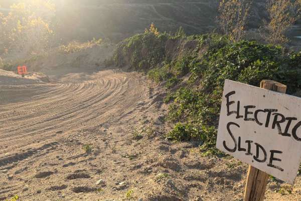
Electric Slide
This trail can be found at the end of Skyline Drive and Rim Cut. It is a directional long steep descent. YOU MAY ONLY DRIVE DOWN THE HILL. The trail finishes down near The Troubles and Cat Walk. The park usually keeps this trail groomed regularly. It is very slippery in the snow and turns to ice ver...
Learn more about Electric Slide
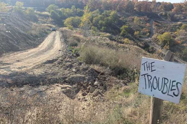
The Troubles
This is an intermediate trail with a hill descent or climb and a little off-camber areas. It is a multi-directional trail. One end can be found on Skyline Drive and the other can be located on South Rim Road. As with any of the trails at Holly Oaks, this trail could be more difficult if you run it g...
Learn more about The Troubles
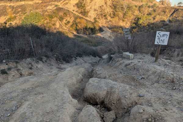
Sloppy Joe
This trail is a multi-directional steep, deeply rutted hill climb or descent with a small rock ledge in the middle. Either end of the trail can be found on the South Rim Trail or the Sloppy Joe Bypass. This trail would most likely be very difficult if the terrain is wet. The entrance on the South Ri...
Learn more about Sloppy Joe
ATV trails near Saginaw, Michigan
Explore ATV-friendly trails near you. These trails are accessible for vehicles up to 50 inches wide, perfect for ATVs and smaller off-road machines.
West Isabella Bypass
A scenic, easy-going trail through the woods in the Gladwin Forest area west of Midland. One of the few dry trails in the area, especially in the spring. The trail winds through woods and wetland. There has been some logging on the trail. The trail is mostly one vehicle wide, though there are severa...
Learn more about West Isabella Bypass
Sandy Puddles
This is an out-and-back sandy two-track trail through dense woods with several large water holes along the way. Some of the water holes are 12 to 18 inches deep, depending on the season, and have soft sandy bottoms that may be difficult to get good traction in. There is a large clearing in the woods...
Learn more about Sandy Puddles
Lone Oak
This out-and-back trail starts off as a two-track through a logged area with a few lone oak trees still standing before getting sandier and heading into the woods. The first half of the trail is fairly dry, but near the end, there are several large water holes. Depending on the season and weather, t...
Learn more about Lone Oak
West Olson Trail
The trail starts at the intersection of West Olson Road and Geneva Road. There are large yellow turn signs on either side of the trail marking the normal roads. It is 1 to 2 vehicles wide with numerous mud holes, though most were not very deep, even in the spring, no more than a few inches. This cou...
Learn more about West Olson Trail
UTV/side-by-side trails near Saginaw, Michigan
Find UTV and side-by-side trails near you. These trails accommodate vehicles up to 60 inches wide, ideal for UTVs, side-by-sides, and wider off-road rigs.
West Isabella Bypass
A scenic, easy-going trail through the woods in the Gladwin Forest area west of Midland. One of the few dry trails in the area, especially in the spring. The trail winds through woods and wetland. There has been some logging on the trail. The trail is mostly one vehicle wide, though there are severa...
Learn more about West Isabella Bypass
Sandy Puddles
This is an out-and-back sandy two-track trail through dense woods with several large water holes along the way. Some of the water holes are 12 to 18 inches deep, depending on the season, and have soft sandy bottoms that may be difficult to get good traction in. There is a large clearing in the woods...
Learn more about Sandy Puddles
Lone Oak
This out-and-back trail starts off as a two-track through a logged area with a few lone oak trees still standing before getting sandier and heading into the woods. The first half of the trail is fairly dry, but near the end, there are several large water holes. Depending on the season and weather, t...
Learn more about Lone Oak
West Olson Trail
The trail starts at the intersection of West Olson Road and Geneva Road. There are large yellow turn signs on either side of the trail marking the normal roads. It is 1 to 2 vehicles wide with numerous mud holes, though most were not very deep, even in the spring, no more than a few inches. This cou...
Learn more about West Olson Trail
The onX Offroad Difference
onX Offroad combines trail photos, descriptions, difficulty ratings, width restrictions, seasonality, and more in a user-friendly interface. Available on all devices, with offline access and full compatibility with CarPlay and Android Auto. Discover what you're missing today!
Open Trail Map