
Dirt Bike Trails
Near Rosemount, Minnesota
Explore All Dirt Bike Trails Near Rosemount, Minnesota
Dirt Bike Trails Near Rosemount, Minnesota
Discover the best dirt bike trails near you. Browse trail maps, check difficulty ratings, and find your next adventure — whether you're looking for a quick ride or an all-day expedition.
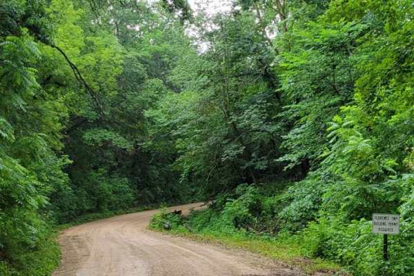
East Central Scenic Trail
Beautiful easy dirt road. Great views year-round, especially in the fall or in the winter after a light snow. This is an easy-maintained gravel road meandering through the driftless area of east central Minnesota. Close to many other beautiful gravel roads to explore. There are many nice small towns...
Learn more about East Central Scenic Trail
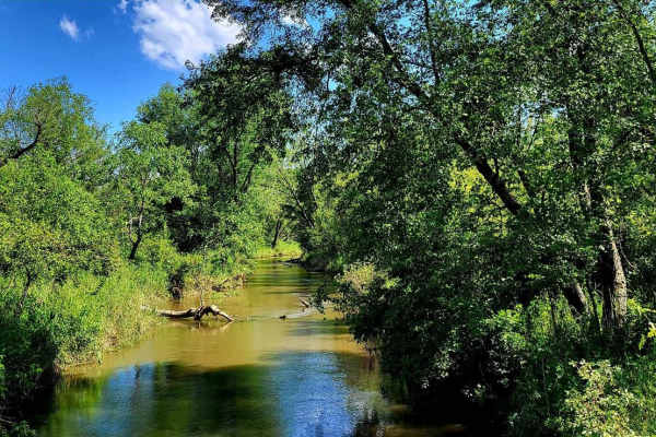
Sand Road Driftless Loop
A relaxing drive through the Driftless area north of Pepin, Wisconsin. There is nothing technical;this is a gravel county road drive with a few tar sections. You can take a hike at Five Mile Bluff Prairie State Natural Area. This trail would be extra beautiful in the fall and after a fresh snowstorm...
Learn more about Sand Road Driftless Loop
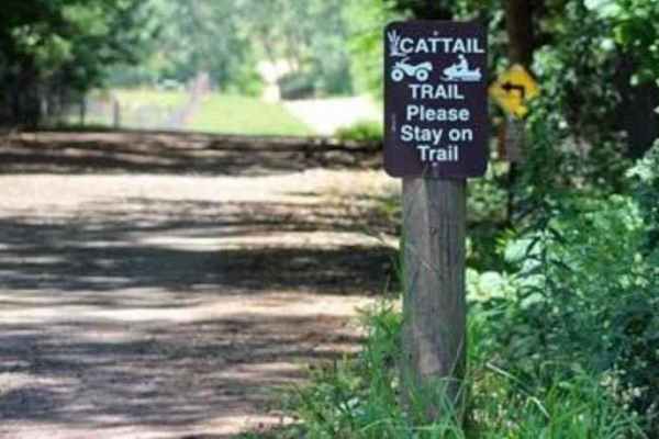
Cattail State Trail: Amery to Turtle Lake
Cattail State Trail: Amery to Turtle Lake is an 11.8-mile point-to-point trail rated 2 of 10 located in Polk County. The Amery to Turtle Lake section of the Cattail State Trail is a packed gravel rail-to-trail that has a gentle elevation gain of 200 feet over the length of the trail. Departing Amery...
Learn more about Cattail State Trail: Amery to Turtle Lake
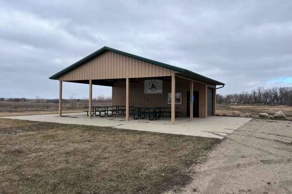
Meeker County OHV Park Outer Loop
Narrow and winding trails travel through this 40-acre parcel of woods. There is a youth training area on site, as well as a picnic shelter area, restroom facilities, and plenty of parking. There is a constructed mud pit area and good cell service. Standard Minnesota ATV permits/licenses are required...
Learn more about Meeker County OHV Park Outer Loop
ATV trails near Rosemount, Minnesota
Explore ATV-friendly trails near you. These trails are accessible for vehicles up to 50 inches wide, perfect for ATVs and smaller off-road machines.
East Central Scenic Trail
Beautiful easy dirt road. Great views year-round, especially in the fall or in the winter after a light snow. This is an easy-maintained gravel road meandering through the driftless area of east central Minnesota. Close to many other beautiful gravel roads to explore. There are many nice small towns...
Learn more about East Central Scenic Trail
Cattail State Trail: Amery to Turtle Lake
Cattail State Trail: Amery to Turtle Lake is an 11.8-mile point-to-point trail rated 2 of 10 located in Polk County. The Amery to Turtle Lake section of the Cattail State Trail is a packed gravel rail-to-trail that has a gentle elevation gain of 200 feet over the length of the trail. Departing Amery...
Learn more about Cattail State Trail: Amery to Turtle Lake
Meeker County OHV Park Outer Loop
Narrow and winding trails travel through this 40-acre parcel of woods. There is a youth training area on site, as well as a picnic shelter area, restroom facilities, and plenty of parking. There is a constructed mud pit area and good cell service. Standard Minnesota ATV permits/licenses are required...
Learn more about Meeker County OHV Park Outer Loop
UTV/side-by-side trails near Rosemount, Minnesota
Find UTV and side-by-side trails near you. These trails accommodate vehicles up to 60 inches wide, ideal for UTVs, side-by-sides, and wider off-road rigs.
East Central Scenic Trail
Beautiful easy dirt road. Great views year-round, especially in the fall or in the winter after a light snow. This is an easy-maintained gravel road meandering through the driftless area of east central Minnesota. Close to many other beautiful gravel roads to explore. There are many nice small towns...
Learn more about East Central Scenic Trail
Sand Road Driftless Loop
A relaxing drive through the Driftless area north of Pepin, Wisconsin. There is nothing technical;this is a gravel county road drive with a few tar sections. You can take a hike at Five Mile Bluff Prairie State Natural Area. This trail would be extra beautiful in the fall and after a fresh snowstorm...
Learn more about Sand Road Driftless Loop
Meeker County OHV Park Outer Loop
Narrow and winding trails travel through this 40-acre parcel of woods. There is a youth training area on site, as well as a picnic shelter area, restroom facilities, and plenty of parking. There is a constructed mud pit area and good cell service. Standard Minnesota ATV permits/licenses are required...
Learn more about Meeker County OHV Park Outer Loop
The onX Offroad Difference
onX Offroad combines trail photos, descriptions, difficulty ratings, width restrictions, seasonality, and more in a user-friendly interface. Available on all devices, with offline access and full compatibility with CarPlay and Android Auto. Discover what you're missing today!
Open Trail Map