
Dirt Bike Trails
Near Prestonsburg, Kentucky
Explore All Dirt Bike Trails Near Prestonsburg, Kentucky
Dirt Bike Trails Near Prestonsburg, Kentucky
Discover the best dirt bike trails near you. Browse trail maps, check difficulty ratings, and find your next adventure — whether you're looking for a quick ride or an all-day expedition.
Trail 7
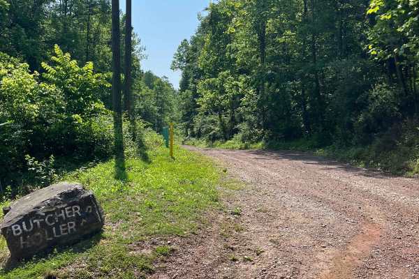
Trail 7 is an old haul road once used by the mines. Full of twists and turns with the occasional rain ruts. As it winds you through the hills, you will notice wildlife like deer, turkey, rabbits, and the occasional elk. Trail 7 also takes you out to Route 3 if you miss your turn for Trail 8.
Learn more about Trail 7
Trail 8
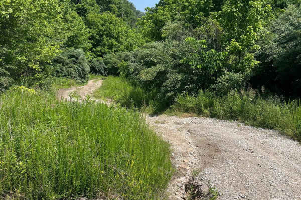
Trail 8 is short, but it is jam-packed with deep mudholes and some ruts. There are bypasses for the deep holes, but sometimes it's fun to try and make it through, just make sure you have another machine with you or at least a winch because you will probably need it.
Learn more about Trail 8
Trail 6
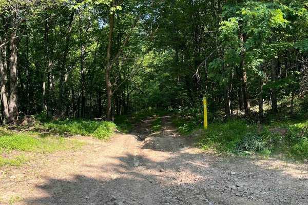
Trail 6 is a blue trail that, like many others, changes with the weather. Rain ruts, washouts, and mud holes make this trail a great little thrill ride to get to Butcher Holler. Once you hit the black top, you can go left to visit Loretta Lynn's Homeplace or go right to continue on the Butcher Holle...
Learn more about Trail 6
Trail 5
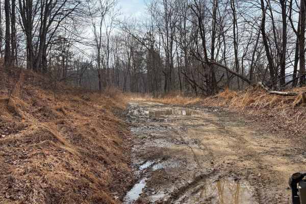
This is an extension of Trail 5, making it three-quarters of a mile longer, with plans to extend it. Trail 5 leads you to a few new trails that we have opened up in the Butcher Holler area. Deer, bobcats, turkey, black bear, and elk have all been seen in this area.
Learn more about Trail 5
Trail 2
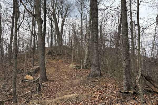
Trail 2 is a black trail. Its a steep climb from each end of it and goes along the ridge line. It's narrow in spots where it weaves through the trees, but has beautiful views and rock formations along the way! Trail 2 is only three-quarters of a mile long, but it's a very fun trail in the backwoods ...
Learn more about Trail 2
Trail 11
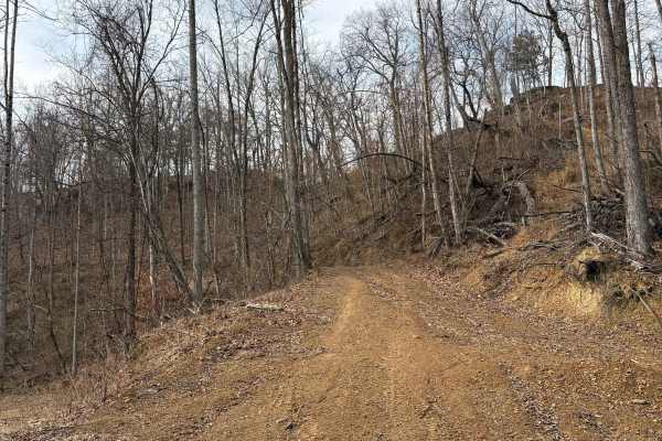
Trail 11 is a great new blue trail that's about a mile long. It dead-ends at the top for now, but there is plenty of room to park or turn around and go back down. It also leads you to the other end of Trail 2, which is a new black trail. You can see some rock formations along this trail as well as w...
Learn more about Trail 11
Trail 3
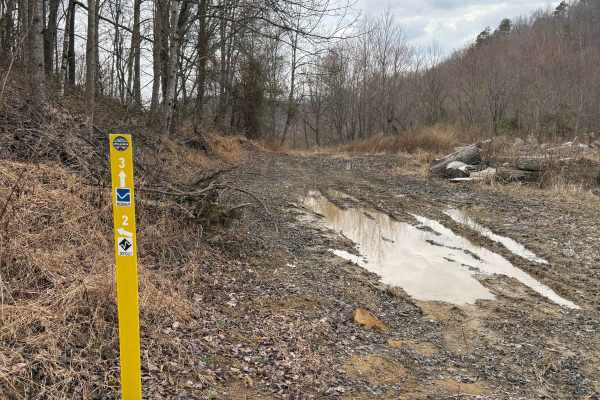
Trail 3 takes you from Trail 6 in Butcher Holler up to the top, where Trails 5, 2, and 11 are. There are a couple of decent climbs going up, but they're not too bad, so we labeled this a blue trail. You will see a couple of cool rock formations along the way.
Learn more about Trail 3
Trail 4
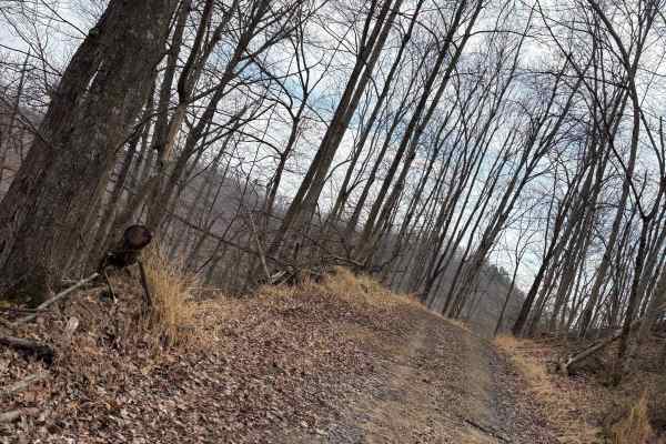
Trail 4 is a half-mile trail that takes you from the end of Trail 5 back around to Trail 5 again. There are a few muddy spots, so we labeled this a blue trail. You usually always see deer on this trail. There is potential to open another trail or two from Trail 4 very soon.
Learn more about Trail 4
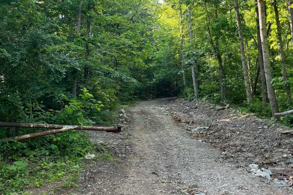
Trail 5
Kind of rugged terrain on an old haul road, mainly rock and gravel. Runs along the rock wall as it winds deeper into the hills towards Butcher Holler. You see deer, turkey, and the occasional elk on Trail 5. Black bears are in the area, but rarely seen on the trail.
Learn more about Trail 5
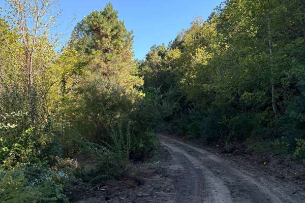
Trail 15
This is a 3-mile extension to Trail 15. We did some dozing and cutting to make this take you back down to Wolf Creek off of Trail 14. It's a little steep in a couple of spots, but I had no trouble going up or down it. It's labeled as a black trail due to the steep climb and few ruts in the woods.
Learn more about Trail 15
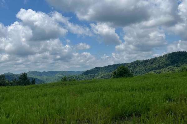
Trail 12
Trail 12 is a newly dozed trail that takes you from Trail 15 down to a black top road that takes you to German Bridge in Floyd County. It has breathtaking views at the top, along with some free-range cattle. The trail is a little steep down towards the black top, but 4WD won't have a problem.
Learn more about Trail 12
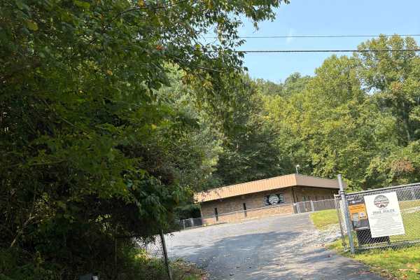
Martin County Trailhead to Trail 1
This is the First Frontier Appalachian Trails office/trailhead. This route takes you from the parking lot to Trail 1. Office/trailhead is located off Route 3 in Martin County. 3548 Davella Road, Debord, KY. There is a porta-john at the trailhead parking. Very easy parking is available in a gravel l...
Learn more about Martin County Trailhead to Trail 1
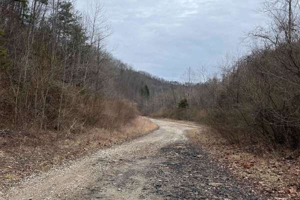
Trail 14 Cow Fork
Trail 14 is known to locals as Cow Fork. It is a great blue trail that is full of creek crossings and wildlife. Another trail that changes with the seasons the water crossings change with rainfall and some require 4x4 to get thru. There is a small pond along the trail. You can access a couple other ...
Learn more about Trail 14 Cow Fork
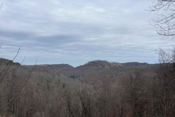
Trail 31
The free range cows don't mind showing you this is their land and won't move very fast when grazing along the trail. This is a short trail with breathtaking views and a nice rocky and sandy trail. It goes from trail 15 and gets you to trail 34. Being a short trail, its fun to travel it in each direc...
Learn more about Trail 31
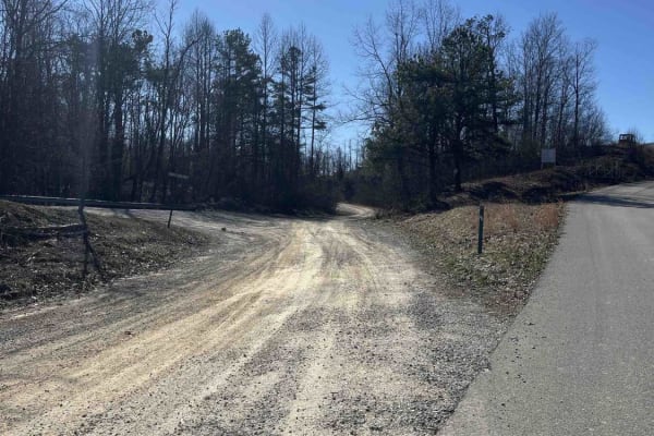
WCR
This is an old county road that does not get maintained regularly. It starts out black top changes to stone and dirt. It changes with the weather. It is a blue trail with rocks and rain ruts along the way. WCR is the main route in and out of the trails in Martin County.
Learn more about WCR
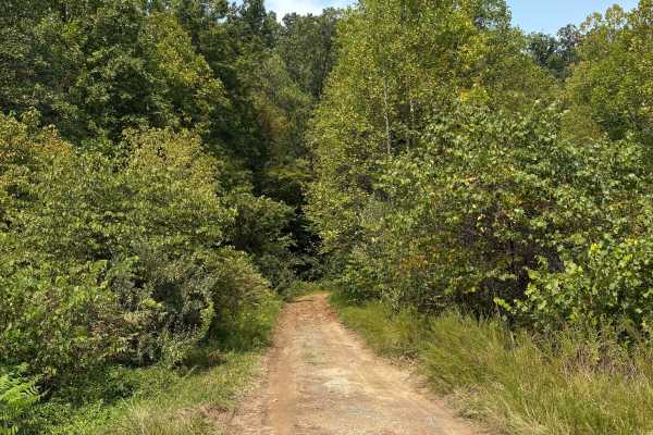
Trail 1
Trail 1 is a short trail that bypasses the 4-lane. It takes you from the FFAT trailhead in Martin County to Wolf Creek Road. It is a one-lane trail for now, coming off Davella Road, and it is a little steep on that side as well.
Learn more about Trail 1
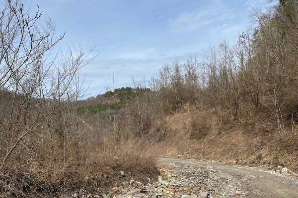
Trail 20 Wash Branch
Trail 20 starts from Trail 34 and connects to Trail 15. There are a couple of creek crossings and small waterfalls along the way. There is also a nice pond that you ride beside. Rocky and muddy terrain might require 4x4 in some spots. Keep an eye out for hill climb loops along the way.
Learn more about Trail 20 Wash Branch
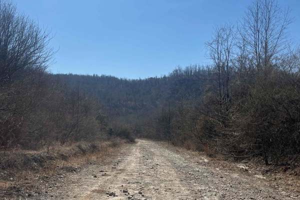
Trail 30 (Bear Branch)
Trail 30 is a blue trail that connects trails 34 and 15. Locally known as Bear Branch, you can encounter all types of wildlife. The trail is rocky with some ruts and has mountain views all around you. It changes with the weather and can have ruts and hill slides along this trail.
Learn more about Trail 30 (Bear Branch)
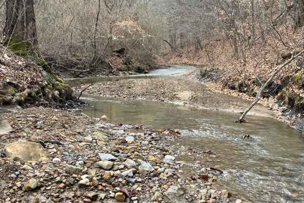
Trail 34 Maynards Fork
Trail 34, known as Maynards Fork, is jam-packed with thrills all the way through. Multiple creek crossings give you plenty of places to stop and let the kids play in the spring-fed creek. A few small waterfalls along the way give you great photo ops as well as a couple challenges along the trail. A ...
Learn more about Trail 34 Maynards Fork
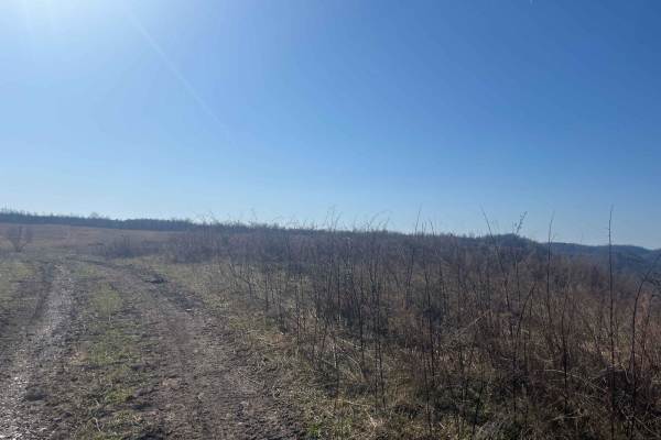
Trail 18
Trail 18 is a blue trail that loops from trail 15 to trail 30 and is jam-packed with everything! Has a nice hillclimb from both ends on rocky terrain. Beautiful views once you get to the top. You will usually always see free range cattle and horses up here.
Learn more about Trail 18
ATV trails near Prestonsburg, Kentucky
Explore ATV-friendly trails near you. These trails are accessible for vehicles up to 50 inches wide, perfect for ATVs and smaller off-road machines.
Trail 7
Trail 7 is an old haul road once used by the mines. Full of twists and turns with the occasional rain ruts. As it winds you through the hills, you will notice wildlife like deer, turkey, rabbits, and the occasional elk. Trail 7 also takes you out to Route 3 if you miss your turn for Trail 8.
Learn more about Trail 7
Trail 8
Trail 8 is short, but it is jam-packed with deep mudholes and some ruts. There are bypasses for the deep holes, but sometimes it's fun to try and make it through, just make sure you have another machine with you or at least a winch because you will probably need it.
Learn more about Trail 8
Trail 6
Trail 6 is a blue trail that, like many others, changes with the weather. Rain ruts, washouts, and mud holes make this trail a great little thrill ride to get to Butcher Holler. Once you hit the black top, you can go left to visit Loretta Lynn's Homeplace or go right to continue on the Butcher Holle...
Learn more about Trail 6
Trail 5
This is an extension of Trail 5, making it three-quarters of a mile longer, with plans to extend it. Trail 5 leads you to a few new trails that we have opened up in the Butcher Holler area. Deer, bobcats, turkey, black bear, and elk have all been seen in this area.
Learn more about Trail 5
UTV/side-by-side trails near Prestonsburg, Kentucky
Find UTV and side-by-side trails near you. These trails accommodate vehicles up to 60 inches wide, ideal for UTVs, side-by-sides, and wider off-road rigs.
Trail 7
Trail 7 is an old haul road once used by the mines. Full of twists and turns with the occasional rain ruts. As it winds you through the hills, you will notice wildlife like deer, turkey, rabbits, and the occasional elk. Trail 7 also takes you out to Route 3 if you miss your turn for Trail 8.
Learn more about Trail 7
Trail 8
Trail 8 is short, but it is jam-packed with deep mudholes and some ruts. There are bypasses for the deep holes, but sometimes it's fun to try and make it through, just make sure you have another machine with you or at least a winch because you will probably need it.
Learn more about Trail 8
Trail 6
Trail 6 is a blue trail that, like many others, changes with the weather. Rain ruts, washouts, and mud holes make this trail a great little thrill ride to get to Butcher Holler. Once you hit the black top, you can go left to visit Loretta Lynn's Homeplace or go right to continue on the Butcher Holle...
Learn more about Trail 6
Trail 5
This is an extension of Trail 5, making it three-quarters of a mile longer, with plans to extend it. Trail 5 leads you to a few new trails that we have opened up in the Butcher Holler area. Deer, bobcats, turkey, black bear, and elk have all been seen in this area.
Learn more about Trail 5
The onX Offroad Difference
onX Offroad combines trail photos, descriptions, difficulty ratings, width restrictions, seasonality, and more in a user-friendly interface. Available on all devices, with offline access and full compatibility with CarPlay and Android Auto. Discover what you're missing today!
Open Trail Map