
Dirt Bike Trails
Near Poplar Bluff, Missouri
Explore All Dirt Bike Trails Near Poplar Bluff, Missouri
Dirt Bike Trails Near Poplar Bluff, Missouri
Discover the best dirt bike trails near you. Browse trail maps, check difficulty ratings, and find your next adventure — whether you're looking for a quick ride or an all-day expedition.
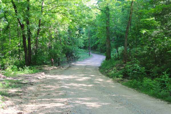
Section 22 - BCR 431 FS 3664
Section 22 (FS 3664) and Butler County Road 431 is a gravel road, made up of Butler County right of way and partly within the Poplar Bluff Unit of Mark Twain National Forest. The gravel road begins heading north off Missouri Route PP, along the Crooked Branch and Cane Creek along its track, placed o...
Learn more about Section 22 - BCR 431 FS 3664
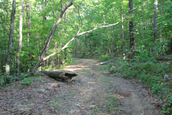
Sheehy Road - FS 3741
Sheehy Road (FS 3741) is a natural gravel and dirt forest service road within the Poplar Bluff Unit of Mark Twain National Forest. Sheehy Road begins heading north where County Road 431/FS 3664 meets its northeast end at private property, First the road crosses a small brook with a splash level of w...
Learn more about Sheehy Road - FS 3741
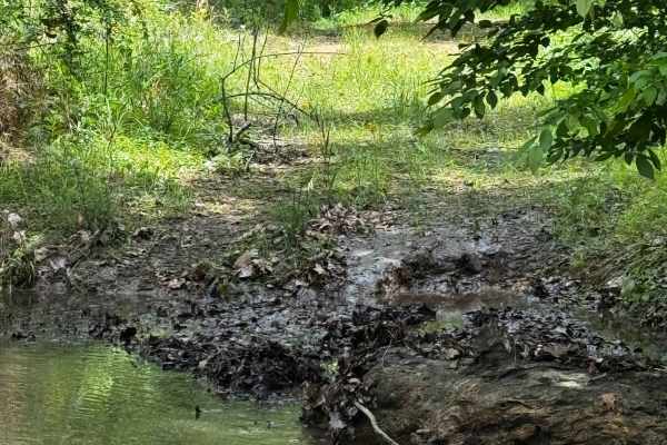
Hillside Adventure
This is, in my opinion, one of the coolest trails for full-size rigs — or really any rig. It offers beautiful deep-forest views, with obstacles along the way ranging from rocks and creek crossings to mud holes, making it a fun trail to run. Be mindful of others, as this is a two-way trail that goes ...
Learn more about Hillside Adventure
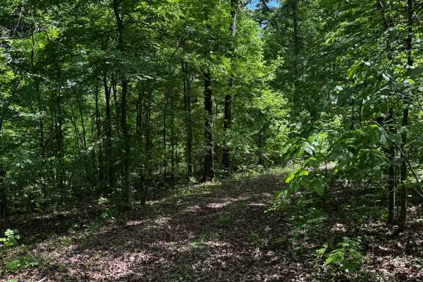
Hillside 69
The Hillside area contains a few different “main” trails, with this one being one of the longer routes stretching from the northern gate almost down to the Hillside entrance trail. It features beautiful forest scenery and a few fun obstacles along the way. Be mindful of others in this area, as there...
Learn more about Hillside 69
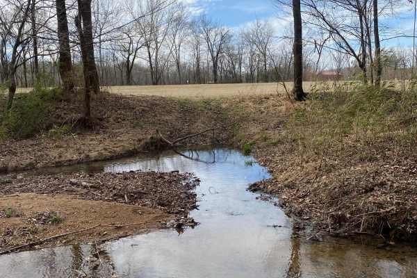
Nasty Climb 1
Extreme extreme extreme. Not for the faint of heart. Nasty climb 1 is debatably nastier than 2, but both have their features that make them very gnarly. Not recommended for full-size rigs or non-caged rigs. Be mindful of others in the area and be respectful of the park.
Learn more about Nasty Climb 1
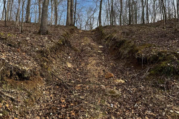
Nasty Climb 2
This trail has one of the hardest, if not the hardest obstacle in the park. This trail has extreme terrain, massive washouts, and huge rocks along your way up this nasty climb. This is not recommended for full-size or non-caged vehicles. Be mindful of others who may be trying the obstacle and be cle...
Learn more about Nasty Climb 2
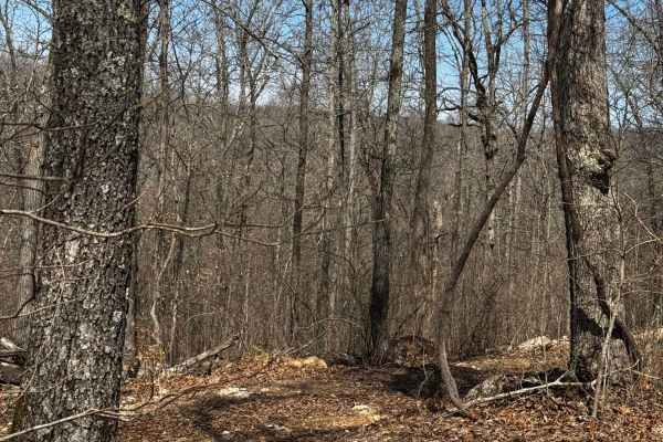
Backside Connector
This is the "long" way around the commitment hill climbs. This will take you around to the backside and take you up a enjoyable moderate trail back to the top of the climbs be mindful of others that may be in the area as theirs quite a few spur trails off this main trail.
Learn more about Backside Connector
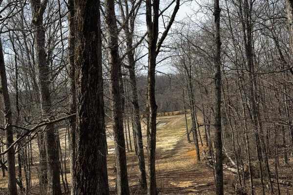
Backside Hill Climb Access
This is a relatively long trail taking you up to the top of hill climbs. The trail has a moderate terrain with a few spots that can get a little tight for those larger rigs. With this being a more moderate trail, expect high traffic during events as this space can be used by spectators wanting to wa...
Learn more about Backside Hill Climb Access
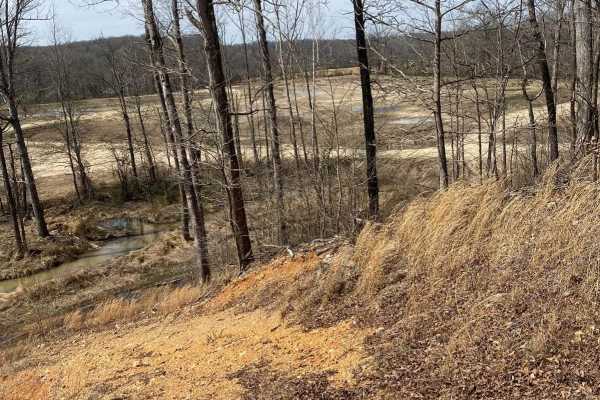
Commitment Hill Climb 8
Commitment Hill Climb 8 is technically one of the easier rides up the hill, but with an optional 8-rated climb up a borderline vertical red clay section, it makes this one an absolute doozy for someone looking to set the bar high. Use extreme caution if you decide to try your hand at the optional ch...
Learn more about Commitment Hill Climb 8
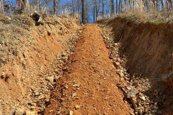
Commitment Hill Climb 1
Commitment Hill 1 is debatably the steepest of the climbs, although not long, it requires some momentum on the top half to get up there. Loose rocks on this one make for a bit more of a challenge, and if it's wet, you will be in for it.
Learn more about Commitment Hill Climb 1
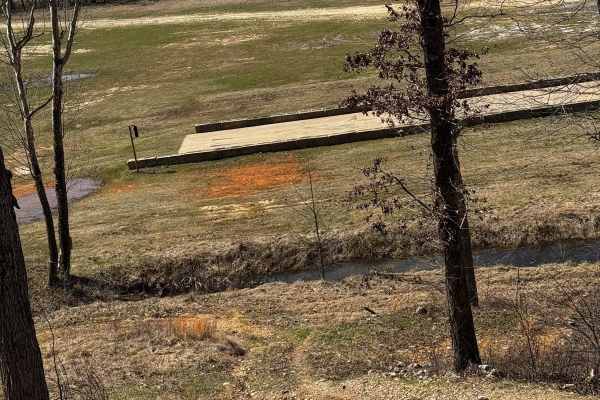
Commitment Hill Climb 7
Commitment Hill Climb 7 is a few notches up from 2 and 3 featuring a even steeper climb and bigger rocks along the way be mindful of the sharper obstacles damage to tires can be possible and with the turn featured at the top can make it difficult to see others that may be sharing the trail with you....
Learn more about Commitment Hill Climb 7
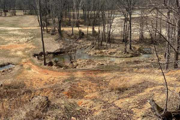
Commitment Hill Climb 5
Commitment Hill Climb 5 is a mild grade challenge similar to 4, featuring small obstacles, loose terrain, and is also used as a bypass for the smaller tire vehicles and/or ATV, Dirt bike climbing. Be mindful of those using this climb to make their way up and down the hill.
Learn more about Commitment Hill Climb 5
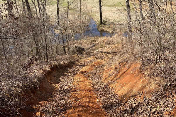
Commitment Hill Climb 3
Commitment Hill Climb 3 is more of an "easy" climb up, bypassing the washout sections, although still a steep challenge, it doesn't have anything too serious. Still be mindful of other riders that may be in the area, as it can become a bit challenging during large events to navigate.
Learn more about Commitment Hill Climb 3

Pussy Foot
As the name states, this is a trail for those really not wanting to try any of the other challenges in the area. Easy winding trail through the forest, making its way up to the backside hill climb access trail. This is predominantly an ATV MX trail, but not limited to them.
Learn more about Pussy Foot

Commitment Hill Climb 4
The shortest of the commitment hill climbs, although still a bit of a challenge, as it has a nice thick tree root appearing through the dirt that can cause a bit of a bounce on smaller tires. Be mindful of it as you make your way into this challenge.
Learn more about Commitment Hill Climb 4

Commitment Hill Climb 6
Commitment Hill Climb 6 is an absolute doozy, starting with a nice climb up a dirt mound, followed by a mixture of dirt, rock, and clay on an extremely washed-out obstacle that throws you into a mound of dirt that can easily cause body damage on larger vehicles. Proceed with caution.
Learn more about Commitment Hill Climb 6

Commitment Hill Climb 2
Of the multiple "commitment hill climbs" this one and #1 are the most tame although still very steep and increasingly washing out it can very well be a challenge for most on busy weekends. This area can be very busy. Be mindful of riders coming down the obstacle before starting your ascent/descent.
Learn more about Commitment Hill Climb 2

Hillside Climb Access
This trail stretches across the base of many hill climb challenges with varying difficulty. Small portions of the base also vary in difficulty, with some being muddy, sloppy starts, and others dry dirt starts. This area is heavily used and not restricted to only uphill use. So be very mindful of oth...
Learn more about Hillside Climb Access

Ball Tickler
The start of this trail greets your axles with some tall hay, which is where it gets its name "ball tickler" up a mild climb and into a squeeze amongst some trees, taking you up to the backside hill climb access road. Be mindful of others coming down the trail as it's a two-way.
Learn more about Ball Tickler

Mud Hole Main Loop
This loop takes you around one of the parks "main" mud holes. This massive deep and likely impassable by most rigs is not for the faint of heart. Big area with lots of spectators during events. Be mindful of others in the area and respectful of the park do not leave trash behind in this area.
Learn more about Mud Hole Main Loop
ATV trails near Poplar Bluff, Missouri
Explore ATV-friendly trails near you. These trails are accessible for vehicles up to 50 inches wide, perfect for ATVs and smaller off-road machines.
Section 22 - BCR 431 FS 3664
Section 22 (FS 3664) and Butler County Road 431 is a gravel road, made up of Butler County right of way and partly within the Poplar Bluff Unit of Mark Twain National Forest. The gravel road begins heading north off Missouri Route PP, along the Crooked Branch and Cane Creek along its track, placed o...
Learn more about Section 22 - BCR 431 FS 3664
Sheehy Road - FS 3741
Sheehy Road (FS 3741) is a natural gravel and dirt forest service road within the Poplar Bluff Unit of Mark Twain National Forest. Sheehy Road begins heading north where County Road 431/FS 3664 meets its northeast end at private property, First the road crosses a small brook with a splash level of w...
Learn more about Sheehy Road - FS 3741
Hillside Adventure
This is, in my opinion, one of the coolest trails for full-size rigs — or really any rig. It offers beautiful deep-forest views, with obstacles along the way ranging from rocks and creek crossings to mud holes, making it a fun trail to run. Be mindful of others, as this is a two-way trail that goes ...
Learn more about Hillside Adventure
Hillside 69
The Hillside area contains a few different “main” trails, with this one being one of the longer routes stretching from the northern gate almost down to the Hillside entrance trail. It features beautiful forest scenery and a few fun obstacles along the way. Be mindful of others in this area, as there...
Learn more about Hillside 69
UTV/side-by-side trails near Poplar Bluff, Missouri
Find UTV and side-by-side trails near you. These trails accommodate vehicles up to 60 inches wide, ideal for UTVs, side-by-sides, and wider off-road rigs.
Section 22 - BCR 431 FS 3664
Section 22 (FS 3664) and Butler County Road 431 is a gravel road, made up of Butler County right of way and partly within the Poplar Bluff Unit of Mark Twain National Forest. The gravel road begins heading north off Missouri Route PP, along the Crooked Branch and Cane Creek along its track, placed o...
Learn more about Section 22 - BCR 431 FS 3664
Sheehy Road - FS 3741
Sheehy Road (FS 3741) is a natural gravel and dirt forest service road within the Poplar Bluff Unit of Mark Twain National Forest. Sheehy Road begins heading north where County Road 431/FS 3664 meets its northeast end at private property, First the road crosses a small brook with a splash level of w...
Learn more about Sheehy Road - FS 3741
Hillside Adventure
This is, in my opinion, one of the coolest trails for full-size rigs — or really any rig. It offers beautiful deep-forest views, with obstacles along the way ranging from rocks and creek crossings to mud holes, making it a fun trail to run. Be mindful of others, as this is a two-way trail that goes ...
Learn more about Hillside Adventure
Hillside 69
The Hillside area contains a few different “main” trails, with this one being one of the longer routes stretching from the northern gate almost down to the Hillside entrance trail. It features beautiful forest scenery and a few fun obstacles along the way. Be mindful of others in this area, as there...
Learn more about Hillside 69
The onX Offroad Difference
onX Offroad combines trail photos, descriptions, difficulty ratings, width restrictions, seasonality, and more in a user-friendly interface. Available on all devices, with offline access and full compatibility with CarPlay and Android Auto. Discover what you're missing today!
Open Trail Map