
Dirt Bike Trails
Near Pinckney, Michigan
Explore All Dirt Bike Trails Near Pinckney, Michigan
Dirt Bike Trails Near Pinckney, Michigan
Discover the best dirt bike trails near you. Browse trail maps, check difficulty ratings, and find your next adventure — whether you're looking for a quick ride or an all-day expedition.
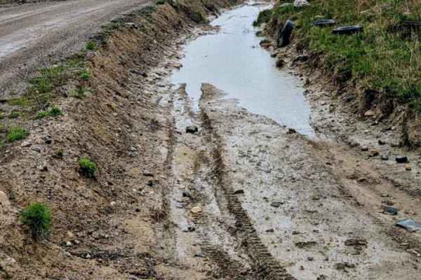
Long Haul Trench
This is a long, muddy trench that runs right next to the Long Haul Trail and the Mount Magna play area. The trench is about 10 feet wide and 4 feet deep from the ground level. The mud looks very mucky and thick, and can get pretty thick when the weather has been wet. Anyone can walk along the edge t...
Learn more about Long Haul Trench

Gawkers Pass
Gawkers Pass is a short incline/descent trail that runs between Mount Magna and Soggy Bottom Loop. It is steep and can get washed out easily. There are also a few rocks along the trail. This trail runs right next to The Notch and can be a great place to watch the buggies give The Notch a go!
Learn more about Gawkers Pass
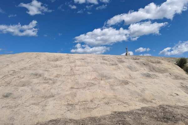
Mount Magna Loop
This trail runs along the entire base of Mount Magna. It is a trail that gives access to anyone who wants to try the many routes to the top of Mount Magna. Mount Magna is a concrete area that was designed to simulate obstacles that can be found out west. Those obstacles are;Hot Tub, Potato Salad, Ba...
Learn more about Mount Magna Loop
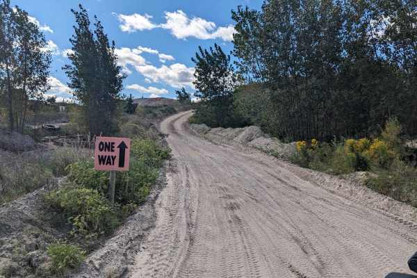
Noyes Boulevard
Noyes Boulevard is a main road that connects the front of the park with the Mount Magna area and the back of the park. There is a westbound and eastbound road, and they are directional. This is a high-traffic route so pay attention to the direction of the traffic.
Learn more about Noyes Boulevard
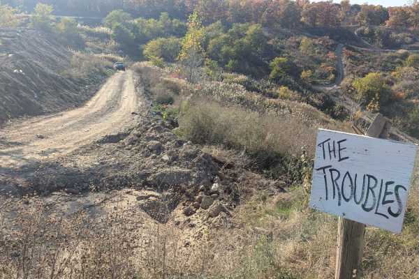
The Troubles
This is an intermediate trail with a hill descent or climb and a little off-camber areas. It is a multi-directional trail. One end can be found on Skyline Drive and the other can be located on South Rim Road. As with any of the trails at Holly Oaks, this trail could be more difficult if you run it g...
Learn more about The Troubles
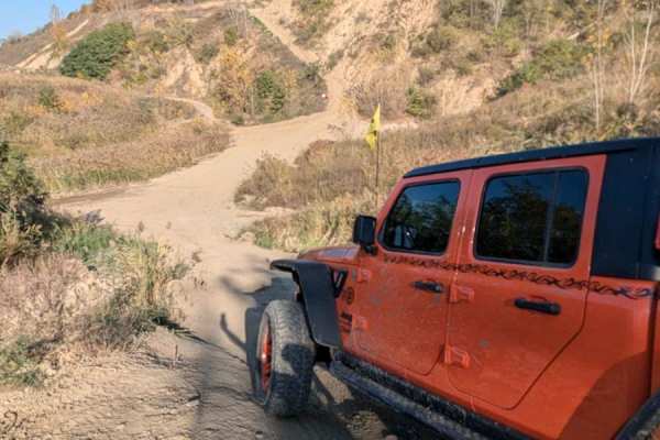
Sloppy Joe Bypass
This trail is an easy trail that connects to the middle of The Troubles trail. It runs along the hillside where you can find the Sloppy Joe trail and connects to the Catwalk. This trail is easy, but in true Holly Oaks fashion, it can be muddy if the trail has been wet.
Learn more about Sloppy Joe Bypass
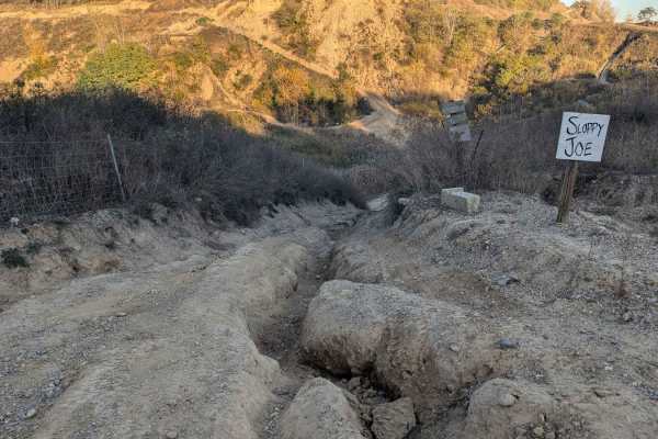
Sloppy Joe
This trail is a multi-directional steep, deeply rutted hill climb or descent with a small rock ledge in the middle. Either end of the trail can be found on the South Rim Trail or the Sloppy Joe Bypass. This trail would most likely be very difficult if the terrain is wet. The entrance on the South Ri...
Learn more about Sloppy Joe
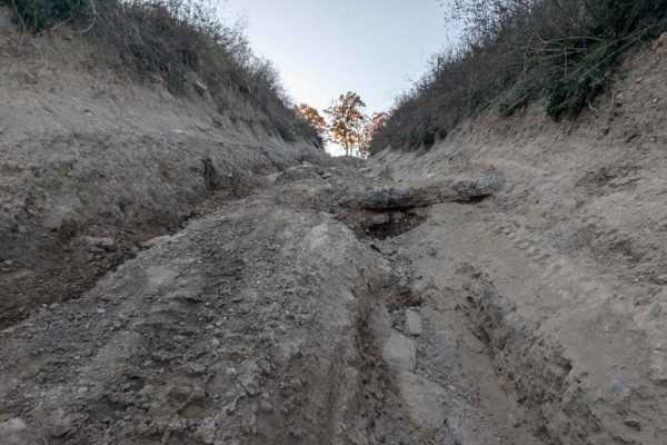
Big Trouble
The trail is multi-directional and can be picked up near the bottom of Sloppy Joe or off of The Troubles. This trail is an intermediately steep trail and rutted. As with any of the Holly Oak trails, this could be slippery if wet. The trail is narrow in some spots and the brush may be a little overgr...
Learn more about Big Trouble
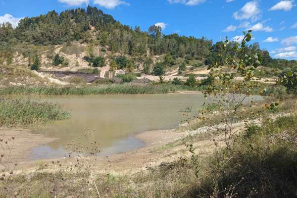
Soggy Bottom Loop
Soggy Bottom Loop is a moderate trail that runs through an area that can be very wet. There are tracks going through the water in some areas of the loop. The recorded track is a loop that DOES NOT go into the water. As with some of the trails in the park, sometimes the trail does get some grading or...
Learn more about Soggy Bottom Loop
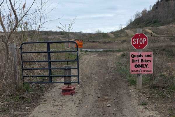
The Bathtub
This track is for dirt bikes and quads only and it's gated to limit access to anyone other than those vehicles. It is a short loop with moderate hills and small banked turns. The track runs around a water hole that look to be very deep. Riders are not allowed to enter the water. The track is ONE WAY...
Learn more about The Bathtub
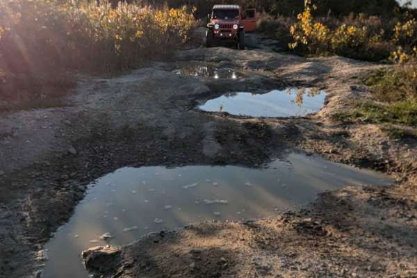
West Point Hill Climb
This trail is multi-directional, steep, and with large bumps causing your vehicle to articulate. Either entrance to this trail can be located along the South Rim Trail. The trail is very rutted. There was standing water on the trail and it has been dry. The trail would be very challenging if it was ...
Learn more about West Point Hill Climb
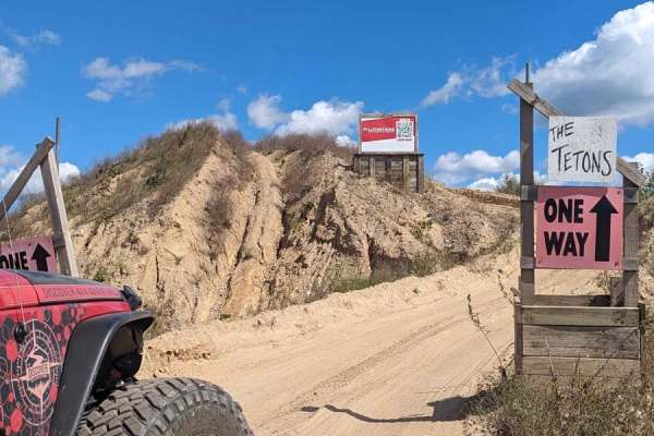
The Tetons
The Tetons can be found just to the right when you first drop into the offroad area of the park. It is a short trail that has two steep sandy hill climbs back to back. The trail is directional and there is a stop sign at the end. This trail is also a part of the Endurance Route, which is a combinati...
Learn more about The Tetons
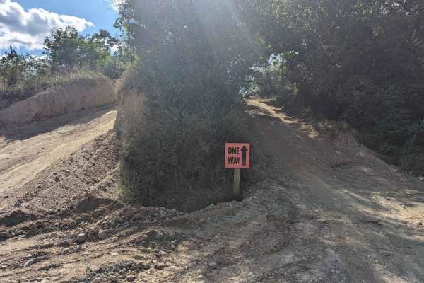
Darlene's Ridge
There are three entrances to this short trail off of Skyline Drive. It is directional. There are some small rocks along the trail but nothing a stock vehicle can't handle. This route is a good alternative to the Skyline trail if you are headed from the front of the park to the back.
Learn more about Darlene's Ridge
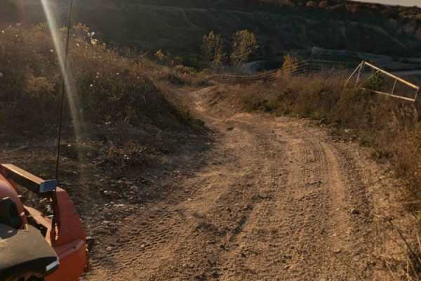
Top Line
This moderate trail is sandy. It is multi-directional and can be found at the end of Skyline Drive, or at the top of the Electric Slide. This trail also runs next to Rats Nest and Rim Cut. All three trails will dump you out in the same area at the top of Electric Slide.
Learn more about Top Line
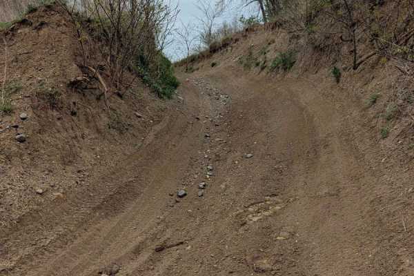
Rat's Nest
This is a short sandy trail that can be found at the end of Skyline Ridge and is a connector trail to Rim Cut. There are no elevation changes, but it does drop into the entrance to the Electric Slide. Electric Slide is a one-way trail going down.
Learn more about Rat's Nest
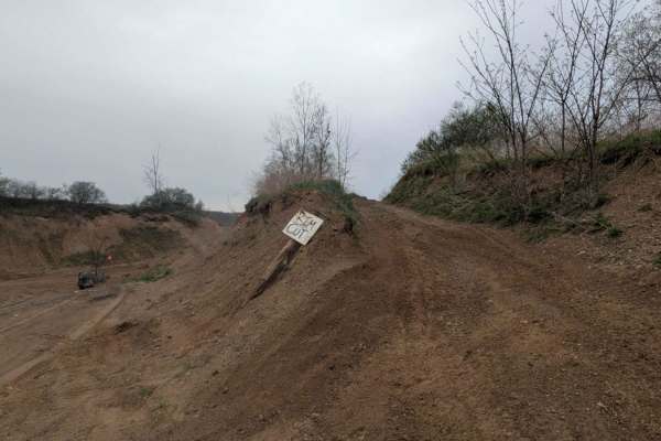
Rim Cut
Rim Cut is a short sandy connector trail that can be found at the end of Skyline Trail. It is next to Top Line and Rat's Nest. It also loops at the top of the Electric Slide entrance. It does have a small area that is beginning to get washed out.
Learn more about Rim Cut
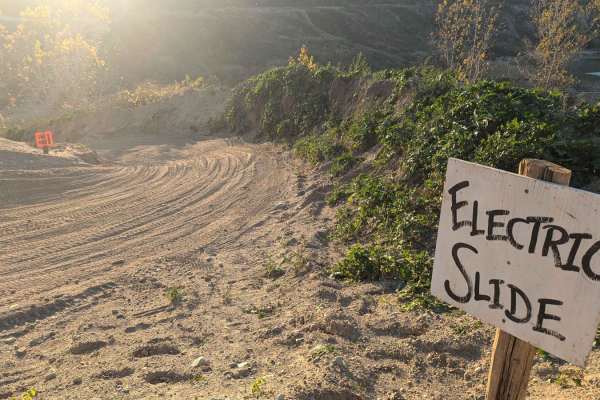
Electric Slide
This trail can be found at the end of Skyline Drive and Rim Cut. It is a directional long steep descent. YOU MAY ONLY DRIVE DOWN THE HILL. The trail finishes down near The Troubles and Cat Walk. The park usually keeps this trail groomed regularly. It is very slippery in the snow and turns to ice ver...
Learn more about Electric Slide
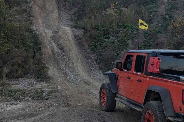
Bad Influence
This trail is a multi-directional bumpy, steep hill climb or descent. It branches off of the West Point Hill Climb. It does level off in the middle for a second, so if you need to slow your momentum in either direction, you can. This trail would require some horsepower if it was muddy.
Learn more about Bad Influence
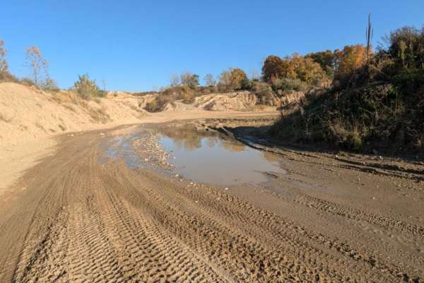
Katy's Loop
This trail is sandy with little rocks and loops around the far back area of the park. It's easy to drive and in most areas wide enough for two vehicles. There is a section near the Northwest Corner that has standing water. The water can be deep if it's been wet. Be cautious. The trail currently dead...
Learn more about Katy's Loop
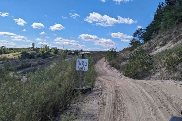
Taurus Way
This is a fun moderate trail that gives the riders a bird's eye view of the front of the park. It starts behind the Sandbox area (which is for dirtbikes only) and is directional. It starts with a sandy hill climb and finishes with a descent finishing right at the middle of the park intersection.
Learn more about Taurus Way
ATV trails near Pinckney, Michigan
Explore ATV-friendly trails near you. These trails are accessible for vehicles up to 50 inches wide, perfect for ATVs and smaller off-road machines.
Long Haul Trench
This is a long, muddy trench that runs right next to the Long Haul Trail and the Mount Magna play area. The trench is about 10 feet wide and 4 feet deep from the ground level. The mud looks very mucky and thick, and can get pretty thick when the weather has been wet. Anyone can walk along the edge t...
Learn more about Long Haul Trench
Gawkers Pass
Gawkers Pass is a short incline/descent trail that runs between Mount Magna and Soggy Bottom Loop. It is steep and can get washed out easily. There are also a few rocks along the trail. This trail runs right next to The Notch and can be a great place to watch the buggies give The Notch a go!
Learn more about Gawkers Pass
Mount Magna Loop
This trail runs along the entire base of Mount Magna. It is a trail that gives access to anyone who wants to try the many routes to the top of Mount Magna. Mount Magna is a concrete area that was designed to simulate obstacles that can be found out west. Those obstacles are;Hot Tub, Potato Salad, Ba...
Learn more about Mount Magna Loop
Noyes Boulevard
Noyes Boulevard is a main road that connects the front of the park with the Mount Magna area and the back of the park. There is a westbound and eastbound road, and they are directional. This is a high-traffic route so pay attention to the direction of the traffic.
Learn more about Noyes Boulevard
UTV/side-by-side trails near Pinckney, Michigan
Find UTV and side-by-side trails near you. These trails accommodate vehicles up to 60 inches wide, ideal for UTVs, side-by-sides, and wider off-road rigs.
Long Haul Trench
This is a long, muddy trench that runs right next to the Long Haul Trail and the Mount Magna play area. The trench is about 10 feet wide and 4 feet deep from the ground level. The mud looks very mucky and thick, and can get pretty thick when the weather has been wet. Anyone can walk along the edge t...
Learn more about Long Haul Trench
Gawkers Pass
Gawkers Pass is a short incline/descent trail that runs between Mount Magna and Soggy Bottom Loop. It is steep and can get washed out easily. There are also a few rocks along the trail. This trail runs right next to The Notch and can be a great place to watch the buggies give The Notch a go!
Learn more about Gawkers Pass
Mount Magna Loop
This trail runs along the entire base of Mount Magna. It is a trail that gives access to anyone who wants to try the many routes to the top of Mount Magna. Mount Magna is a concrete area that was designed to simulate obstacles that can be found out west. Those obstacles are;Hot Tub, Potato Salad, Ba...
Learn more about Mount Magna Loop
Noyes Boulevard
Noyes Boulevard is a main road that connects the front of the park with the Mount Magna area and the back of the park. There is a westbound and eastbound road, and they are directional. This is a high-traffic route so pay attention to the direction of the traffic.
Learn more about Noyes Boulevard
The onX Offroad Difference
onX Offroad combines trail photos, descriptions, difficulty ratings, width restrictions, seasonality, and more in a user-friendly interface. Available on all devices, with offline access and full compatibility with CarPlay and Android Auto. Discover what you're missing today!
Open Trail Map