
Dirt Bike Trails
Near Patterson Springs, North Carolina
Explore All Dirt Bike Trails Near Patterson Springs, North Carolina
Dirt Bike Trails Near Patterson Springs, North Carolina
Discover the best dirt bike trails near you. Browse trail maps, check difficulty ratings, and find your next adventure — whether you're looking for a quick ride or an all-day expedition.
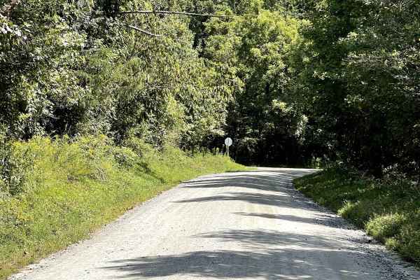
Playmore Beach Road
Playmore Beach Road is a through route consisting of hard-packed dirt that is approximately two lanes wide and free from major obstacles. The trail provides an easy and enjoyable drive through the surrounding area and is suitable for most vehicles. Along the route, users can enjoy the scenery of a n...
Learn more about Playmore Beach Road
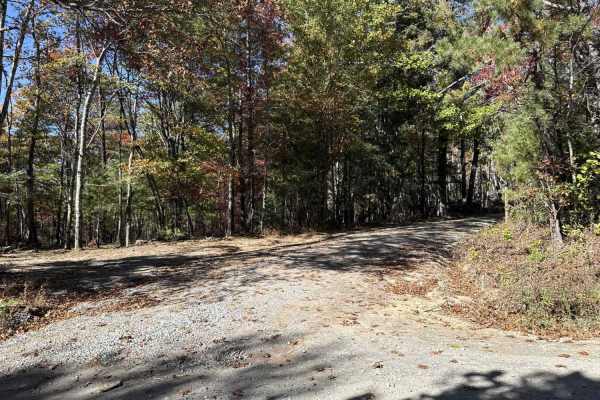
Dobson Knob - FS 106
This out-and-back trail is a gravel-over-packed-dirt route beginning at Old North Carolina 105 and following a ridge with scenic views on both sides. Around 4.4 miles in, it narrows to a six-foot-wide path near a large camping area, then continues another 1.5 miles as the Mountains-to-Sea hiking tra...
Learn more about Dobson Knob - FS 106
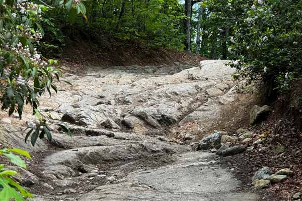
Brown Mountain OHV Trail System
Brown Mountain OHV Trail System offers 34 miles of designated off-road trails in the Grandfather Ranger District of Pisgah National Forest near Morganton, North Carolina. It is the only designated OHV area in Pisgah National Forest and is designed primarily for dirt bikes and ATVs.
The trail networ...
Learn more about Brown Mountain OHV Trail System
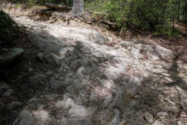
1A
Trail 1A is a difficult and narrow ATV trail open to vehicles 50" or less. The trail winds through a lush forest, crossing small creeks and constantly weaving against the mountainside, often with blind corners. The trail has big embedded rock layers, maintained cinderblock paths, deep ruts, fast and...
Learn more about 1A
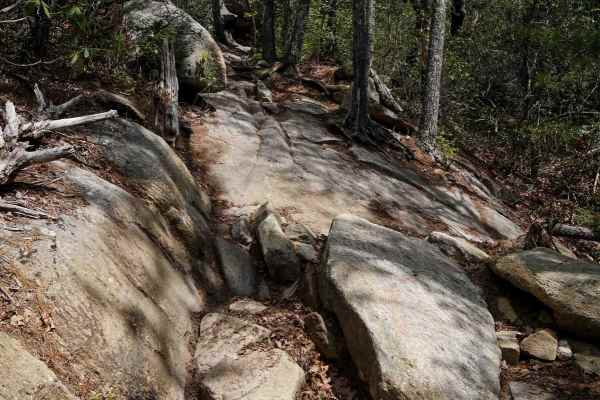
Trail 2 Elliot Deer
Trail 2 is a difficult ATV trail for vehicles 50" or less. It starts as a shelfy and smooth traverse across the mountainside, dug out in spots, with big sweeping corners, and fast between the trees, but has large rock obstacles for the majority of the route. Most of the obstacles are large embedded ...
Learn more about Trail 2 Elliot Deer
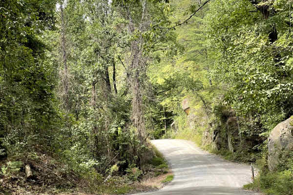
Brown Beach
Brown Beach is a hard-packed dirt trail that is approximately two lanes wide and free from major obstacles. The route provides an easy and enjoyable drive through a beautiful gorge, with the trail following alongside the river for much of the journey. The combination of the surrounding rock formatio...
Learn more about Brown Beach

Trail 3 Sullivan's Pass
Sullivan's Pass is a One-Way trail in the east-to-west (clockwise) direction. The first mile is a long descent down, and the second mile climbs back up to Trail 1B. It's a pretty wide singletrack the entire route. The descent down is very troughed in many spots, switchbacking down, with small logs a...
Learn more about Trail 3 Sullivan's Pass

Trail 9 - 50 Inch
The southern portion of Trail 9 is designated for vehicles 50" or less, and is of extreme difficulty. This trail is directional north to south and should not be ridden in the uphill direction. The north end starts off easy with flat embedded rock layers, but it quickly ramps up intensity with a tech...
Learn more about Trail 9 - 50 Inch
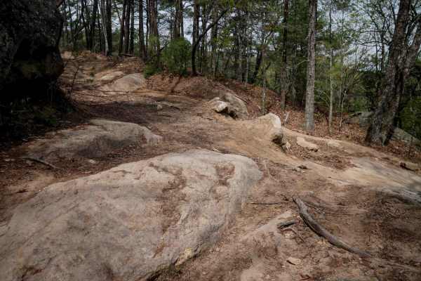
Trail 10
Trail 10 is open to vehicles 65" or less, and has a couple of moderate rock obstacles, plus steep climbs and descents. It starts at the intersection with Trail 9 with a steep, rutted descent with embedded rock layers that make small drop-offs less than a foot tall. The descent is technical because i...
Learn more about Trail 10
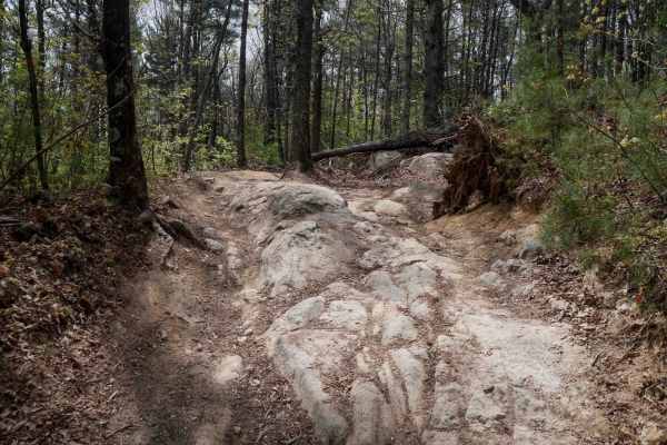
Trail 4 Kirby's Loop
Trail 4 is a wide OHV route open to vehicles 65 inches or less, accommodating two-way travel with plenty of space. The trail features a mix of smooth surfaces, loose rock, and root sections, along with cinderblock reinforcement in spots. Waterbars are present throughout for drainage. Several notable...
Learn more about Trail 4 Kirby's Loop
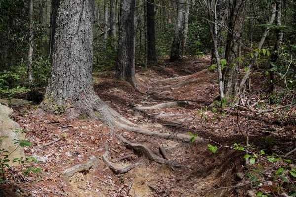
Trail 5 Ned's Knob
Ned's Knob is a directional, north-to-south singletrack trail offering a 1.4-mile gradual descent through tight, wooded terrain. The narrow path winds between small trees, with sections deeply troughed from wear. Riders can expect small roots, a few overhanging logs requiring ducking, and embedded b...
Learn more about Trail 5 Ned's Knob

Trail 7 Richard's Bypass
Richard's Bypass is a 2-mile directional singletrack descending gradually from north to south. The trail winds tightly through dense forest, with embedded rock layers and roots creating a slightly technical surface. Fallen leaves can obscure the path and mask angled roots that may catch tires, espec...
Learn more about Trail 7 Richard's Bypass

Brown Mountain Trail 8
Trail 8 is the second trail accessible to full-size vehicles in the Brown Mountain OHV area. The trail runs from about three-quarters of the way through Trail 1 and connects to the end of it, creating a loop. Generally, people run all of Trail 1 and then go onto Trail 8 which will feed them back ont...
Learn more about Brown Mountain Trail 8

Trail 6 Miller Circle
Trail 6 descends from west to east, with the eastern section being the steepest. Open to vehicles 65" wide or less and allowing two-way travel, the trail offers a generally wide path that can feel narrow in spots due to encroaching bushes and low branches. Riders should be prepared for tight corners...
Learn more about Trail 6 Miller Circle

Trail 9 - 65 Inch
From the north end, Trail 9 is designated for vehicles 65" or less until the intersection with Trail 10. It descends from north to south, offering a wide path that mixes fast, flowy sections with slightly more technical terrain. Medium embedded rock outcroppings and flat rock slabs are common, many ...
Learn more about Trail 9 - 65 Inch
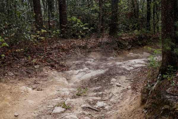
Trail 1B
Trail 1B is a well-maintained 2.5-mile UTV trail in Pisgah National Forest, offering a gradual 600-foot descent from north to south. Suitable for vehicles 65" wide or less, the trail is wide and smooth, featuring cinderblock paths, water bars, and occasional embedded rock slabs--some flush with the ...
Learn more about Trail 1B
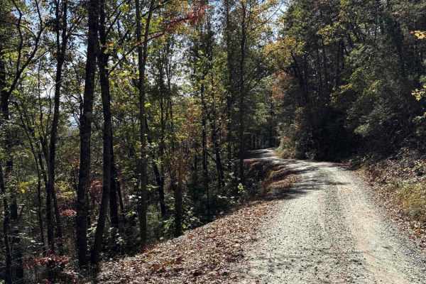
Steeles Creek - FS 228
This trail is fairly well maintained with gravel over hard-packed dirt. Some sections are narrow with pull-off areas, while others are wide enough for two vehicles to pass. A single water crossing has a warning sign advising caution during heavy rain and high water. Drivers should watch for narrow s...
Learn more about Steeles Creek - FS 228
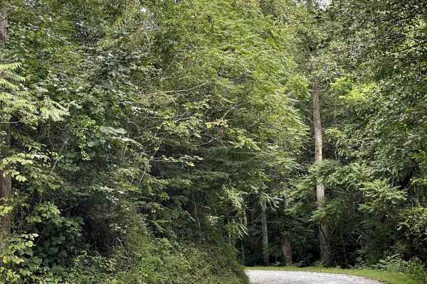
Shallow Creek Road
Shallow Creek Road is a well-maintained county road consisting primarily of hard-packed gravel and free from major obstacles. The road provides an easy and comfortable drive through the surrounding mountain countryside and is suitable for most vehicles. The gravel surface is generally smooth and doe...
Learn more about Shallow Creek Road
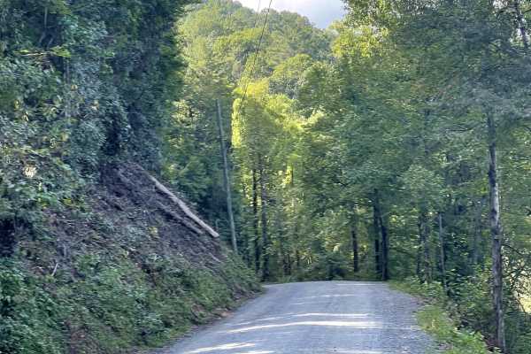
Wilson Creek
Wilson Creek Road connects users with many of the area’s best trails and provides an easy route through the surrounding mountain countryside. The road consists of hard-packed dirt, is approximately two lanes wide, and is free from major obstacles. The trail is suitable for all vehicles and does not ...
Learn more about Wilson Creek

South Toe River
South Toe River is a basic, but scenic trail located near Mount Mitchell in North Carolina. The trail begins at the Blue Ridge Parkway on its south end and terminates at the Toe River Trail at its north end. The quaint forest service road meanders along the south toe river and past a handful of smal...
Learn more about South Toe River
ATV trails near Patterson Springs, North Carolina
Explore ATV-friendly trails near you. These trails are accessible for vehicles up to 50 inches wide, perfect for ATVs and smaller off-road machines.
Dobson Knob - FS 106
This out-and-back trail is a gravel-over-packed-dirt route beginning at Old North Carolina 105 and following a ridge with scenic views on both sides. Around 4.4 miles in, it narrows to a six-foot-wide path near a large camping area, then continues another 1.5 miles as the Mountains-to-Sea hiking tra...
Learn more about Dobson Knob - FS 106
Brown Mountain OHV Trail System
Brown Mountain OHV Trail System offers 34 miles of designated off-road trails in the Grandfather Ranger District of Pisgah National Forest near Morganton, North Carolina. It is the only designated OHV area in Pisgah National Forest and is designed primarily for dirt bikes and ATVs.
The trail networ...
Learn more about Brown Mountain OHV Trail System
1A
Trail 1A is a difficult and narrow ATV trail open to vehicles 50" or less. The trail winds through a lush forest, crossing small creeks and constantly weaving against the mountainside, often with blind corners. The trail has big embedded rock layers, maintained cinderblock paths, deep ruts, fast and...
Learn more about 1A
Trail 2 Elliot Deer
Trail 2 is a difficult ATV trail for vehicles 50" or less. It starts as a shelfy and smooth traverse across the mountainside, dug out in spots, with big sweeping corners, and fast between the trees, but has large rock obstacles for the majority of the route. Most of the obstacles are large embedded ...
Learn more about Trail 2 Elliot Deer
UTV/side-by-side trails near Patterson Springs, North Carolina
Find UTV and side-by-side trails near you. These trails accommodate vehicles up to 60 inches wide, ideal for UTVs, side-by-sides, and wider off-road rigs.
Dobson Knob - FS 106
This out-and-back trail is a gravel-over-packed-dirt route beginning at Old North Carolina 105 and following a ridge with scenic views on both sides. Around 4.4 miles in, it narrows to a six-foot-wide path near a large camping area, then continues another 1.5 miles as the Mountains-to-Sea hiking tra...
Learn more about Dobson Knob - FS 106
Brown Mountain OHV Trail System
Brown Mountain OHV Trail System offers 34 miles of designated off-road trails in the Grandfather Ranger District of Pisgah National Forest near Morganton, North Carolina. It is the only designated OHV area in Pisgah National Forest and is designed primarily for dirt bikes and ATVs.
The trail networ...
Learn more about Brown Mountain OHV Trail System
Trail 10
Trail 10 is open to vehicles 65" or less, and has a couple of moderate rock obstacles, plus steep climbs and descents. It starts at the intersection with Trail 9 with a steep, rutted descent with embedded rock layers that make small drop-offs less than a foot tall. The descent is technical because i...
Learn more about Trail 10
Trail 4 Kirby's Loop
Trail 4 is a wide OHV route open to vehicles 65 inches or less, accommodating two-way travel with plenty of space. The trail features a mix of smooth surfaces, loose rock, and root sections, along with cinderblock reinforcement in spots. Waterbars are present throughout for drainage. Several notable...
Learn more about Trail 4 Kirby's Loop
The onX Offroad Difference
onX Offroad combines trail photos, descriptions, difficulty ratings, width restrictions, seasonality, and more in a user-friendly interface. Available on all devices, with offline access and full compatibility with CarPlay and Android Auto. Discover what you're missing today!
Open Trail Map