
Dirt Bike Trails
Near Neibert, West Virginia
Explore All Dirt Bike Trails Near Neibert, West Virginia
Dirt Bike Trails Near Neibert, West Virginia
Discover the best dirt bike trails near you. Browse trail maps, check difficulty ratings, and find your next adventure — whether you're looking for a quick ride or an all-day expedition.
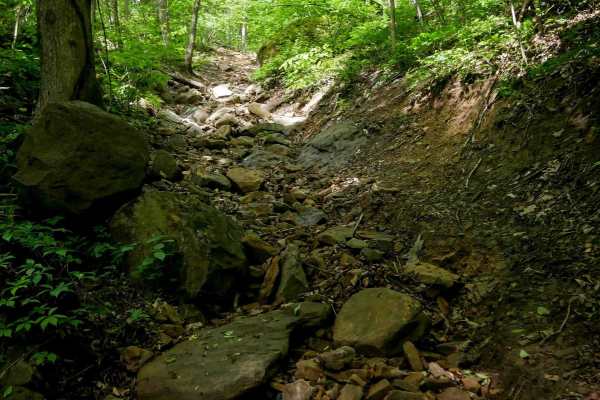
B53
B53 drops off of B50 into a rocky, narrow ravine and descends steeply from north to south. Though just 170 yards long, this short advanced trail is packed with technical features. The tight path is lined closely by a couple of trees and filled with large loose river rock, boulders, and foot-high dro...
Learn more about B53
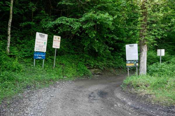
RH 10
At 7.3 miles, RH 10 is a long, easy trail that serves as one of the main access routes from the Rock House staging area--expect to see other riders. The trail follows a pipeline through scenic, lush forest with wide sections, shallow ruts, switchbacks, puddles, and occasional minor rock or uneven gr...
Learn more about RH 10
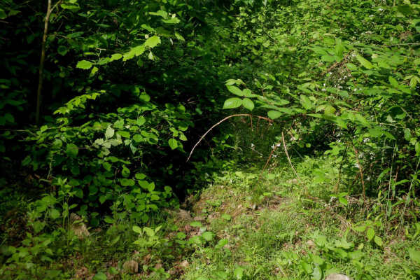
B195
B195 is a faint and overgrown dirt bike-only route that spans approximately one mile. It's clearly not very trafficked, with low-hanging branches, poor visibility, and minimal signs of recent use. Riders should be prepared for potential downed logs--several were encountered, including one at head he...
Learn more about B195
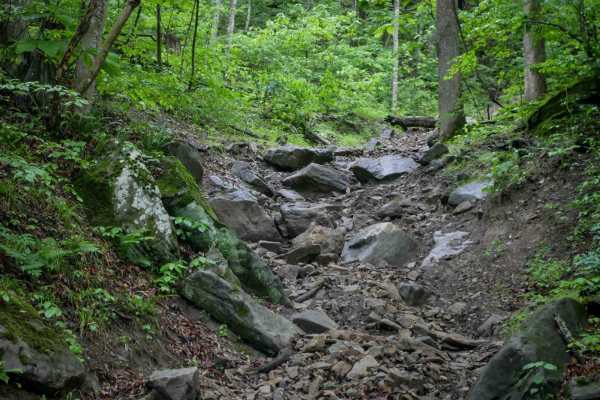
B79
Trail 79 is a short 130-yard advanced loop off Trail 14, offering a quick technical challenge for experienced drivers. When driven counterclockwise, it begins with a steep, loose, and rutted climb, then transitions into a more difficult rocky descent filled with large boulders, log debris, and 1-2 f...
Learn more about B79
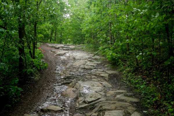
RH 29
RH 29 is a more challenging trail best suited for intermediate riders, and can be even more difficult in wet conditions. Starting from the north, it immediately presents embedded rock layers forming 6-inch ledges along a narrow path, followed by loose rock as it curves across a hillside. The trail n...
Learn more about RH 29
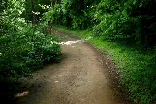
B20
Trail B20 is a 3.3-mile easy access corridor located along the southern edge of the trail system. It winds gradually through lush woods with consistent curves and moderate elevation change. The route features waterbars, shallow ruts, and occasional embedded or loose rock, but remains manageable for ...
Learn more about B20
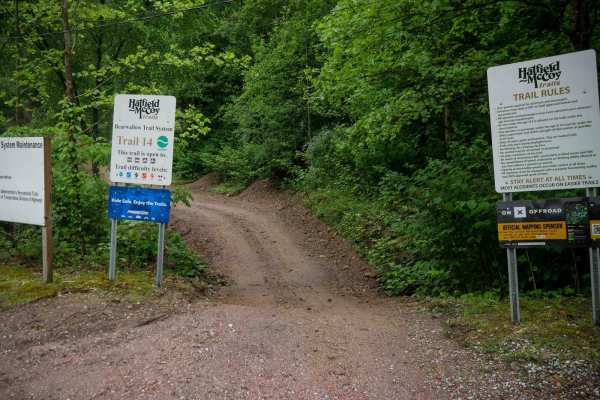
B14
B14 is a 2.5-mile easy access trail that begins at the Bearwallow parking lot and climbs gradually up the mountainside. It features a mix of narrow and wide sections along a shelfy path, with shallow ruts, loose rock, and large waterbars throughout. The trail has mostly gradual grades and corners, m...
Learn more about B14
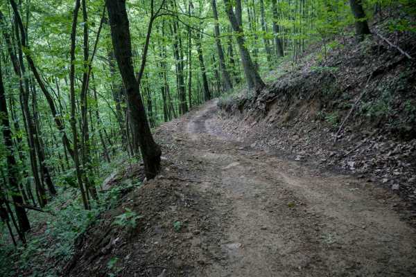
B24
B24 is a shelfy, one-lane-wide path with minor loose rock, traversing across a hillside. The surface is generally easy, but the trail is narrow and shelfy, requiring caution. When ridden clockwise as a loop, the trail gradually ascends the entire route, featuring tight, semi-steep switchbacks--espec...
Learn more about B24
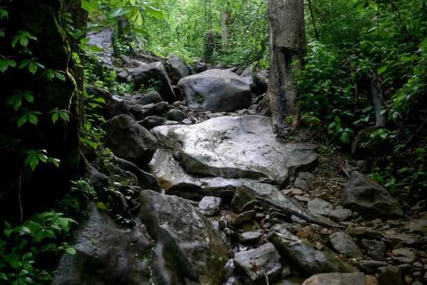
B80
This nearly half-mile trail climbs steadily through a tight, technical ravine filled with continuous rock obstacles (ascending east to west). Water runs down the ravine, creating a slick surface that challenges traction from the start. The ravine is packed with large loose rocks, boulders, downed lo...
Learn more about B80
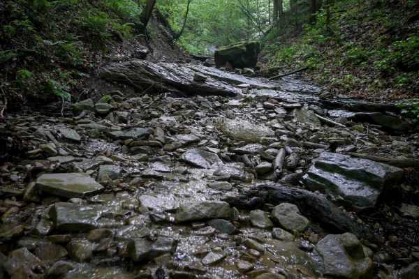
B76
B76 is a short but highly technical descent into a rocky ravine (from west to east). The upper section is steep and off-camber, filled with massive boulders, slick mossy rocks, and articulation points that will challenge even experienced drivers. Narrow passages between rock and dirt walls require c...
Learn more about B76
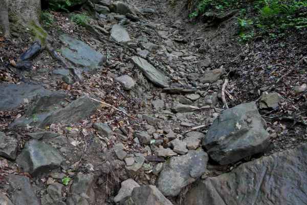
B87
This 280-yard advanced trail is packed with rock features and technical challenges. It splits off from trail 88 at a difficult section, with 88 acting more like a bypass around a steep descent of boulders and ledges. From the east end, trail 87 drops sharply into a rocky ravine lined with large boul...
Learn more about B87
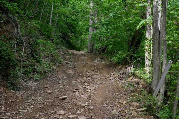
B50
B50 is a moderate, one-lane trail that offers a steady 1.8-mile climb when heading north. The route features minor shallow ruts, loose rock, and occasional mud puddles. It begins with a steeper grade before easing into a more gradual middle section, then climbs again more steeply toward the top. As ...
Learn more about B50
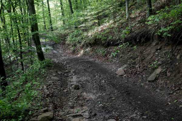
B93
This moderately easy 1.6-mile route starts near the staging area, and is a good start to your day trip with a bit more technical features. It features a mix of semi-steep grades and gradual climbs and descents over small hills. The path is one lane wide and shelfy in sections, with uneven ground, sh...
Learn more about B93
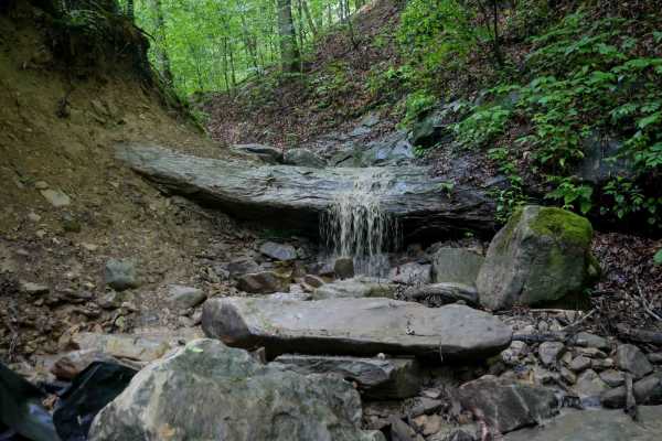
B81
B81 is a short loop off B14 - only 200 yards. When taken clockwise, the trail begins on a narrow path through overgrown bushes. It then doubles back on a tight hairpin turn that drops into a rocky, technical ravine. This section features a slickrock slab covered in water and a waterfall shelf with a...
Learn more about B81
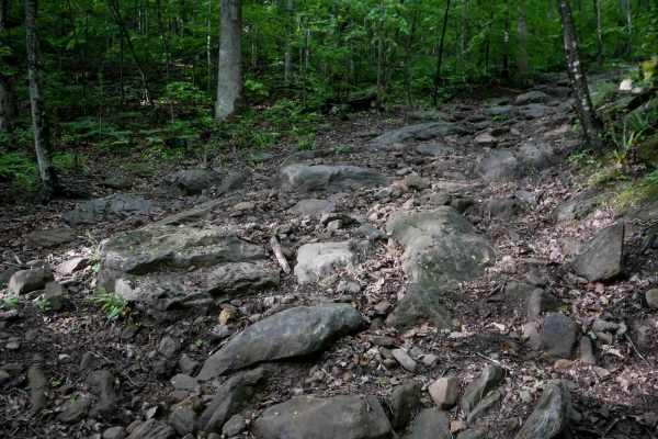
B88
This trail features a steep, shelfy descent under dense tree cover, with constant embedded rock obstacles, including boulders and shelves ranging from 1 to 3 feet tall. A slick leaf layer and greasy soil make traction difficult throughout the route. The trail follows a series of rock shelves on a st...
Learn more about B88
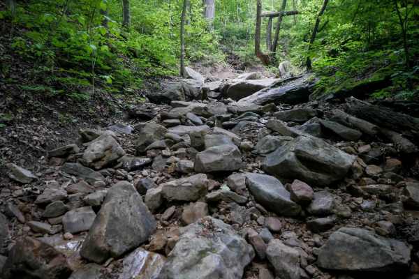
B77
This trail continues across trail 15 from the bottom of 78, following the same ravine. It is a bit steeper than 78, with huge boulders forming big uneven drop-offs with holes between the rocks. Drivers must carefully navigate between trees lining the narrow path. The mossy wet rocks create slippery ...
Learn more about B77
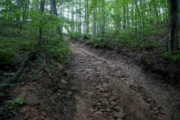
B92
This is a very steep and sustained half-mile climb from south to north, connecting B69 to B12. Most of the route is covered in smaller loose rocks, making traction a constant challenge. There are no large ledges or shelves, but the relentless incline and rocky surface make it more difficult. It's a ...
Learn more about B92
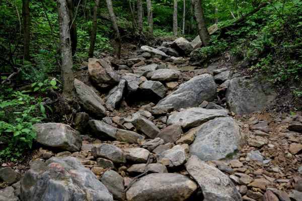
B78
This short 124-yard advanced trail drops into a rocky ravine off of B19. The ravine is wet with a stream running through it and is filled with large boulders. The path is narrow with drop-offs and difficult footing, making it really steep as you navigate over the rocks. The trail is tightly lined wi...
Learn more about B78
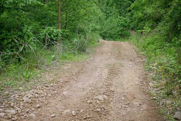
B43
B43 is a moderately easy trail less than a mile long that serves as an alternate connector through the middle of the trail system. The route includes a shelfy one-lane path that dips down to a stream crossing where the trail becomes slightly more rocky. Other sections are wider with only minor loose...
Learn more about B43
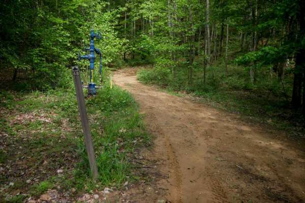
B68
B68 is a moderately easy, half-mile loop that connects B50 to B24. The trail traverses along the hilltop on a rugged but manageable path, with shallow ruts and minor loose rock. While there are some semi-steep grades, the overall difficulty remains low, making it a good connector for drivers looking...
Learn more about B68
ATV trails near Neibert, West Virginia
Explore ATV-friendly trails near you. These trails are accessible for vehicles up to 50 inches wide, perfect for ATVs and smaller off-road machines.
B53
B53 drops off of B50 into a rocky, narrow ravine and descends steeply from north to south. Though just 170 yards long, this short advanced trail is packed with technical features. The tight path is lined closely by a couple of trees and filled with large loose river rock, boulders, and foot-high dro...
Learn more about B53
RH 10
At 7.3 miles, RH 10 is a long, easy trail that serves as one of the main access routes from the Rock House staging area--expect to see other riders. The trail follows a pipeline through scenic, lush forest with wide sections, shallow ruts, switchbacks, puddles, and occasional minor rock or uneven gr...
Learn more about RH 10
B79
Trail 79 is a short 130-yard advanced loop off Trail 14, offering a quick technical challenge for experienced drivers. When driven counterclockwise, it begins with a steep, loose, and rutted climb, then transitions into a more difficult rocky descent filled with large boulders, log debris, and 1-2 f...
Learn more about B79
RH 29
RH 29 is a more challenging trail best suited for intermediate riders, and can be even more difficult in wet conditions. Starting from the north, it immediately presents embedded rock layers forming 6-inch ledges along a narrow path, followed by loose rock as it curves across a hillside. The trail n...
Learn more about RH 29
UTV/side-by-side trails near Neibert, West Virginia
Find UTV and side-by-side trails near you. These trails accommodate vehicles up to 60 inches wide, ideal for UTVs, side-by-sides, and wider off-road rigs.
B53
B53 drops off of B50 into a rocky, narrow ravine and descends steeply from north to south. Though just 170 yards long, this short advanced trail is packed with technical features. The tight path is lined closely by a couple of trees and filled with large loose river rock, boulders, and foot-high dro...
Learn more about B53
RH 10
At 7.3 miles, RH 10 is a long, easy trail that serves as one of the main access routes from the Rock House staging area--expect to see other riders. The trail follows a pipeline through scenic, lush forest with wide sections, shallow ruts, switchbacks, puddles, and occasional minor rock or uneven gr...
Learn more about RH 10
B79
Trail 79 is a short 130-yard advanced loop off Trail 14, offering a quick technical challenge for experienced drivers. When driven counterclockwise, it begins with a steep, loose, and rutted climb, then transitions into a more difficult rocky descent filled with large boulders, log debris, and 1-2 f...
Learn more about B79
RH 29
RH 29 is a more challenging trail best suited for intermediate riders, and can be even more difficult in wet conditions. Starting from the north, it immediately presents embedded rock layers forming 6-inch ledges along a narrow path, followed by loose rock as it curves across a hillside. The trail n...
Learn more about RH 29
The onX Offroad Difference
onX Offroad combines trail photos, descriptions, difficulty ratings, width restrictions, seasonality, and more in a user-friendly interface. Available on all devices, with offline access and full compatibility with CarPlay and Android Auto. Discover what you're missing today!
Open Trail Map