
Dirt Bike Trails
Near Matheny, West Virginia
Explore All Dirt Bike Trails Near Matheny, West Virginia
Dirt Bike Trails Near Matheny, West Virginia
Discover the best dirt bike trails near you. Browse trail maps, check difficulty ratings, and find your next adventure — whether you're looking for a quick ride or an all-day expedition.
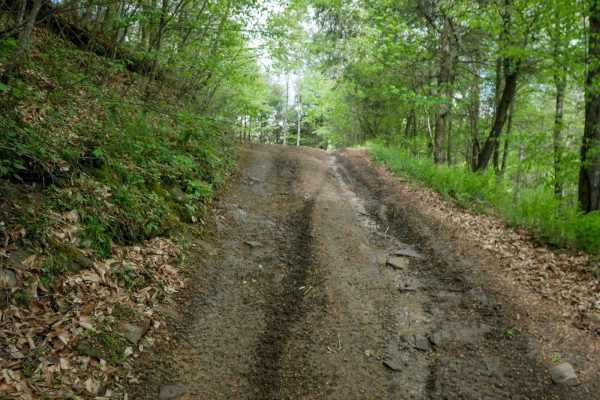
PC 33
PC 33 is a 0.6-mile connector between two segments of trail PC 18. It is fast and wide with shallow ruts and loose rock, running shelf-like along the hillside. While there are a few steeper sections, the trail remains generally easy and suitable for most riders. Its open layout and smooth flow make ...
Learn more about PC 33
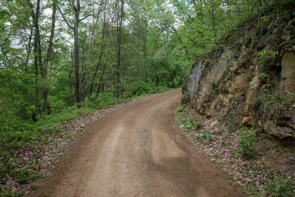
PC 31
PC 31 is a 1.3-mile, beginner-friendly route near the Pinnacle Creek staging area, making it a common starting point where riders may encounter other trail users. The trail is wide with shallow ruts, minor loose and embedded rock, and passes scenic rock walls. While it includes a few steeper section...
Learn more about PC 31

PC 38
PC 38 is a 0.6-mile easy connector that is smooth and wide, making it suitable for all skill levels. It features a moderate climb on the east end and a slightly steeper descent on the west, with shallow ruts, loose rock, and well-placed waterbars along the route. The trail runs shelf-like along the ...
Learn more about PC 38
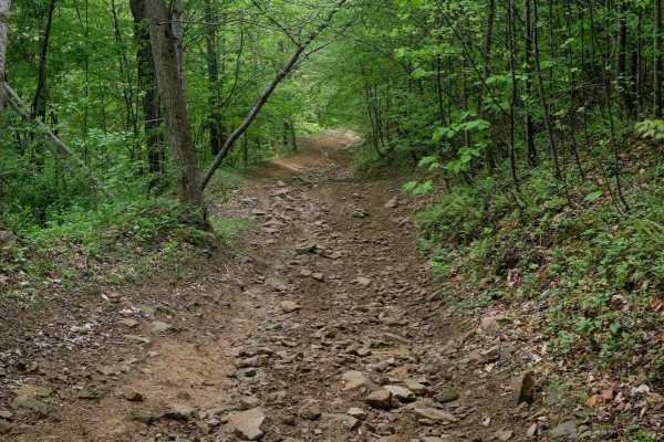
PC 35
PC 35 is a short connector--less than a quarter mile--linking trail PC 18 to PC 38. While still classified as easy, it features more ruts, loose rock, and a steeper grade than surrounding trails, along with a brief off-camber section. Its short length keeps it accessible, but riders should be prepar...
Learn more about PC 35
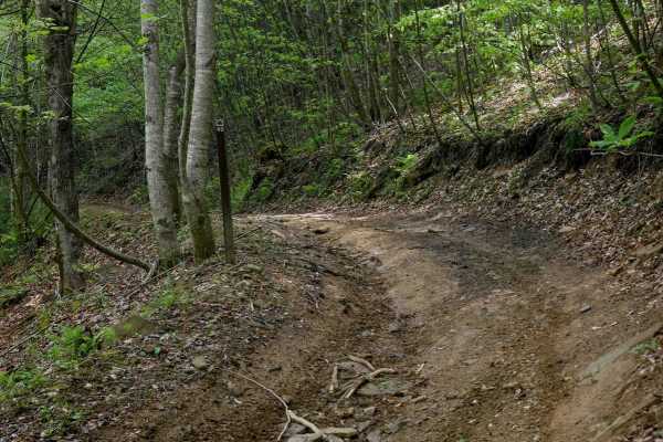
PC 40
PC 40 is a narrow, shelfy route that is smoother than the surrounding rocky trails, making it the easy connector option between parallel trails PC 92 and PC 93, which are more moderate. Lined with dense rhododendron, it offers a lush, jungle-like feel along the mountainside. Despite its uneven and n...
Learn more about PC 40
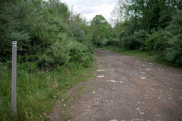
PC 18
PC 18 is a 2.1-mile route that descends steadily from south to north, starting as a fast, flowing option early in a ride from the Pinnacle Creek staging area. The trail runs shelf-like along the hillside with gradual and sometimes blind corners, water bars, and occasional mud puddles. A few large bu...
Learn more about PC 18
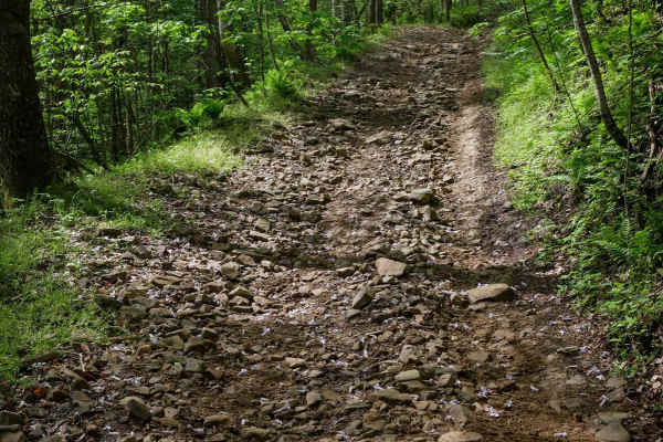
PC 91
PC 91 is a short but challenging 0.25-mile climb from north to south, marked by an extremely steep grade and a surface covered in loose rock. While there are no major ledges, the trail includes mild embedded rock layers and heavy loose rock of various sizes. The shelf-like route runs along the mount...
Learn more about PC 91
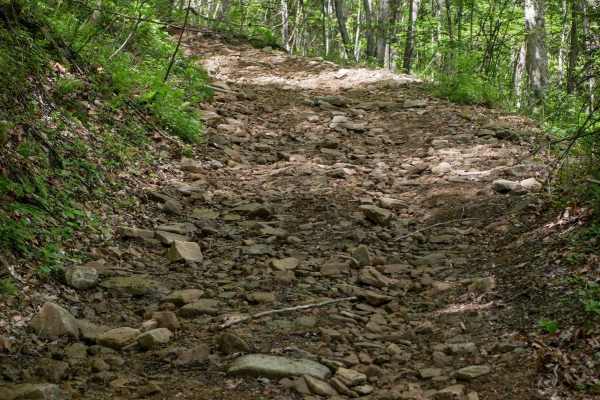
PC 93
PC 93 is a short, quarter-mile route with steep grades and loose, rocky terrain, similar in character to trails PC 91 and PC 92. It follows a shelf-like path along the hillside before dropping into a steep, rocky descent from west to east. The trail features softball-sized loose rocks, pronounced ru...
Learn more about PC 93

PC 55
PC 55 is a 2.5-mile-long ascent, with the steepest section at the south end. The north beginning features a wide, shelf-like, smooth path with excellent visibility for oncoming traffic, allowing room for two-way travel. As the trail turns up the hill, it narrows and follows a shelf along a lush, for...
Learn more about PC 55

PC 45
PC 45 offers a steep climb with downed branches, minor loose rock, and embedded rock surfaces, along with a few rutted sections and waterbars. While it has some shelfy, narrow spots, the trail remains overall very easy. The lush jungle atmosphere provides plenty of shade, and small logs are scattere...
Learn more about PC 45

PC 92
Trail PC 92 is a 0.7-mile trail with a steep climb and descent, offering a moderately difficult ride with pronounced ruts and chunky embedded rock layers. The ascent is shelfy and steep, with loose rock and embedded surfaces similar to nearby PC 91. The trail appears less traveled, with grass growin...
Learn more about PC 92
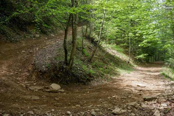
PC 61
PC 61 is a smooth and easy 0.8-mile shelf path connecting trails PC 12 and PC 55. The route is shaded with consistent tree coverage and features a few narrow sections with minor loose rock. As it descends from south to north, it includes several large, manageable hairpin switchbacks. Overall, it's a...
Learn more about PC 61
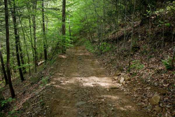
PC 56
PC 56 is a short, steep descent from south to north, featuring loose rock and shallow ruts. The narrow path winds under the trees, with loamy soil that can be slick when wet. Despite its steepness, the trail remains manageable for average riders, serving as a quick quarter-mile connector between tra...
Learn more about PC 56

PC 48
PC 48 is a short connector off of trail PC 45 that splits from the south end and climbs onto a higher elevated shelf above 45, following the curvature of the hillside. The trail is smooth and easy, with only minor loose rock, making it mostly a comfortable ride. It serves as a half-mile connector be...
Learn more about PC 48

PC 41
PC 41 begins at its north end off of trail PC 45, starting in the trees on a shelf-like path that climbs toward the intersection with trail PC 48. The trail features large hairpin corners with banked sides as it ascends the open hillsides under the power lines. It is rutted and uneven, with some min...
Learn more about PC 41
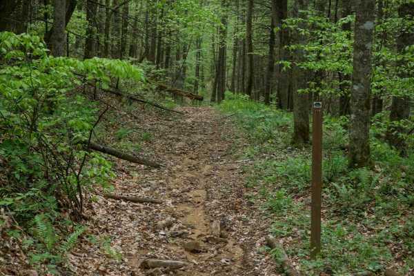
PC 119
PC 119 is a dirt bike-only route, though this designation is not clearly marked at the start of the trail. It begins as a wide path through the trees and descends steeply with ruts and significant leaf decay along the surface. A small stream crossing adds variety before the trail narrows into a shel...
Learn more about PC 119
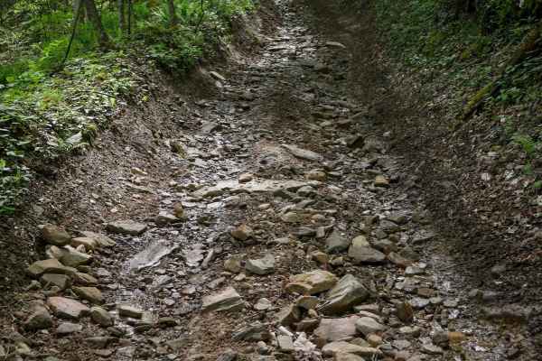
PC 82
PC 82 is a steep, rocky descent running south to north over less than half a mile. The trail follows a straight, shelf-like path along the mountainside with uneven ground and a heavily rutted, troughed surface filled with loose rock. Shaded and lush throughout, the descent is particularly steep, wit...
Learn more about PC 82
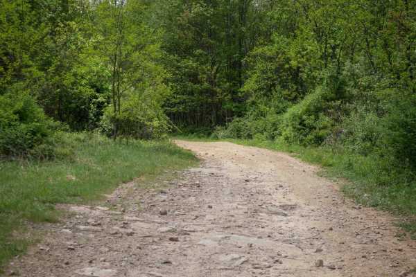
PC 19
PC 19 is a 3.7-mile route that begins as a wide path along the hilltops with minor embedded rock and transitions into tall forested areas with patches of black, coal-like dirt. The trail weaves gently beneath power lines and through open forest sections, featuring wide, gradual switchbacks. It provi...
Learn more about PC 19
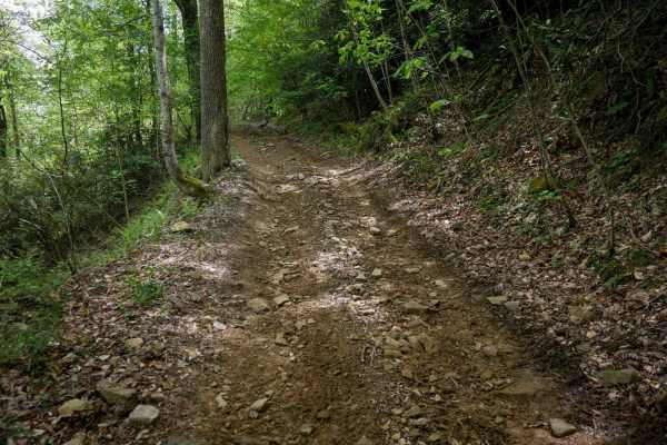
PC 81
PC 81 is a short, quarter-mile climb from north to south, beginning with a steep ascent from PC 52. The narrow path is marked by ruts, loose rock, and embedded rock, making the initial section a challenging climb. After the steep start, the trail flattens out before reaching its intersection with PC...
Learn more about PC 81
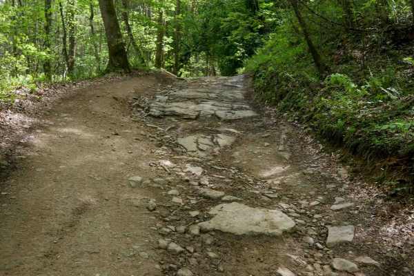
PC 16
PC 16 is a 2.6-mile route that begins with a mostly gradual descent from the north end. It starts wide along the hilltop with open skies, featuring big sweeping corners, waterbars, mud puddles, and minor embedded rock layers. The trail becomes steeper and faster as it drops, with loose dirt over emb...
Learn more about PC 16
ATV trails near Matheny, West Virginia
Explore ATV-friendly trails near you. These trails are accessible for vehicles up to 50 inches wide, perfect for ATVs and smaller off-road machines.
PC 33
PC 33 is a 0.6-mile connector between two segments of trail PC 18. It is fast and wide with shallow ruts and loose rock, running shelf-like along the hillside. While there are a few steeper sections, the trail remains generally easy and suitable for most riders. Its open layout and smooth flow make ...
Learn more about PC 33
PC 31
PC 31 is a 1.3-mile, beginner-friendly route near the Pinnacle Creek staging area, making it a common starting point where riders may encounter other trail users. The trail is wide with shallow ruts, minor loose and embedded rock, and passes scenic rock walls. While it includes a few steeper section...
Learn more about PC 31
PC 38
PC 38 is a 0.6-mile easy connector that is smooth and wide, making it suitable for all skill levels. It features a moderate climb on the east end and a slightly steeper descent on the west, with shallow ruts, loose rock, and well-placed waterbars along the route. The trail runs shelf-like along the ...
Learn more about PC 38
PC 35
PC 35 is a short connector--less than a quarter mile--linking trail PC 18 to PC 38. While still classified as easy, it features more ruts, loose rock, and a steeper grade than surrounding trails, along with a brief off-camber section. Its short length keeps it accessible, but riders should be prepar...
Learn more about PC 35
UTV/side-by-side trails near Matheny, West Virginia
Find UTV and side-by-side trails near you. These trails accommodate vehicles up to 60 inches wide, ideal for UTVs, side-by-sides, and wider off-road rigs.
PC 33
PC 33 is a 0.6-mile connector between two segments of trail PC 18. It is fast and wide with shallow ruts and loose rock, running shelf-like along the hillside. While there are a few steeper sections, the trail remains generally easy and suitable for most riders. Its open layout and smooth flow make ...
Learn more about PC 33
PC 31
PC 31 is a 1.3-mile, beginner-friendly route near the Pinnacle Creek staging area, making it a common starting point where riders may encounter other trail users. The trail is wide with shallow ruts, minor loose and embedded rock, and passes scenic rock walls. While it includes a few steeper section...
Learn more about PC 31
PC 38
PC 38 is a 0.6-mile easy connector that is smooth and wide, making it suitable for all skill levels. It features a moderate climb on the east end and a slightly steeper descent on the west, with shallow ruts, loose rock, and well-placed waterbars along the route. The trail runs shelf-like along the ...
Learn more about PC 38
PC 35
PC 35 is a short connector--less than a quarter mile--linking trail PC 18 to PC 38. While still classified as easy, it features more ruts, loose rock, and a steeper grade than surrounding trails, along with a brief off-camber section. Its short length keeps it accessible, but riders should be prepar...
Learn more about PC 35
The onX Offroad Difference
onX Offroad combines trail photos, descriptions, difficulty ratings, width restrictions, seasonality, and more in a user-friendly interface. Available on all devices, with offline access and full compatibility with CarPlay and Android Auto. Discover what you're missing today!
Open Trail Map