
Dirt Bike Trails
Near Madison, West Virginia
Explore All Dirt Bike Trails Near Madison, West Virginia
Dirt Bike Trails Near Madison, West Virginia
Discover the best dirt bike trails near you. Browse trail maps, check difficulty ratings, and find your next adventure — whether you're looking for a quick ride or an all-day expedition.
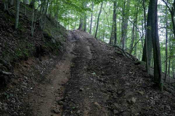
IB 59
IB 59 is a short 260-yard connector between IB 45 and IB 46 on the eastern edge of the trail system. The trail features a steep grade with deep ruts, embedded rocks, and loose rock throughout. It includes mostly straight descending sections with one large corner. Despite its short length, the steep ...
Learn more about IB 59
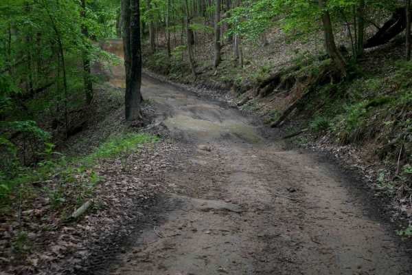
IB 46
IB 46 is a 1.4-mile trail that completes the loop with IB 45 along the eastern edge of the trail system. It features a smooth, wide path with good visibility, shallow ruts, and minimal loose rock. The trail has wide, easy corners and maintains a gradual grade throughout, making it a good option for ...
Learn more about IB 46
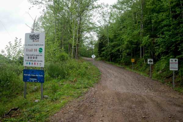
IB 10
This 3.7-mile trail serves as a primary access route from the Ivy Branch parking lot. It is very wide and generally smooth, with only minor ruts and some sections of loose rock. A paved portion is located on the northern end. In the beginning, the trail climbs steadily to an overlook at 1,096 feet i...
Learn more about IB 10

IB 36
IB 36 is a short, easy 0.6-mile route that runs parallel to a section of IB 10. This wide trail features shallow ruts, small dips, and water bars but remains manageable for most vehicles. The route passes through a lush forest of moss-covered trees and dense undergrowth, with a thick layer of decomp...
Learn more about IB 36
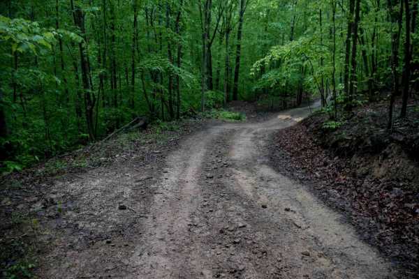
IB 43
IB 43 is a short quarter-mile connector trail linking IB 36 and IB 10. It follows a narrower shelf cut into the hillside, with shallow ruts, minor loose rock, and uneven ground that may require slower speeds. The trail winds through a dense forest of white ash and yellow birch beneath a thick leafy ...
Learn more about IB 43
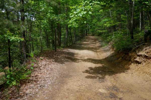
IB 66
IB 66 is a 0.7-mile trail that is mostly easy, with a generally smooth surface and minor ruts and loose rock. It features a slightly steeper grade in the middle, a few sharper turns, a small ridge section, and a shallow stream crossing through Ivy Creek on the north end. Easy overall and suitable fo...
Learn more about IB 66
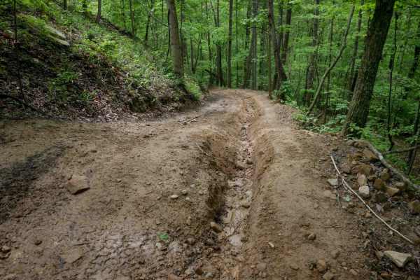
IB 45
IB 45 is a 2-mile trail along the eastern edge of the system, starting from the north with deep ruts--often along the sides and sometimes down the center--along with natural uneven surfaces creating small drop-offs. The northern section includes loose rock, tight switchbacks, steep grades, large wat...
Learn more about IB 45
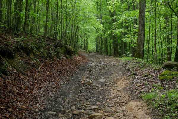
IB 35
IB 35 is a 0.8-mile trail that begins with a shallow but extended stream crossing off IB 13 through Ivy Creek, and gradually climbs southward to connect with IB 40. The path is uneven and rutted, with loose rock throughout, but the climb remains moderate and steady. Overall, it's a moderately easy t...
Learn more about IB 35
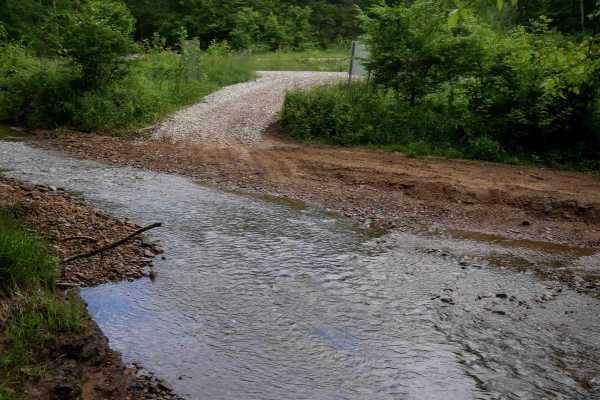
IB 39
IB 39 is a 1.3-mile trail on the eastern edge of the trail system, starting at IB 15 on the north end near the train track, and ending at IB 45 on the south end. The trail features shallow ruts, loose rock, and embedded flat rock layers that do not add significant difficulty. It includes wide, smoot...
Learn more about IB 39
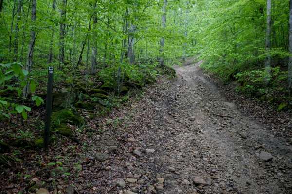
IB 38
IB 38 is a 0.8-mile trail that begins on the north end with a semi-steep ascent, loose rocks, ruts, and embedded larger rocks for the first quarter mile. It includes waterbars and then climbs to the hilltops, transitioning into a wider, flatter trail with a gradual, smooth grade. Overall, it's an ea...
Learn more about IB 38
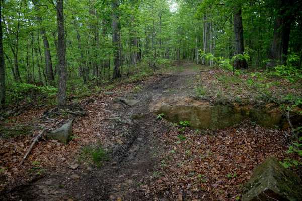
IB 161
IB 161 is a dirt bike trail that enters the woods along a small ridge under a dense tree canopy. It features a fairly wide path that meanders tightly through the trees, with moderate obstacles including small rock ledges a foot tall. A heavy layer of decaying leaves can obscure roots and embedded ro...
Learn more about IB 161
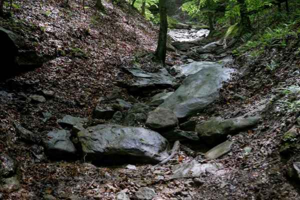
IB 85
IB 85 is a short, advanced 230-yard trail that drops into a tight ravine with off-camber walls (downhill from south to north). Embedded slick boulders create large drop-offs, and the constant loose big rocks make it difficult to maintain traction. The mossy forest traps moisture, with a heavy layer ...
Learn more about IB 85
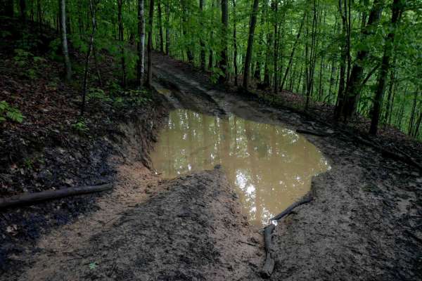
IB 69
IB 69 is a short, narrow trail with numerous mud puddles throughout, some of which have bypasses. The surface is smooth and free of rocks or roots, but has big dips in and out of the puddles, along a shelf-like path along a hillside. The trail is easy overall but can become slick and greasy when wet...
Learn more about IB 69
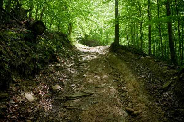
IB 65
IB 65 begins with a shallow, easy stream crossing through Ivy Creek, followed by a steep, rutted climb with loose rocks and embedded rock layers. A steep switchback continues the ascent, with rock and stick debris filling the ruts. The trail eventually levels out on the hilltop. Due to the sustained...
Learn more about IB 65

IB 64
IB 64 is a narrow, intermediate-level spur trail that begins and ends at IB 55, climbing steeply for approximately 230 yards from east to west. The trail is heavily rutted, with foot-deep ruts on either side, and the whole trail is dug out several feet below the forest floor, exposing the moss-cover...
Learn more about IB 64

IB 24
IB 24 forms a 1.5-mile loop off of IB 12, winding through lush, mossy forest with consistent shade and greenery. This one-lane-width trail is shelf-cut into the hillside, with gentle climbs and descents, shallow ruts, and mud puddles. Most loose rock is pushed to the sides, but the ground remains un...
Learn more about IB 24
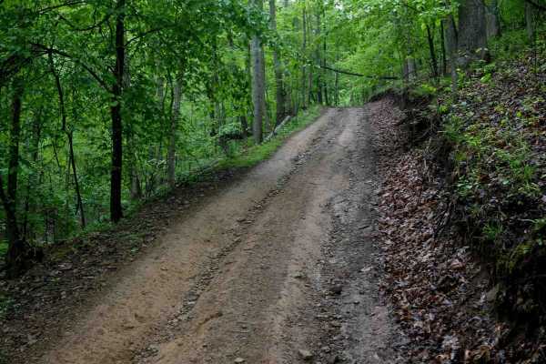
IB 47
IB 47 is a 0.8-mile loop off of IB 55 that offers a slightly more rugged experience while remaining easy and manageable for most drivers. The trail features a wide path with loose rock and noticeable ruts throughout. Gradual switchbacks climb steadily up small hills, with a steeper switchback near t...
Learn more about IB 47
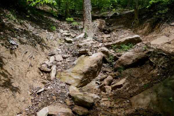
IB 82
From the north end, this trail drops down a steep, loose descent on a primitive hillside. Embedded boulders form tall ledges, and loose rock makes traction difficult. It enters a narrow ravine with logs down that could present clearance issues. As of the time of this review (May 2025), a tree blocka...
Learn more about IB 82
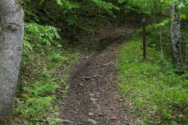
IB 134
IB 134 is a short dirt bike trail with a wide path and loamy soil covered in leaf decay and decomposing dirt. It follows a gradual shelf path up the hillside with no major obstacles, easily meandering through the forest. Riders should watch for occasional downed logs. This easy, flowy trail is well...
Learn more about IB 134
IB 68
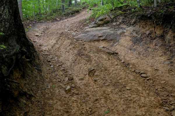
IB 68 is a narrow, one-lane-width trail with uneven terrain, ruts, loose rocks, and scattered mud puddles. It features several steep descending sections, including a notable rock ramp with embedded ledges about a foot tall that can be slick in wet conditions. Fallen logs and deep ruts continue along...
Learn more about IB 68
ATV trails near Madison, West Virginia
Explore ATV-friendly trails near you. These trails are accessible for vehicles up to 50 inches wide, perfect for ATVs and smaller off-road machines.
IB 59
IB 59 is a short 260-yard connector between IB 45 and IB 46 on the eastern edge of the trail system. The trail features a steep grade with deep ruts, embedded rocks, and loose rock throughout. It includes mostly straight descending sections with one large corner. Despite its short length, the steep ...
Learn more about IB 59
IB 46
IB 46 is a 1.4-mile trail that completes the loop with IB 45 along the eastern edge of the trail system. It features a smooth, wide path with good visibility, shallow ruts, and minimal loose rock. The trail has wide, easy corners and maintains a gradual grade throughout, making it a good option for ...
Learn more about IB 46
IB 10
This 3.7-mile trail serves as a primary access route from the Ivy Branch parking lot. It is very wide and generally smooth, with only minor ruts and some sections of loose rock. A paved portion is located on the northern end. In the beginning, the trail climbs steadily to an overlook at 1,096 feet i...
Learn more about IB 10
IB 36
IB 36 is a short, easy 0.6-mile route that runs parallel to a section of IB 10. This wide trail features shallow ruts, small dips, and water bars but remains manageable for most vehicles. The route passes through a lush forest of moss-covered trees and dense undergrowth, with a thick layer of decomp...
Learn more about IB 36
UTV/side-by-side trails near Madison, West Virginia
Find UTV and side-by-side trails near you. These trails accommodate vehicles up to 60 inches wide, ideal for UTVs, side-by-sides, and wider off-road rigs.
IB 59
IB 59 is a short 260-yard connector between IB 45 and IB 46 on the eastern edge of the trail system. The trail features a steep grade with deep ruts, embedded rocks, and loose rock throughout. It includes mostly straight descending sections with one large corner. Despite its short length, the steep ...
Learn more about IB 59
IB 46
IB 46 is a 1.4-mile trail that completes the loop with IB 45 along the eastern edge of the trail system. It features a smooth, wide path with good visibility, shallow ruts, and minimal loose rock. The trail has wide, easy corners and maintains a gradual grade throughout, making it a good option for ...
Learn more about IB 46
IB 10
This 3.7-mile trail serves as a primary access route from the Ivy Branch parking lot. It is very wide and generally smooth, with only minor ruts and some sections of loose rock. A paved portion is located on the northern end. In the beginning, the trail climbs steadily to an overlook at 1,096 feet i...
Learn more about IB 10
IB 36
IB 36 is a short, easy 0.6-mile route that runs parallel to a section of IB 10. This wide trail features shallow ruts, small dips, and water bars but remains manageable for most vehicles. The route passes through a lush forest of moss-covered trees and dense undergrowth, with a thick layer of decomp...
Learn more about IB 36
The onX Offroad Difference
onX Offroad combines trail photos, descriptions, difficulty ratings, width restrictions, seasonality, and more in a user-friendly interface. Available on all devices, with offline access and full compatibility with CarPlay and Android Auto. Discover what you're missing today!
Open Trail Map