
Dirt Bike Trails
Near Lake Lorraine, Florida
Explore All Dirt Bike Trails Near Lake Lorraine, Florida
Dirt Bike Trails Near Lake Lorraine, Florida
Discover the best dirt bike trails near you. Browse trail maps, check difficulty ratings, and find your next adventure — whether you're looking for a quick ride or an all-day expedition.
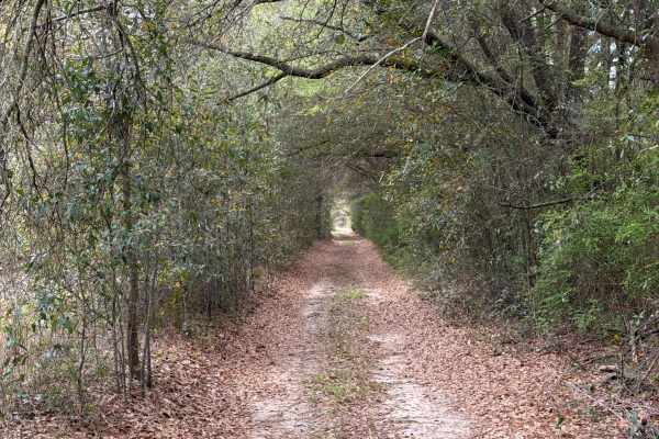
Johnny Parker Road
Johnny Parker Road connects Boundary Line Road at the west end and US 90 at the east end. It is a 2-mile-long trail that takes you through the southeast part of the Blackwater River State Forest and gives you access to several OHV and off-road trails. The road conditions are a mixture of packed sand...
Learn more about Johnny Parker Road
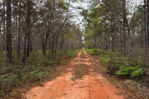
J 50
Forest Road J 50 connects Boundary Line Road at the west end and Johnny Parker Road at the east end. It is a 3-mile-long trail that takes you through the southeast part of the Blackwater River State Forest and gives you access to several OHV and off-road trails. The road conditions are a mixture of ...
Learn more about J 50
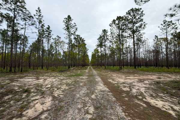
J 57
Forest Road J 57 is a dead end road that starts at the Johnny Parker Road. It is a 2 miles long trail that takes you through the south east part of the Blackwater River State Forest and gives you access to several OHV and off-road trails and a hiking trail down to Blackwater River. The road conditio...
Learn more about J 57
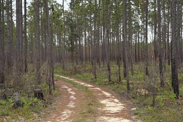
J 56
Forest Road J 56 connects Boundary Line Road at the west end and Johnny Parker Road at the east end. It is a 2-mile-long trail that takes you through the southeast part of the Blackwater River State Forest and gives you access to several OHV and off-road trails. The road conditions are a mixture of ...
Learn more about J 56
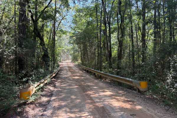
Shammah Road - FS J37
Shammah Road - FS J37 is a dead-end road that starts at the Bryant Bridge Road. It is a short trail that takes you through the southeast part of the Blackwater River State Forest and gives you access to Blackwater Joe's Canoes, Cabins, and Camping, and a few hiking trails to the Blackwater River. Th...
Learn more about Shammah Road - FS J37
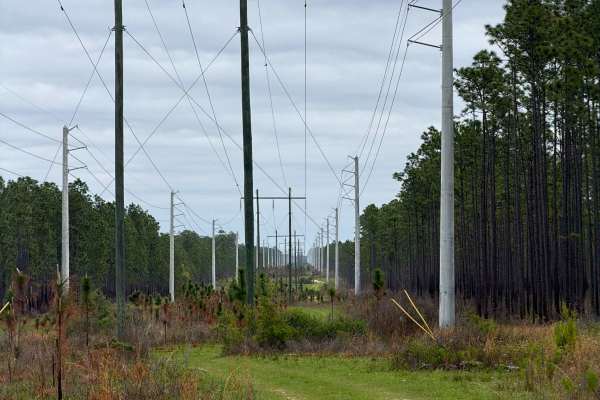
J 54
Forest Road J 54 connects Boundary Line Road at the west end and FR J 57 at the east end. It is a 2-mile-long trail that takes you through the southeast part of the Blackwater River State Forest and gives you access to several OHV and off-road trails. The west part of the trail takes you along the p...
Learn more about J 54
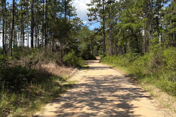
FS J221
Forest Road J221 is a dead-end road that starts at the Bryant Bridge Road. It is a short trail that takes you through the southeast part of the Blackwater River State Forest and gives you access to a public boat ramp for kayaks and a few hiking trails to the Blackwater River. The road conditions are...
Learn more about FS J221
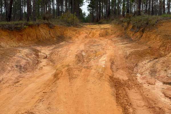
J 45
Forest Road J 45 connects Boundary Line Road at the south end and FR J 40 at the north end. It is a short trail that takes you through the southeast part of the Blackwater River State Forest and gives you access to a few OHV and off-road trails. The road conditions are a mixture of packed sand, loos...
Learn more about J 45
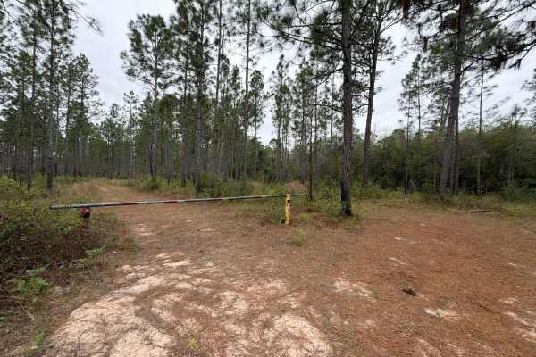
J 121
Forest Road J 121 is a dead-end road that starts at Bob Pitts Road. It is a short trail that takes you through the southeast part of the Blackwater River State Forest and gives you access to several OHV and off-road trails along the Shingle Branch, and ends at a hiking trail to the Blackwater River....
Learn more about J 121
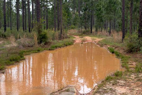
J 70
Forest Road J 70 is a dead-end road that starts at FR 61. It is a short trail that takes you through the southeast part of the Blackwater River State Forest and takes you to a camping and swimming spot at the Blackwater River. The road conditions are a mixture of packed sand, loose sand, and some de...
Learn more about J 70
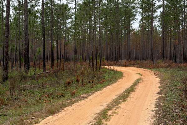
J 46
Forest Road J 46 is a dead-end road that starts at Boundary Line Road. It is a 2-mile-long trail that takes you through the southeast part of the Blackwater River State Forest and gives you access to several OHV and off-road trails, and ends at a beautiful swimming area and kayak launch. The road co...
Learn more about J 46
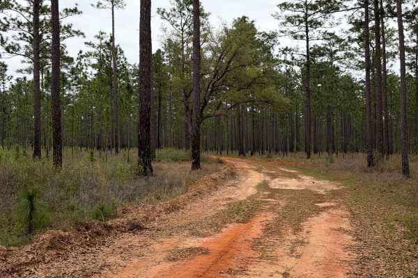
F 82
Forest Road F 82 is a loop trail that starts and ends at the Bryant Bridge Road. It is a short trail that takes you through the southeast part of the Blackwater River State Forest and gives you access to several OHV and off-road trails in the Shingle Branch District. The road conditions are a mixtur...
Learn more about F 82

Sandbar Camp
This trail offers a challenging yet rewarding ride, featuring deep water holes that can vary in depth depending on recent rainfall. Along the way, you'll find ample off-grid camping opportunities, making it a great spot to set up for a night under the stars. One of the highlights is its access to th...
Learn more about Sandbar Camp
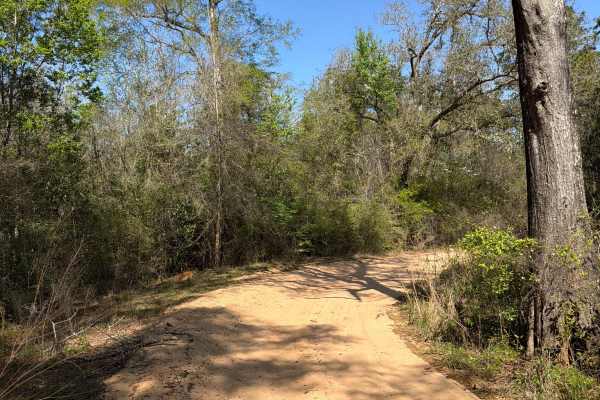
Penny Creek Road
Penny Creek Road is a dead-end road that starts at the Yow Road. It is a short trail that takes you through the southeast part of the Blackwater River State Forest and takes you to one of the most unique camping and swimming spots at the Blackwater River. The road conditions are a mixture of packed ...
Learn more about Penny Creek Road
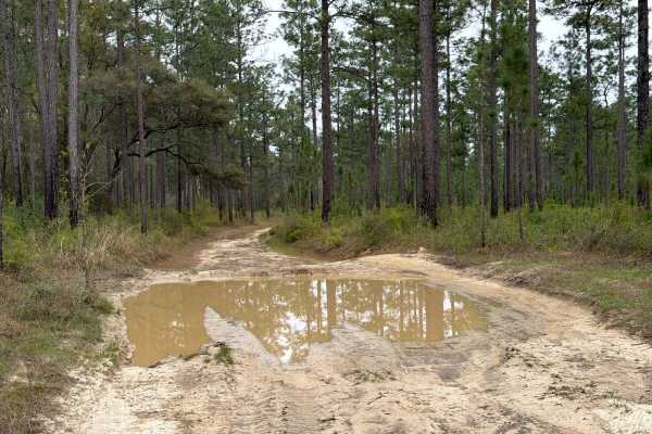
J 81
Forest Road J 81 is a dead-end road that starts at Bob Pitts Road. It is a short trail that takes you through the southeast part of the Blackwater River State Forest and gives you access to several OHV and off-road trails along the Shingle Branch, and ends at a hiking trail to the Blackwater River. ...
Learn more about J 81
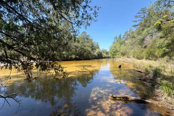
B 68
Forest Road B 68 is a dead-end road that starts at Penny Creek Road. It is a short trail that takes you through the southeast part of the Blackwater River State Forest and takes you to a camping and swimming spot at the Blackwater River. The road conditions are a mixture of packed sand, loose sand, ...
Learn more about B 68
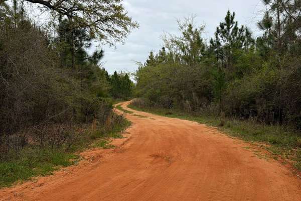
J 61
Forest Road J 61 is a dead-end road that starts at Bob Pitts Road. It is a 2.3-mile-long trail that takes you through the southeast part of the Blackwater River State Forest and takes you to a camping and swimming spot at the Blackwater River. The road conditions are a mixture of packed sand, loose ...
Learn more about J 61
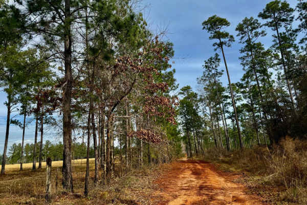
J39
This chill and scenic trail winds through a beautiful landscape, hugging the edge of private land. The route is mostly easygoing, but be prepared for a few deep mud holes that can add a bit of excitement, especially after rain. A peaceful ride with great views and a touch of adventure, this trail is...
Learn more about J39
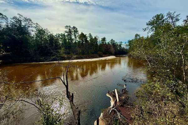
Bass Bud Road
This main thoroughfare serves as a key route through the area, offering numerous side trails and offshoots for further exploration. The road itself is fairly straightforward, making for an easy and efficient way to navigate the forest. Whether you're using it as a primary access road or venturing of...
Learn more about Bass Bud Road
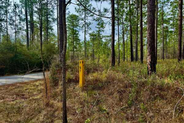
Florida State F61
F61 feels like a forest trail, taking you deep into the wilderness as it rises into the pine forest and drier terrain. This unmaintained route is rugged and raw, offering an authentic backcountry experience. Along the way, you'll pass through a large burn area, a striking reminder of nature's power ...
Learn more about Florida State F61
ATV trails near Lake Lorraine, Florida
Explore ATV-friendly trails near you. These trails are accessible for vehicles up to 50 inches wide, perfect for ATVs and smaller off-road machines.
Johnny Parker Road
Johnny Parker Road connects Boundary Line Road at the west end and US 90 at the east end. It is a 2-mile-long trail that takes you through the southeast part of the Blackwater River State Forest and gives you access to several OHV and off-road trails. The road conditions are a mixture of packed sand...
Learn more about Johnny Parker Road
J 50
Forest Road J 50 connects Boundary Line Road at the west end and Johnny Parker Road at the east end. It is a 3-mile-long trail that takes you through the southeast part of the Blackwater River State Forest and gives you access to several OHV and off-road trails. The road conditions are a mixture of ...
Learn more about J 50
J 57
Forest Road J 57 is a dead end road that starts at the Johnny Parker Road. It is a 2 miles long trail that takes you through the south east part of the Blackwater River State Forest and gives you access to several OHV and off-road trails and a hiking trail down to Blackwater River. The road conditio...
Learn more about J 57
J 56
Forest Road J 56 connects Boundary Line Road at the west end and Johnny Parker Road at the east end. It is a 2-mile-long trail that takes you through the southeast part of the Blackwater River State Forest and gives you access to several OHV and off-road trails. The road conditions are a mixture of ...
Learn more about J 56
UTV/side-by-side trails near Lake Lorraine, Florida
Find UTV and side-by-side trails near you. These trails accommodate vehicles up to 60 inches wide, ideal for UTVs, side-by-sides, and wider off-road rigs.
Johnny Parker Road
Johnny Parker Road connects Boundary Line Road at the west end and US 90 at the east end. It is a 2-mile-long trail that takes you through the southeast part of the Blackwater River State Forest and gives you access to several OHV and off-road trails. The road conditions are a mixture of packed sand...
Learn more about Johnny Parker Road
J 50
Forest Road J 50 connects Boundary Line Road at the west end and Johnny Parker Road at the east end. It is a 3-mile-long trail that takes you through the southeast part of the Blackwater River State Forest and gives you access to several OHV and off-road trails. The road conditions are a mixture of ...
Learn more about J 50
J 57
Forest Road J 57 is a dead end road that starts at the Johnny Parker Road. It is a 2 miles long trail that takes you through the south east part of the Blackwater River State Forest and gives you access to several OHV and off-road trails and a hiking trail down to Blackwater River. The road conditio...
Learn more about J 57
J 56
Forest Road J 56 connects Boundary Line Road at the west end and Johnny Parker Road at the east end. It is a 2-mile-long trail that takes you through the southeast part of the Blackwater River State Forest and gives you access to several OHV and off-road trails. The road conditions are a mixture of ...
Learn more about J 56
The onX Offroad Difference
onX Offroad combines trail photos, descriptions, difficulty ratings, width restrictions, seasonality, and more in a user-friendly interface. Available on all devices, with offline access and full compatibility with CarPlay and Android Auto. Discover what you're missing today!
Open Trail Map