
Dirt Bike Trails
Near Lake City, South Carolina
Explore All Dirt Bike Trails Near Lake City, South Carolina
Dirt Bike Trails Near Lake City, South Carolina
Discover the best dirt bike trails near you. Browse trail maps, check difficulty ratings, and find your next adventure — whether you're looking for a quick ride or an all-day expedition.
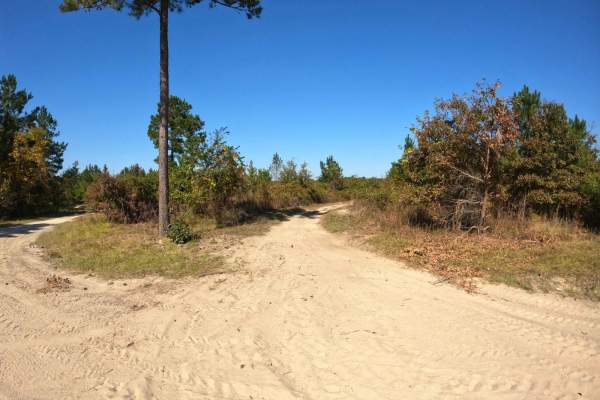
Devine Drive
The trail is well-maintained, wide, and features compact sand, making it relatively easy. Starting from the southern section near Lola's Loop, the trail is wide and dusty, offering little challenge. However, as you approach the intersection near Monies Hollow, it gradually narrows and becomes muddie...
Learn more about Devine Drive
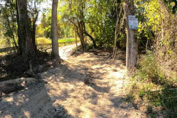
Monies Hollow
This is a single-lane trail that follows the gas line to Devine Drive at the western edge of the property. This trail is mostly comprised of compact sand and has several sections prone to standing water, with no bypass available. The sections of standing water are long and potentially deep. The trai...
Learn more about Monies Hollow
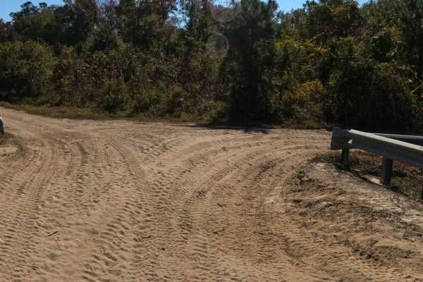
RCS Track
RCS Track is a single-lane trail, with plenty of areas to pass, that is mostly comprised of compact sand. Several low areas exist where mud pits have formed after heavy rain; bypass trails exist above all of them. This trail offers a little something for all abilities as well as cut-through access t...
Learn more about RCS Track
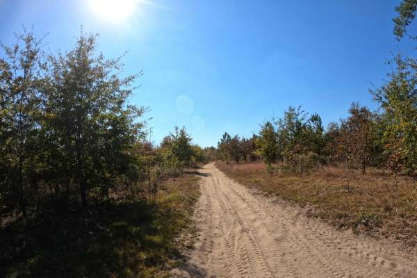
Tweety's Tweet
Tweety's Tweet is an easy, single-lane trail of compact sand that is great for bird-watching or escaping the crowds. Sitting higher than RCS Track, there is no mud on this trail, and it is seemingly less dusty than other trails in the area. However, the trail is narrow in most places, with very few ...
Learn more about Tweety's Tweet
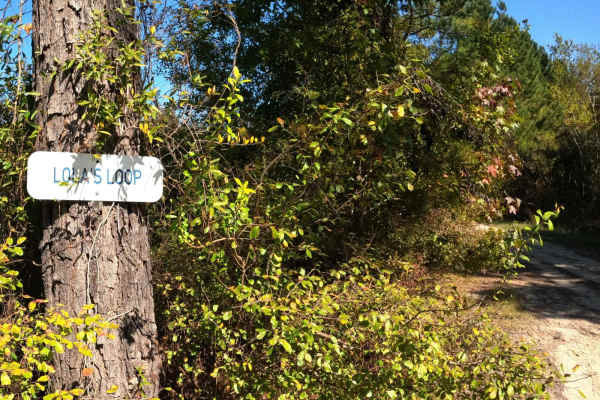
Lola's Loop
Lola's Loop is an easy, scenic cut-off that will bypass the area on Secret Passage that tends to have standing water. There is a deep rutted section on Lola's that you'll need to use caution around, however there is a wide bypass along the edge of it. It is more shaded in the afternoon if you're loo...
Learn more about Lola's Loop
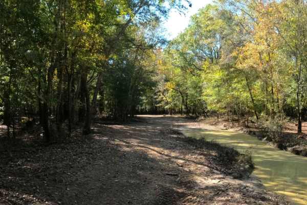
Paradise Way
This is a wide trail of mostly compact sand, with several seasonal mud holes along the way. As with Mercy Lane, when this trail approaches the gas line, a large mud pit exists and all bypasses around are deeply worn and rutted. As there isn't much past this mud pit, unless you're equipped for it, th...
Learn more about Paradise Way
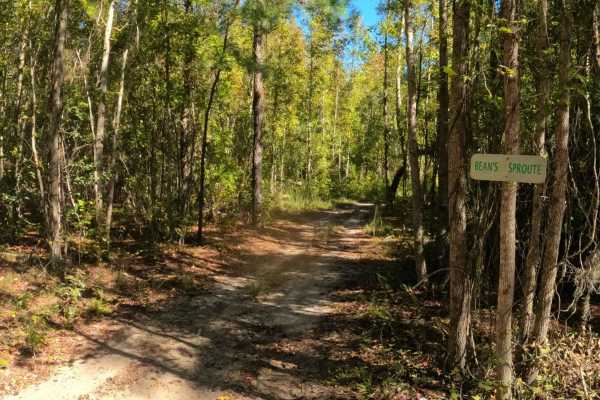
Bean Sprout
If you're looking for a little side trip off of Jordan's Circle to beat the crowds or cut the corner, then Bean Sprout is a nice option. It's also your only option. A winding single-lane trail of compact sand with no obstacles is a nice shortcut through the woods.
Learn more about Bean Sprout
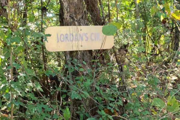
Jordan's Circle
This is a nice loop trail that will also give you access to other sections of the park. Most of the trail consists of hard-packed sand;however, the northern section of the loop is prone to minor flooding, and several mudholes and deep ruts exist that require a bypass through a narrow section of tree...
Learn more about Jordan's Circle
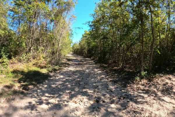
Barnhill Road
From fan-leaf palms and tall pines to green pastures and primeval swamps, this area of Riverneck offers a little bit of everything that makes the low country of South Carolina great. This is an easy trail with a few small mudholes that are easily bypassed. It is comprised of compact sand and wide en...
Learn more about Barnhill Road

Peacemaker's Way
This is a wide easy trail comprised of compact sand. There is a very nice picnic shelter near the intersection with Skipper's Road that is a great place to stop and take a break or use as a meet-up spot. There are no obstacles on this trail and it's large enough for two-way traffic.
Learn more about Peacemaker's Way
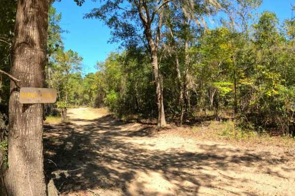
Barnes Road
This is a short spur trail that gives access to Jamey's Swamp Road from the intersection of Peacemaker's Way and Barnhill Road. This is a great way to bypass the cabins at the entrance to Jamey's Swamp Road. It's compact sand with no obstacles to note and wide enough for two-way traffic.
Learn more about Barnes Road
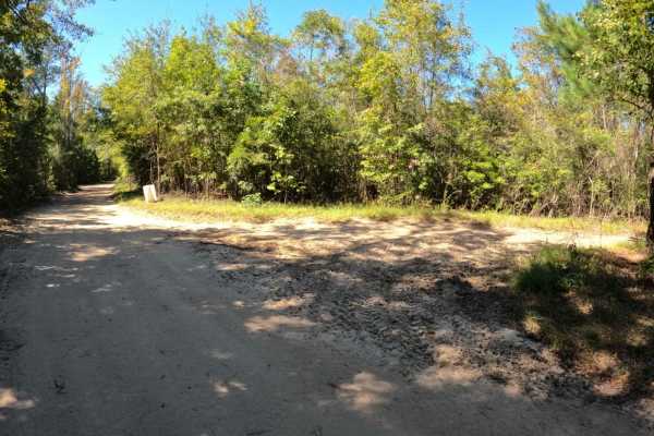
Uncle John's Pass
This trail is a cut-through between Jamey's Swamp Road and Barnhill Road. It's a single-lane trail with no obstacles comprised of compact sand. This trail is a great way to avoid any traffic that may be near the cabins at the end of Jamey's Swamp Road or as a way to head back in the direction of Res...
Learn more about Uncle John's Pass
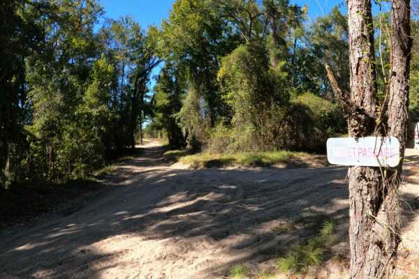
Secret Passage
This is a wide and well-maintained trail made of compact sand that gives access to several other trails in the system. There is one small area of water about midway through the trail, but it is shallow and easily passed along the edge. No other obstacles exist on this trail.
Learn more about Secret Passage
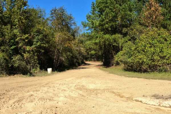
Jamey's Swamp Road
This is an easy scenic drive for those looking for more trails and less mud. The trail is mostly compacted sand and well-maintained, with plenty of room for passing traffic in most sections. You can access this trail via Mercy Lane or Peacemaker's Way. There are also several cut-throughs from Barnhi...
Learn more about Jamey's Swamp Road
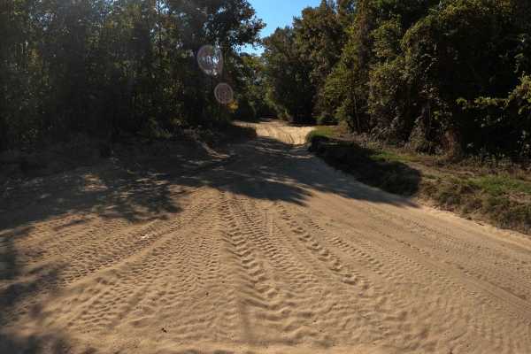
Skipper's Road
This is an easy, main-access trail to and from the campground and staging area. It is wide and well-maintained, comprised of compact sand with large sections of soft sand as you near the intersection with Peacemaker's Way. A high volume of traffic exists on this trail, so please use caution.
Learn more about Skipper's Road
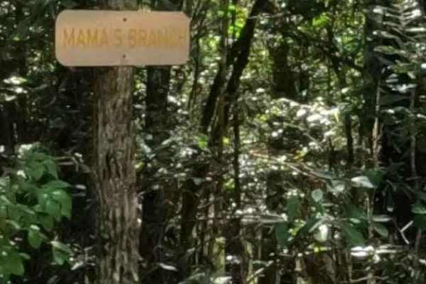
Mama's Branch
Mama's Branch is a beautiful trail into a bald cypress swamp land. The trail is subject to flooding, but when it's accessible, this is a highly recommended stop. The trail is mostly soft sand as it meanders through the trees, with several small areas of mud that are easily bypassed. Once at the rive...
Learn more about Mama's Branch
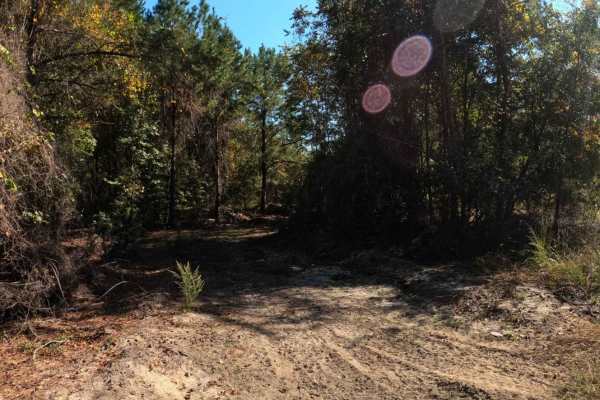
Andrew's Avenue
This is a narrow, single-lane trail mostly comprised of compact sand. The trail is often bypassed in favor of its bigger and faster brother, Skipper's Road, but Andrew's Avenue offers a nice and serene drive through the forest. However, it is slightly overgrown, so larger vehicles can expect pinstri...
Learn more about Andrew's Avenue
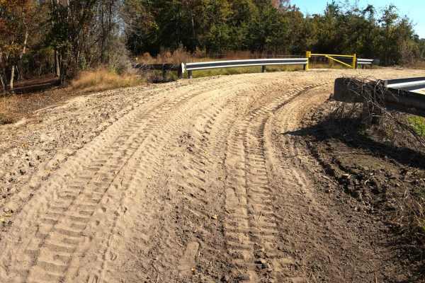
Loki Lane
This unmarked trail is a connector between Monies Hollow and Secret Passage. It's a wide trail comprised of mostly loose sand. This is a great option if you're looking to bypass the flooded section of Monies Hollow or if you're looking for a quick way to access Divine Drive.
Learn more about Loki Lane

Mercy Lane
This is an easy trail that's comprised of compact sand with some loose sections, primarily passing the intersection with Jamey's Swamp Road. As the trail approaches its end near the gas line, the mud holes and difficulty increase. There are bypasses around most, but they also tend to hold water as w...
Learn more about Mercy Lane
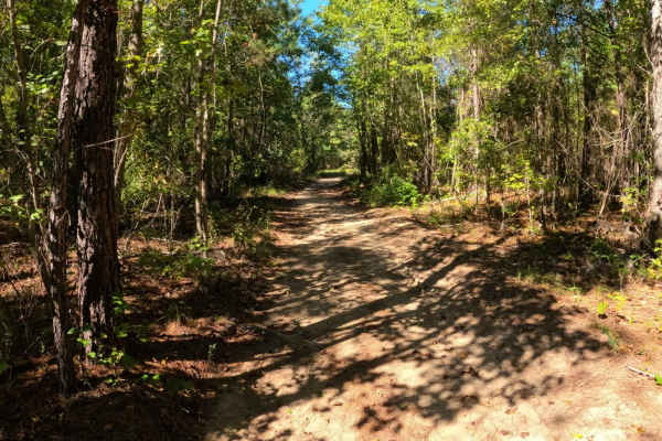
Twilight Lane
This trail is a nice option if you're looking to shorten Jordan's Circle or to get back to the staging area. It's an easy single-lane trail that's comprised of compact sand and no obstacles; however, there isn't much room to allow for passing traffic. Although short, this is an enjoyable ride throug...
Learn more about Twilight Lane
ATV trails near Lake City, South Carolina
Explore ATV-friendly trails near you. These trails are accessible for vehicles up to 50 inches wide, perfect for ATVs and smaller off-road machines.
Devine Drive
The trail is well-maintained, wide, and features compact sand, making it relatively easy. Starting from the southern section near Lola's Loop, the trail is wide and dusty, offering little challenge. However, as you approach the intersection near Monies Hollow, it gradually narrows and becomes muddie...
Learn more about Devine Drive
Monies Hollow
This is a single-lane trail that follows the gas line to Devine Drive at the western edge of the property. This trail is mostly comprised of compact sand and has several sections prone to standing water, with no bypass available. The sections of standing water are long and potentially deep. The trai...
Learn more about Monies Hollow
RCS Track
RCS Track is a single-lane trail, with plenty of areas to pass, that is mostly comprised of compact sand. Several low areas exist where mud pits have formed after heavy rain; bypass trails exist above all of them. This trail offers a little something for all abilities as well as cut-through access t...
Learn more about RCS Track
Tweety's Tweet
Tweety's Tweet is an easy, single-lane trail of compact sand that is great for bird-watching or escaping the crowds. Sitting higher than RCS Track, there is no mud on this trail, and it is seemingly less dusty than other trails in the area. However, the trail is narrow in most places, with very few ...
Learn more about Tweety's Tweet
UTV/side-by-side trails near Lake City, South Carolina
Find UTV and side-by-side trails near you. These trails accommodate vehicles up to 60 inches wide, ideal for UTVs, side-by-sides, and wider off-road rigs.
Devine Drive
The trail is well-maintained, wide, and features compact sand, making it relatively easy. Starting from the southern section near Lola's Loop, the trail is wide and dusty, offering little challenge. However, as you approach the intersection near Monies Hollow, it gradually narrows and becomes muddie...
Learn more about Devine Drive
Monies Hollow
This is a single-lane trail that follows the gas line to Devine Drive at the western edge of the property. This trail is mostly comprised of compact sand and has several sections prone to standing water, with no bypass available. The sections of standing water are long and potentially deep. The trai...
Learn more about Monies Hollow
RCS Track
RCS Track is a single-lane trail, with plenty of areas to pass, that is mostly comprised of compact sand. Several low areas exist where mud pits have formed after heavy rain; bypass trails exist above all of them. This trail offers a little something for all abilities as well as cut-through access t...
Learn more about RCS Track
Tweety's Tweet
Tweety's Tweet is an easy, single-lane trail of compact sand that is great for bird-watching or escaping the crowds. Sitting higher than RCS Track, there is no mud on this trail, and it is seemingly less dusty than other trails in the area. However, the trail is narrow in most places, with very few ...
Learn more about Tweety's Tweet
The onX Offroad Difference
onX Offroad combines trail photos, descriptions, difficulty ratings, width restrictions, seasonality, and more in a user-friendly interface. Available on all devices, with offline access and full compatibility with CarPlay and Android Auto. Discover what you're missing today!
Open Trail Map