
Dirt Bike Trails
Near Jenkins, Kentucky
Explore All Dirt Bike Trails Near Jenkins, Kentucky
Dirt Bike Trails Near Jenkins, Kentucky
Discover the best dirt bike trails near you. Browse trail maps, check difficulty ratings, and find your next adventure — whether you're looking for a quick ride or an all-day expedition.
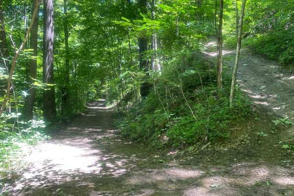
Trail 1
This is the main trail from the parking behind Fishpond Lake. It connects all other trails currently in the marked system. The trail is mostly dirt; expect a lot of standing water even in the summer, occasional tight switchbacks, and short climbs. This trail leads to Trail 6 which eventually wraps b...
Learn more about Trail 1
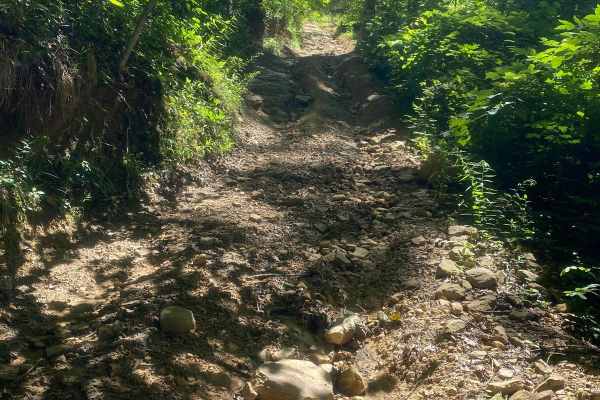
Trail 6
This is the Mid-Mountain Bench Trail that completes the loop around the Fishpond Lake property. It's slightly more technical than Trail 1, but still a main trail. Expect more narrow bench-cut mine roads, but less standing water and mud. Trail 6 gives access to some out-and-back spur trails to the to...
Learn more about Trail 6
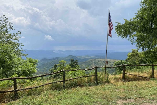
Trail 25
This is a connector trail from Main 23 to Laura's Lookout and beyond. It has a hard base with numerous shallow water holes. It's wide enough for most vehicles, including some full-size vehicles. This short route leads to one of the most scenic overlooks on a Kentucky OHV trail and there's a picnic t...
Learn more about Trail 25
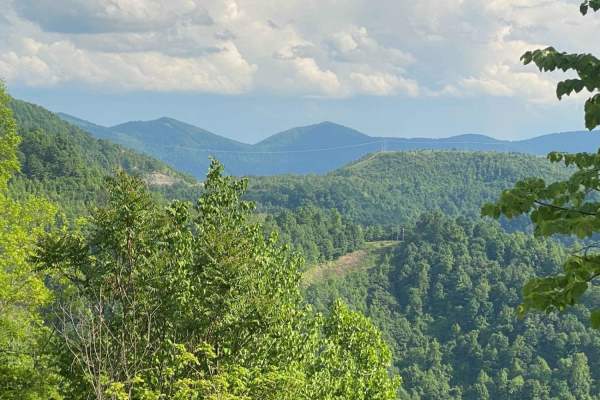
Trail 23 - Flatwoods Road
Trail 23 is the main artery for the Dorton/Flatwoods Area of the new Pike County Hillbilly Trails System. Trail 23 is a wide, graded dirt and gravel access road for an array of utilities and other infrastructure located on Caney Mountain. This trail can be driven with basic 4x4 and street tires when...
Learn more about Trail 23 - Flatwoods Road
23 Main Loop
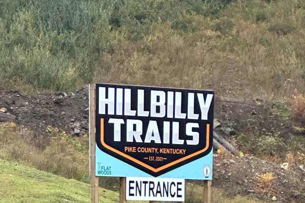
Trail 23 is the Main Loop around and through the Hillbilly Trails Offroad Park. Connect this section with Trail 23- Flatwoods Road to make a complete loop. This is the easiest of the trails and will be the thoroughfare for finding most all the other trails in the park. This trail is roughly just ove...
Learn more about 23 Main Loop
Flat Fork
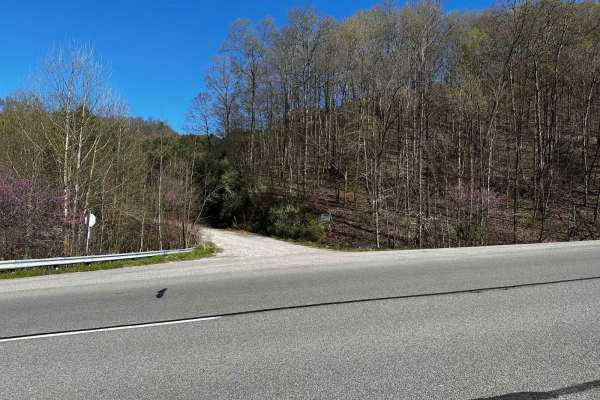
This is the alternate entrance to Hillbilly Trails of Pike County. It's a gravel road that leads to Trail 23 of Hillbilly Trails. Once you get to the top there are a lot of trails that is developed and many more to develop. There's plenty of primitive camping available with nearly 6,000 acres in the...
Learn more about Flat Fork
Caney Creek
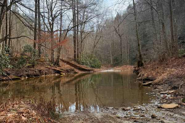
This trail is a point-to-point route that begins as a two-track gravel road following Caney Creek. Expect multiple water crossings; depending on recent rainfall, these can range from A foot deep to completely impassable. The initial stretch features several pull-offs offering stunning views of tower...
Learn more about Caney Creek
Wild Horse Trail (Lige Hollow)
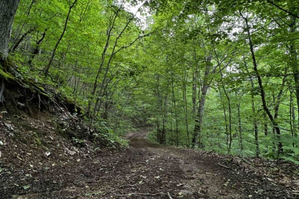
This trail begins at an abandoned coal mine, twisting back and forth through a covered forest as it makes its way to the top of a regrown strip mine full of roaming wild horses. After seeing the horses and the view from the top of the mountain you'll begin to make your way back down the other side. ...
Learn more about Wild Horse Trail (Lige Hollow)
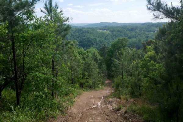
RV26
RV 26 is a short connector between segments of RV40 in the Ridgeview trail system, offering an easy dirt surface with a semi-steep slope. Light ruts are present, but the trail is easy overall. When descending, riders are rewarded with a scenic view overlooking the surrounding mountains, making it a ...
Learn more about RV26
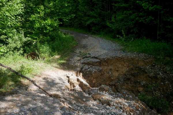
RV1
RV1 is a 12-mile main access route through the Ridgeview trail system, suitable for all skill levels. The trail features mostly easy, gradual grades with narrow ridgeline sections, shelf-like paths, small loose rocks, ruts, debris, and some slick spots. The northern end is the steepest part of the t...
Learn more about RV1
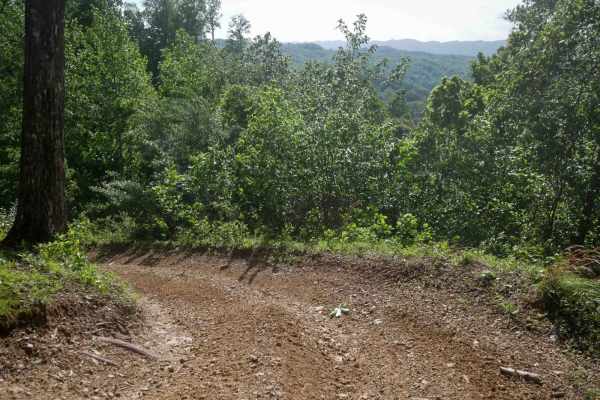
RV24
RV 24 is a very short, 100-foot long connector between segments of RV40 in the Ridgeview trail system. It features a semi-steep climb from north to south over smooth dirt with light ruts. The trail presents no significant obstacles and is easy to navigate. It allows you to bail out early from the lo...
Learn more about RV24
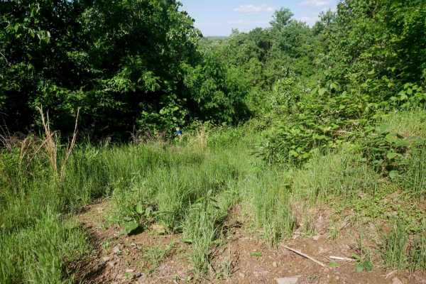
RV22
RV 22 is a short, 120-yard connector trail between segments of RV40 in the Ridgeview trail system. It is a grassy and overgrown shelf cut into the hillside and appears to see very little traffic. While easy overall, its narrow width and lack of recent use may require cautious navigation.
Learn more about RV22
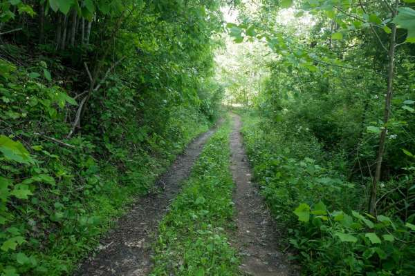
RV40
RV40 is a mix of ridgeline and a shelfy path cut along the edge of a slope, offering views over the valley below. The trail is decently wide and includes grassy sections and small hills with loose rock. Moderate rock features, such as embedded shelves under a foot tall, add challenge, especially giv...
Learn more about RV40
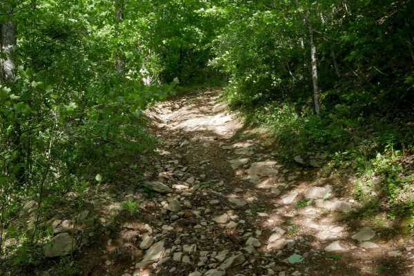
RV28
RV28 is a short 230-yard spur off of RV1 that descends steeply over loose and embedded rock. The trail features tight corners, pronounced ruts, and water on the trail, making it slick in wet conditions. A series of switchbacks leads down to RV30. It's moderate difficulty due to the combination of gr...
Learn more about RV28
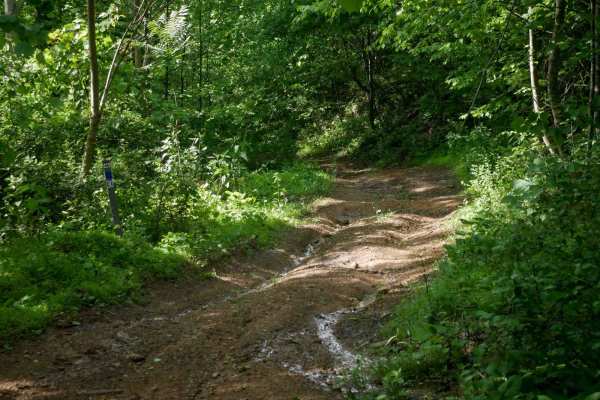
RV30
RV30 is a short connector trail in the Ridgeview trail system that climbs from the intersection with RV28 back up to RV1. While it is less rocky than RV28, it does feature some pronounced ruts and a semi-steep grade. Despite the slope, the trail remains easy overall with no significant obstacles.
Learn more about RV30
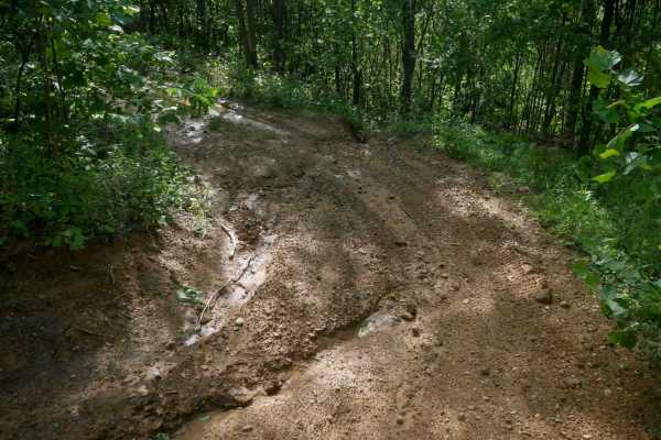
RV20
RV 20 is a 540-yard-long spur off of RV1 in the Ridgeview trail system. The trail is grassy and overgrown, with tight corners and dense tree cover on both sides. It features some dips, bumps, and a small rutted climb, but remains easy overall with no significant technical challenges.
Learn more about RV20
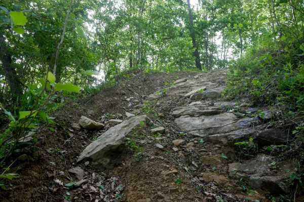
RV53
RV53 is a shelfy path cut into the hillside, starting on the west end with a more challenging climb with numerous embedded jagged rock layers forming one-foot-tall shelves along a steep slope. The slick leaf layer and muddy surface make traction difficult, especially in wet conditions. Steady moment...
Learn more about RV53
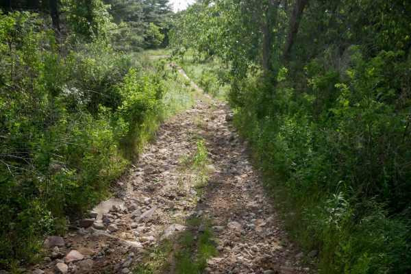
RV3
RV3 is a 0.6-mile trail that runs through the middle of the Ridgeview system. The west end begins with a section of embedded and loose cobble as it climbs to the ridgeline. It then transitions to a smoother shelf path along the hillside, with numerous muddy ruts. The trail ends at an intersection wi...
Learn more about RV3
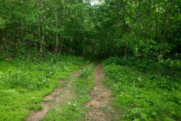
RV29
RV29 is a short, grassy connector trail through dense woods between trails RV53 and RV21. It features a semi-steep climb followed by a gradual descent. While the descent has slight ruts, the trail is not rocky, making it easy overall despite the elevation change. It's suitable for most skill levels.
Learn more about RV29
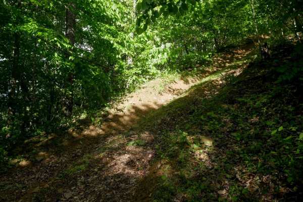
RV51
RV51 begins at RV21 and features a very steep hill climb from north to south. The climb is slightly rutted and covered with a slick layer of decomposing leaves, which can make traction difficult. At the top, the trail transitions to a flat, grassy, shelfy path that appears lightly used, as if many r...
Learn more about RV51
ATV trails near Jenkins, Kentucky
Explore ATV-friendly trails near you. These trails are accessible for vehicles up to 50 inches wide, perfect for ATVs and smaller off-road machines.
Trail 1
This is the main trail from the parking behind Fishpond Lake. It connects all other trails currently in the marked system. The trail is mostly dirt; expect a lot of standing water even in the summer, occasional tight switchbacks, and short climbs. This trail leads to Trail 6 which eventually wraps b...
Learn more about Trail 1
Trail 6
This is the Mid-Mountain Bench Trail that completes the loop around the Fishpond Lake property. It's slightly more technical than Trail 1, but still a main trail. Expect more narrow bench-cut mine roads, but less standing water and mud. Trail 6 gives access to some out-and-back spur trails to the to...
Learn more about Trail 6
Trail 25
This is a connector trail from Main 23 to Laura's Lookout and beyond. It has a hard base with numerous shallow water holes. It's wide enough for most vehicles, including some full-size vehicles. This short route leads to one of the most scenic overlooks on a Kentucky OHV trail and there's a picnic t...
Learn more about Trail 25
Trail 23 - Flatwoods Road
Trail 23 is the main artery for the Dorton/Flatwoods Area of the new Pike County Hillbilly Trails System. Trail 23 is a wide, graded dirt and gravel access road for an array of utilities and other infrastructure located on Caney Mountain. This trail can be driven with basic 4x4 and street tires when...
Learn more about Trail 23 - Flatwoods Road
UTV/side-by-side trails near Jenkins, Kentucky
Find UTV and side-by-side trails near you. These trails accommodate vehicles up to 60 inches wide, ideal for UTVs, side-by-sides, and wider off-road rigs.
Trail 1
This is the main trail from the parking behind Fishpond Lake. It connects all other trails currently in the marked system. The trail is mostly dirt; expect a lot of standing water even in the summer, occasional tight switchbacks, and short climbs. This trail leads to Trail 6 which eventually wraps b...
Learn more about Trail 1
Trail 6
This is the Mid-Mountain Bench Trail that completes the loop around the Fishpond Lake property. It's slightly more technical than Trail 1, but still a main trail. Expect more narrow bench-cut mine roads, but less standing water and mud. Trail 6 gives access to some out-and-back spur trails to the to...
Learn more about Trail 6
Trail 25
This is a connector trail from Main 23 to Laura's Lookout and beyond. It has a hard base with numerous shallow water holes. It's wide enough for most vehicles, including some full-size vehicles. This short route leads to one of the most scenic overlooks on a Kentucky OHV trail and there's a picnic t...
Learn more about Trail 25
Trail 23 - Flatwoods Road
Trail 23 is the main artery for the Dorton/Flatwoods Area of the new Pike County Hillbilly Trails System. Trail 23 is a wide, graded dirt and gravel access road for an array of utilities and other infrastructure located on Caney Mountain. This trail can be driven with basic 4x4 and street tires when...
Learn more about Trail 23 - Flatwoods Road
The onX Offroad Difference
onX Offroad combines trail photos, descriptions, difficulty ratings, width restrictions, seasonality, and more in a user-friendly interface. Available on all devices, with offline access and full compatibility with CarPlay and Android Auto. Discover what you're missing today!
Open Trail Map