
Dirt Bike Trails
Near Gaffney, South Carolina
Explore All Dirt Bike Trails Near Gaffney, South Carolina
Dirt Bike Trails Near Gaffney, South Carolina
Discover the best dirt bike trails near you. Browse trail maps, check difficulty ratings, and find your next adventure — whether you're looking for a quick ride or an all-day expedition.
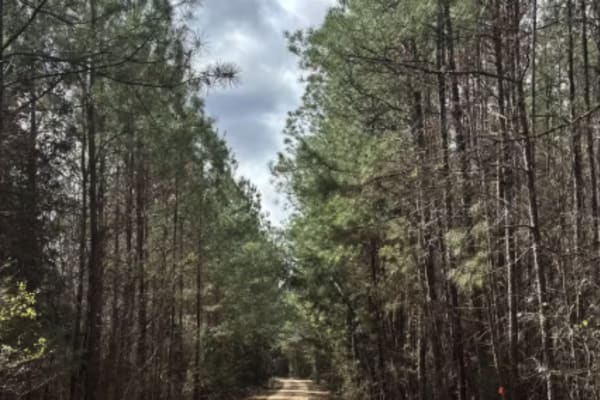
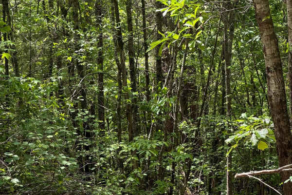
Cricket Tree Road
This scenic forest trail winds through tall pine trees and sandy terrain, offering a quiet off-road drive surrounded by nature. The surface is mostly sandy and graded, with occasional muddy puddles after rain and scattered pinecones along the path. Gentle curves and narrow sections between trees add...
Learn more about Cricket Tree Road
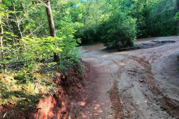
The Ridge
Nice easy bypass when Palmetto Krawler gets too wet, slick, and muddy. Smooth and fairly flat trail that runs along the north property line, so please stay on the trail so we can keep good relations with our neighbors. This trail is lightly used, so is usually in very good condition.
Learn more about The Ridge
Bill's Flexy Time
If you feel the need to test your sway bar disconnect, this is the place to do it. Alternating ruts near the top end will give your rig a "Flexy" workout. Typically well drained and dry, but holes in the flex section can hold plenty of water after a rainstorm.
Learn more about Bill's Flexy Time
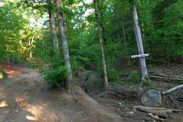
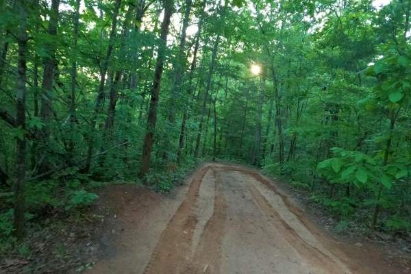
Sidewinder
Developed by Cam & David- This trail can sometimes bite you. Several serious off-camber spots that could lean you into the wall, as well as more logs and roots than actual rocks. Narrow and twisty trail with plenty of challenging spots. It's good to have a spotter here to keep you out of trouble.
Learn more about Sidewinder
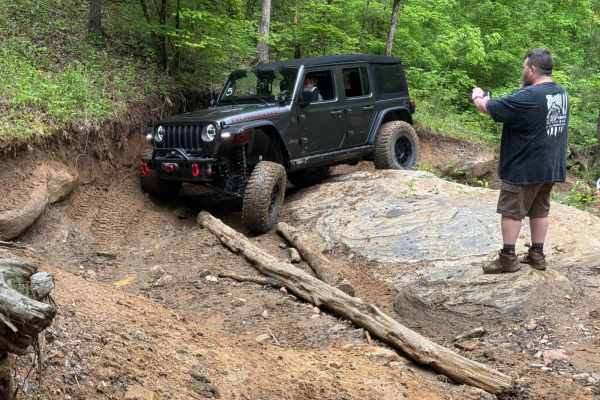
Palmetto Crossing
Palmetto Krawlers 4x4 Club pioneered this rock garden, chance of body damage. Large rock formations and fallen logs scattered throughout this trail are a challenge for stock rigs. Any recent hard rains can make it a whole new challenge. The large rock ledge mid-trail is the primary obstacle for more...
Learn more about Palmetto Crossing
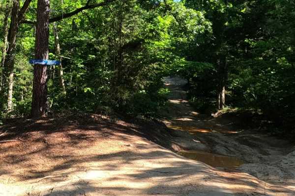
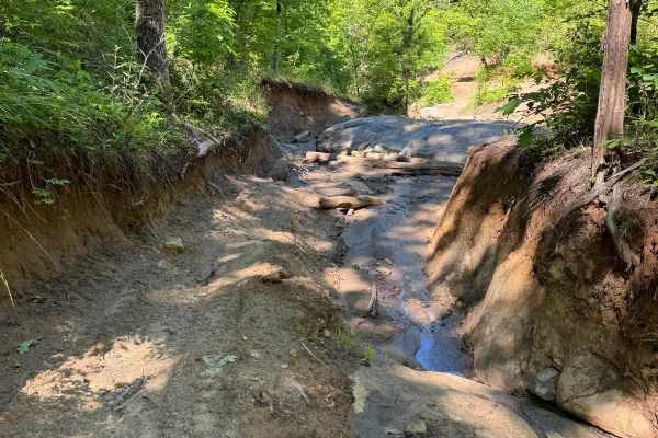
Tornado Alley
Narrow trail that a tornado touched down on several years ago. There is a large buried rock ledge that spans the width of the trail in the top section. Runoff can expose the rock, leaving a sharp drop-off. Keep your eyes open, or a nosebleed could be in your future.
Learn more about Tornado Alley
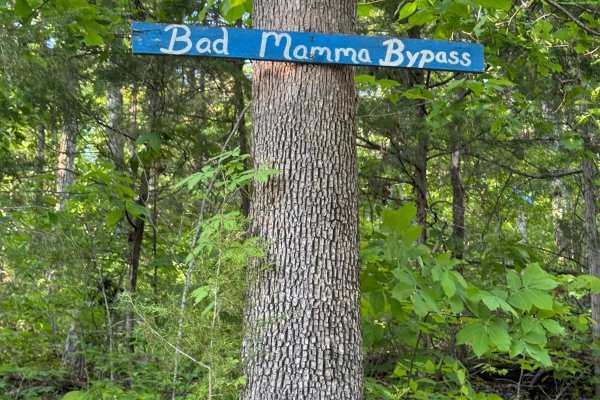
Bad Mamma Bypass
It may be easier than Bad Mamma, but not by much. A very steep uphill run with some rocks and debris in the washouts makes it a great challenge. Rutted high walls are best for vehicles with plenty of rubber outside of the fenders and sides to reduce the chance of body damage.
Learn more about Bad Mamma Bypass
Bamboozled
This is an easier way to get up the hill. Interesting and scenic twisty trail lined with bamboo at the bottom that makes you feel like you're in a foreign country. Bamboozled is a much easier way to get out of the river valley and start back up to the top of the park.
Learn more about Bamboozled
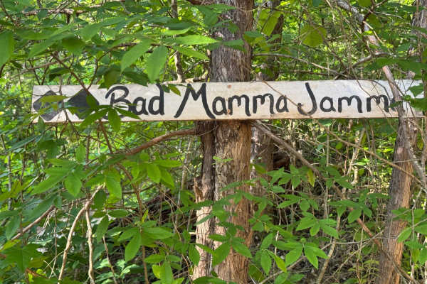
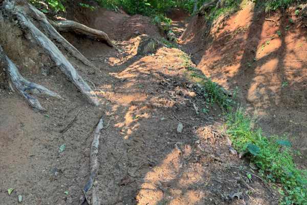
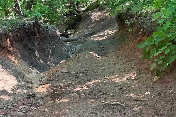
Bad Mamma Jamma
Seriously steep and rutted, deep gulch climb rated a solid 9. Not for the faint of heart. One way uphill only. High probability of body damage on stock vehicles. Bad Mamma Jamma is short, but it makes up for it in challenge. It's in an out-of-the-way part of Gulches, so there won't be a lot of witne...
Learn more about Bad Mamma Jamma

Squatch Pass
When you run out of trail at the north end of River Road, take this fun little trail to start back up the hill where it joins to Palmetto Crawler. Squatch Pass provides access to Bad Mamma Jamma, Bad Mamma Bypass and Tree Hugger trails. This is the northwest extent of Gulches ORV Park.
Learn more about Squatch Pass
Tree Hugger
The most northern tough trail in the park, Tree Hugger, is a short, stee,p and rutted narrow gulch climb. Big tires and plenty of horsepower make this short trail a fun ride. You may find some interesting items in the ruts, such as rocks or logs, but that just adds to the challenge.
Learn more about Tree Hugger
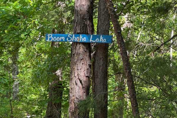
Boom Shaka Locka
Seven Slat 4x4 guys named this one. has some black bypasses that appear to be the main part of the trail, but that would require a difficulty rating change. Good choices at each bypass will keep you and your rig in the "blue zone". This is a short trail to give you more choices along the way.
Learn more about Boom Shaka Locka
Sidewinder/Tornado Cutoff
Uphill bailout trail from Sidewinder to Tornado Alley. If you don't want to follow Sidewinder through the narrows, take this cutoff over to Tornado Alley to give you a chance to try some other trails in the northeast area. It's subject to erosion so take a close look before you commit to taking the ...
Learn more about Sidewinder/Tornado Cutoff

Tornado/Trail 14 Cutoff
Easy bail out, or drop in, between Tornado Alley and Trail 14. If you're not paying close attention, it's possible to find yourself on the other trail by accident. Headed westward, Tornado Alley bears off to the right, and Trail 14 continues on straight ahead. That's the only clue we will give you,...
Learn more about Tornado/Trail 14 Cutoff
Lone Rock
Lone Rock is a loop trail that branches off of the upper part of Trail 14 near Shipwreck. The trail heads downhill, makes a switchback, and heads back to Trail 14. Narrow off camber with one switchback. Most of the trail, especially in the lower section, is deeply rutted and will lean your vehicle ...
Learn more about Lone Rock
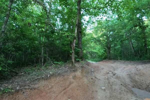
Palmetto Krawler
Off-camber perimeter trail with some advanced or intermediate bypass options. It is the primary access route across the north end of the park and around the far northeast corner. It provides access to many of the moderate trails in the northeast corner. The surface is mostly smooth dirt with severa...
Learn more about Palmetto Krawler
Rocker Knocker
Fun rock garden that eats rocker panels and egos. The trail is relatively wide in the rock garden area, giving you a good variety of lines for your climbing pleasure. Rainfall can and does change the layout and difficulty, so it will be a new experience almost every time. If you've had enough fun, e...
Learn more about Rocker Knocker
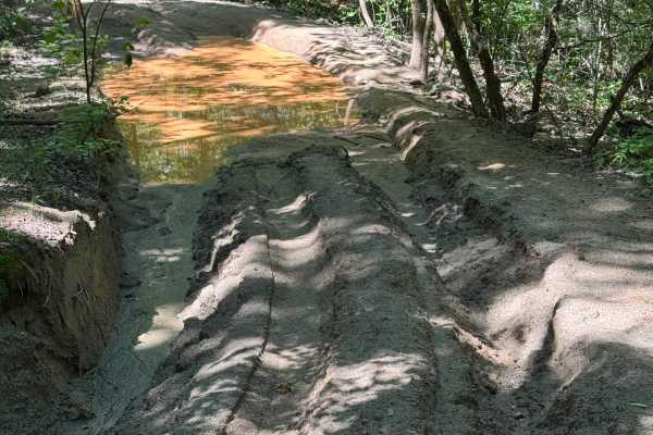
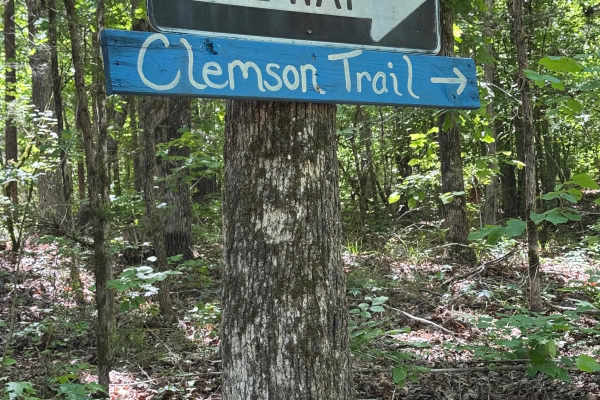
Clemson Detour
If you find The Clemson Trail just too easy for you and your rig, take the detour for an added challenge of a steep drop and a monster mud hole. Detour is a misnomer. The drop is at least five feet on one side, so flex is important. The mud hole can range from a foot to several feet, depending on wa...
Learn more about Clemson Detour
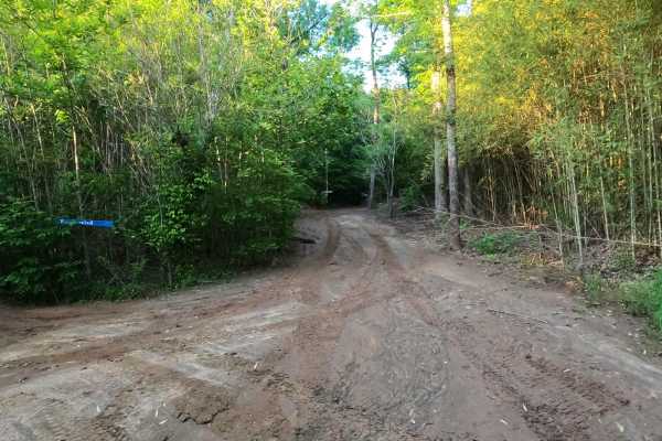
Clemson/Tornado Cutoff
Easier way to get from Tornado Alley to Clemson Trail if you so choose. The trail also passes Clemson Detour if you just have a need to get muddy. Note the One Way sign to keep traffic moving in the proper direction, or suffer the consequences. Not much space here for vehicles to pass.
Learn more about Clemson/Tornado Cutoff
Rocker Knocker Bypass
Relatively smooth and moderate trail that provides access to and then parallels Rocker Knocker. Several exit points from Rocker Knocker provide options in case Rocker Knocker is giving you problems. Also gives a good vantage point to watch drivers on Rocker Knocker as they navigate the ledges, bould...
Learn more about Rocker Knocker Bypass
ATV trails near Gaffney, South Carolina
Explore ATV-friendly trails near you. These trails are accessible for vehicles up to 50 inches wide, perfect for ATVs and smaller off-road machines.
Cricket Tree Road
This scenic forest trail winds through tall pine trees and sandy terrain, offering a quiet off-road drive surrounded by nature. The surface is mostly sandy and graded, with occasional muddy puddles after rain and scattered pinecones along the path. Gentle curves and narrow sections between trees add...
Learn more about Cricket Tree Road
The Ridge
Nice easy bypass when Palmetto Krawler gets too wet, slick, and muddy. Smooth and fairly flat trail that runs along the north property line, so please stay on the trail so we can keep good relations with our neighbors. This trail is lightly used, so is usually in very good condition.
Learn more about The Ridge
Bill's Flexy Time
If you feel the need to test your sway bar disconnect, this is the place to do it. Alternating ruts near the top end will give your rig a "Flexy" workout. Typically well drained and dry, but holes in the flex section can hold plenty of water after a rainstorm.
Learn more about Bill's Flexy Time
Sidewinder
Developed by Cam & David- This trail can sometimes bite you. Several serious off-camber spots that could lean you into the wall, as well as more logs and roots than actual rocks. Narrow and twisty trail with plenty of challenging spots. It's good to have a spotter here to keep you out of trouble.
Learn more about Sidewinder
UTV/side-by-side trails near Gaffney, South Carolina
Find UTV and side-by-side trails near you. These trails accommodate vehicles up to 60 inches wide, ideal for UTVs, side-by-sides, and wider off-road rigs.
Cricket Tree Road
This scenic forest trail winds through tall pine trees and sandy terrain, offering a quiet off-road drive surrounded by nature. The surface is mostly sandy and graded, with occasional muddy puddles after rain and scattered pinecones along the path. Gentle curves and narrow sections between trees add...
Learn more about Cricket Tree Road
The Ridge
Nice easy bypass when Palmetto Krawler gets too wet, slick, and muddy. Smooth and fairly flat trail that runs along the north property line, so please stay on the trail so we can keep good relations with our neighbors. This trail is lightly used, so is usually in very good condition.
Learn more about The Ridge
Bill's Flexy Time
If you feel the need to test your sway bar disconnect, this is the place to do it. Alternating ruts near the top end will give your rig a "Flexy" workout. Typically well drained and dry, but holes in the flex section can hold plenty of water after a rainstorm.
Learn more about Bill's Flexy Time
Sidewinder
Developed by Cam & David- This trail can sometimes bite you. Several serious off-camber spots that could lean you into the wall, as well as more logs and roots than actual rocks. Narrow and twisty trail with plenty of challenging spots. It's good to have a spotter here to keep you out of trouble.
Learn more about Sidewinder
The onX Offroad Difference
onX Offroad combines trail photos, descriptions, difficulty ratings, width restrictions, seasonality, and more in a user-friendly interface. Available on all devices, with offline access and full compatibility with CarPlay and Android Auto. Discover what you're missing today!
Open Trail Map