
Dirt Bike Trails
Near Elrod, Indiana
Explore All Dirt Bike Trails Near Elrod, Indiana
Dirt Bike Trails Near Elrod, Indiana
Discover the best dirt bike trails near you. Browse trail maps, check difficulty ratings, and find your next adventure — whether you're looking for a quick ride or an all-day expedition.
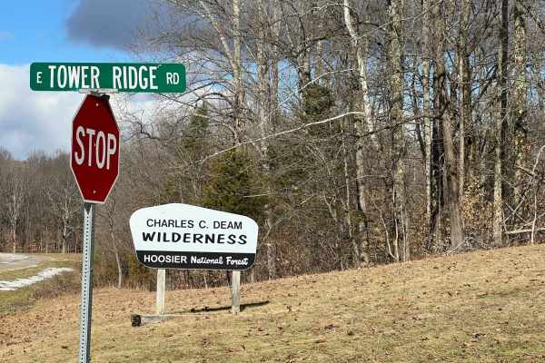
Tower Ridge Road
Tower Ridge Road is a rough gravel road best traveled with AWD SUV's and 4x4 vehicles. It is off Highway 446, south of Lake Monroe, which is south of Bloomington, Indiana. This scenic road goes through the Charles C. Deam Wilderness area, which is overseen by the U.S. Forest Service, Hoosier Nationa...
Learn more about Tower Ridge Road
ATV trails near Elrod, Indiana
Explore ATV-friendly trails near you. These trails are accessible for vehicles up to 50 inches wide, perfect for ATVs and smaller off-road machines.
Tower Ridge Road
Tower Ridge Road is a rough gravel road best traveled with AWD SUV's and 4x4 vehicles. It is off Highway 446, south of Lake Monroe, which is south of Bloomington, Indiana. This scenic road goes through the Charles C. Deam Wilderness area, which is overseen by the U.S. Forest Service, Hoosier Nationa...
Learn more about Tower Ridge Road
UTV/side-by-side trails near Elrod, Indiana
Find UTV and side-by-side trails near you. These trails accommodate vehicles up to 60 inches wide, ideal for UTVs, side-by-sides, and wider off-road rigs.
Tower Ridge Road
Tower Ridge Road is a rough gravel road best traveled with AWD SUV's and 4x4 vehicles. It is off Highway 446, south of Lake Monroe, which is south of Bloomington, Indiana. This scenic road goes through the Charles C. Deam Wilderness area, which is overseen by the U.S. Forest Service, Hoosier Nationa...
Learn more about Tower Ridge Road
The onX Offroad Difference
onX Offroad combines trail photos, descriptions, difficulty ratings, width restrictions, seasonality, and more in a user-friendly interface. Available on all devices, with offline access and full compatibility with CarPlay and Android Auto. Discover what you're missing today!
Open Trail Map