
Dirt Bike Trails
Near Ejido Guadalajara, Baja California
Explore All Dirt Bike Trails Near Ejido Guadalajara, Baja California
Dirt Bike Trails Near Ejido Guadalajara, Baja California
Discover the best dirt bike trails near you. Browse trail maps, check difficulty ratings, and find your next adventure — whether you're looking for a quick ride or an all-day expedition.
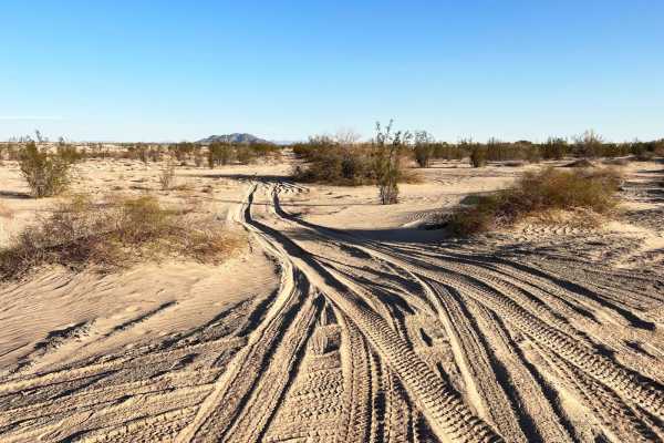
Pilot Knob
Pilot Knob connects Pilot Knob Long Term Visitors Area with Ogilby Road. This sandy remote route is deep with loose sand to the west until meeting up with the powerline road which is better maintained and has more gravel the closer you get to Pilot Knob RV Resort. This is a short fun route that conn...
Learn more about Pilot Knob
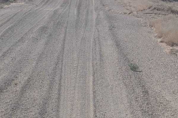
BLM 920
This trail starts just off Ogilby Road, just north of Highway 80, and heads toward Pasadena Mountain to the east with Imperial Dunes to the west, while Mohawk Peak in Mexico can be seen to the south, providing dramatic landmarks in multiple directions. The surface is rough, grainy sand that can be d...
Learn more about BLM 920
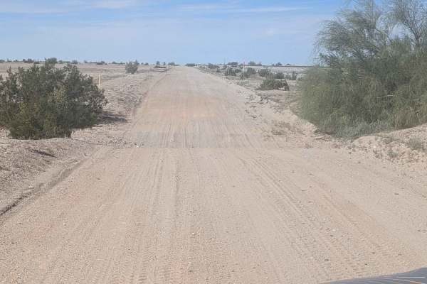
Pipeline Cutoff
This trail is a shortcut from Ogilby Road connecting to BLM 920. The surface is hard-packed sand and gravel and has been recently graded, providing excellent conditions. You'll cross various small drainage washes that are easy to maneuver but can be bumpy as you navigate these minor crossings. The t...
Learn more about Pipeline Cutoff
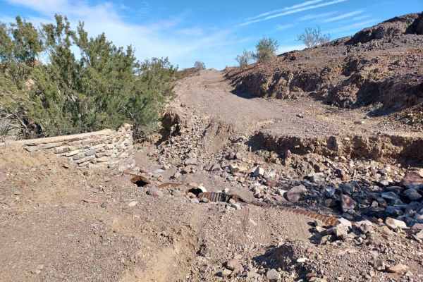
Barney Oldfield Road
Barney Oldfield Road is a mixed surface road of gravel, sand, and rock. Most of this road runs through a wash, the sand can be deep in areas, and these spots are prone to flash floods, which do not attempt during rainy seasons. The road runs through the Bureau of Land Management property. The road h...
Learn more about Barney Oldfield Road
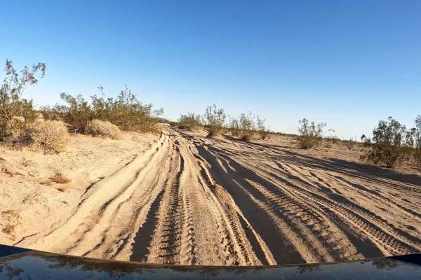
Dunes Vista
Dunes Vista is a loose, sandy open desert driving experience with many ruts, washboards, and whoops connecting Dunes Vista dispersed campground near I-8 and Ogilby to the north. It is a narrow, fun high-speed trail with great views of the dunes to the west. Airing down low and 4wd is highly recommen...
Learn more about Dunes Vista
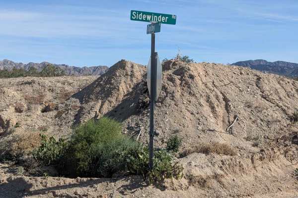
Sidewinder Road
Connecting Ogilby Road to Sidewinder Road to Picacho Wash trail, this graded, sandy road stretches 2.5 vehicle widths, providing generous room for navigation. Power lines overhead provide a reliable reference throughout the journey. The route heads toward Picacho Wilderness, and Pasadena Mountain do...
Learn more about Sidewinder Road
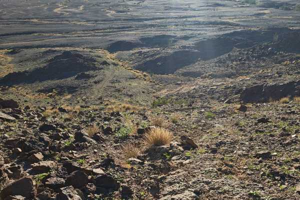
Pasadena Mountain Express - Single Track
I found a very old hiking path that goes up over the mountain and used that as the launch point for this ride. I was by myself, so there's not going to be much to follow besides the onX track. In any case, you can make this even more difficult or super easy to travel around the base of the mountain....
Learn more about Pasadena Mountain Express - Single Track
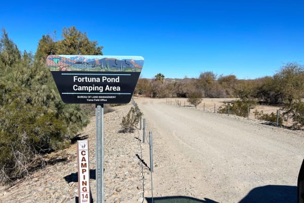
South Levee to Yuma
South Levee Road to Yuma is a wide elevated road with many washboards and several deep potholes. It follows along the Gila Aqueduct until reaching the Colorado River. The confluence is a popular river access point with open riding opportunities as well as fishing and camping. This road also passes F...
Learn more about South Levee to Yuma
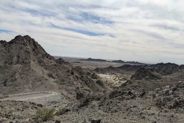
Padre Madre Mine
This trail is an out-and-back if you're not up for doing one of the connecting trails rated 7+. The route starts by going past an active mine and then quickly opens up to the Padre Madre Mine claim. Reports say there are multiple vertical shafts (now capped, you can see steel structures over the top...
Learn more about Padre Madre Mine
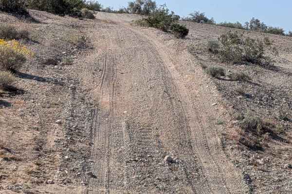
BLM 668
Departing Ogilby Road toward the high-rising Picacho Peak Wilderness mountains, this route navigates terrain lined with many small rocks and scattered vegetation, including ocotillo, desert brush, and grasses. Off-camber sections, ruts, and drops into various washes ranging in depth, all under 12 in...
Learn more about BLM 668
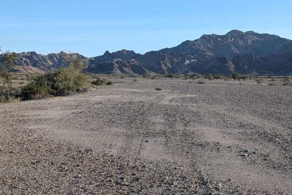
BLM 770
Departing Walker Way northbound toward BLM 702, this route briefly starts in a wash before quickly jumping onto a plateau and heading toward Picacho Peak Wilderness. Hard-packed sand and gravel create the surface with very little vegetation directly around the trail, though desert trees and brush ap...
Learn more about BLM 770
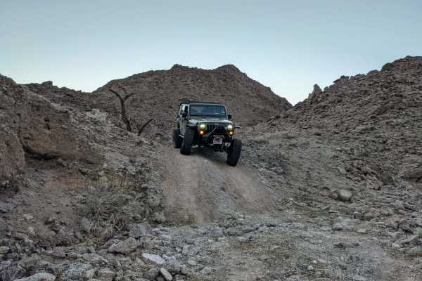
Sidewinder Road to Picacho Wash
This point-to-point trail connects the popular camping area on American Girl Mine Road to Yuma. This route takes you up and down steep portions of the Cargo Muchacho Mountains. This area is scattered with old mines, as well as an active mine you pass near the beginning of the trail off of American G...
Learn more about Sidewinder Road to Picacho Wash
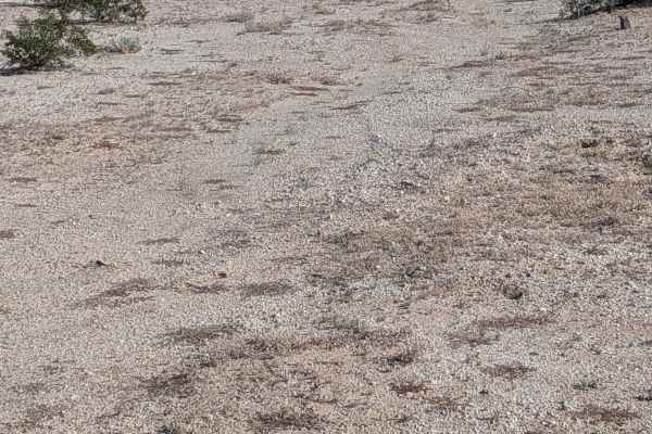
BLM 771
Part of the limited-use area requiring staying on trails, this hard-packed gravel route departs Ogilby Road heading straight for the Imperial Sand Dunes with determination. Very little vegetation surrounds the trail bed initially, though overgrown trees eventually appear, forcing you to navigate aro...
Learn more about BLM 771
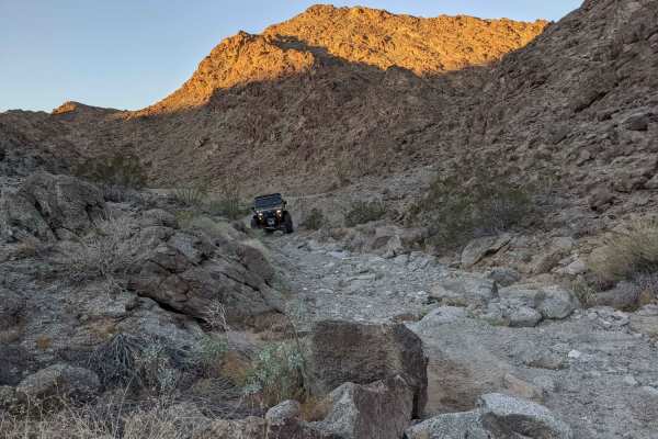
You Gotta Be Kidding Me Muchacho
This trail is short but technical! You can come up it from Araz Wash or down from Padre Madre Mine. This trail is strewn with various size boulders, many being 1-2 feet in diameter. The highlight is a turn followed by about a 15-foot drop in elevation in a short distance. This drop has a V notch dow...
Learn more about You Gotta Be Kidding Me Muchacho
Oh My Muchacho
Coming through the Muchacho Mountain on the Padre Madre Mine Trail, you will reach a fork in the road. Oh My Muchacho takes a scenic trail and turns it into a technical challenge. There is a boulder that, depending on the wheelbase, will get tippy, feeling like you are going to slide into the boulde...
Learn more about Oh My Muchacho
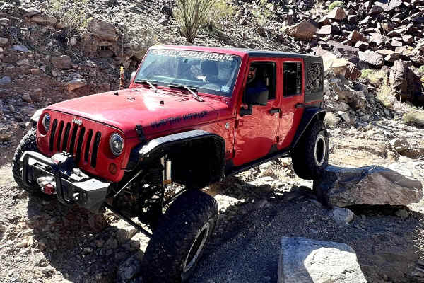
American Girl Mine Overlook
This short 2.3-mile out-and-back trail is a great side trip for a lunch stop while trail running in the Pasadena Mountains. The trail starts with a hill climb with loose rocks up to 12 inches in height and several off-camber washed-out sections. Once past the hill climb, you will enter a wash. The d...
Learn more about American Girl Mine Overlook
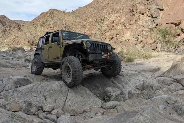
Araz Wash South
Araz Wash runs through the Cargo Muchacho Mountains. The boulders strewn along this trail make for a great challenge, offering many options, but a few of the most difficult obstacles are not optional, so you will want to be properly equipped. There are some tight spots as far as trees, so expect so...
Learn more about Araz Wash South
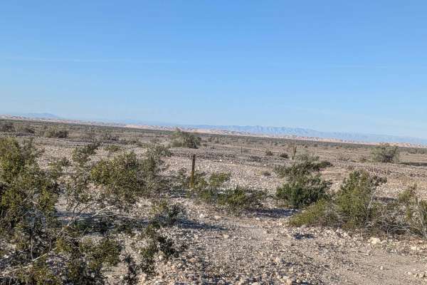
BLM 702
Starting at BLM 801 near the base of Picacho Peak Wilderness and ending at Walker Way, this hard-pack sand and gravel route crosses both Ogilby Road and BLM 701 along its journey. The section north of Walker Way transitions to hard-packed dirt and sand with lots of scattered rocks blanketing the sur...
Learn more about BLM 702
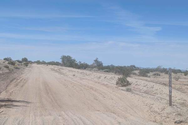
Ted Kipf Road SE - BLM 721
This trail is located in a limited-use area where vehicles are allowed on open trails only, so stay on designated routes. The surface is a mix of grainy sand and gravel, creating varied traction conditions. You'll encounter lots of washboards, ruts, off-camber sections, and drops in and out of washe...
Learn more about Ted Kipf Road SE - BLM 721
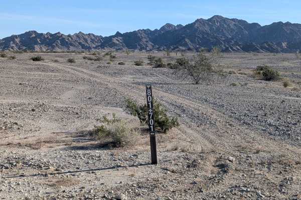
BLM 801
Launching from BLM 701 toward the high-rising Picacho Peak Wilderness mountains towering to the east, this hard-packed sand route wears a gravel overlay throughout. Vegetation stays sparse with just a few desert bushes and ocotillo breaking up the barren landscape. Chocolate Mountains loom in the di...
Learn more about BLM 801
ATV trails near Ejido Guadalajara, Baja California
Explore ATV-friendly trails near you. These trails are accessible for vehicles up to 50 inches wide, perfect for ATVs and smaller off-road machines.
Pilot Knob
Pilot Knob connects Pilot Knob Long Term Visitors Area with Ogilby Road. This sandy remote route is deep with loose sand to the west until meeting up with the powerline road which is better maintained and has more gravel the closer you get to Pilot Knob RV Resort. This is a short fun route that conn...
Learn more about Pilot Knob
BLM 920
This trail starts just off Ogilby Road, just north of Highway 80, and heads toward Pasadena Mountain to the east with Imperial Dunes to the west, while Mohawk Peak in Mexico can be seen to the south, providing dramatic landmarks in multiple directions. The surface is rough, grainy sand that can be d...
Learn more about BLM 920
Pipeline Cutoff
This trail is a shortcut from Ogilby Road connecting to BLM 920. The surface is hard-packed sand and gravel and has been recently graded, providing excellent conditions. You'll cross various small drainage washes that are easy to maneuver but can be bumpy as you navigate these minor crossings. The t...
Learn more about Pipeline Cutoff
Barney Oldfield Road
Barney Oldfield Road is a mixed surface road of gravel, sand, and rock. Most of this road runs through a wash, the sand can be deep in areas, and these spots are prone to flash floods, which do not attempt during rainy seasons. The road runs through the Bureau of Land Management property. The road h...
Learn more about Barney Oldfield Road
UTV/side-by-side trails near Ejido Guadalajara, Baja California
Find UTV and side-by-side trails near you. These trails accommodate vehicles up to 60 inches wide, ideal for UTVs, side-by-sides, and wider off-road rigs.
Pilot Knob
Pilot Knob connects Pilot Knob Long Term Visitors Area with Ogilby Road. This sandy remote route is deep with loose sand to the west until meeting up with the powerline road which is better maintained and has more gravel the closer you get to Pilot Knob RV Resort. This is a short fun route that conn...
Learn more about Pilot Knob
BLM 920
This trail starts just off Ogilby Road, just north of Highway 80, and heads toward Pasadena Mountain to the east with Imperial Dunes to the west, while Mohawk Peak in Mexico can be seen to the south, providing dramatic landmarks in multiple directions. The surface is rough, grainy sand that can be d...
Learn more about BLM 920
Pipeline Cutoff
This trail is a shortcut from Ogilby Road connecting to BLM 920. The surface is hard-packed sand and gravel and has been recently graded, providing excellent conditions. You'll cross various small drainage washes that are easy to maneuver but can be bumpy as you navigate these minor crossings. The t...
Learn more about Pipeline Cutoff
Barney Oldfield Road
Barney Oldfield Road is a mixed surface road of gravel, sand, and rock. Most of this road runs through a wash, the sand can be deep in areas, and these spots are prone to flash floods, which do not attempt during rainy seasons. The road runs through the Bureau of Land Management property. The road h...
Learn more about Barney Oldfield Road
The onX Offroad Difference
onX Offroad combines trail photos, descriptions, difficulty ratings, width restrictions, seasonality, and more in a user-friendly interface. Available on all devices, with offline access and full compatibility with CarPlay and Android Auto. Discover what you're missing today!
Open Trail Map