
Dirt Bike Trails
Near Dalton, Missouri
Explore All Dirt Bike Trails Near Dalton, Missouri
Dirt Bike Trails Near Dalton, Missouri
Discover the best dirt bike trails near you. Browse trail maps, check difficulty ratings, and find your next adventure — whether you're looking for a quick ride or an all-day expedition.
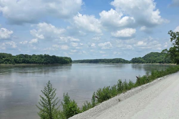
River Road
This scenic route follows a well-maintained gravel road that runs parallel to both the Katy Trail and the Missouri River, often called "The Big Muddy." While occasional washboard patches, potholes, and loose gravel demand attention, the drive is generally smooth and enjoyable. You'll pass a few scat...
Learn more about River Road
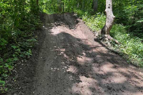
Red 72
This trail features a steep, slick hill climb that is challenging to ascend, requiring skill and caution. After the climb, the trail continues with off-camber sections that lead to another difficult trail. A tricky rock section near a tree demands careful navigation to avoid sliding into it. The bot...
Learn more about Red 72
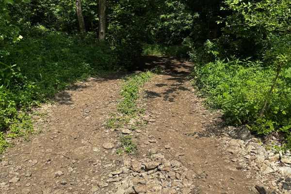
Green 74
This trail connects to Yellow 71 and Red 72 at one end, and to Yellow 73 at the other. It features some narrow sections squeezed between trees, requiring careful navigation to avoid scratches. There are a few small mud holes scattered along the route, but otherwise, the trail remains relatively easy...
Learn more about Green 74
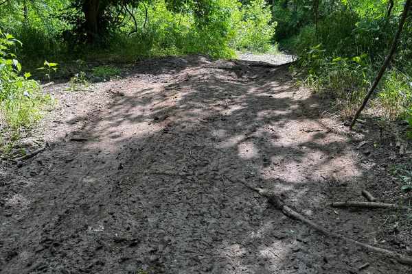
Yellow 73
This trail is a partial out-and-back route, requiring you to retrace part of your path before reaching another connecting trail. Alternatively, you can return all the way to the start. The entrance into the creek features a steep, off-camber descent. When crossing the creek, stay on the north side, ...
Learn more about Yellow 73
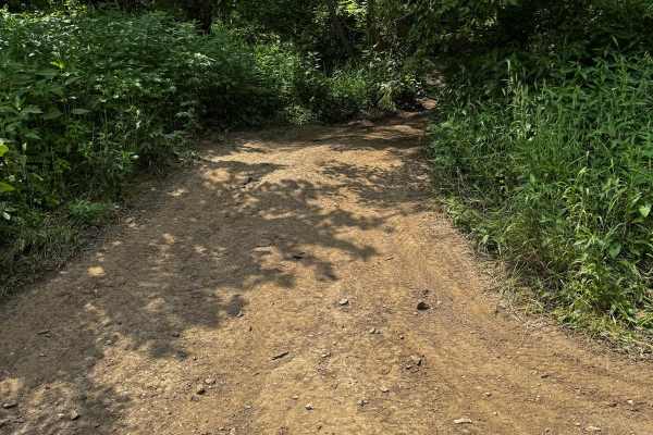
Green 75
This trail branches off from Yellow 73 and leads to Green 76. It has a dirt base that can become muddy after rain. Some sections are narrow, making it challenging for wider or longer wheelbase vehicles to pass comfortably. There are no significant obstacles, making it a relatively straightforward ro...
Learn more about Green 75
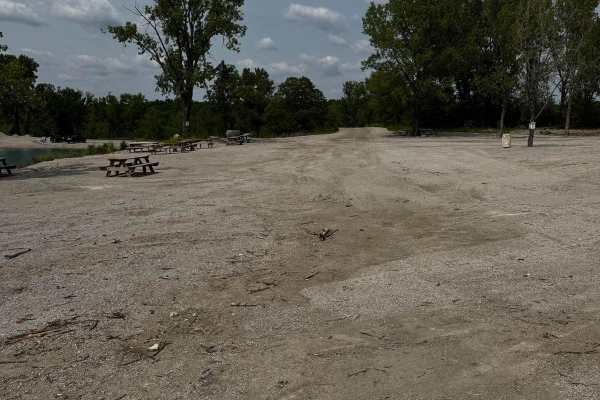
Green 18
This trail begins near the swimming hole parking area and travels across the beach before curving around to the opposite side. As the trail continues, it enters a wooded area and begins to climb a steep hill. The uphill section contains several larger rocks embedded in the surface, which may require...
Learn more about Green 18
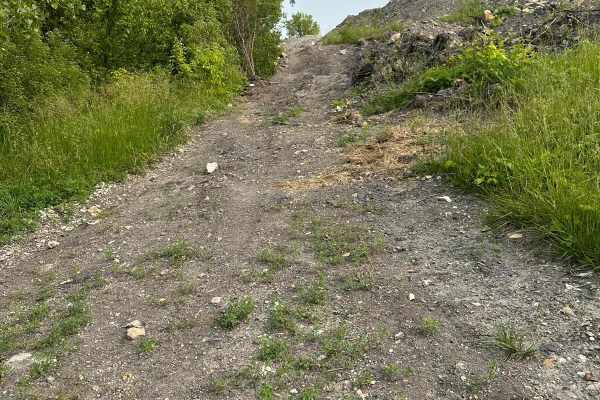
Yellow 38
This trail runs from Green 37 at the bottom up to Green 18 near the beach. It features numerous ruts and flex sections, challenging the suspension and requiring four-wheel drive. The trail climbs a hill with off-camber areas that demand careful navigation. When wet, the trail becomes especially diff...
Learn more about Yellow 38
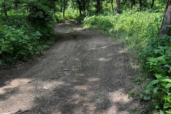
Green 78
This trail winds through a densely wooded section of the park where overgrown trees make pinstriping likely. It takes you down through the West Fork Crooked River for a short distance, so water levels should be checked before proceeding cautiously. The trail begins off Yellow 71 and runs nearly para...
Learn more about Green 78
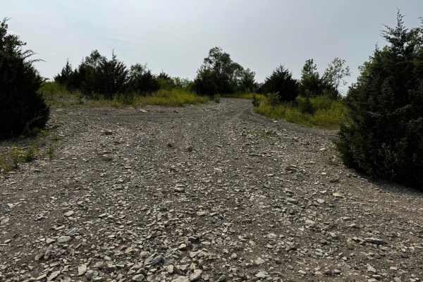
Green 22
This trail begins at Main Road Trail and leads down to the access points for Rollover 84 and Rolling Rock 86. The main section features a hill with a steady 13-degree descent, which is manageable for most 4WD vehicles. There are no major obstacles along the route, making it a fairly straightforward ...
Learn more about Green 22
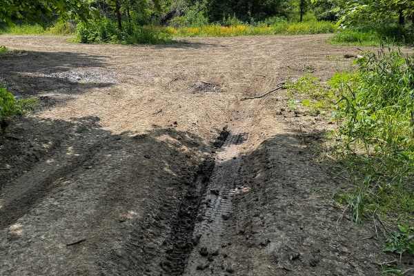
Green 76
Green 76 links Green 75 at one end and Green 4 at the other, leading down to the base of more challenging trails. The trail features a steep off-camber descent that leans toward a tree, so extra caution is needed when wet to avoid sliding into it. With heavy tree cover, the dirt base often turns to ...
Learn more about Green 76
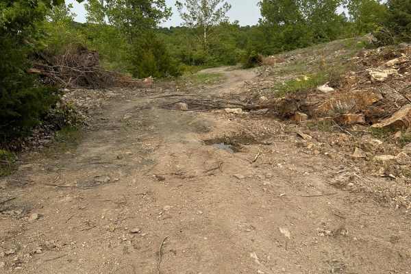
Green 37
This trail runs between Yellow 34 and Yellow 38 and is mostly flat with a dirt and rock base. While the terrain is generally easy, there is some tree debris scattered along the trail, likely due to water runoff. This debris can create obstacles or slippery spots, so caution is advised when driving. ...
Learn more about Green 37

Yellow 34
This trail runs between Green 18 and Green 22 and is off-camber for nearly its entire length, with most sections around 12 degrees and some reaching up to 16 degrees. The surface is a mix of dirt and rock, which can become slick when wet. In those conditions, the off-camber angle increases the risk ...
Learn more about Yellow 34
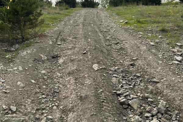
Yellow 35
This trail runs from Green 21 at the top down to Yellow 34 at the bottom. It features a steep hill climb that covers most of the trail, with some sections reaching up to an 18-degree incline. The trail is also slightly off-camber in places. The surface consists of dirt and rock, which can become ver...
Learn more about Yellow 35
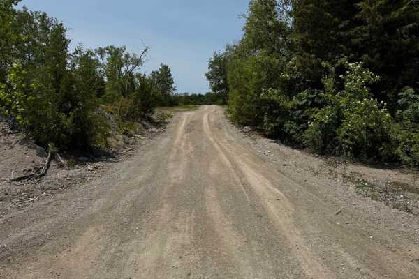
Green 12
This is a straightforward trail that loops around the base of a hill, providing a reliable route between key areas of the property. This trail serves as a connection to or from the primitive tent camping area and the section known as the Playground, helping users easily transition between recreation...
Learn more about Green 12
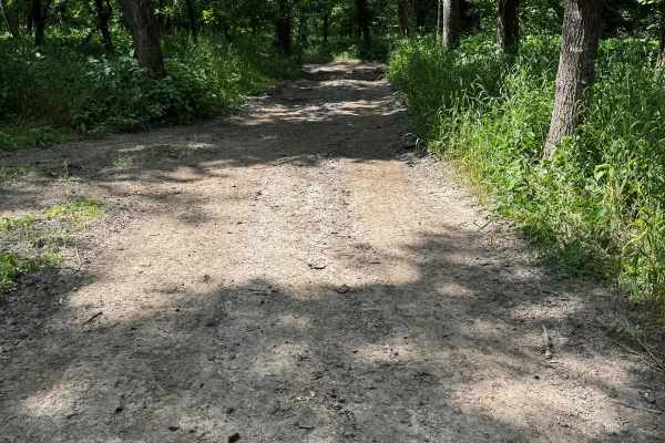
Green 77
This short trail winds gently through the woods, connecting Green 76 at one end and Green 4 at the other. Along the way, you will encounter some mild mud ruts, but nothing too challenging. The path is mostly straightforward, making it an easy and enjoyable drive through the forested area.
Learn more about Green 77
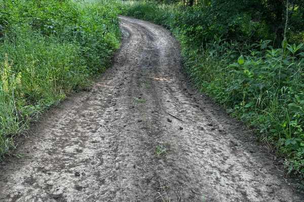
Green 88
This trail winds gently through the woods and stays mostly level with a dirt surface, making it generally easy to navigate in dry conditions. After rainfall, the dirt can become slick, which may require more careful throttle control. A minor washout is present on a turn, but it's not severe and shou...
Learn more about Green 88
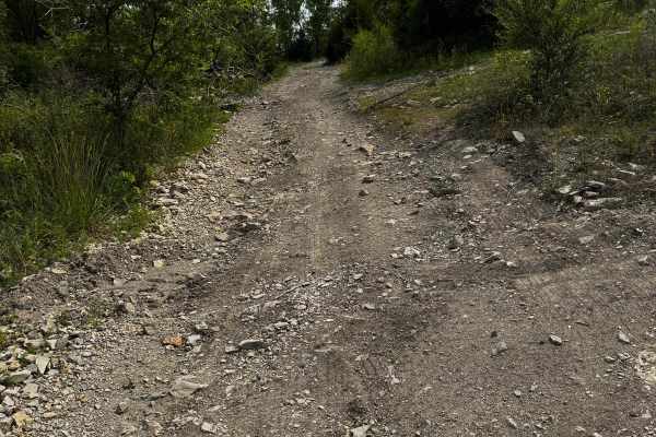
Green 21
This trail follows a dirt and rock surface and remains free of major obstacles, making it accessible for most high-clearance four-wheel-drive vehicles. However, several sections are off-camber, with angles reaching up to 15 degrees, which may require cautious navigation. These angled areas can becom...
Learn more about Green 21
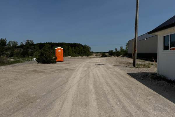
Main Road
The main road is the main entrance into the park. This road starts from the office where you check in and runs all the way to where it connects to Green 140. Because this is the main road through the park, there are several offshoot trails to choose from while traveling along the way.
Learn more about Main Road

Green 20
This trail connects Green 19 at one end and Green 21 at the other, featuring a hard-packed dirt and rock surface with no major obstacles. Some sections are off-camber up to 15 degrees, requiring careful vehicle positioning to maintain stability. The trail is generally wide enough for most 4WD vehicl...
Learn more about Green 20
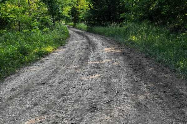
Green 81
This trail is an easygoing path that winds through a wooded area with moderate tree overgrowth, which may lead to some pin striping on wider vehicles. The surface is a mix of dirt and rock, generally firm under normal conditions. It offers a relaxed drive with no significant obstacles to navigate.
Learn more about Green 81
ATV trails near Dalton, Missouri
Explore ATV-friendly trails near you. These trails are accessible for vehicles up to 50 inches wide, perfect for ATVs and smaller off-road machines.
River Road
This scenic route follows a well-maintained gravel road that runs parallel to both the Katy Trail and the Missouri River, often called "The Big Muddy." While occasional washboard patches, potholes, and loose gravel demand attention, the drive is generally smooth and enjoyable. You'll pass a few scat...
Learn more about River Road
Red 72
This trail features a steep, slick hill climb that is challenging to ascend, requiring skill and caution. After the climb, the trail continues with off-camber sections that lead to another difficult trail. A tricky rock section near a tree demands careful navigation to avoid sliding into it. The bot...
Learn more about Red 72
Green 74
This trail connects to Yellow 71 and Red 72 at one end, and to Yellow 73 at the other. It features some narrow sections squeezed between trees, requiring careful navigation to avoid scratches. There are a few small mud holes scattered along the route, but otherwise, the trail remains relatively easy...
Learn more about Green 74
Yellow 73
This trail is a partial out-and-back route, requiring you to retrace part of your path before reaching another connecting trail. Alternatively, you can return all the way to the start. The entrance into the creek features a steep, off-camber descent. When crossing the creek, stay on the north side, ...
Learn more about Yellow 73
UTV/side-by-side trails near Dalton, Missouri
Find UTV and side-by-side trails near you. These trails accommodate vehicles up to 60 inches wide, ideal for UTVs, side-by-sides, and wider off-road rigs.
River Road
This scenic route follows a well-maintained gravel road that runs parallel to both the Katy Trail and the Missouri River, often called "The Big Muddy." While occasional washboard patches, potholes, and loose gravel demand attention, the drive is generally smooth and enjoyable. You'll pass a few scat...
Learn more about River Road
Red 72
This trail features a steep, slick hill climb that is challenging to ascend, requiring skill and caution. After the climb, the trail continues with off-camber sections that lead to another difficult trail. A tricky rock section near a tree demands careful navigation to avoid sliding into it. The bot...
Learn more about Red 72
Green 74
This trail connects to Yellow 71 and Red 72 at one end, and to Yellow 73 at the other. It features some narrow sections squeezed between trees, requiring careful navigation to avoid scratches. There are a few small mud holes scattered along the route, but otherwise, the trail remains relatively easy...
Learn more about Green 74
Yellow 73
This trail is a partial out-and-back route, requiring you to retrace part of your path before reaching another connecting trail. Alternatively, you can return all the way to the start. The entrance into the creek features a steep, off-camber descent. When crossing the creek, stay on the north side, ...
Learn more about Yellow 73
The onX Offroad Difference
onX Offroad combines trail photos, descriptions, difficulty ratings, width restrictions, seasonality, and more in a user-friendly interface. Available on all devices, with offline access and full compatibility with CarPlay and Android Auto. Discover what you're missing today!
Open Trail Map