
Dirt Bike Trails
Near Clayton, Wisconsin
Explore All Dirt Bike Trails Near Clayton, Wisconsin
Dirt Bike Trails Near Clayton, Wisconsin
Discover the best dirt bike trails near you. Browse trail maps, check difficulty ratings, and find your next adventure — whether you're looking for a quick ride or an all-day expedition.
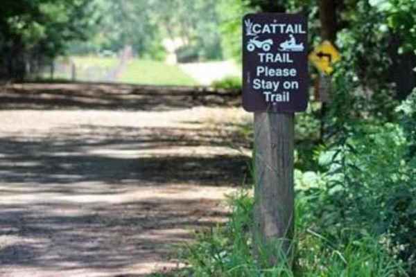
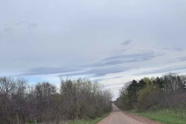
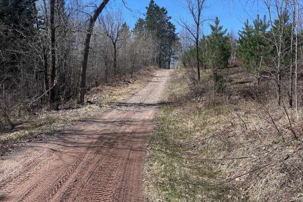
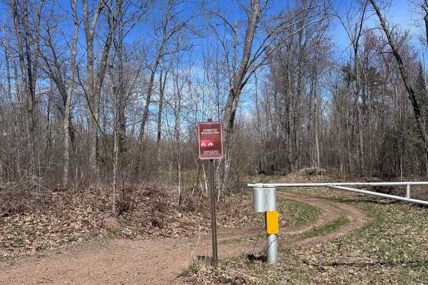
Cattail State Trail: Amery to Turtle Lake
Cattail State Trail: Amery to Turtle Lake is an 11.8-mile point-to-point trail rated 2 of 10 located in Polk County. The Amery to Turtle Lake section of the Cattail State Trail is a packed gravel rail-to-trail that has a gentle elevation gain of 200 feet over the length of the trail. Departing Amery...
Learn more about Cattail State Trail: Amery to Turtle Lake
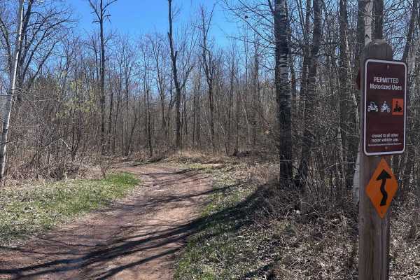
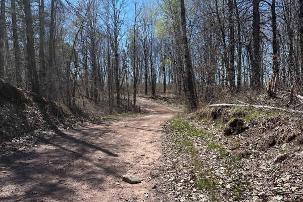
High Ground
This trail is one of the few in the whole forest that does not have any deep water crossings. There are a few shallow puddles that you'll encounter, but nothing extreme. Overall, this route is a nice break from the boggy trails in the rest of the system. It also smells wonderfully of pine.
Learn more about High Ground
Matthew Lourey State Trail
This is a short section of the Matthew Lourey State Trail that's accessible to OHVs in the summertime. Note that this is an out-and-back trail because OHV access ends at a dirt turn-around while the snowmobile trail continues north. Expect some smaller whoops, braking bumps, a few mud holes, and roc...
Learn more about Matthew Lourey State Trail
Gandy Dancer Trail
The Minnesota portion of the Gandy Dancer trail is an easy 30-mile ride. The trail is open year-round to ATV/UTV/ORV and bikes. In winter, the trail is groomed and shared with snowmobiles. The trail connects to other trails in the Danbury area, Nemadji State Forest, and Douglas County, WI. The trail...
Learn more about Gandy Dancer Trail
Chengwatana Forest Road
This is a simple dirt road serving as the main avenue to the rest of the forest. Along the way, there are some nice views, especially where it opens up to the main bog/marshland. Keep in mind, this road sits very close to the waterline in several spots, so the ground may get soft in those sections d...
Learn more about Chengwatana Forest Road
East Arm Forest Road
East Arm Forest Road connects Mallard Lake Forest Road and the Gandy Dancer Trail. It is fairly smooth in the western half, then gets progressively rockier as you travel east. This route is the primary way to access the eastern side of St. Croix State Forest when traveling on the Gandy Dancer Trail....
Learn more about East Arm Forest Road
Boulder Hill Trail
Boulder Hill Trail is a short but very rocky trail with a rocky hill climb section at the west entrance. The hill is steep, and the rocks are loose, which can make it challenging for 4x4s. OHVs should be able to crawl up. The hill can also get rutted badly during periods of heavy rainfall, making it...
Learn more about Boulder Hill Trail
Tamarack Sandway
Tamarack Sandway is a long sand track that runs adjacent to the Lower Tamarack River. The trail begins at the end of St.Croix High Line South and is OHV only. Expect rolling terrain with deep, sugary sand that's loose and dusty in dry conditions. There are lots of blind corners and hills, so be sure...
Learn more about Tamarack Sandway
St. Croix High Line South
St. Croix High Line South is the southern portion of the trail, which begins at the staging area along Mallard Lake Forest Road. It ends at a large clearing with a small shelter and a vault toilet. OHV riders can continue beyond that point, but 4x4 drivers will have to use this as an out-and-back, a...
Learn more about St. Croix High Line South
Trout Brook Trail
Trout Brook Trail is a short out-and-back that spurs off the Gandy Dancer Trail. Expect some medium-sized rocks and several mud holes that can get deep depending on the time of year. There is a go-around for the deeper one towards the end of the trail. OHV access ends short of Trout Brook, but you c...
Learn more about Trout Brook Trail
Mallard Lake Spur B
Mallard Lake Spur B is a short trail section with a few mud holes along the way. You can use this route to connect up to St.Croix High Line S from Mallard Lake Road. The mud holes vary in depth depending on the time of year, but are generally less than a foot deep. There are several large clearings ...
Learn more about Mallard Lake Spur B
Grace Lake Trail
The Grace Lake Trail connects Tamarack Sandway to Grace Lake and empties just down the road from the public water access. This route is one of the most beautiful ones in the state forest, featuring a bridge crossing the Lower Tamarack River and countless stunning white pines with unique shapes. Expe...
Learn more about Grace Lake Trail
Saint Croix High Line
The Saint Croix High Line is one of the higher elevation trails in the forest, featuring lots of small to medium-sized rocks and moderate puddles throughout. This is one of the first trails you pass if you access the forest from Mallard Lake Trail. There is a parking lot at the trailhead where you c...
Learn more about Saint Croix High Line
Churchill Lake Trail
Churchill Lake Trail is a fairly relaxed route that connects Grace and Churchill Lakes via Tamarack Forest Road and Grace Lake Road. It's mostly sand and has fewer rocks than most of the trails in this system. There are a few shallow water crossings, most of which have by-passes. There is one sectio...
Learn more about Churchill Lake Trail
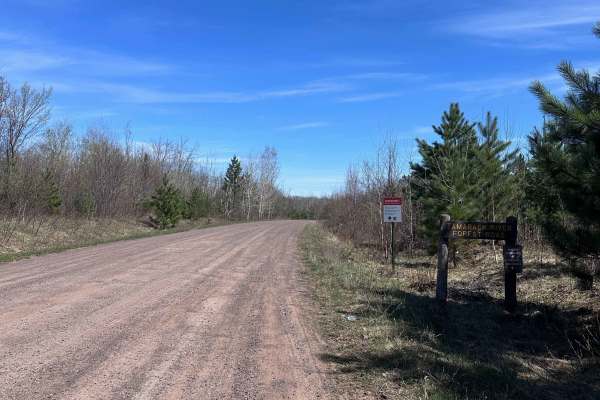
Tamarack River Forest Road
Tamarack River Forest Road is a smooth gravel road with gentle grades. It serves as one of the main roads through St. Croix State Forest with many trail crossings along the way. It begins at Grace Lake Road and ends at Boulder Campground and Rock Lake. Note that OHVs are not permitted inside the cam...
Learn more about Tamarack River Forest Road
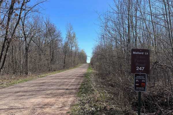
Mallard Lake Forest Road
Mallard Lake Forest Road is the main north/south forest road for the eastern side of the Tamarack River. It has mostly gentle grades but does have a fair amount of bumps and rough spots where erosion can make for a rougher ride. 4x4's towing campers or trailers will want to take it slower, while OHV...
Learn more about Mallard Lake Forest Road
Dog Sled Drive
The dog sled drive begins as a smooth, dry trail that gets progressively wetter as you go. There is a flowage/bog section where the water can get quite deep, depending on the time of year and recent rainfall. If you like water, this can be one of the deeper crossings that will test you and your mach...
Learn more about Dog Sled Drive
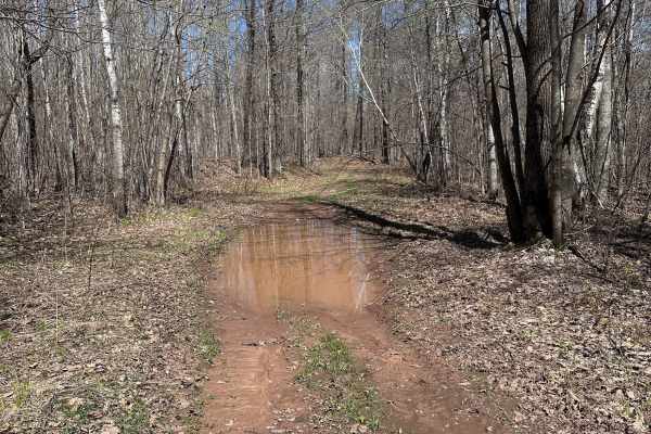
Hay Creek Trail
Hay Creek Trail is mostly a tame route with several mud holes along the way but there is a creek crossing at Longstrem Brook that can be a little intimidating. It's not deep but the steep approach makes it seem worse than it is. It can be used as a low consequence confidence booster for newer riders...
Learn more about Hay Creek Trail
Hunter's Spur
This is a short spur trail off the main trail that leads to a small clearing. There are often a number of grouse in the middle of the trail. There are many birch trees that line this route, which fall across the trail frequently and may be in the way if they haven't been cleared recently.
Learn more about Hunter's Spur
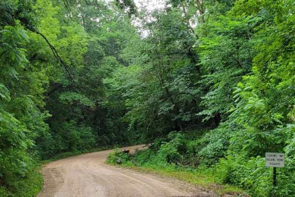
East Central Scenic Trail
Beautiful easy dirt road. Great views year-round, especially in the fall or in the winter after a light snow. This is an easy-maintained gravel road meandering through the driftless area of east central Minnesota. Close to many other beautiful gravel roads to explore. There are many nice small towns...
Learn more about East Central Scenic Trail
ATV trails near Clayton, Wisconsin
Explore ATV-friendly trails near you. These trails are accessible for vehicles up to 50 inches wide, perfect for ATVs and smaller off-road machines.
Cattail State Trail: Amery to Turtle Lake
Cattail State Trail: Amery to Turtle Lake is an 11.8-mile point-to-point trail rated 2 of 10 located in Polk County. The Amery to Turtle Lake section of the Cattail State Trail is a packed gravel rail-to-trail that has a gentle elevation gain of 200 feet over the length of the trail. Departing Amery...
Learn more about Cattail State Trail: Amery to Turtle Lake
High Ground
This trail is one of the few in the whole forest that does not have any deep water crossings. There are a few shallow puddles that you'll encounter, but nothing extreme. Overall, this route is a nice break from the boggy trails in the rest of the system. It also smells wonderfully of pine.
Learn more about High Ground
Matthew Lourey State Trail
This is a short section of the Matthew Lourey State Trail that's accessible to OHVs in the summertime. Note that this is an out-and-back trail because OHV access ends at a dirt turn-around while the snowmobile trail continues north. Expect some smaller whoops, braking bumps, a few mud holes, and roc...
Learn more about Matthew Lourey State Trail
Gandy Dancer Trail
The Minnesota portion of the Gandy Dancer trail is an easy 30-mile ride. The trail is open year-round to ATV/UTV/ORV and bikes. In winter, the trail is groomed and shared with snowmobiles. The trail connects to other trails in the Danbury area, Nemadji State Forest, and Douglas County, WI. The trail...
Learn more about Gandy Dancer Trail
UTV/side-by-side trails near Clayton, Wisconsin
Find UTV and side-by-side trails near you. These trails accommodate vehicles up to 60 inches wide, ideal for UTVs, side-by-sides, and wider off-road rigs.
Matthew Lourey State Trail
This is a short section of the Matthew Lourey State Trail that's accessible to OHVs in the summertime. Note that this is an out-and-back trail because OHV access ends at a dirt turn-around while the snowmobile trail continues north. Expect some smaller whoops, braking bumps, a few mud holes, and roc...
Learn more about Matthew Lourey State Trail
Chengwatana Forest Road
This is a simple dirt road serving as the main avenue to the rest of the forest. Along the way, there are some nice views, especially where it opens up to the main bog/marshland. Keep in mind, this road sits very close to the waterline in several spots, so the ground may get soft in those sections d...
Learn more about Chengwatana Forest Road
East Arm Forest Road
East Arm Forest Road connects Mallard Lake Forest Road and the Gandy Dancer Trail. It is fairly smooth in the western half, then gets progressively rockier as you travel east. This route is the primary way to access the eastern side of St. Croix State Forest when traveling on the Gandy Dancer Trail....
Learn more about East Arm Forest Road
Boulder Hill Trail
Boulder Hill Trail is a short but very rocky trail with a rocky hill climb section at the west entrance. The hill is steep, and the rocks are loose, which can make it challenging for 4x4s. OHVs should be able to crawl up. The hill can also get rutted badly during periods of heavy rainfall, making it...
Learn more about Boulder Hill Trail
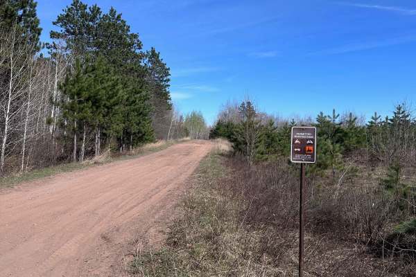
The onX Offroad Difference
onX Offroad combines trail photos, descriptions, difficulty ratings, width restrictions, seasonality, and more in a user-friendly interface. Available on all devices, with offline access and full compatibility with CarPlay and Android Auto. Discover what you're missing today!
Open Trail Map