
Dirt Bike Trails
Near Carbon Hill, Alabama
Explore All Dirt Bike Trails Near Carbon Hill, Alabama
Dirt Bike Trails Near Carbon Hill, Alabama
Discover the best dirt bike trails near you. Browse trail maps, check difficulty ratings, and find your next adventure — whether you're looking for a quick ride or an all-day expedition.
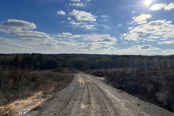
CR339
County Road 339 is a somewhat maintained public gravel road that offers great views of the surrounding area for those looking to get off the beaten path. Running from Alabama Highway 5 east to Rocky Plains Road, CR339 winds through prime Alabama Forestland, into creek bottoms, and along ridgetops. R...
Learn more about CR339
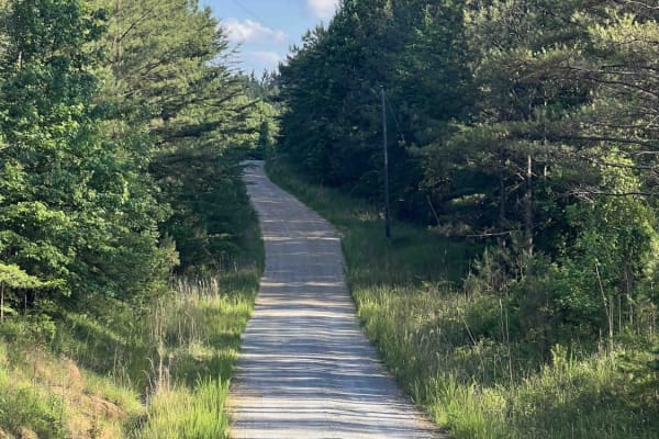
Meadow Creek Road
Meadow Creek Road or Winston County 357 is a maintained public gravel road running North from Highway 278 through Pine Timber Forestlands to Yankee Trace Road just before Highway 13. Meadow Creek Road offers an easy drive with ample opportunity for wildlife viewing as well as great views of the surr...
Learn more about Meadow Creek Road
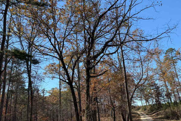
Wilbur Ford Road - FS 109A
Wilbur Ford Road - FS109A is a two-track road featuring deep ruts and flowing water during the wet season. This trail winds through various cut units and stunning stands of timber, offering a mix of terrain that challenges even experienced off-roaders. The road is narrow and windy, with massive poth...
Learn more about Wilbur Ford Road - FS 109A
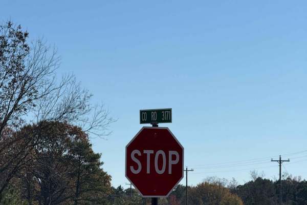
Grindstone Road - FS 109
FS 109 is a burned area within the Bankhead National Forest. The open forest features big potholes but also a beautiful, flowy road. Signs of ample conservation efforts are evident in the well-maintained pine stands. Unlike its counterpart, FS109A, this route is much smoother and receives far more r...
Learn more about Grindstone Road - FS 109
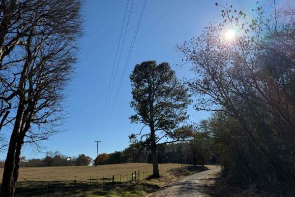
National Forest Road 121
National Forest Road 121 is a long, flowy road with deep washboard sections, including a particularly brutal paved portion. The area offers ample opportunities for hunting and gathering. Due to the road's condition, be prepared for a rough ride. Remember to tread lightly and always pack in and pack ...
Learn more about National Forest Road 121
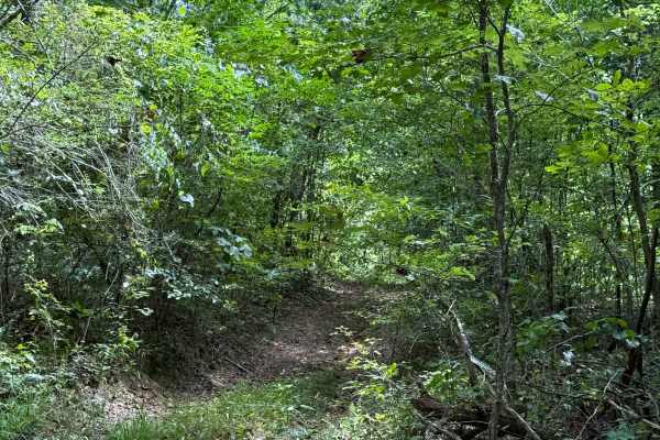
Cell Tower Dead End
This trail is by the cell tower, and is another way that used to fully take you up to the cell tower. This is now a dead-end trail, but it does have a lot of dirt bike trails around it. This trail is all deep in the woods with some tight areas to go around trees. The trail is somewhat overgrown at t...
Learn more about Cell Tower Dead End
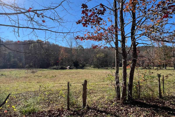
Beechy Creek - FS 244
This well-traveled two-track road serves as a fantastic connector through the stunning landscapes of the Bankhead National Forest. Following the serene Beechy Creek, it offers a peaceful journey immersed in nature's beauty. Be mindful that it can become slick and challenging during mud season, so pl...
Learn more about Beechy Creek - FS 244
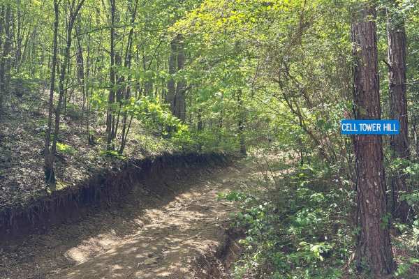
Cell Tower Road
Cell tower road had some very deep ruts along the route, as well as a couple of different splits in the trail that take you two different directions. The second split has a left trail that is not as wide as the right trail. If you are in a full-size vehicle, you need to take the right side, but the ...
Learn more about Cell Tower Road
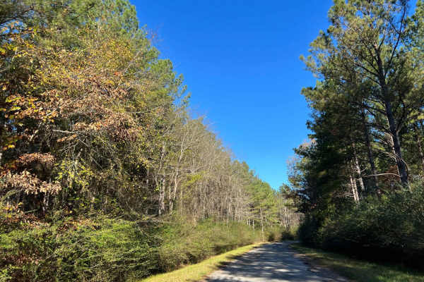
Bylor RD - FS 203
Starting at FS203, this scenic route transitions from pavement to gravel, leading you deep into the heart of the Bankhead National Forest. Along the way, it passes the historic Kinlock Lookout on Bylor Road, a notable landmark in the area. Forest Service Road 203 is a well-maintained two-track trail...
Learn more about Bylor RD - FS 203
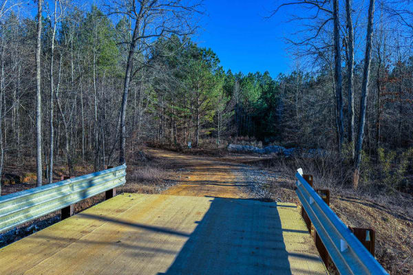
300 Main
Trail 300 Main is a practical and accessible route that connects to many one-way trails in the 300-series system. At the start, there is a bridge and creek where you can stop and explore the area on foot. Its manageable terrain and well-maintained width make it an ideal starting point for exploring ...
Learn more about 300 Main
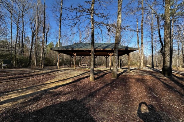
Pavilion/Cell Tower Trail
The Pavilion/Cell Tower Trail offers a mix of terrain, starting with a dirt road that skirts the lower track obstacle course and transitions into a wooded path. Along the way, the trail provides a scenic and varied off-road experience, including a creek crossing and a few shallow water holes.
Learn more about Pavilion/Cell Tower Trail
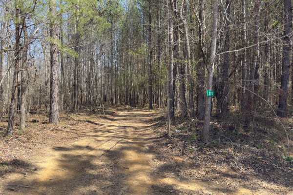
302
Trail 302 is a one-way Level 5 trail that runs parallel to Trail 300, starting near the creek on the west end. The route features uneven, rutted terrain with loose rock, erosion, and short, steep grades. After rain, water crossings can reach up to 20 inches, with frequent mud holes and slick section...
Learn more about 302
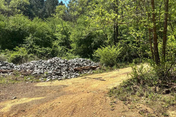
303
Trail 303 starts off as just a dirt trail along a creek. It does not have any major obstacles to begin with, about half way through the trail it does have a steep grade up the mountain and back down with a couple of one and two foot ledges and ruts to work around.
Learn more about 303
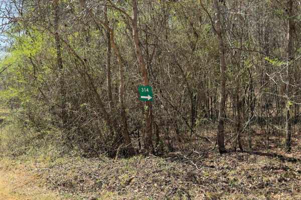
314
Trail 314 is a fun, moderately challenging trail on the south side of the park. This area tends to stay wetter than the north end, so you'll run into more mud, water crossings, and slick spots. The terrain is a mix of hard-packed dirt, loose rock from old washouts, and some standing water that can b...
Learn more about 314
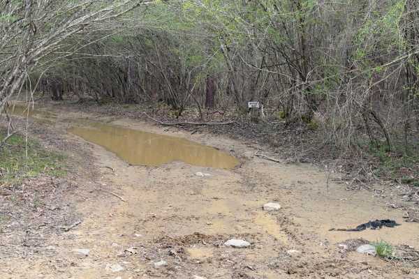
Mary's Road
Mary's Road is a wet trail with numerous mud holes and water crossings. It's a one-way route that begins off the main trail before entering the park and offers plenty of options along the way for deep water, mud, and ruts, giving drivers the choice to test their rigs through a variety of challenging...
Learn more about Mary's Road
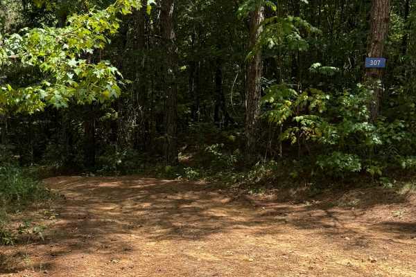
307
Trail 307 is a wooded route with several off-camber sections and a couple of switchbacks. Some ruts reach about two feet deep but can be straddled to cross, and there are no major rock or mud obstacles along the way.
Learn more about 307
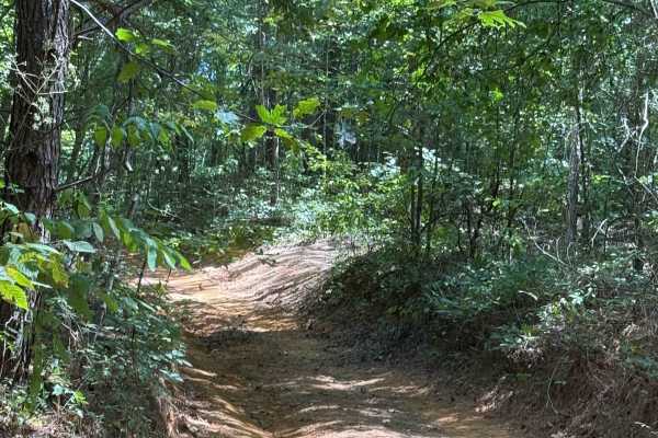
301
Trail 301 is a very long trail that connects you to a lot of shorter, harder trails. It has a lot of off-camber areas and some large step-down ledges that are one and two feet tall. There are some mud holes along this route that aren't very deep. Some ruts are one and two feet deep as well.
Learn more about 301
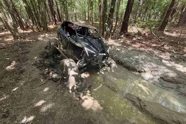
311 Mud
Trail 311 Mud was in a wooded area with a lot of trees. This trail will have a lot of mud holes in the spring and winter months when it is wetter. There are 3 and 4-foot mud holes along it with several by-passes and roundabouts that aren't as bad as other areas. In the summer and fall, this trail is...
Learn more about 311 Mud
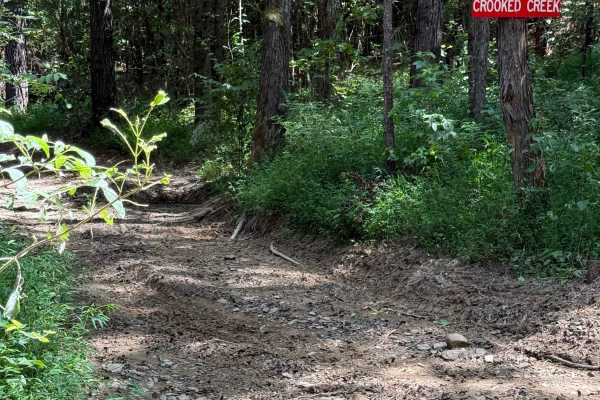
Crooked Creek
Crooked Creek is an old creek bed trail that has a lot of very tight areas. It is not very wide for larger vehicles at all. It has some water in it after a rain, but it was dry during mapping. This trail has some rocks that are 2-3 feet tall.
Learn more about Crooked Creek
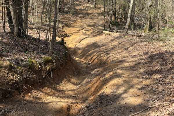
306 Hard
Trail 306 Hard is a one-way, hard-packed trail that offers a more challenging route than the easy line. It starts at the end of Trail 305 and branches off to the left before the entrance to 306 Easy. Expect deeper ruts, steeper climbs, and off-camber sections that require good ground clearance and d...
Learn more about 306 Hard
ATV trails near Carbon Hill, Alabama
Explore ATV-friendly trails near you. These trails are accessible for vehicles up to 50 inches wide, perfect for ATVs and smaller off-road machines.
CR339
County Road 339 is a somewhat maintained public gravel road that offers great views of the surrounding area for those looking to get off the beaten path. Running from Alabama Highway 5 east to Rocky Plains Road, CR339 winds through prime Alabama Forestland, into creek bottoms, and along ridgetops. R...
Learn more about CR339
Meadow Creek Road
Meadow Creek Road or Winston County 357 is a maintained public gravel road running North from Highway 278 through Pine Timber Forestlands to Yankee Trace Road just before Highway 13. Meadow Creek Road offers an easy drive with ample opportunity for wildlife viewing as well as great views of the surr...
Learn more about Meadow Creek Road
Wilbur Ford Road - FS 109A
Wilbur Ford Road - FS109A is a two-track road featuring deep ruts and flowing water during the wet season. This trail winds through various cut units and stunning stands of timber, offering a mix of terrain that challenges even experienced off-roaders. The road is narrow and windy, with massive poth...
Learn more about Wilbur Ford Road - FS 109A
Grindstone Road - FS 109
FS 109 is a burned area within the Bankhead National Forest. The open forest features big potholes but also a beautiful, flowy road. Signs of ample conservation efforts are evident in the well-maintained pine stands. Unlike its counterpart, FS109A, this route is much smoother and receives far more r...
Learn more about Grindstone Road - FS 109
UTV/side-by-side trails near Carbon Hill, Alabama
Find UTV and side-by-side trails near you. These trails accommodate vehicles up to 60 inches wide, ideal for UTVs, side-by-sides, and wider off-road rigs.
CR339
County Road 339 is a somewhat maintained public gravel road that offers great views of the surrounding area for those looking to get off the beaten path. Running from Alabama Highway 5 east to Rocky Plains Road, CR339 winds through prime Alabama Forestland, into creek bottoms, and along ridgetops. R...
Learn more about CR339
Meadow Creek Road
Meadow Creek Road or Winston County 357 is a maintained public gravel road running North from Highway 278 through Pine Timber Forestlands to Yankee Trace Road just before Highway 13. Meadow Creek Road offers an easy drive with ample opportunity for wildlife viewing as well as great views of the surr...
Learn more about Meadow Creek Road
Wilbur Ford Road - FS 109A
Wilbur Ford Road - FS109A is a two-track road featuring deep ruts and flowing water during the wet season. This trail winds through various cut units and stunning stands of timber, offering a mix of terrain that challenges even experienced off-roaders. The road is narrow and windy, with massive poth...
Learn more about Wilbur Ford Road - FS 109A
Grindstone Road - FS 109
FS 109 is a burned area within the Bankhead National Forest. The open forest features big potholes but also a beautiful, flowy road. Signs of ample conservation efforts are evident in the well-maintained pine stands. Unlike its counterpart, FS109A, this route is much smoother and receives far more r...
Learn more about Grindstone Road - FS 109
The onX Offroad Difference
onX Offroad combines trail photos, descriptions, difficulty ratings, width restrictions, seasonality, and more in a user-friendly interface. Available on all devices, with offline access and full compatibility with CarPlay and Android Auto. Discover what you're missing today!
Open Trail Map