
Dirt Bike Trails
Near Cambridge, Idaho
Explore All Dirt Bike Trails Near Cambridge, Idaho
Dirt Bike Trails Near Cambridge, Idaho
Discover the best dirt bike trails near you. Browse trail maps, check difficulty ratings, and find your next adventure — whether you're looking for a quick ride or an all-day expedition.
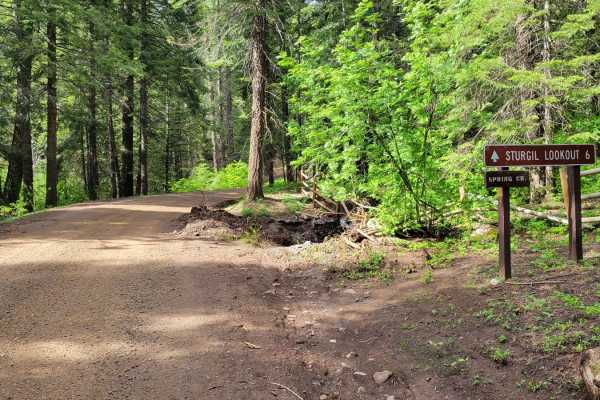
Sturgill Peak - Fire Lookout Tower
This is the second half of FR 09 (Mann Creek). The next six miles beyond the Spring Creek Campground are less maintained and progressively become less and less smooth. Erosion ruts and small rocks make for a bumpy ride. Most of this trail would actually rate 2 - 3, but it's the very last section to ...
Learn more about Sturgill Peak - Fire Lookout Tower
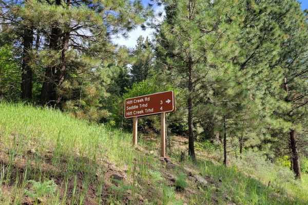
FR 573 - Hitt Creek
This offshoot trail from FR 09 leads to a couple of trailheads - Hitt Creek Trailhead and Keithy Saddle Trailhead. Hitt Creek Trailhead (Trail No. 276) is accessible to bikes and ATVs and is an alternative route to the Sturgil Lookout Tower. If continuing up the trail, unfortunately, there isn't a g...
Learn more about FR 573 - Hitt Creek
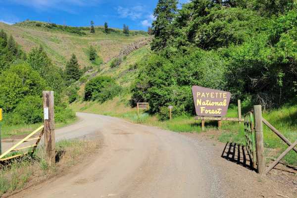
FR 09 - Mann Creek
This is the first section of FR 09. It's an easy and maintained dirt road as it leads to several established campgrounds. There are a handful of offshoot trails to take, as well as a hiking trailhead or two. If looking for primitive campsites, continue up the trail and you'll find quite a few. The M...
Learn more about FR 09 - Mann Creek
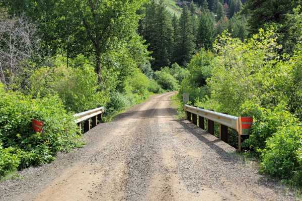
FR 025 - Adams Creek
Adams Creek Trail in the Payette National Forest is a picturesque mountain trail that is half of a scenic loop. It's an easy gradual ascent/descent dirt road with scattered primitive campsites along the way. Easy enough for observed large fifth-wheel camper trailers to reach the summit. At the top, ...
Learn more about FR 025 - Adams Creek
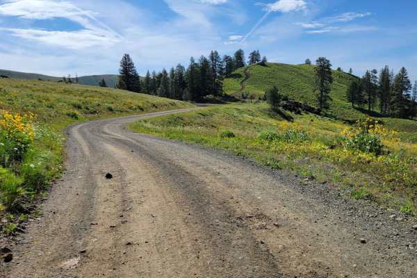
NR 019 - Bear Creek Saddle
From off of NF-24, this beautiful trail takes you North, weaving and winding its way along the side of the mountain, climbing over 1,000' in elevation. At the top is Bear Saddle, where the trail splits. From the top, you can catch some amazing views Northwest and spot neighboring peaks in the distan...
Learn more about NR 019 - Bear Creek Saddle
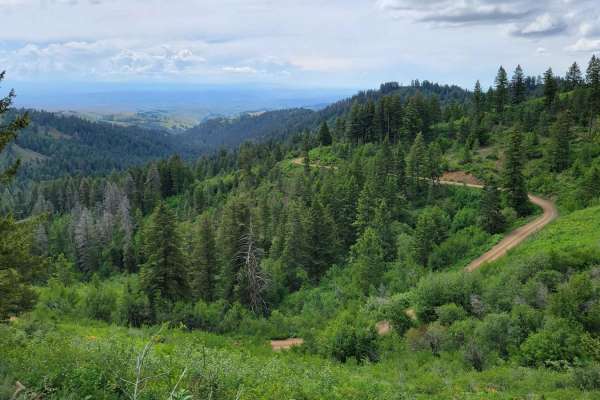
FR 306 - Iron Mountain Trail
This trail briefly parallels FR 025 before climbing up onto the mountain ridgeline. There are a handful of short steep climbs to navigate. The trail is narrow and full-size vehicles would undoubtedly brush vegetation. Erosion damage is present throughout, with an active section happening at the time...
Learn more about FR 306 - Iron Mountain Trail
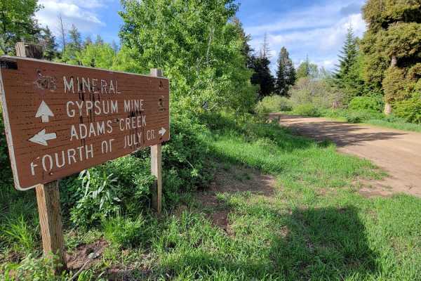
FR 024 - Fourth of July Creek
Fourth of July Creek Trail is the other half of a scenic mountain loop through the Payette National Forest. Plenty of off-shoot trails to explore and primitive camping spots throughout. This trail has more shelf sections (cut into the side of the hill) and offers beautiful views across the forest an...
Learn more about FR 024 - Fourth of July Creek
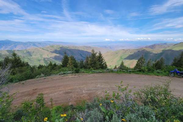
Sturgil Dennett
This loop connects the top of Bear Creek Saddleback to the main road (FR 025, Adams Creek). It involves three trails: FR 51651, 283, and 010. When this trial was mapped (early June) there were still snowdrifts across the trail, at the top towards Bear Saddle. They proved to be a challenge to cross. ...
Learn more about Sturgil Dennett
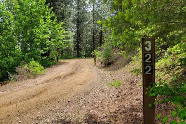
FR 322 - Wolf/Monroe Creek
Passing through a (seasonal) gate at the entrance, this trail begins as a progressive climb up the hill. The puddles are certainly present after wet conditions. There are erosion ruts to navigate as well. There are plenty of offshoot trails to explore, especially towards the top. The trail eventuall...
Learn more about FR 322 - Wolf/Monroe Creek
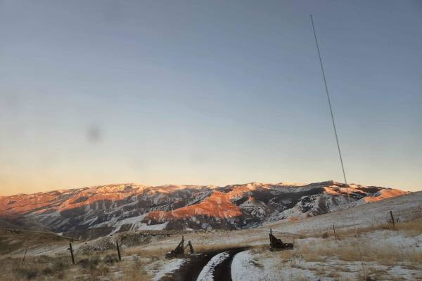
Oregan Eagle Mountain View
Have a good set of mud tires during the cold and wet seasons on this trail. 4x4 is recommended. You will find awesome views of the Eagle Cap Mountains Public Access Road with a little climb to the best view. This is a great place to take the family and watch the sunset or sunrise. There is lots of l...
Learn more about Oregan Eagle Mountain View
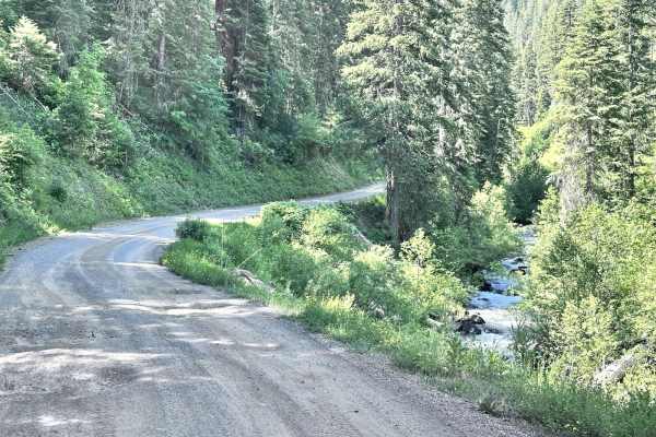
East Fork Weiser
East Fork Weiser is a 13.5-mile point-to-point trail that parallels the East Fork of the Weiser River. This winding trail takes you up into the West Mountains and connects to several other trails. This is a maintained Forest Service Road with light washboarding and shallow mud holes. This trail may ...
Learn more about East Fork Weiser
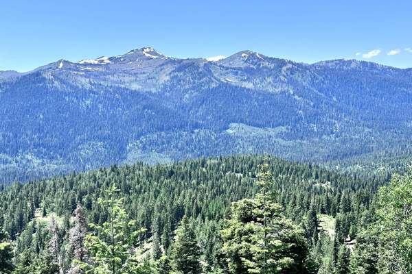
West Mountain
West Mountain is a 9-mile point-to-point trail that has multiple cut-off trails giving access to the West Mountain Jeep trail. The mountain views along this trail are spectacular. The trail is a maintained Forest Service road with light washboarding and shallow mud holes. The southern end of the tra...
Learn more about West Mountain
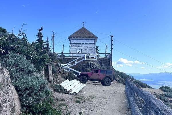
No Business Lookout
No Business Lookout is a 7.6-mile out and back trail in the West Mountains that travels up to an old fire lookout on top of No Business Mountain. This trail is single vehicle width, with erosion damage and loose rocks under 12" in height/depth. The last section up to the Lookout is the roughest port...
Learn more about No Business Lookout
Old Cascade
Old Cascade is a 7.2 mile point to point trail that travels into the West Mountains. The trail starts from North Mill Creek at Cutoff Saddle. Upon leaving North Mill Creek the trail becomes more rough and narrows, with erosion damage and loose rocks under 12 inches in height/depth. Enjoy the three m...
Learn more about Old Cascade
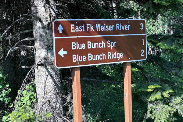
Blue Bunch Ridge
Blue Bunch Ridge is a 7.1-mile point-to-point trail that follows the ridge line and gives majestic views of Payette Lake and the valley below. Blue Bunch Ridge trail also provides great views of Council Mountain. This trail is single vehicle width and has erosion damage and loose rocks under 12" in ...
Learn more about Blue Bunch Ridge
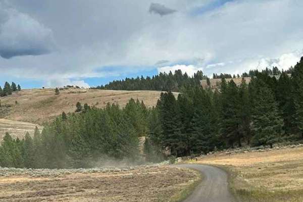
West Fork Weiser
The West Fork Weiser off-road trail, following Forest Service Road 50127, offers a scenic drive through some of Idaho’s most rugged backcountry. The road surface is a mix of compacted dirt, loose gravel, and rocky stretches, with sections that can be muddy or rutted after storms or snowmelt. High-cl...
Learn more about West Fork Weiser
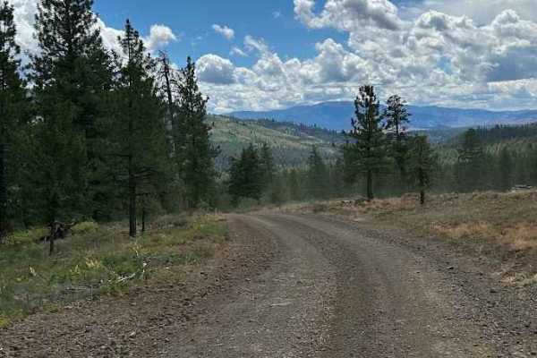
Lick Creek - FS 50143
Lick Creek Road, Forest Service Road 50143 in Idaho, is a classic mountain drive that offers a mix of rugged adventure and scenic beauty. The road begins with well-graded gravel, making for a fairly smooth approach, but quickly transitions into narrower stretches with loose rock, washboards, and occ...
Learn more about Lick Creek - FS 50143
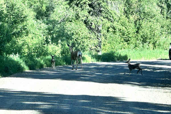
Middle Fork Weiser
Middle Fork Weiser is a 25.8-mile point-to-point road that crosses the West Mountains and parallels the Middle Fork of the Weiser River. This road gives access to several good hiking trails (Sheep Creek and Warm Spring Creek) and the Cabin Creek Campground. This is a maintained forest service road w...
Learn more about Middle Fork Weiser
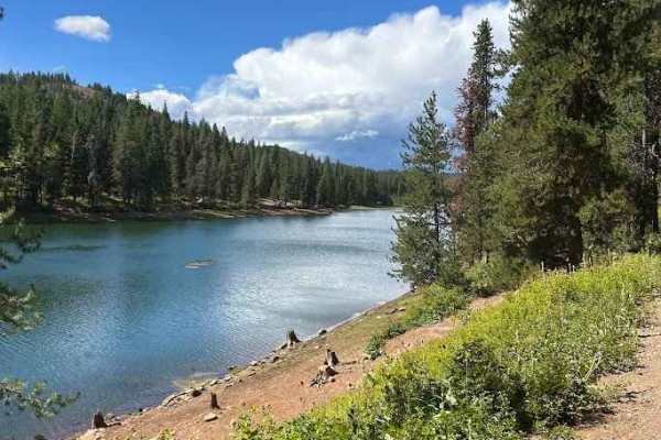
Lost Valley Reservoir Loop
The Lost Valley Reservoir Loop in Idaho offers a scenic and enjoyable off-road drive that combines easy cruising with plenty of sights worth stopping for. The road surface is primarily well-graded dirt and gravel, making it accessible to most high-clearance vehicles and ideal for those looking for a...
Learn more about Lost Valley Reservoir Loop
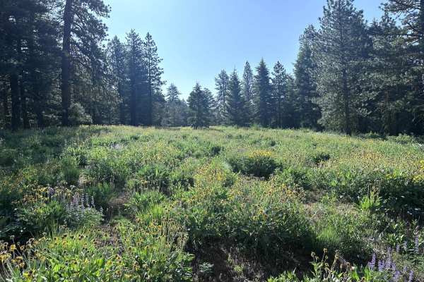
Beaver Creek
Beaver Creek is a 12.7-mile point-to-point trail that parallels Beaver Creek in the West Mountains. The trail starts from Highway 95 and passes through private lands;be respectful, stay on the trail, and drive the speed limit. The first half of the trail parallels Beaver Creek in a scenic canyon, th...
Learn more about Beaver Creek
ATV trails near Cambridge, Idaho
Explore ATV-friendly trails near you. These trails are accessible for vehicles up to 50 inches wide, perfect for ATVs and smaller off-road machines.
Sturgill Peak - Fire Lookout Tower
This is the second half of FR 09 (Mann Creek). The next six miles beyond the Spring Creek Campground are less maintained and progressively become less and less smooth. Erosion ruts and small rocks make for a bumpy ride. Most of this trail would actually rate 2 - 3, but it's the very last section to ...
Learn more about Sturgill Peak - Fire Lookout Tower
FR 573 - Hitt Creek
This offshoot trail from FR 09 leads to a couple of trailheads - Hitt Creek Trailhead and Keithy Saddle Trailhead. Hitt Creek Trailhead (Trail No. 276) is accessible to bikes and ATVs and is an alternative route to the Sturgil Lookout Tower. If continuing up the trail, unfortunately, there isn't a g...
Learn more about FR 573 - Hitt Creek
FR 09 - Mann Creek
This is the first section of FR 09. It's an easy and maintained dirt road as it leads to several established campgrounds. There are a handful of offshoot trails to take, as well as a hiking trailhead or two. If looking for primitive campsites, continue up the trail and you'll find quite a few. The M...
Learn more about FR 09 - Mann Creek
FR 025 - Adams Creek
Adams Creek Trail in the Payette National Forest is a picturesque mountain trail that is half of a scenic loop. It's an easy gradual ascent/descent dirt road with scattered primitive campsites along the way. Easy enough for observed large fifth-wheel camper trailers to reach the summit. At the top, ...
Learn more about FR 025 - Adams Creek
UTV/side-by-side trails near Cambridge, Idaho
Find UTV and side-by-side trails near you. These trails accommodate vehicles up to 60 inches wide, ideal for UTVs, side-by-sides, and wider off-road rigs.
Sturgill Peak - Fire Lookout Tower
This is the second half of FR 09 (Mann Creek). The next six miles beyond the Spring Creek Campground are less maintained and progressively become less and less smooth. Erosion ruts and small rocks make for a bumpy ride. Most of this trail would actually rate 2 - 3, but it's the very last section to ...
Learn more about Sturgill Peak - Fire Lookout Tower
FR 573 - Hitt Creek
This offshoot trail from FR 09 leads to a couple of trailheads - Hitt Creek Trailhead and Keithy Saddle Trailhead. Hitt Creek Trailhead (Trail No. 276) is accessible to bikes and ATVs and is an alternative route to the Sturgil Lookout Tower. If continuing up the trail, unfortunately, there isn't a g...
Learn more about FR 573 - Hitt Creek
FR 09 - Mann Creek
This is the first section of FR 09. It's an easy and maintained dirt road as it leads to several established campgrounds. There are a handful of offshoot trails to take, as well as a hiking trailhead or two. If looking for primitive campsites, continue up the trail and you'll find quite a few. The M...
Learn more about FR 09 - Mann Creek
FR 025 - Adams Creek
Adams Creek Trail in the Payette National Forest is a picturesque mountain trail that is half of a scenic loop. It's an easy gradual ascent/descent dirt road with scattered primitive campsites along the way. Easy enough for observed large fifth-wheel camper trailers to reach the summit. At the top, ...
Learn more about FR 025 - Adams Creek
The onX Offroad Difference
onX Offroad combines trail photos, descriptions, difficulty ratings, width restrictions, seasonality, and more in a user-friendly interface. Available on all devices, with offline access and full compatibility with CarPlay and Android Auto. Discover what you're missing today!
Open Trail Map