
Dirt Bike Trails
Near Blacksburg, South Carolina
Explore All Dirt Bike Trails Near Blacksburg, South Carolina
Dirt Bike Trails Near Blacksburg, South Carolina
Discover the best dirt bike trails near you. Browse trail maps, check difficulty ratings, and find your next adventure — whether you're looking for a quick ride or an all-day expedition.
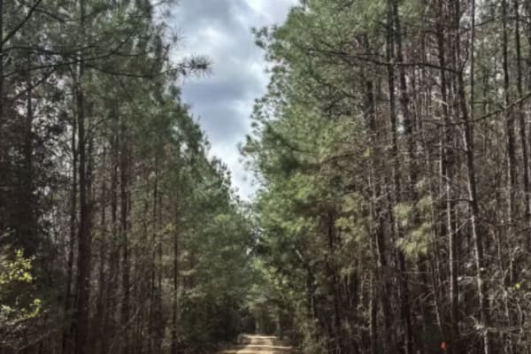
Cricket Tree Road
This scenic forest trail winds through tall pine trees and sandy terrain, offering a quiet off-road drive surrounded by nature. The surface is mostly sandy and graded, with occasional muddy puddles after rain and scattered pinecones along the path. Gentle curves and narrow sections between trees add...
Learn more about Cricket Tree Road
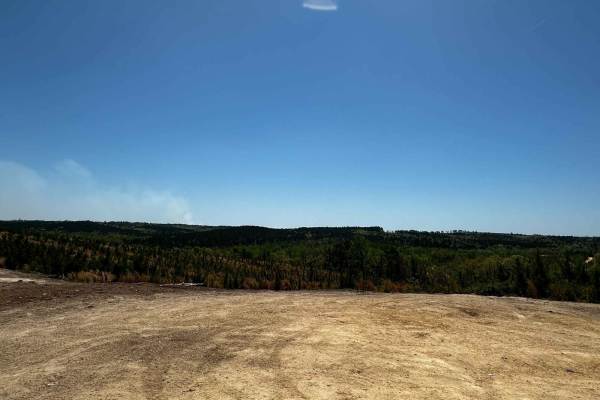
Trail 4
Expect bedrock on some hill climbs. This is mainly a dirt road, with plenty of straightaways and hill climbs. There are two nice overlooks about halfway on the trail, some ruts on the trail (along the hill climbs), and one mud bog beside the trail. The backside of the trail has big holes you can go ...
Learn more about Trail 4
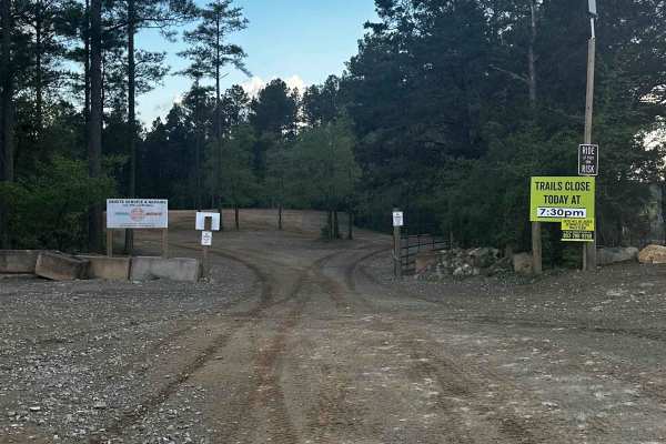
Service Road 4 (SR 4)
One of our main service roads that leads to trails, SR 4 is rocky in some areas. It's a very wide road that is very dusty if the ground is dry. The road is used by EMS/the Rescue Squad if needed. There are a couple of curves but it's mainly a straight road that leads to the bridge crossing. It's rea...
Learn more about Service Road 4 (SR 4)
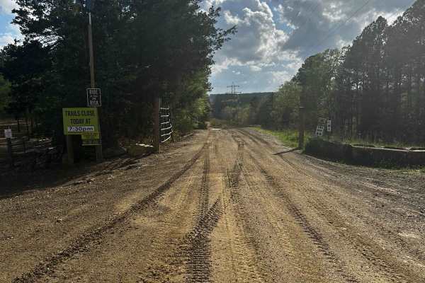
Trail 11
This is one of the main trails to access two of the longest trails in the park. It is wide like a service road and is also known as the Powerline Trail (powerline towers go down the whole trail). Expect a creek crossing and clay/bedrock for 50% of the trail. It ends at Trail 4.
Learn more about Trail 11
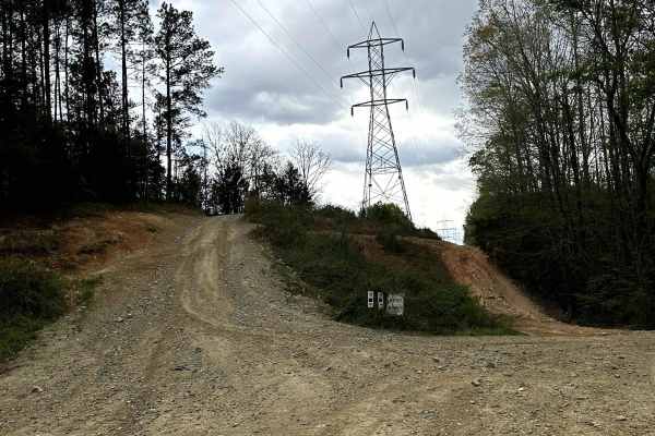
Trail 9
Trail 9 is a two-way trail that connects Service Road 4 and Trail 11. From the Trail 11 side, it begins with a slight hill climb of loose rock. The rest of the trail consists of relatively flat hard-packed dirt. The trail has a few rut sections that are around 12 inches deep.
Learn more about Trail 9

Trail 6
This is the longest trail in the trail system with a lot of mergers onto other trails. It goes through the whole park on a mostly dirt road with some bedrock in certain spots. When it rains, there will be some mud spots on the trail. Though the trail can be windy in some sections, it's the easiest t...
Learn more about Trail 6
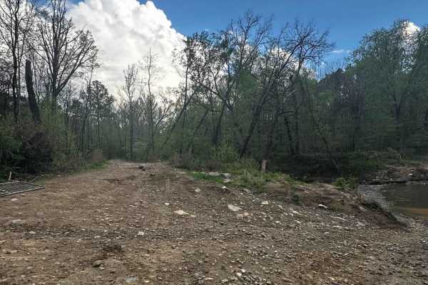
Trail 2
Trail 2 is mainly dirt but there is bedrock in some areas. It's a short trail that is windy in some areas and rocky in one section. It starts right beside the creek crossing on Trail 11. The first 200 feet will be closed if the creek rises over its full limit. A one-way trail, Trail 2 spits you out ...
Learn more about Trail 2
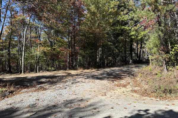
Dobson Knob - FS 106
This out-and-back trail is a gravel-over-packed-dirt route beginning at Old North Carolina 105 and following a ridge with scenic views on both sides. Around 4.4 miles in, it narrows to a six-foot-wide path near a large camping area, then continues another 1.5 miles as the Mountains-to-Sea hiking tra...
Learn more about Dobson Knob - FS 106

Trail 1
Trail 1 is a 1.5-mile moderate trail that begins off of Trail 5. Trail 1 is a shaded dirt trail with mild ruts and little loose rocks until you get you exit the wooded part of the trail. The trail enters a grassy rolling hill and the terrain becomes uneven and rocky. This creates some good challenge...
Learn more about Trail 1
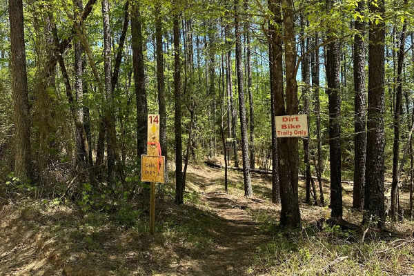
Trail 14
Trail 14 is a one-way dirt bike-only trail that begins on Service Road 7. This trail is rated as most difficult and provides many challenges. The trail is tight and provides narrow paths through trees, moderate hill climbs, and numerous downed tree obstacles. It's an enjoyable trail for an experienc...
Learn more about Trail 14

Trail 23
Trail 23 is a 2.5-mile moderate trail that begins at the end of Service Road 21. This trail is a shady trail of hard-packed dirt that is relatively flat, creating a relaxing ride. There are a couple of rutted portions but nothing a stock vehicle cannot overcome. This trail offers a nice and relaxing...
Learn more about Trail 23
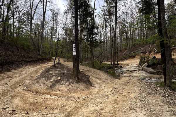
Trail 10
Trail 10 is a two-way moderate trail that connects Trail 5 to Service Road 7. The trail is hard-packed dirt with slight elevation gains. The ruts on this trail are shallow. All ruts have a depth of less than 12 inches. The trail has some mild uneven areas that can be easily completed with a stock un...
Learn more about Trail 10

Trail 8
Trail 8 is a half-mile trail that begins off of Trail 5. It is rated as most difficult and should be approached strategically. The trail begins with a hill climb containing uneven terrain, loose rocks, and deep ruts ranging from approximately 12 to 24 inches. Once the climb is complete, the trail sm...
Learn more about Trail 8
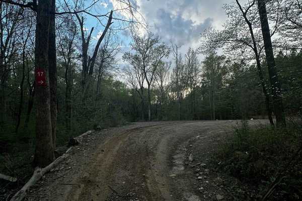
Service Road 17 (SR 17)
SR 17 is the road from the bridge crossing to SR 18. It's mainly a dirt road with some bedrock in one section. Trail 6, SR 18, the end of Trail 44, and a shortcut to SR 18 are accessed from this road. This service road is used for emergencies. It's a wide road that provides access to dirt bike Trail...
Learn more about Service Road 17 (SR 17)
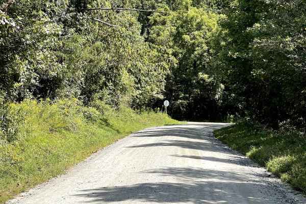
Playmore Beach Road
Playmore Beach Road is a through route consisting of hard-packed dirt that is approximately two lanes wide and free from major obstacles. The trail provides an easy and enjoyable drive through the surrounding area and is suitable for most vehicles. Along the route, users can enjoy the scenery of a n...
Learn more about Playmore Beach Road
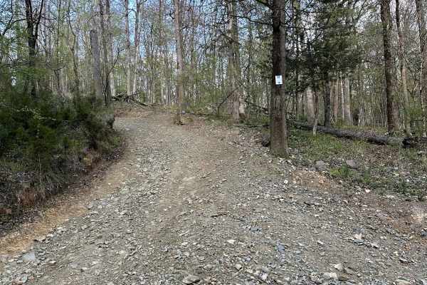
Trail 22
Trail 22 is a short 2-way moderate trail that connects Trail 5 and Service Road 1. Trail 22 is a mix of loose stone and packed dirt with very mild hills. There are a few uneven sections but the trail is easily completed by a stock unit.
Learn more about Trail 22
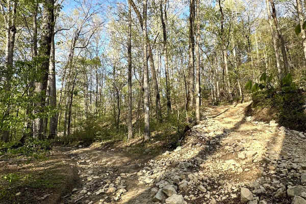
Trail 20
Trail 20 is a short two-way moderate trail that runs beside Service Road 14. This trail provides a more gradual hill to climb or descent as an alternative option for those who wish for an easier route from the hill on Service Road 14. The trail is a mix of loose rock and packed dirt.
Learn more about Trail 20

Trail 41
Trail 41 is a 2.5-mile moderate trail that begins on Service Road 21. The trail offers a primarily dirt pathway with slight elevation gain and drops. The trail offers some rather challenging ruts, approximately 2 feet deep at the most difficult sections. The ruts are avoidable for those who choose t...
Learn more about Trail 41
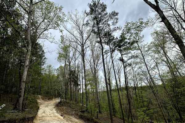
Trail 18
Trail 18 begins on Service Road 14 at the top of Grizzly Hill. This trail is a dirt trail with some sections of loose rock. Just after coming down the first hill, there are some milder hill climbs than the ones of Grizzly Hill. The trail follows alongside Big Wateree Creek and will finish on Service...
Learn more about Trail 18
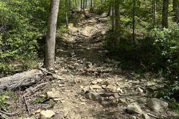
Trail 34 Grizzly Hill
Trail 34, also known as Grizzly Hill, is the most difficult-rated trail beside Service Road 7 near Wateree Creek. This trail consists of various routes to climb the hill. Each route consists of steep, uneven, and rutted terrain. The terrain contains obstacles of loose rock, large embedded rocks, and...
Learn more about Trail 34 Grizzly Hill
ATV trails near Blacksburg, South Carolina
Explore ATV-friendly trails near you. These trails are accessible for vehicles up to 50 inches wide, perfect for ATVs and smaller off-road machines.
Cricket Tree Road
This scenic forest trail winds through tall pine trees and sandy terrain, offering a quiet off-road drive surrounded by nature. The surface is mostly sandy and graded, with occasional muddy puddles after rain and scattered pinecones along the path. Gentle curves and narrow sections between trees add...
Learn more about Cricket Tree Road
Trail 4
Expect bedrock on some hill climbs. This is mainly a dirt road, with plenty of straightaways and hill climbs. There are two nice overlooks about halfway on the trail, some ruts on the trail (along the hill climbs), and one mud bog beside the trail. The backside of the trail has big holes you can go ...
Learn more about Trail 4
Service Road 4 (SR 4)
One of our main service roads that leads to trails, SR 4 is rocky in some areas. It's a very wide road that is very dusty if the ground is dry. The road is used by EMS/the Rescue Squad if needed. There are a couple of curves but it's mainly a straight road that leads to the bridge crossing. It's rea...
Learn more about Service Road 4 (SR 4)
Trail 11
This is one of the main trails to access two of the longest trails in the park. It is wide like a service road and is also known as the Powerline Trail (powerline towers go down the whole trail). Expect a creek crossing and clay/bedrock for 50% of the trail. It ends at Trail 4.
Learn more about Trail 11
UTV/side-by-side trails near Blacksburg, South Carolina
Find UTV and side-by-side trails near you. These trails accommodate vehicles up to 60 inches wide, ideal for UTVs, side-by-sides, and wider off-road rigs.
Cricket Tree Road
This scenic forest trail winds through tall pine trees and sandy terrain, offering a quiet off-road drive surrounded by nature. The surface is mostly sandy and graded, with occasional muddy puddles after rain and scattered pinecones along the path. Gentle curves and narrow sections between trees add...
Learn more about Cricket Tree Road
Trail 4
Expect bedrock on some hill climbs. This is mainly a dirt road, with plenty of straightaways and hill climbs. There are two nice overlooks about halfway on the trail, some ruts on the trail (along the hill climbs), and one mud bog beside the trail. The backside of the trail has big holes you can go ...
Learn more about Trail 4
Service Road 4 (SR 4)
One of our main service roads that leads to trails, SR 4 is rocky in some areas. It's a very wide road that is very dusty if the ground is dry. The road is used by EMS/the Rescue Squad if needed. There are a couple of curves but it's mainly a straight road that leads to the bridge crossing. It's rea...
Learn more about Service Road 4 (SR 4)
Trail 11
This is one of the main trails to access two of the longest trails in the park. It is wide like a service road and is also known as the Powerline Trail (powerline towers go down the whole trail). Expect a creek crossing and clay/bedrock for 50% of the trail. It ends at Trail 4.
Learn more about Trail 11
The onX Offroad Difference
onX Offroad combines trail photos, descriptions, difficulty ratings, width restrictions, seasonality, and more in a user-friendly interface. Available on all devices, with offline access and full compatibility with CarPlay and Android Auto. Discover what you're missing today!
Open Trail Map