
Beginner Off-Road Trails
Near Wisdom, Montana
Explore All Beginner Trails Near Wisdom, Montana
Beginner Off-Road Trails Near Wisdom, Montana
Discover the best beginner-friendly off-road trails near you. These easier, lower-rated trails are a great place to start — browse trail maps, check difficulty ratings, and find your next adventure.
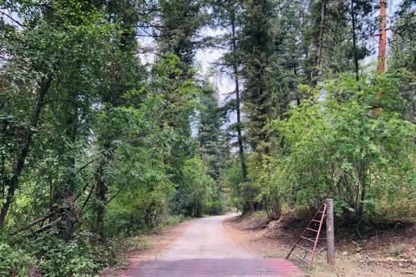
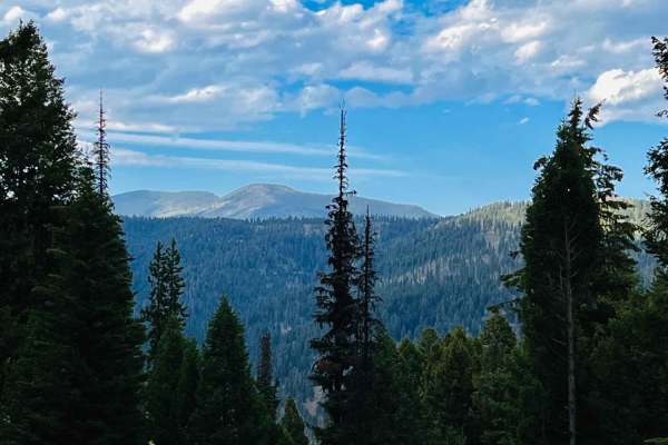
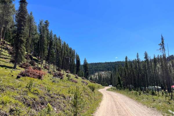
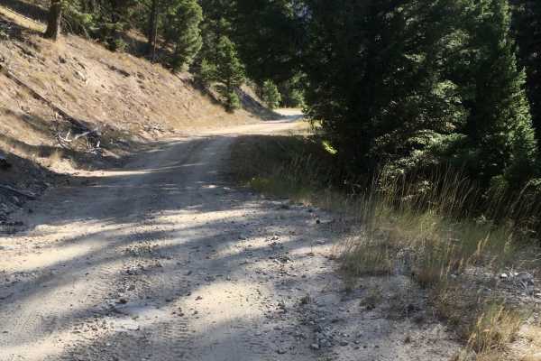
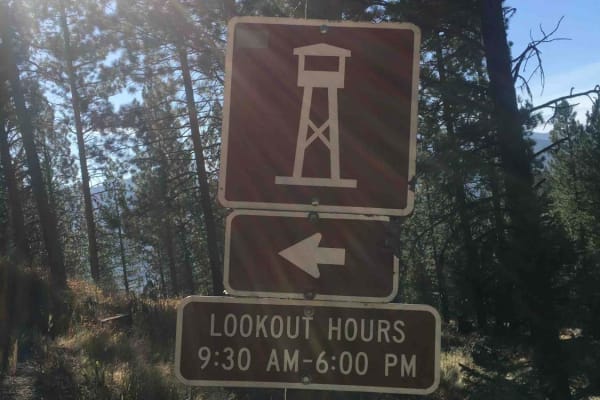
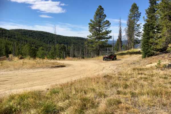
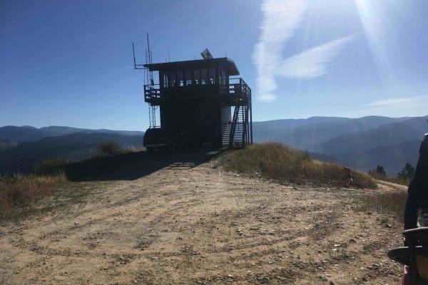
4th of July Trail
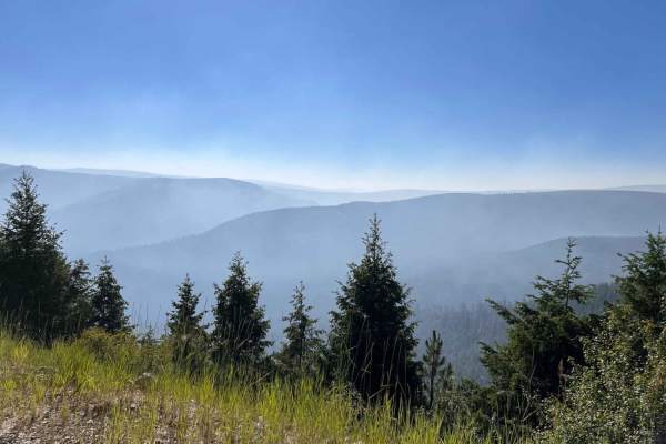
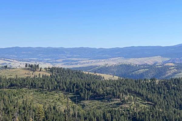
This is a 2 lane, maintained forest service road that leads to the long-standing fire tower for the Northfork, ID area with a 360-degree view of the surrounding mountain ranges. The knowledgeable and friendly watchman we spoke to has been standing watch over this area for 20 summers. There is a shor...
Learn more about 4th of July Trail
Powder Gulch
Powder Gulch is an easy alpine single track near Gibbonsville, Idaho. It starts right off of Lick Creek Road #60078. The entrance is unmarked from Lick Creek Road, but there is a trail sign partway through. It starts with a couple of tiny creek crossings, more like muddy ravines. It's a very narrow ...
Learn more about Powder Gulch
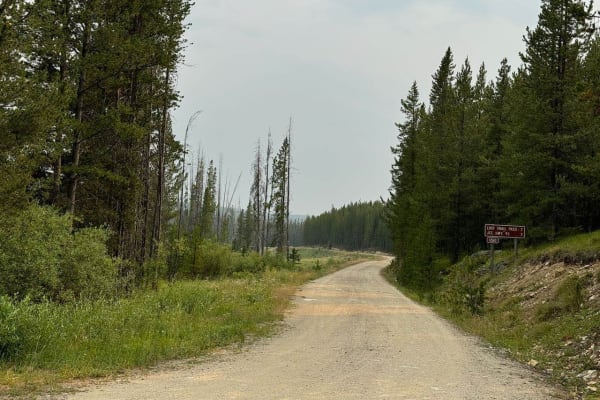
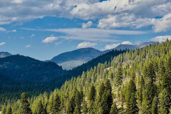
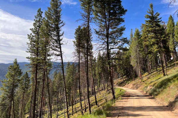
Gibbons Pass
This seven-mile section of the Gibbons Pass Road system is a smooth gravel road that is plenty wide for two vehicles to pass at nearly any point. The majority of this road is flat but there are a few spots of elevation change that are fairly mild slopes. This road is gravel with very few rocky spots...
Learn more about Gibbons Pass
Anderson Mountain Trail
Anderson Mountain Trail is a pretty good mix of gravel, dirt, and rocks throughout the whole trail. It is a wide trail, where two full-size vehicles shouldn't have trouble passing each other at most points. This trail is pretty fun. Although you are climbing in elevation the whole way, there are man...
Learn more about Anderson Mountain Trail
McCart Tower to Swift Creek the Cutover
This run is an excellent easy cutover trail that links the Johnson Peak Trailhead and McCart Lookout Tower Trail to the Swift Creek Hiking Trailhead. It's a twisty windy dirt trail along the ridge with some narrow spots only wide enough for one vehicle. Some ruts and potholes to look out for but not...
Learn more about McCart Tower to Swift Creek the Cutover
Sagebrush ATV Trail
This trail does not live up to its “Sagebrush” moniker. Rather, it travels through thick stands of scenic mixed conifers along the south-facing slope of Kerlee Ridge. This trail was built on the surface of an abandoned logging road, so the tread is level and relatively wide. Even so, deadfall is ab...
Learn more about Sagebrush ATV Trail
Silverleads Ridge
Silverleads Ridge is a 1.6-mile-long single track in the Salmon National Forest that is open from 5/22 to 9/7. The east end starts at the end of Stein Mountain Trail. As it goes west, it goes up a skinny alpine single track that is really narrow, through a forest of pine trees and grassy meadows. It...
Learn more about Silverleads Ridge
Johnson Peak Trailhead
This trail is a well-maintained grated dirt trail up to the Johnson Peak Trailhead and McCart Lookout Tower. The trail ends at a large pullout for parking or dispersed camping. There are stock ties, and at the time this trail was run, a 19 ft bumper pull was at the trailhead camping along with six h...
Learn more about Johnson Peak Trailhead
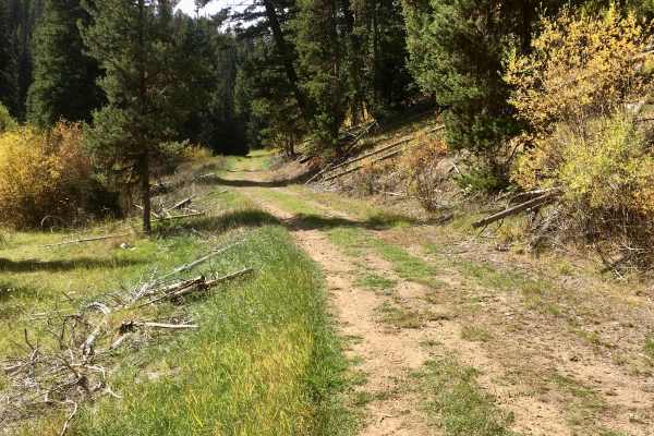
Little East Fork
Your average Civic or Prius could easily make it all the way to the end. The first third of the trail runs through private properties with many cabins. Some of them look pretty old. Just after the cabins are nice dispersed campsite right on the river, it appears there may be a few more dispersed sit...
Learn more about Little East Fork
Moose Creek & Trail 40
This trail is generally easy and wide enough to pass oncoming traffic. The trail seems to follow the path of the creek. However, there are not a lot of places to access it or see it. At the end, there is a large pullout and creek access. There are several offshoots along the way that lead to dispers...
Learn more about Moose Creek & Trail 40
Martin Creek to Chain of Lakes Trail
This is a lovely wide, well-maintained dirt trail with room for two cars to pass the whole way easily. A few more minor ruts and potholes closer to the trail's end. The trail runs up the mountains, beginning lower in a valley, and follows along Martin creek. The established Martin Creek campground i...
Learn more about Martin Creek to Chain of Lakes Trail
Teepee Point Vehicle Access
This is a nice, well-maintained dirt trail. It is by no means super narrow, however, it is mostly one vehicle wide most of the way with pullouts. It is a cliffside trail and has some pretty decent drop-offs. This trail is not recommended for those who are afraid of heights. The trail appears to be s...
Learn more about Teepee Point Vehicle Access
Reynolds Ridge Road - FS 5770
The Reynolds Ridge Road (FS 5770), is a well-maintained single-lane dirt logging road that basically follows a ridge just to the south of Reynolds Creek. The first 2.1 miles of this road are open year-round for all motorized vehicles. The remainder of FS 5770 has been converted to a trail for vehicl...
Learn more about Reynolds Ridge Road - FS 5770
Tepee Creek - 13314 (East Portion)
This is Forest Service Road 13314 which leads to the road up to the Tepee Fire Lookout and then to a trail going west for about six miles. This is an easy dirt and gravel road available to all vehicles seasonally. The road travels through a forested area and is quite scenic.
Learn more about Tepee Creek - 13314 (East Portion)
Swift Creek Trailhead
This is a well-maintained dirt trail that almost any 2WD passenger car could make. The trail runs along a river, then Forks away, and continues along a smaller creek. There is a large dispersed campsite at the beginning of the trail on the left after you cross the bridge right over the river. The tr...
Learn more about Swift Creek Trailhead
Tepee Creek Trail
This trail, designated for use by high clearance 4X4 vehicles, 50" ATVs, and Dirt Bikes, is based on an old Forest Service logging road. The first portion of this road has been recently used for vegetation treatments by the Forest Service and is a full lane width in most places and deadfall has been...
Learn more about Tepee Creek Trail
Lick Creek Road
During the summer of 2020, the lower segments of this road were rebuilt in anticipation of a vegetation management logging project, and more recently, during the summer of 2025, the upper segments received routine maintenance. Therefore, this road, when evaluated, was in very good condition and two...
Learn more about Lick Creek Road
Porcupine Saddle
This is a narrow switchback trail up to the Porcupine Saddle. The trail surface is mostly well maintained, with a few potholes. The beginning of the trail is wider and runs through pine trees before turning into long switchbacks that are narrow and becomes a steep shelf trail. Views out over the val...
Learn more about Porcupine Saddle
Waugh Gulch
This is a narrow switchback trail with views of the valley below. It ends at a tiny dispersed campsite. A few side trails at the beginning of the trail could lead to dispersed camping--no winter maintenance. Bring equipment to potentially clear down trees if traveling in spring. There is also a nice...
Learn more about Waugh Gulch
Tepee Point Lookout
Forest Road 73571 intersects with Forest Road 13314 and leads to the Tepee Point Fire Lookout. The road is a one-lane dirt road with some rutting that is easily navigated. As you might expect, the panoramic views from the lookout are quite spectacular. The lookout is manned during the fire season by...
Learn more about Tepee Point Lookout
Beginner ATV trails near Wisdom, Montana
Explore ATV-friendly trails near you. These trails are accessible for vehicles up to 50 inches wide, perfect for ATVs and smaller off-road machines.
4th of July Trail
This is a 2 lane, maintained forest service road that leads to the long-standing fire tower for the Northfork, ID area with a 360-degree view of the surrounding mountain ranges. The knowledgeable and friendly watchman we spoke to has been standing watch over this area for 20 summers. There is a shor...
Learn more about 4th of July Trail
Gibbons Pass
This seven-mile section of the Gibbons Pass Road system is a smooth gravel road that is plenty wide for two vehicles to pass at nearly any point. The majority of this road is flat but there are a few spots of elevation change that are fairly mild slopes. This road is gravel with very few rocky spots...
Learn more about Gibbons Pass
Anderson Mountain Trail
Anderson Mountain Trail is a pretty good mix of gravel, dirt, and rocks throughout the whole trail. It is a wide trail, where two full-size vehicles shouldn't have trouble passing each other at most points. This trail is pretty fun. Although you are climbing in elevation the whole way, there are man...
Learn more about Anderson Mountain Trail
McCart Tower to Swift Creek the Cutover
This run is an excellent easy cutover trail that links the Johnson Peak Trailhead and McCart Lookout Tower Trail to the Swift Creek Hiking Trailhead. It's a twisty windy dirt trail along the ridge with some narrow spots only wide enough for one vehicle. Some ruts and potholes to look out for but not...
Learn more about McCart Tower to Swift Creek the Cutover
Beginner UTV/side-by-side trails near Wisdom, Montana
Find UTV and side-by-side trails near you. These trails accommodate vehicles up to 60 inches wide, ideal for UTVs, side-by-sides, and wider off-road rigs.
4th of July Trail
This is a 2 lane, maintained forest service road that leads to the long-standing fire tower for the Northfork, ID area with a 360-degree view of the surrounding mountain ranges. The knowledgeable and friendly watchman we spoke to has been standing watch over this area for 20 summers. There is a shor...
Learn more about 4th of July Trail
Gibbons Pass
This seven-mile section of the Gibbons Pass Road system is a smooth gravel road that is plenty wide for two vehicles to pass at nearly any point. The majority of this road is flat but there are a few spots of elevation change that are fairly mild slopes. This road is gravel with very few rocky spots...
Learn more about Gibbons Pass
Anderson Mountain Trail
Anderson Mountain Trail is a pretty good mix of gravel, dirt, and rocks throughout the whole trail. It is a wide trail, where two full-size vehicles shouldn't have trouble passing each other at most points. This trail is pretty fun. Although you are climbing in elevation the whole way, there are man...
Learn more about Anderson Mountain Trail
McCart Tower to Swift Creek the Cutover
This run is an excellent easy cutover trail that links the Johnson Peak Trailhead and McCart Lookout Tower Trail to the Swift Creek Hiking Trailhead. It's a twisty windy dirt trail along the ridge with some narrow spots only wide enough for one vehicle. Some ruts and potholes to look out for but not...
Learn more about McCart Tower to Swift Creek the Cutover
The onX Offroad Difference
onX Offroad combines trail photos, descriptions, difficulty ratings, width restrictions, seasonality, and more in a user-friendly interface. Available on all devices, with offline access and full compatibility with CarPlay and Android Auto. Discover what you're missing today!
Open Trail Map